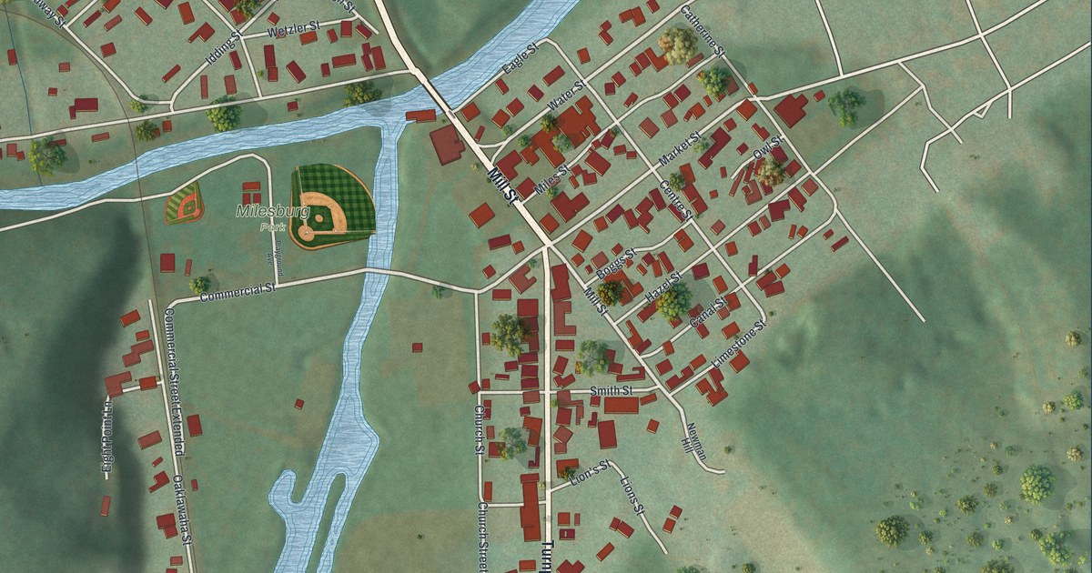
If you grew up in Milesburg, crossed the bridge on Mill Street every day, or played ball at Milesburg Park, this map shows the streets you know. It's a modern aerial view of Milesburg in Centre County, Pennsylvania, made from modern data and given a soft vintage feel. Two blue creeks meet beside Milesburg Park, right of the sheet's center. Red buildings fill the blocks on both sides, with green hills all around. South Eagle Valley Road cuts across in a long straight line, with a rail line beside it.
Mill Street, Market Street and Milesburg Park
Start at Milesburg Park, near the middle of the map. You'll see a small ball diamond there, between the two creeks. Just east of the park, the main road crosses the water on a bridge. Near the bridge it's printed Mill St. Follow it south and it becomes Turnpike St. Eagle Street and Smith Street meet it on the east side. Behind them, Market Street heads northeast through a tight block of red buildings. Centre, Catherine and Hazel Streets all meet Market Street. Water Street is closer to the bridge.
Go back over the bridge and follow Front Street west to Railroad Street. Head north on Railroad Street past Broadway Street to High Street. Spring Street and Logan Street are nearby in the top-center grid. Railroad Street runs north to south through that neighborhood, close to South Eagle Valley Road. Cross that long straight road and you'll come to the grid in the top left corner. Dell Street, Serge Street and Cove Street run through it, with Cross Street and View Street near the top. Tank Road heads up into the hills. Many roads are labeled, and each red shape is a building, so zoom in on the preview and look for yours.
How Milesburg's first town lots were laid out in 1793
Milesburg was founded in 1793. That same year, the first town lots were surveyed. The 1883 History of Centre and Clinton Counties says the survey covered the land inside Limestone, Creek, Mill and Catharine Streets. A good many lots were sold. But lots of buyers never paid, and their lots went back to the Miles family. The book says the family still held the unpaid notes in 1883. Joseph Miles had built a grist mill and a sawmill on Spring Creek. By 1819, Milesburg had about a dozen houses. Only two of them weren't log houses. Milesburg became a borough in 1843.
Look east of the bridge and you'll find Limestone Street, Mill St and Catherine Street close together. The map spells Catherine with an e. The book puts the old Black Horse tavern at the corner of Water and Limestone Streets. Both names sit near Centre Street on the map. The place is older than the town, too. A state historical marker says a Delaware village called Bald Eagle's Nest stood where Spring Creek and Bald Eagle Creek join. It was named for a Munsee chief, Woapalanne, or "Bald Eagle." The marker stands at Turnpike Street and Eagle Street, just south of the bridge over Spring Creek. On the map, look for the spot where the two blue creeks come together beside Milesburg Park.
For anyone who knows the bridge on Mill Street
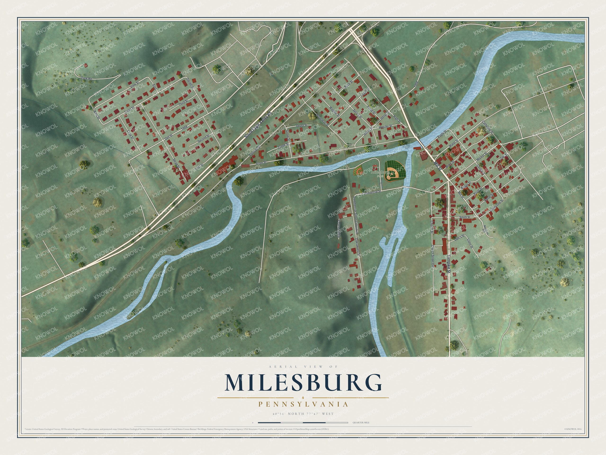
Created by KNOWOL in 2026, this Milesburg map shows the hills in shaded green, the two creeks in blue and each building in red. The shaded hills come from USGS elevation data. The title panel reads "Aerial View of Milesburg, Pennsylvania," with 40°56' North 77°47' West and a quarter-mile scale bar.
It suits a kitchen, a den or a family room. It's a good gift for someone who grew up near Milesburg Park and moved away. Open the preview, find the bridge on Mill St, and trace the way home from there. See sizes and frames for the Milesburg map.