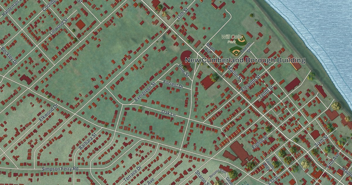
If you grew up in New Cumberland, or still have family near Bridge Street or Memorial Field, this map gives you a lot to find. It's a modern aerial view of New Cumberland in Cumberland County, Pennsylvania, built from modern data and given a vintage look. More than 5,000 buildings are drawn in deep red on soft green hills. A wide blue river with long green islands runs down the right side. A small creek winds along the bottom and meets it at the lower right corner of town.
Bridge Street, Front Street and Drexel Hills
Start at the New Cumberland Borough Building, printed near the middle of the sheet. Will Cole Park is close by. Bridge Street runs past both on a long slant toward the river. Follow it down to the right until you reach Front Street. From Front Street, Reno Street, Locust Alley and Geary Avenue head back into town. Take Geary Avenue past Memorial Field, where ball diamonds are drawn in gold. New Cumberland Borough Park sits just below, near where the creek meets the river.
Now go back to Bridge Street and follow it the other way, up toward the top left. You'll cross 15th Street and 16th Street. Near the top of town, Haldeman Avenue and Haldeman Boulevard branch off, with Warren Street and Westover Drive close by. For the curving streets, follow Park Avenue south from the middle of town into Drexel Hills. Drexel Hills Boulevard winds down past Swarthmore Road and Brookhaven Road to Hilltop Drive. Many roads are labeled, and each red shape is a building, so zoom in on the preview and look for yours.
Haldeman names near Bridge Street
At the upper end of Bridge Street, look for Haldeman Court where it meets Haldeman Avenue. Haldeman Boulevard meets both the avenue and Bridge Street farther left. Warren Street meets Haldeman Avenue near the upper edge.
Governor John W. Geary on Market Street
A state historical marker at Third and Bridge Streets honors John W. Geary. It says he served two terms as Pennsylvania governor, from 1867 to 1873. He was also the first mayor of San Francisco. His home was a block east of the marker, at 308 Market Street. Find Third Street where it meets Bridge Street, then look one block over to Market Street.
Front Street, the river and the title panel
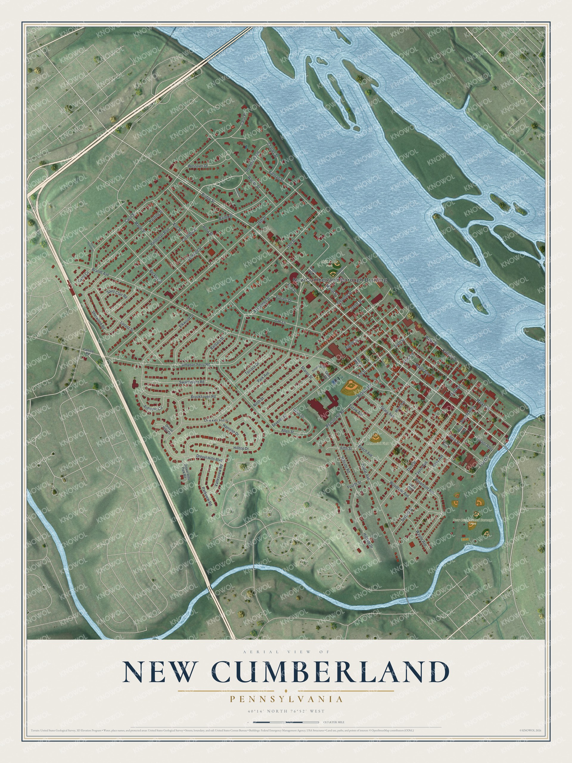
Created by KNOWOL in 2026, this New Cumberland map shows more than 5,000 buildings in deep red, with the hills shaded from USGS elevation data. The river and its islands fill the right side in pale blue. The title panel reads "Aerial View of New Cumberland, Pennsylvania," with the coordinates 40°14' North, 76°52' West and a quarter-mile scale bar.
It suits a kitchen, a den or a front hall. It's a good gift for someone who grew up here and moved away, or for anyone who played ball at Memorial Field. Open the preview, start at the Borough Building and follow Bridge Street to your block. See sizes and frames for the New Cumberland map.