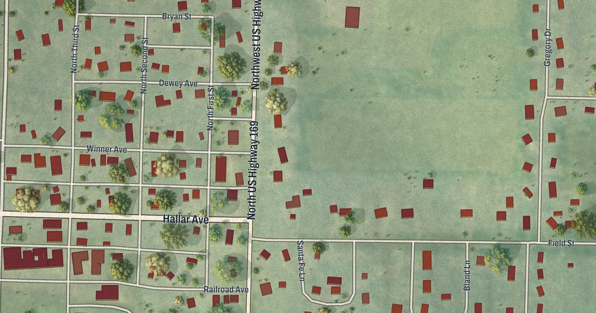
If you grew up in Gower, or have family on the numbered streets off Hallar Avenue, you'll find a lot to recognize here. It's a modern aerial view of Gower in Clinton County, Missouri, drawn from modern data with a vintage look to it. Northwest US Highway 169 runs down the middle of the sheet, then swings toward the bottom right corner. More than 650 buildings are drawn in red on both sides of it. The map also prints Gower City Park near the numbered street grid.
Hallar Avenue, Northwest US Highway 169 and Gower City Park
Start where Hallar Avenue crosses Northwest US Highway 169 in the middle of the sheet. West of the highway, Hallar Avenue crosses the numbered streets. North First Street is closest to the highway, and North Fourth Street is farthest out. One block down is Railroad Avenue, and the Gower City Park label sits just below that. Keep heading south past Whitney Avenue, Shivel Avenue and Smith Street. Castile Avenue runs near the bottom left of the sheet.
Now go back to Hallar Avenue and look north. Winner Avenue, Dewey Avenue and Bryan Street cross parts of the numbered street grid west of the highway. Farther up, Cummings Drive and Harrington Lane run out to the left, with Benjamin Avenue and Edward Avenue near the top. East of the highway, Somerset Drive leads toward Gregory Drive and Matthews Lane in the top right corner. Field Street heads east from the highway. Kennedy Drive and Lincoln Drive fill the bottom right. Down the left edge, State Highway Vv and County Line Road run north to south. Plenty of roads are labeled here, and each red shape is a building. Zoom in on the preview and look for your own roof.
A farmer's tent where Gower now stands
County Line Road runs down the left side of the Gower map. A county history printed in 1881 tells of a farmer who arrived with a team of horses, a yoke of oxen and two hundred dollars. On the 15th of October, he staked his tent where the town of Gower now stands. He entered 160 acres a short way southeast of that spot, near the Buchanan County line. After four years he sold out and bought a farm south of Casteel Creek. A few years later he came back, bought his old place again, and built it up to 300 acres.
The same book has a sketch of a man whose father bought the farm that Gower stands on. When the town was laid out, he was one of its first businessmen. He sold lumber and farm tools, and he put up a number of the town's first buildings. He was president of the first town board. He lived in Gower until 1876, then moved to Plattsburg. A later county history, printed in 1923, adds two more firsts. The first meeting of the town board after Gower was incorporated was held June 21, 1873. And the first school house built in Gower was for a private school. Trace Hallar Avenue through the numbered streets to see Gower's tight grid on the map.
Gower's Hallar Avenue grid on your wall.
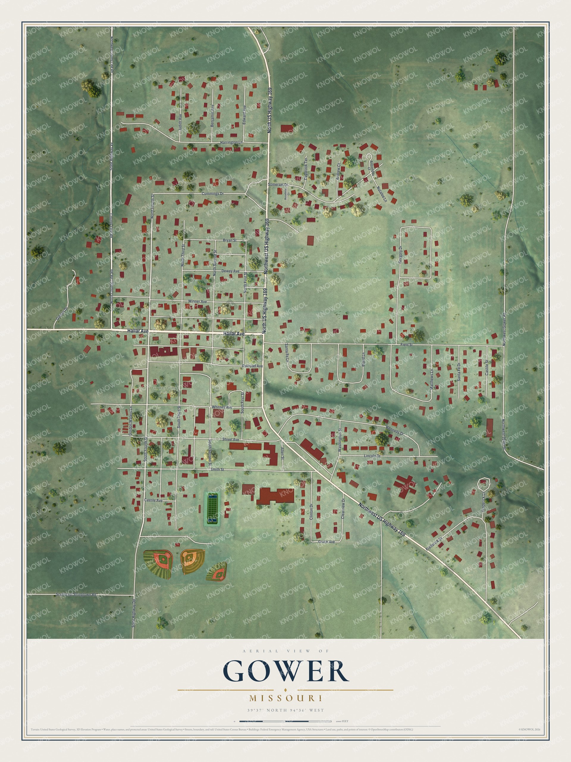
Created by KNOWOL in 2026, this aerial view of Gower shades the ground and shows the street grid. Each of the 650 or more buildings is a small red shape, so the blocks along Hallar Avenue stand out from across a room. The title panel reads "Aerial View of Gower, Missouri" with the coordinates 39°37' North, 94°36' West.
It suits a kitchen wall, a den, a farm office or the break room at work. It makes a good gift for someone who grew up near Gower City Park, has family in Clinton County or moved away from Gower years ago. Open the preview, zoom in, and find the street you know. See sizes and frames for the Gower map.