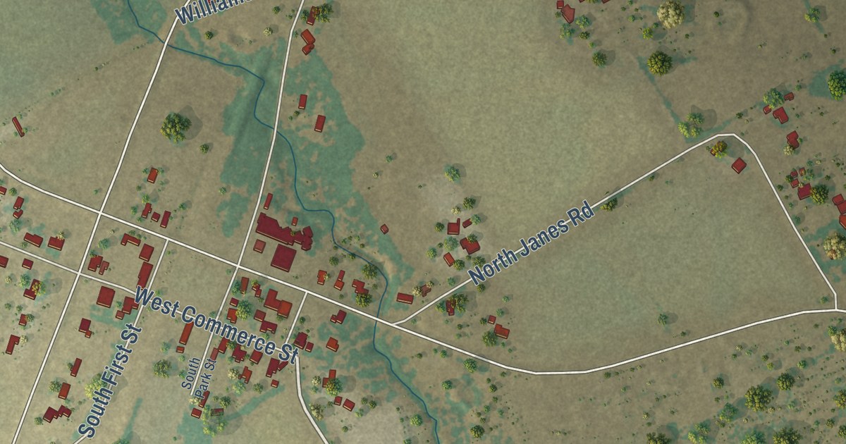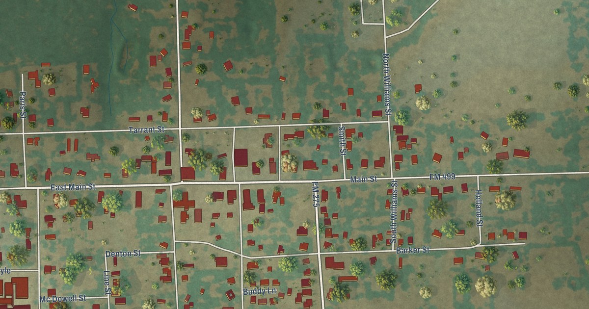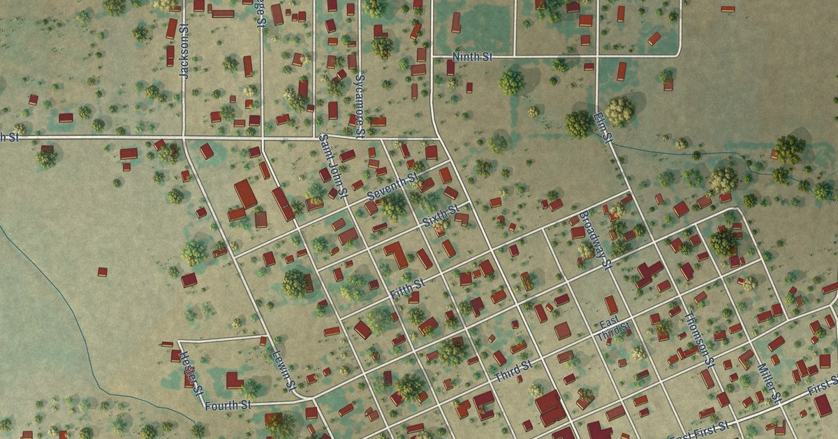
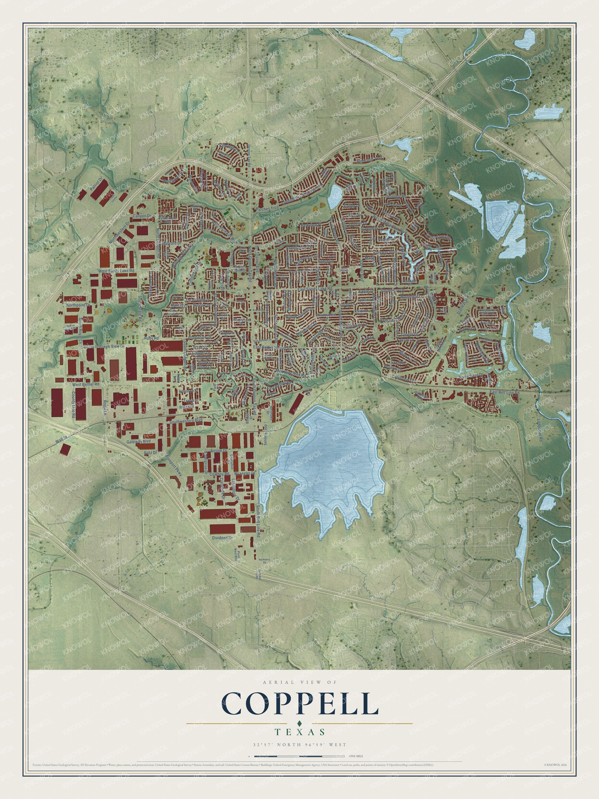
This beautifully detailed map of Coppell, Texas was created in 2026 using aerial imagery combined with modern topographical, census, street and landmark data. It’s a one-of-a-kind view of Coppell that combines accurate data with a vintage aesthetic. The map shows every building in its true location, many of the roads carry their names, and the shaded topographic relief shows the shape of the land.
Explore an aerial view of Coppell, Texas
On the map you’ll find Bethel and Natches Trce, along with South Belt Line Road, North Denton Tap Road, Royal Lane, South Royal Lane, Sugarberry Drive, Rolling Hills Road, East Bethel School Road, Hill Drive, Halifax Lane, Wall Street, and more. If you look closely you can even find your house accurately drawn in its correct location. Zoom in on the preview to look for yours.
Did you know this piece of Coppell, Texas history?
From the Handbook of Texas: "By this time Coppell had adopted the council-manager form of government and had a population of 2,500, ambulance service, police and fire departments, six churches, and schools."
Take a closer look at the Coppell map
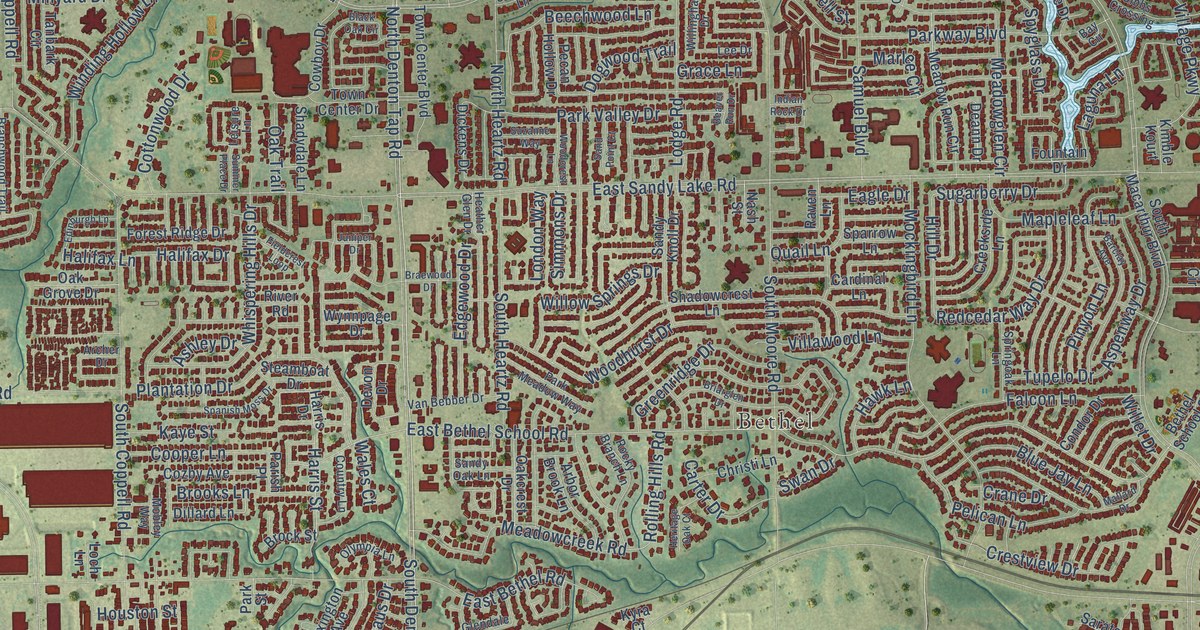
Street and place names on the Coppell, Texas map
These names are printed on the map of Coppell, Texas.
Places: Bethel.
Streets and roads: South Belt Line Road, Natches Trce, North Denton Tap Road, Royal Lane, South Royal Lane, Sugarberry Drive, Rolling Hills Road, East Bethel School Road, Hill Drive, Halifax Lane, Wall Street, Freeport Parkway.
More street names, A to Z
Airline Drive, Alex Drive, Allen Road, Arbor Brook Lane, Archer Drive, Ashley Drive, Aspenway Drive, Avalon Lane, Banbury Road, Barclay Avenue, Bay Circle, Beacon Hill Drive, Beaver Run Drive, Beechwood Lane, Bent Tree Court, Berkshire Lane, Bethel School Court, Black Oak Circle, Blue Jay Lane, Bradford Drive, Braewood Drive, Branchwood Trail, Breanna Way, Briarglen Drive, Brock Street, Brooks Lane, Bullock Street, Burns Street, Cambridge Manor Lane, Canyon Drive, Cardinal Lane, Carter Drive, Castle Creek Drive, Chateaus Drive, Chestnut Lane, Christi Lane, Clear Haven, Club Circle, Condor Drive, Cooper Lane, Coral Drive, Cottonwood Drive, Country Lane, County Line Road, Cove Drive, Cowboy Drive, Cowboy Road, Cozby Avenue, Crane Drive, Creek Crossing, Creekside Lane, Creek View Drive, Creekview Drive, Crestside Drive, Crestview Drive, Cribbs Drive, Dalmalley Lane, Deann Drive, Deforest Road, Denton Tap Road, Devon Drive, Dickens Drive, Dillard Lane, Dividend Drive, Dogwood Trail, Duncan Drive, Eagle Drive, East Belt Line Road, East Bethel Road, East Sandy Lake Road, Edgewood Drive, Edinburgh Lane, Enterprise Drive, Executive Drive, Fairway Drive, Falcon Lane, Falls Road, Fieldcrest Loop, Forest Hill Drive, Forest Ridge Drive, Fountain Drive, Fritz Drive, Gate View Boulevard, Gateway Boulevard, Gibbs Crossing, Gibson Court, Gifford Drive, Glendale Drive, Glen Lakes Drive, Grace Lane, Graham Drive, Grapevine Creek Drive, Greenridge Drive, Greentree Drive, Greenway Drive, Hackberry Road, Halifax Drive, Harris Drive, Harris Street, Harwell Street, Hawk Lane, Heather Glen Drive, Heritage Oak Court, Hollywood Drive, Hood Drive, Houston Street, Indian Rock Drive, Inglenook Court, Juniper Drive, Kaye Street, Kilbridge Lane, Kimble Kourt, Kingsmill Court, Kyra Court, Laguna Lane, Lakeshore Drive, Lakeview Drive, Layton Drive, Ledbetter Road, Lee Drive, Leisure Lane, Levee Place, Lexington Avenue, Loch Lane, Lodge Road, London Way, Lyndsie Drive, Madison Street, Mallard Drive, Mapleleaf Lane, Marlee Circle, Martel Lane, Meadowcreek Road, Meadowglen Circle, Meadow Run Circle, Mill Trail, Minyard Drive, Mobley Way, Mockingbird Lane, Nash Street, North Belt Line Road, North Coppell Road, North Heartz Road, Northlake Drive, North Macarthur Boulevard, North Moore Road, Northpoint Drive, Northwestern Drive, Oakbend Drive, Oakcrest Drive, Oak Grove Drive, Oak Trail, Olympia Lane, Parish Place, Parker Drive, Park Meadow Way, Park Street, Park Valley Drive, Parkview Place, Parkway Boulevard, Patriot Drive, Pebble Creek Drive, Pecan Hollow Drive, Pedmore Drive, Pelican Lane, Phillips Drive, Pinyon Lane, Plantation Drive, Point West Boulevard, Quail Lane, Raintree Circle, Raven Lane, Redcedar Way Drive, Riverchase Drive, River Road, Rock Springs Road, Rocky Branch Lane, Ruby Road, Samuel Boulevard, Sanders Loop, Sand Point Court, Sandy Knoll Drive, Sandy Oak Lane, Saratoga Way, Shadowcrest Lane, Shadydale Lane, Shorewood Drive, Simmons Drive, Snowshill Trail, South Coppell Road, South Denton Tap Road, South Heartz Road, South Macarthur Boulevard, South Moore Road, South State Road, Southwestern Boulevard, Spanish Moss Drive, Sparrow Lane, Springoak Lane, Spyglass Drive, Starleaf Street, Steamboat Drive, Summer Place Drive, Suzanne Way, Swan Drive, Tanbark Circle, Town Center Boulevard, Town Center Drive, Trade Center, Travis Street, Trinity Court, Tupelo Drive, Van Bebber Drive, Village Parkway, Villawood Lane, Wales Court, Waterview Drive, Waverly Lane, Wellington Drive, West Bethel Road, Westhaven Road, Westminster Way, West Parkway Boulevard, West Sandy Lake Road, Whispering Hills Drive, Willet Drive, Willingham Drive, Willow Springs Drive, Winding Hollow Lane, Windsor Road, Wingate Road, Woodcrest Lane, Woodhurst Drive, Woodlake Drive, Wrangler Drive, Wynnpage Drive.
See the Coppell, Texas map on a wall
The Coppell map as an 18 x 24 inch print in a black frame.

This beautifully detailed map of Coppell makes an attractive addition to your office, library, or den, and it can even be used to teach children the geography and history of the area. It also makes a great gift for anyone with Coppell roots. When you’re done exploring, click here to get your copy of the Coppell map.