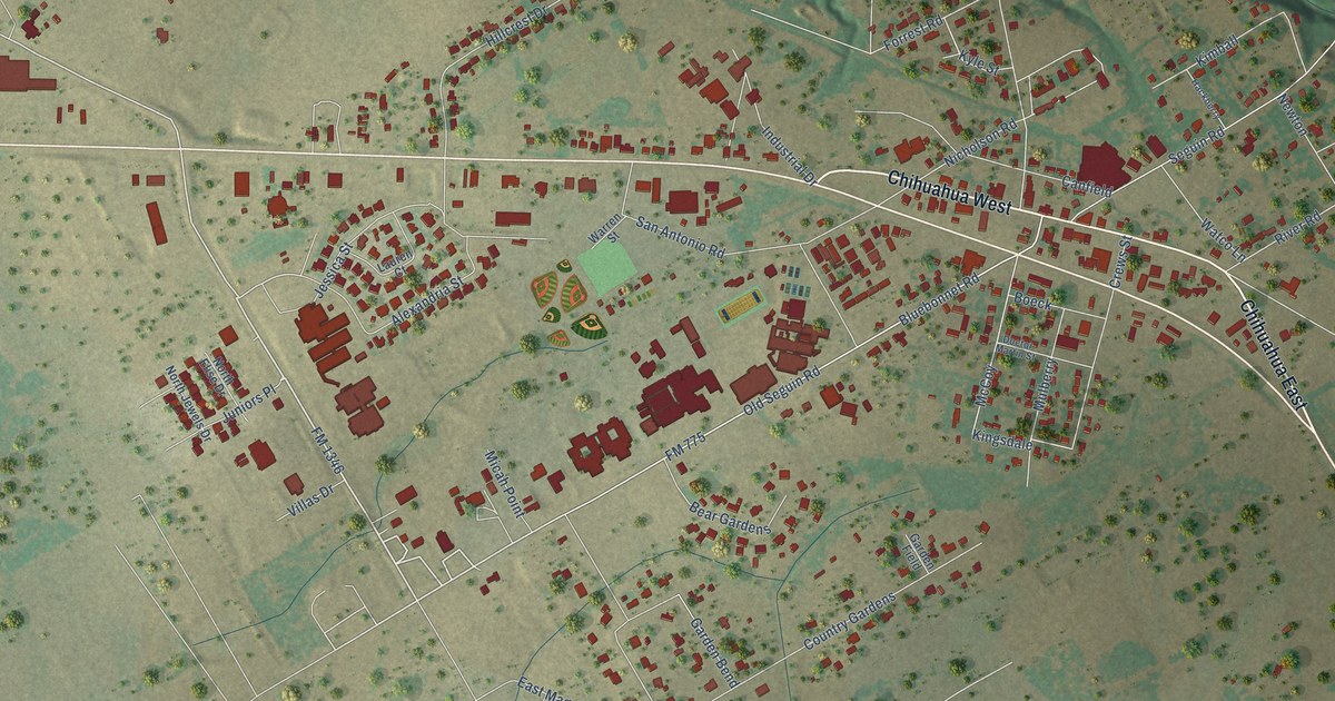
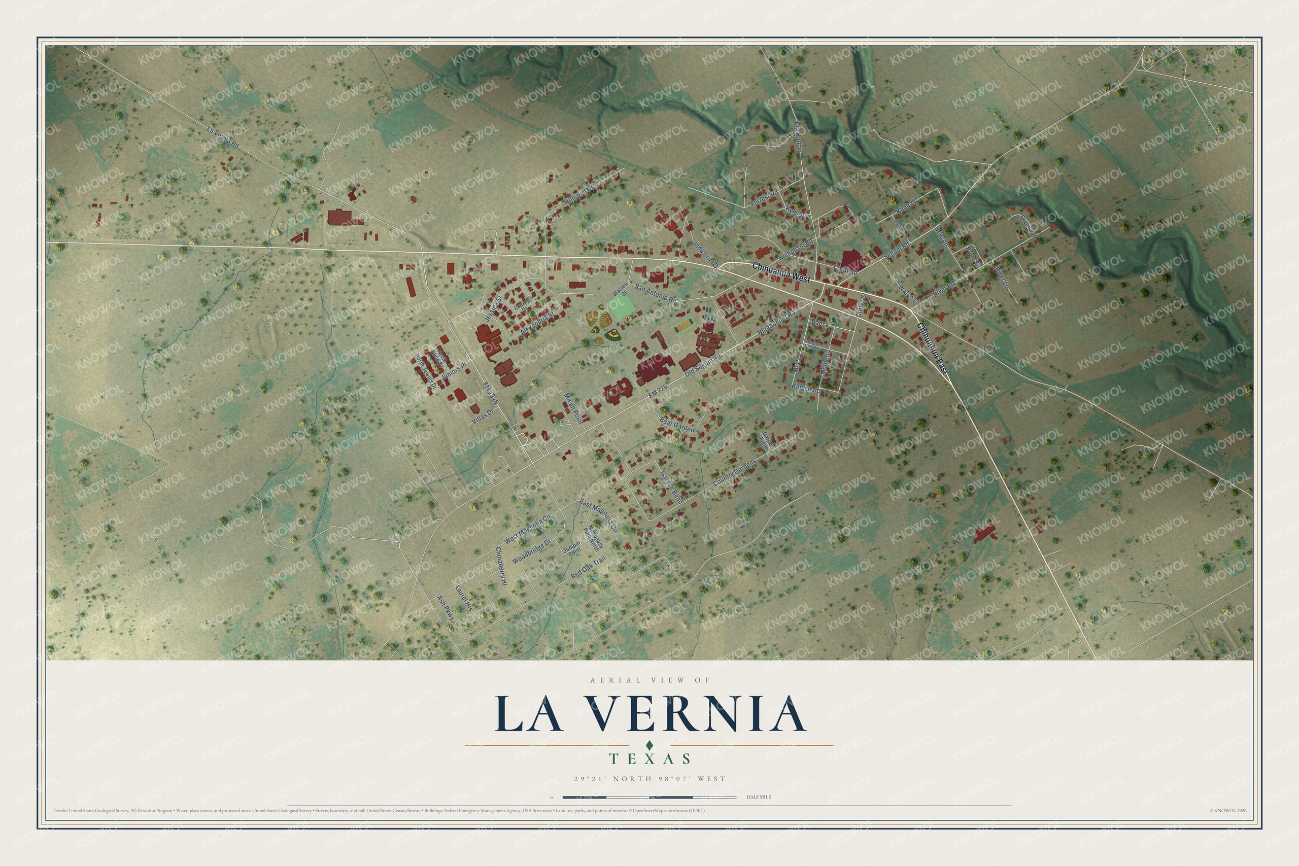
This beautifully detailed map of La Vernia, Texas was created in 2026 using aerial imagery combined with modern topographical, census, street and landmark data. It’s a one-of-a-kind view of La Vernia that combines accurate data with a vintage aesthetic. The map shows every building in its true location, many of the roads carry their names, and the shaded topographic relief shows the shape of the land.
Explore an aerial view of La Vernia, Texas
On the map you’ll find Chihuahua West, Chihuahua East, McCoy, Kingsdale, Dry Hollow, and Country Gardens, along with FM 775, FM 1346, La Vernia Road, Alexandria Street, Nicholson Road, Seguin Road, and more. If you look closely you can even find your house accurately drawn in its correct location. Zoom in on the preview to look for yours.
Did you know this piece of La Vernia, Texas history?
Settlers arrived in earnest around 1850. The first post office, opened in 1853, was called Post Oak. In 1859 the town was renamed La Vernia. Local Masons formed the Brahan lodge that same year, and their hall later held school classes and church services.
Take a closer look at the La Vernia map
Street names on the La Vernia, Texas map
These names are printed on the map of La Vernia, Texas.
Streets and roads: Chihuahua West, Chihuahua East, FM 775, FM 1346, La Vernia Road, Alexandria Street, McCoy, Kingsdale, Nicholson Road, Dry Hollow, Seguin Road, Country Gardens.
More street names, A to Z
Ash Parkway, Bear Gardens, Bluebonnet Road, Boeck, Canfield, Chinaberry Hl, Crews Street, Doctor Martin Street, East Magnolia Circle, Forrest Road, Garden Bend, Garden Field, Hackberry, Hillcrest Drive, Industrial Drive, Jessica Street, Juniors Place, Juniper Point, Kimball, Kyle Street, Laurel Heights, Lauren Court, Mahogany Path North, Micah Point, Mulberry, Newton, North Elise Drive, North Jewels Drive, Old Seguin Road, Prinz Street, Red Oak Trail, River Lane, River Road, River Vw, San Antonio Road, Villas Drive, Warren Street, Watco Lane, West Magnolia Circle, Woodbridge Drive.
See the La Vernia, Texas map on a wall
The La Vernia map as an 18 x 24 inch print in a black frame.

This beautifully detailed map of La Vernia makes an attractive addition to your office, library, or den, and it can even be used to teach children the geography and history of the area. It also makes a great gift for anyone who grew up in La Vernia or moved away. When you’re done exploring, click here to get your copy of the La Vernia map.