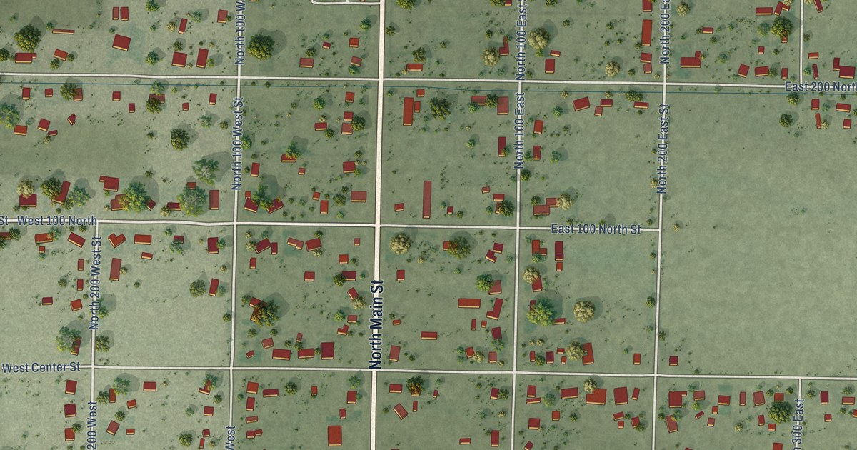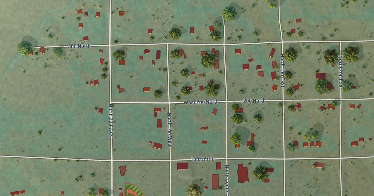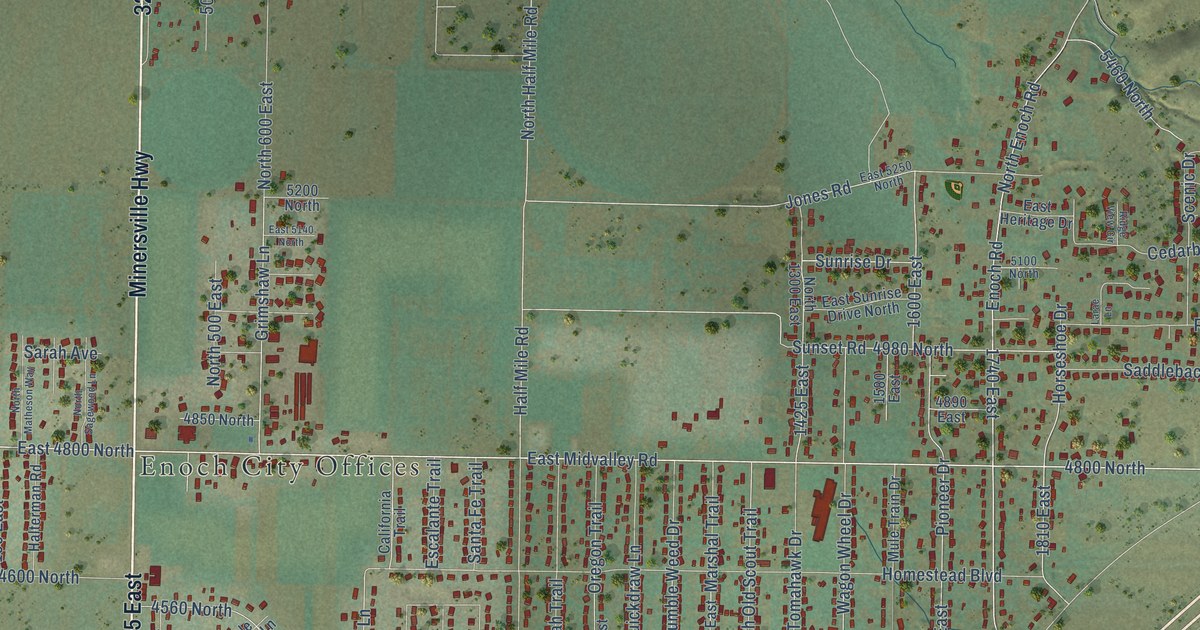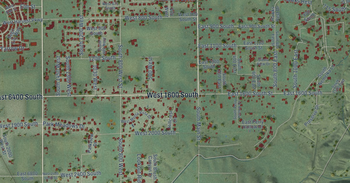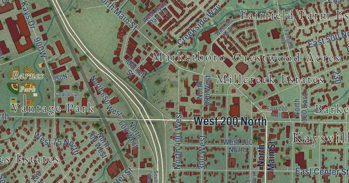
This beautifully detailed map of Kaysville, Utah was created in 2026 using aerial imagery combined with modern topographical, census, street and landmark data. It’s a one-of-a-kind view of Kaysville that combines accurate data with a vintage aesthetic. The map shows every building in its true location, many of the roads carry their names, and the shaded topographic relief shows the shape of the land.
Explore an aerial view of Kaysville, Utah
On the map you’ll find Kaysville City Hall, Barnes Park, Alta Acres, Barker, Barnes Estates, Brook Haven, Calder Hill, Cameron Estates, Chantilly Square, Clover Estates, and Country Estates, along with Country Lane, and more. If you look closely you can even find your house accurately drawn in its correct location. Zoom in on the preview to look for yours.
Did you know this piece of Kaysville, Utah history?
From the National Register of Historic Places: "Designed by the Salt Lake City architecture firm of Ashton and Evans and constructed in phases from 1941-1943, the Kaysville City Hall represents the impact of New Deal programs in Utah, which was one of the states that the Great Depression of the 1930s most severely affected."
Take a closer look at the Kaysville map
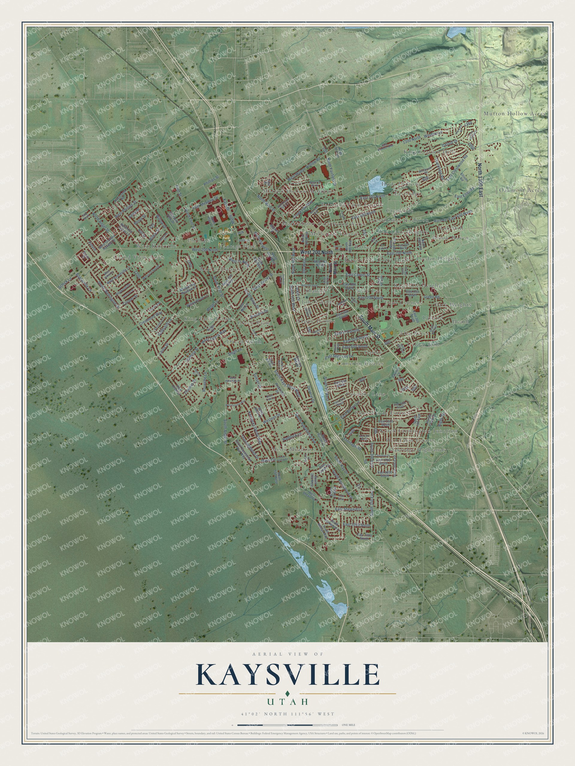
Street and place names on the Kaysville, Utah map
These names are printed on the map of Kaysville, Utah.
Places: Kaysville City Hall, Barnes Park, Mutton Hollow Acres, Misty Meadows, Eastridge, North Farmington Junction, King Farm Estates, Mutton Hollow Meadows, Oakmont Acres, Oakridge Highlands, West Kaysville, Park Heights, Gailey, Oak Lane Heights, Green View, Country Lane, Alta Acres, Johns Acres, Barker, Marketboro, King Clarion Hills, Hen Farm Estates, Barnes Estates, Brook Haven, Upland, Island View Acres, Phillips, Leedot Heights, Calder Hill, Fairfield Farm Estates, Crestwood Acres, David Smith, Vera Lee, Kaysville Heights, Four Corners, Creekside, Happy Homes, Cresthomes Addition, Hob Hill, Cameron Estates, Shanna, Hods Hollow, Vantage Park, Heath, Palos Verde Estates and Millcreek Estates.
Streets and roads: South Main Street, West 200 North, North 1300 East, East 200 North, North Main Street, East Center Street, Bonneville Lane, East 200 South, East Shepard Lane, North Fairfield Street, South 350 East, South 300 East.
More street names, A to Z
300 West, 600 North, 1300 North, 1950 South, Angels Way, Anita Drive, Baer Creek Drive, Barrington Drive, Belmore Drive, Birch Tree Lane, Brandon Drive, Bryce Drive, Charlene Drive, Charles Drive, Cooper Street, Country Mill Drive, Creekside Way, Crestmont Way, Deseret Drive, East 100 South, East 150 South, East 220 North, East 250 North, East 300 South, East 350 South, East 450 North, East 475 South, East 500 North, East 550 South, East 600 South, East 700 North, East 950 South, East 1150 South, East 1175 South, East 1310 South, East 1475 South, East 1700 South, East 1800 South, East 2200 South, East 2300 South, East Burton Lane, East Crestwood Road, East Elias Road, East Sego Lily Drive, East Street, East Windsor Way, Ellison Road, Fairfield Road, Flint Meadow Drive, Flint Street, Francis Circle, Frontage Road, Future, Galbraith Lane, Green Road, Haight Creek Drive, Henry Street, Heywood Drive, Hill Street, Jackson Street, Joshua Drive, Kays Circle, Kayscreek Road, Kays Drive, Kentucky Derby Way, Kings Court, Larkin Lane, Leola Street, Majestic Street, Mare Circle, Market Street, North 50 East, North 100 East, North 300 West, North 400 West, North 500 East, North 600 East, North 600 West, North 650 West, North 700 West, North 750 East, North Angel Street, North Flint Street, North Hill Farms Lane, North Winston Drive, Oak Lane, Old Mill Lane, Oxford Drive, Paddock Lane, Phillips Street, Pin Oak Lane, Pleasent View Drive, Preakness Drive, Ramola Street, Rigby Road, Roueche Lane, Santa Anita Drive, Schick Lane, Seemore Drive, Sherwood Drive, Smith Lane, South 25 West, South 50 East, South 50 West, South 100 West, South 200 West, South 300 West, South 400 East, South 400 West, South 500 East, South 550 East, South 550 West, South 550 West Street, South 700 East, South 875 East, South Angel Street, South Appaloosa Avenue, South Betsys Way, South Burton Lane, South Equestrian Park Way, South Flint Street, South Kay Drive, South Kays Drive, South Kays Drive West, South Kerrybrook Drive, South Parkwood Lane, South Sunset Drive, South Wellington Drive, South Wind Mill Lane, Sport Plex Drive, Sunset Drive, Thomas Drive, Thornfield Road, Thoroughbred Drive, View Crest Lane, Virginia Street, Ward Road, Water Mill Way, Webb Lane, West 75 North, West 75 South, West 100 North, West 100 South, West 150 South, West 600 North, West 770 North, West Bonneville Lane, Westbrook Road, West Center Street, Western Drive, West Hyde Park Lane, West Jakes Lane, West Mutton Hollow Road, West Orchard Harvest Drive, West Palomino Drive, West Phillips Street, West Shepard Lane, West Tylers Way, West Zenyatta Way, Whispering Meadow Lane, Wilford Drive, Wilkie Street, Willow Brook Lane, Willow Drive, Windsor Lane.
See the Kaysville, Utah map on a wall
The Kaysville map as an 18 x 24 inch print in a black frame.

This beautifully detailed map of Kaysville makes an attractive addition to your office, library, or den, and it can even be used to teach children the geography and history of the area. It also makes a great gift for someone who left Kaysville and still calls it home. When you’re done exploring, click here to get your copy of the Kaysville map.