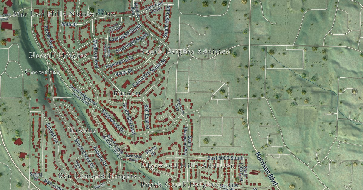
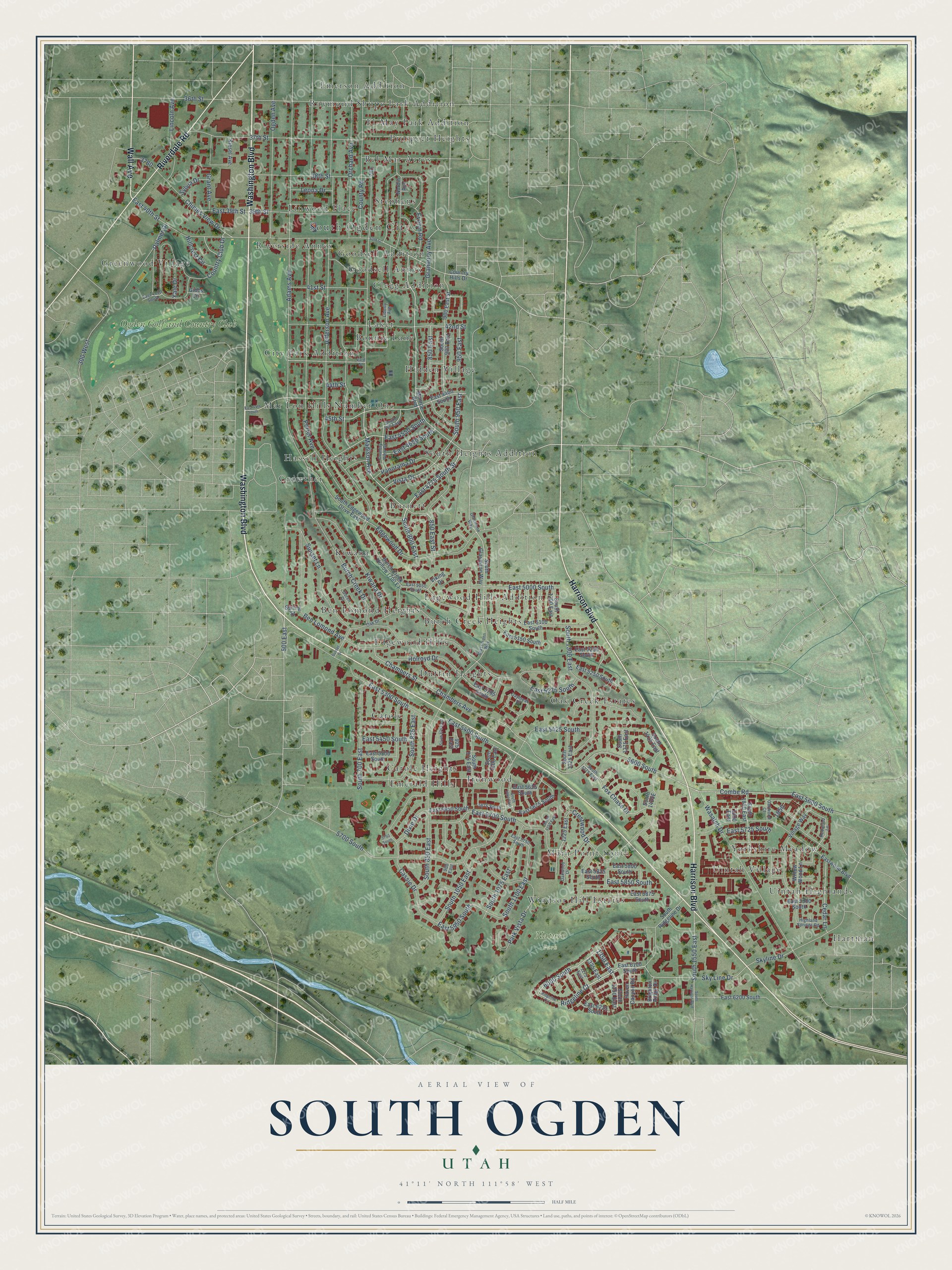
This beautifully detailed map of South Ogden, Utah was created in 2026 using aerial imagery combined with modern topographical, census, street and landmark data. It's a modern aerial view of South Ogden in Weber County, Utah, that combines modern data with a vintage aesthetic. The roads feature printed names, and if you look closely you can find your exact house accurately shown in its correct location.
Explore an aerial view of South Ogden, Utah
On this map you'll find South Ogden City, Nature Park, Bel-Mar Acres, Ben Lomond Heights, Bonnie Lane, Burch Creek Heights, Burnett, Carole, Carole Heights, City Park Addition, Clegg Addition, Crowther, and more. Each red shape is a building, so zoom in on the preview and look for yours.
Here is a piece of South Ogden history, in the words of the record. The OnlineUtah puts it this way: "Burch Creek Elementary and Junior High School was built in 1897. It was the first school in the area and was considered one of the most modern in the state."
South Ogden is a city in Weber County. The Census Bureau counted 17,488 people here in 2020.
Take a closer look at the South Ogden map
Names on this map
These names are printed on this map.
Places: South Ogden City, Nature Park, Bel-Mar Acres, Ben Lomond Heights, Bonnie Lane, Burch Creek Heights, Burnett, Carole, Carole Heights, City Park Addition, Clegg Addition, Crowther, Duffin Heights, Edgewood Hills, Edgewood Hills Addition, El-May Park Addition, Emerald Hills, Emerson Addition, Goodsell Addition, Goodsell Annex, Greenwood Village, Hartman, Hassell Heights, Hidden Village, Ironwood, Kiwana, Laker, Linwood Place, Main Point South, Mar Lon Hills Number One, Oak Creek Estates, Prospect Heights, Raymond Shupe Park Addition, Riverside Annex, South Heights Addition, Stephens, Uintah Highlands, Uintah Village, Windsor Hill Estates, Yorkshire Meadow and Ogden Golf and Country Club.
Streets and roads: Washington Boulevard, Harrison Boulevard, Riverdale Road, Wall Avenue, East 4600 South, 6000 South, East 4775 South Street, 1350 East, Ridgeline Court, South 800 East, Madison Avenue, 500 East.
More street names, A to Z
36th Street, 37th Street, 38th Street, 39th Street, 40th Street, 41st Street, 42nd Street, 43rd Street, 44th Street, 45th Street, 300 West, 850 East, 850 East Street, 900 East, 900 East Street, 925 East, 950 East, 1225 East, 1275 East, 1325 East, 1800 East, 5600 South, 5675 South, 5700 South, 5750 South, Adams Avenue, Ben Lomond Avenue, Brighton Ridge Drive, Burch Creek Drive, Cassie Drive, Cedar Lane, Chambers Avenue, Chambers Street, Chimes View Drive, Combe Road, Country Club Drive, Country Hills Drive, Country View Drive, County Road, Crestwood Drive, Daybreak Drive, Dixie Drive, Doren Drive, East 39th Street, East 40th Street, East 44th South, East 4150 South, East 4400 South, East 4550 South, East 5000 South, East 5050 South, East 5100 South, East 5150 South, East 5200 South, East 5250 South, East 5275 South, East 5285 South, East 5300 South, East 5400 South, East 5425 South, East 5450 South, East 5500 South, East 5600 South, East 5625 South, East 5650 South, East 5675 South, East 5700 South, East 5725 South, East 5750 South, East 5800 South, East 5825 South, East 5850 South, East 5875 South, East 5900 South, East 5950 South, East 6100 South, East 6200 South, East 6225 South, Eastwood Boulevard, Edgewood Drive, Evelyn Road, Fox Chase Drive, Gibbs Circle, Glasmann Way, Glassmann Way, Gramercy Avenue, Grant Avenue, Haven Canyon Road, Highland Springs Road, Hillcrest Circle, Holroyd Drive, Jefferson Avenue, Kiesel Avenue, Kiwana Drive, Leona Drive, Liberty Avenue, Lincoln Avenue, Monroe Boulevard, Nordin Avenue, Oak Drive, Oakwood Court, Oakwood Drive, Ogden Avenue, Orchard Avenue, Palmer Drive, Panorama Drive, Park Vista Drive, Porter Avenue, Redwood Lane, Ridgeline Circle, Skyline Drive, Sky Line Drive, South 700 East, South 750 East, South 825 East, South 850 East, South 875 East, South 900 East, South 950 East, South 975 East, South 1000 East, South 1050 East, South 1060 East, South 1075 East, South 1100 East, South 1150 East, South 1200 East, South 1225 East, South 1275 East, South 1300 East, South 1350 East, South 1375 East, South 1425 East, South 1550 East, South 1850 East, South Edgewood Drive East, South Glasmann Way, South Harrison Boulevard, South Ridgeline Drive, Spring Street, Sunset Drive, Sunset Lane, Sylvia Drive, Viking Drive, Village Way, Vista Drive, Wasatch Drive, Willow Wood Lane, Yale Drive.
Created by KNOWOL in 2026. The buildings are small red shapes, the roads carry their printed names, and shaded relief shows the shape of the land. The title panel reads "AERIAL VIEW OF SOUTH OGDEN UTAH" with 41°11' NORTH 111°58' WEST.
It suits a den, a classroom or a front hall, and it makes a gift for anyone with South Ogden roots. Open the preview and find the block you know. See sizes and frames for the South Ogden map.