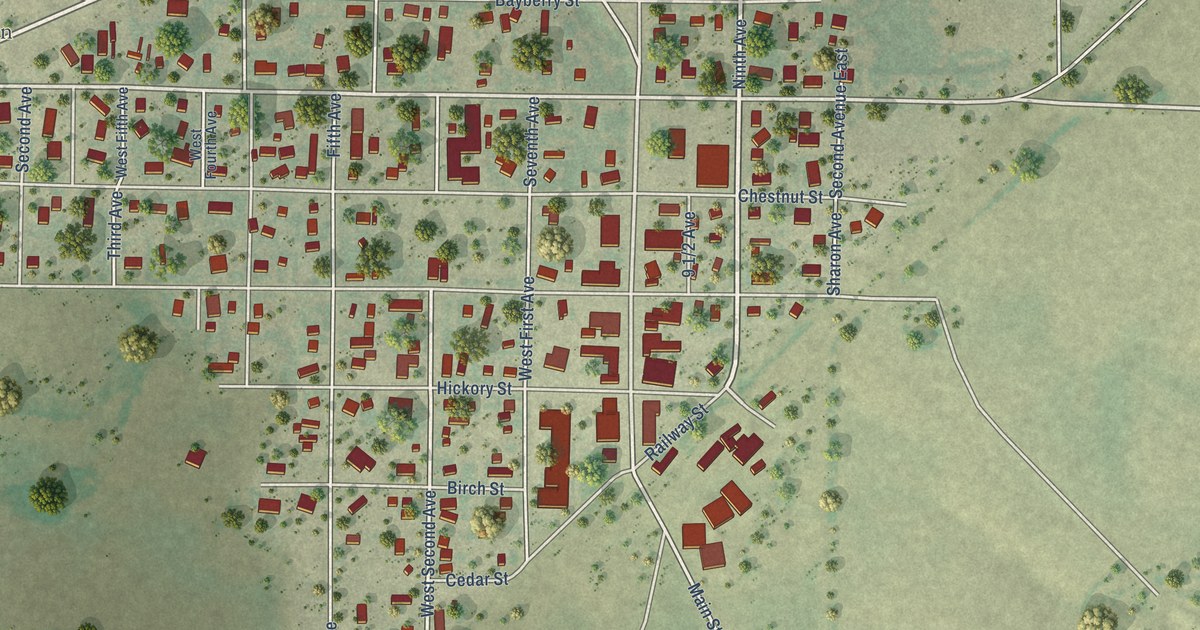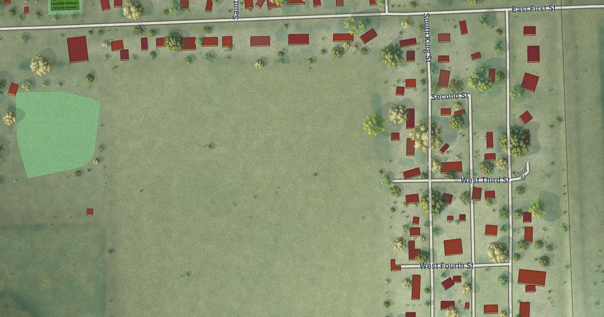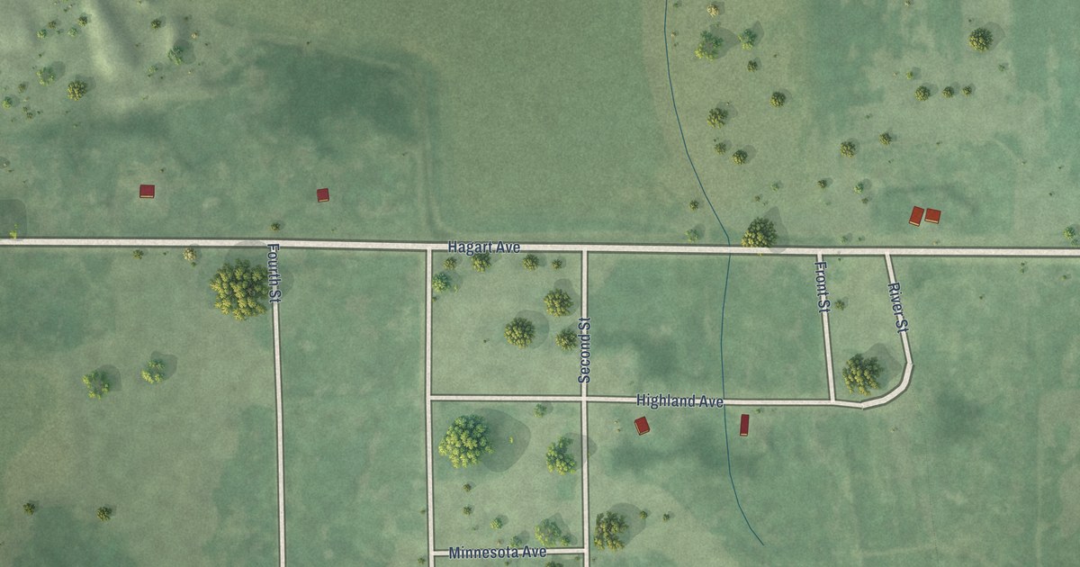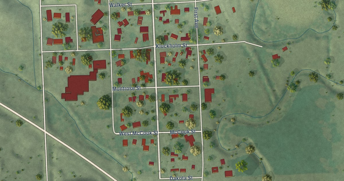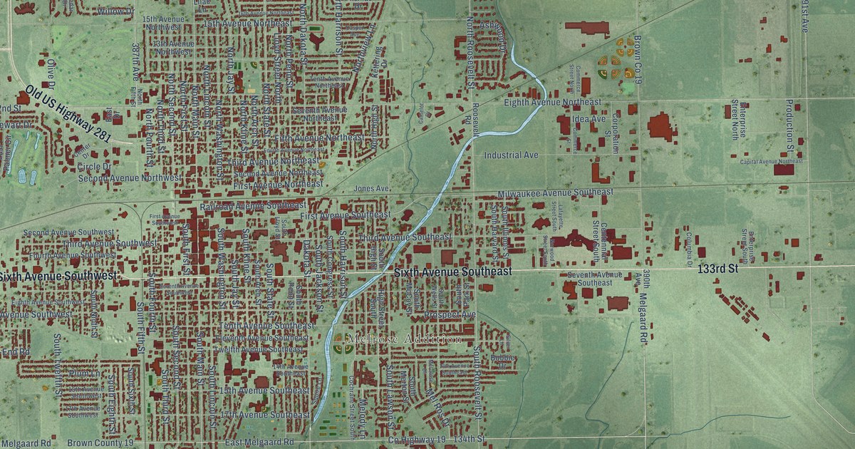
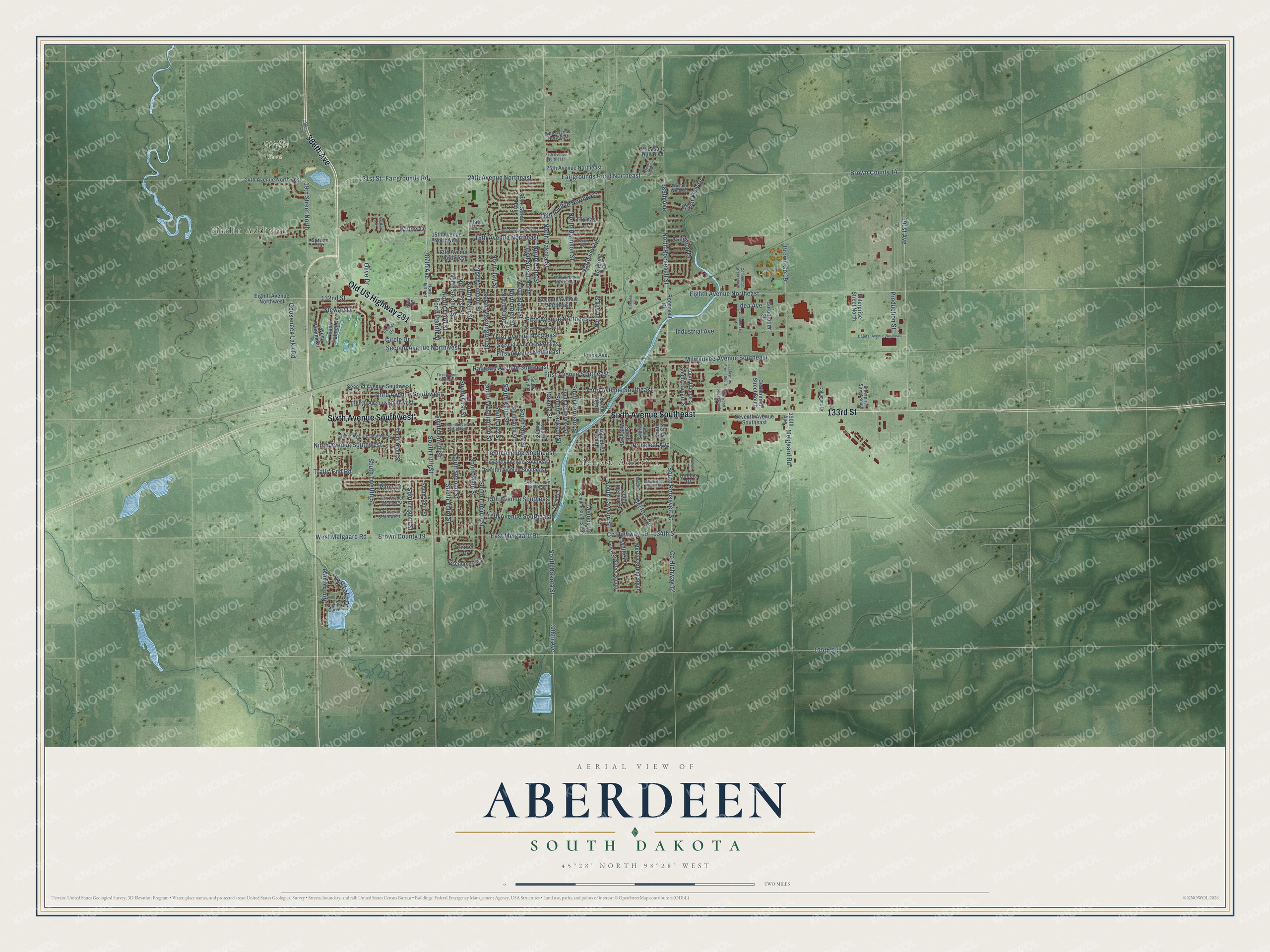
This beautifully detailed map of Aberdeen, South Dakota was created in 2026 using aerial imagery combined with modern topographical, census, street and landmark data. It's a modern aerial view of Aberdeen in Brown County, South Dakota, that combines modern data with a vintage aesthetic. The roads feature printed names, and if you look closely you can find your exact house accurately shown in its correct location.
Explore an aerial view of Aberdeen, South Dakota
On this map you'll find Harlin Addition, Melrose Addition, Wylie Park, 386th Avenue, Sixth Avenue Southeast, Sixth Avenue Southwest, Old US Highway 281, 133rd Street, Co Highway 19, East Melgaard Road, North Main Street, South Main Street, and more. Each red shape is a building, so zoom in on the preview and look for yours.
Aberdeen has a story worth telling. The Chicago and North Western Railway puts it this way: "Aberdeen, Brown County, South Dakota, was named from the city of Aberdeen, Scotland, by Alexander Mitchell of Milwaukee, Wis."
Aberdeen is a city in Brown County. The Census Bureau counted 28,495 people here in 2020.
Take a closer look at the Aberdeen map
Names on this map
These names are printed on this map.
Places: Harlin Addition, Melrose Addition and Wylie Park.
Streets and roads: 386th Avenue, Sixth Avenue Southeast, Sixth Avenue Southwest, Old US Highway 281, 133rd Street, County Highway 19, East Melgaard Road, North Main Street, South Main Street, Fairgrounds Road, South Second Street, North Second Street.
More street names, A to Z
13th Avenue Northwest, 13th Avenue Southeast, 14th Avenue Southeast, 15th Avenue Northeast, 15th Avenue Northwest, 15th Avenue Southeast, 15th Avenue Southwest, 16th Avenue Northeast, 17th Avenue Southeast, 17th Avenue Southwest, 18th Avenue Northeast, 19th Street North, 24th Avenue Northeast, 24th Avenue Northwest, 25th Avenue Northeast, 27th Avenue Northeast, 29th Avenue Northeast, 131st Street, 132nd Street, 134th Street, 135th Street, 387th Avenue, 388th Avenue, 389th Avenue, 390th Avenue, 391st Avenue, Ashwood Drive, Bobbie Drive, Brown County 14, Brown County 19, Camelot Drive, Capital Avenue Northeast, Casper Avenue, Cedar Drive, Centennial Street South, Center Drive, Circle Drive, Cochrane Street South, Columbia Drive, Commerce Street, Commerce Street North, Corporation Street, County Highway 12, Dakota Street, East Drive, East Lake Drive, East Palmer Circle, Eighth Avenue Northeast, Eighth Avenue Northwest, Eighth Avenue Southwest, Eighth Curve, Eisenhower Circle, Eleventh Avenue Southeast, Enterprise Street North, Enterprise Street South, Fairgrounds Road Northeast, Fifth Avenue Northeast, First Avenue Northeast, First Avenue Southeast, First Avenue Southwest, Fourth Avenue Northeast, Fourth Avenue Southwest, Gooseneck Lake Road, Gorder Drive, High Street South, Idea Avenue, Industrial Avenue, Jones Avenue, Kettering Drive, Lafayette Street South, Lawson Street South, Lilac Lane, Lloyd Street North, Mel-Rose Drive, Melgaard Road, Melody Lane, Mel Ros Drive, Merton Street South, Miller Lane, Milwaukee Avenue Southeast, Ninth Avenue Southwest, Ninth Curve, North Arch Street, North Dakota Street, North Fifth Street, North First Street, North Fourth Street, North Harrison Street, North High Street, North Jay Street, North Kline Street, North Lincoln Street, North Penn Street, North Roosevelt Street, North State Street, North Third Street, Northview Lane, North Washington Street, Norwood Street South, Olive Drive, Pheasant Run Boulevard, Plum Lane, Production Street, Prospect Avenue, Quail Run Boulevard, Railroad Avenue Southeast, Roosevelt Road, Second Avenue Northeast, Second Avenue Northwest, Second Avenue Southwest, Seventh Avenue Northeast, Seventh Avenue Southeast, Seventh Avenue Southwest, Silver Lane, South Arch Street, South Congress Street, South Dakota Street, South Eighth Street, South Fifth Street, South First Street, South Fourth Street, South Harrison Street, South Harvard Street, South High Street, South Illinois Street, South Jackson Street, South Jay Street, South Kline Street, South Lawson Street, South Lincoln Street, South Lloyd Street, South McCoy Street, South Merton Street, South Ninth Street, South Park Street, South Penn Street, South Roosevelt Street, South Sixth Street, South State Street, South Third Street, South Twelfth Street, South Washington Street, South Wells Street, Spruce Drive, Squire Lane, State Street North, Stewart Drive, Tenth Avenue Northeast, Tenth Avenue Southeast, Third Avenue Northeast, Third Avenue Southeast, Third Avenue Southwest, Thomas Drive, Trails-End Road, Twelfth Avenue Southeast, Water View Drive, West Melgaard Road, West Palmer Circle, Whisper Wind Drive, Willow Drive.
Created by KNOWOL in 2026. The buildings are small red shapes, the roads carry their printed names, and shaded relief shows the shape of the land. The title panel reads "AERIAL VIEW OF ABERDEEN SOUTH DAKOTA" with 45°28' NORTH 98°28' WEST.
It looks right in a kitchen, an office or a den, and it's a gift for anyone who grew up in Aberdeen or moved away. Open the preview and find your street. See sizes and frames for the Aberdeen map.