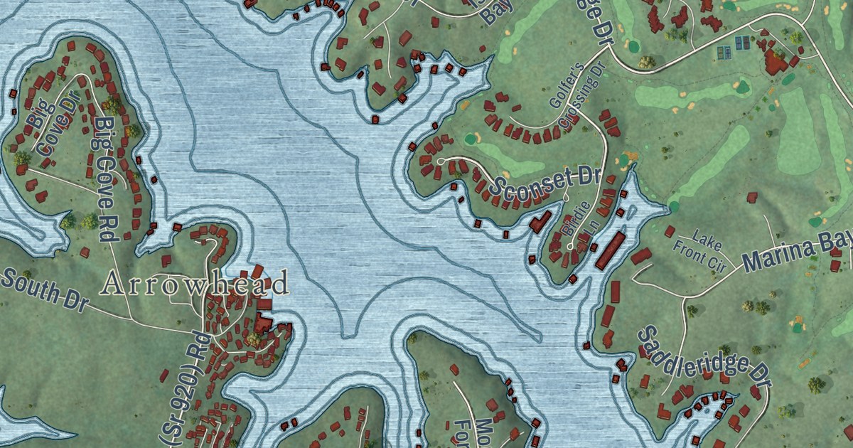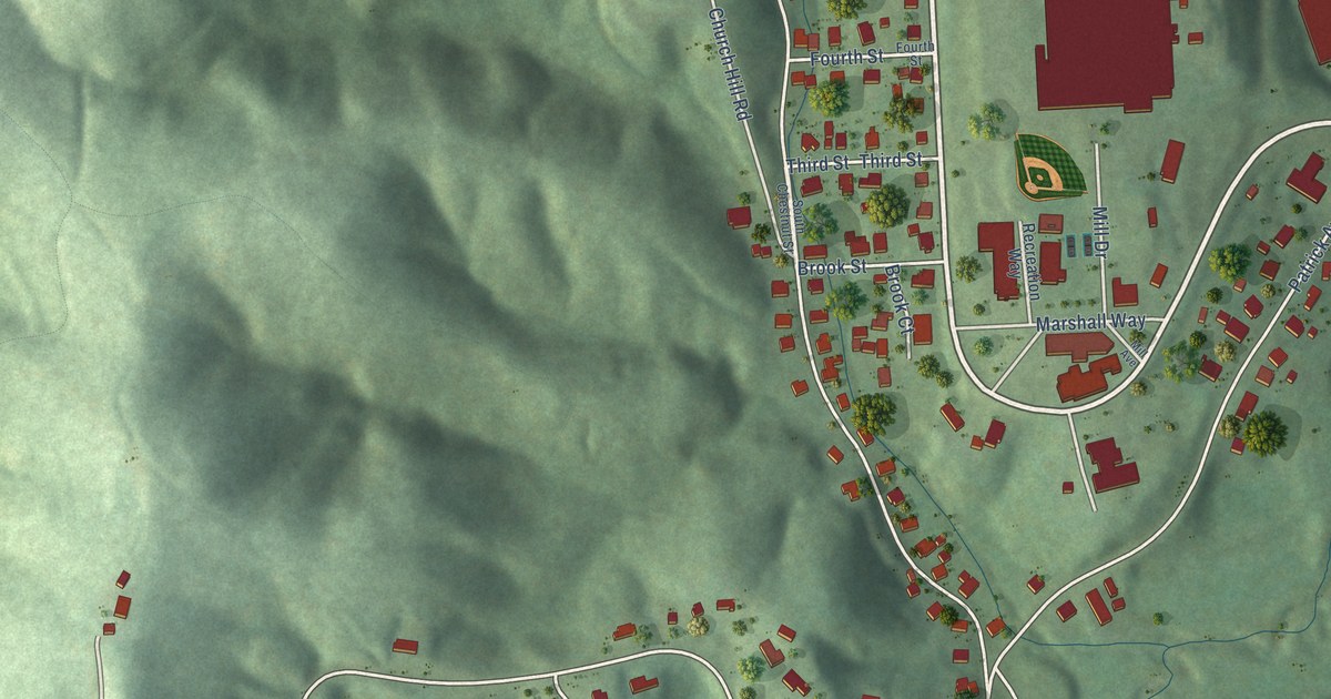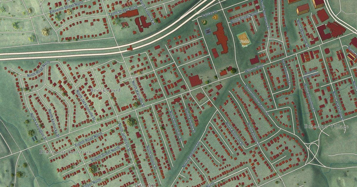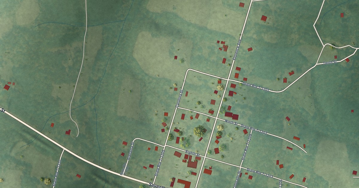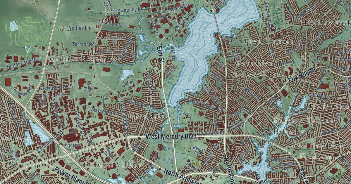
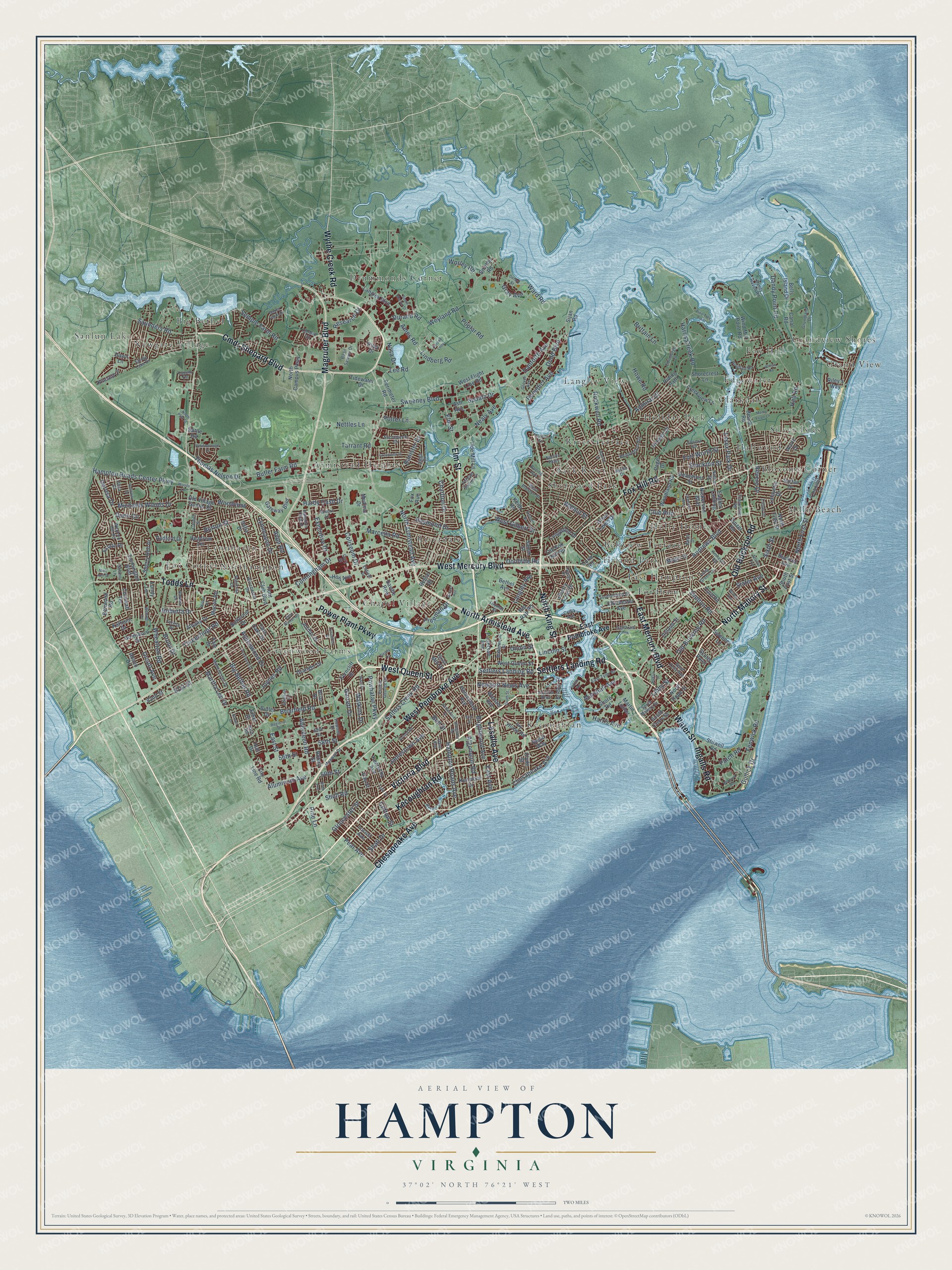
This beautifully detailed map of Hampton, Virginia was created in 2026 using aerial imagery combined with modern topographical, census, street and landmark data. It’s a one-of-a-kind view of Hampton that combines accurate data with a vintage aesthetic. The map shows every building in its true location, many of the roads carry their names, and the shaded topographic relief shows the shape of the land.
Explore an aerial view of Hampton, Virginia
On the map you’ll find Armistead Heights, Back River, Big Bethel, Bloxoms Corner, Chapel Village, Clarkdale, Drummonds Corner, East Hampton, Edgewater, Fordham, and Fox Corner, along with Bellview Terrace, and more. If you look closely you can even find your house accurately drawn in its correct location. Zoom in on the preview to look for yours.
Did you know this piece of Hampton, Virginia history?
From Vcris.dhr.virginia.gov: "Nearby a monument marks the site of the second church at Kecoughtan (later Hampton), built in 1624 for Elizabeth City Parish, established 1610 and now the oldest Protestant parish in continuous existence in America."
Take a closer look at the Hampton map
Street and place names on the Hampton, Virginia map
These names are printed on the map of Hampton, Virginia.
Places: Armistead Heights, Back River, Bellview Terrace, Big Bethel, Bloxoms Corner, Chapel Village, Clarkdale, Drummonds Corner, East Hampton, Edgewater, Fordham, Fox Corner, Fox Hill, Grand View, Grandview Shores, Greenwood Farms, Hallwood, Hiland Park, Holiday Park, Holly Homes, Kecoughtan, Langley View, Lynnhaven, Malo Beach, Newgate Village, Northampton, River Terrace, Riverdale, Sanlun Lake, Sherwood Park and Silver Isles.
Streets and roads: North Armistead Avenue, Victoria Boulevard, Lasalle Avenue, East Mercury Boulevard, North Mallory Street, Kecoughtan Road, West Queen Street, Power Plant Parkway, Settlers Landing Road, Chesapeake Avenue, Elm Street, Cmdr Shepard Boulevard.
More street names, A to Z
50th Street, 56th Street, 58th Street, 60th Street, 81st Street, 82nd Street, Abaco Drive, Aberdeen Road, Addison Court, Admiral Court, Alaric Drive, Albany Drive, Algonquin Road, Alleghany Road, Aluminum Avenue, Ames Road, Amherst Road, Andrews Boulevard, Apollo Drive, Ash Avenue, Aspenwood Drive, Atlantic Avenue, Auburn Lane, Avon Road, Baker Farm Drive, Banister Drive, Basil Sawyer Drive, Battle Road, Beach Road, Beall Drive, Beaumont Street, Beauregard Heights, Bells Island Drive, Bell Street, Bellwood Road, Benedict Avenue, Bernard Road, Bethel Avenue, Big Bethel Road, Birch Avenue, Boeing Avenue, Bowen Drive, Briar Drive, Briarfield Road, Bridge Street, Brightwood Avenue, Brittain Lane, Brout Drive, Buckroe Avenue, Burton Street, Butler Drive, Butler Farm Road, Butternut Drive, Canal Road, Cardiff Street, Cary Street, Channel Lane, Charlton Drive, Cherry Acres Drive, Chichester Avenue, City Line Road, Clifton Street, Club Run, Clyde Street, Coliseum Drive, Cornelius Drive, Cornwall Terrace, Corwin Circle, Creek Avenue, Creekview Lane, Cunningham Drive, Curle Road, Curtis Lane, Dafia Drive, Dandy Haven Road, Dandy Point Road, Danforth Avenue, Dare Avenue, Dawn Lane, Day Street, Deford Street, Derosa Drive, Diggs Drive, Dodd Boulevard, Doolittle Road, Downer Lane, Dunn Circle, Durand Loop, Durand Road, Eagles Landing, East Avenue, East Pembroke Avenue, East Street, East Tyler Street, East Walker Road, Edinburgh Lane, Enfield Drive, Essex Park Drive, Estate Drive, Ethel Drive, Executive Drive, Farmington Boulevard, Fenwick Road, Ferncliff Drive, Fields Drive, Ford Road, Fort Worth Street, Fox Hill Road, Fox Run, Franktown Road, Freeman Drive, Fulton Street, Garrett Drive, Gateway Boulevard, Geddy Drive, Glascow Way, Glica Court, Gloucester Street, Glover Avenue, Goldsboro Drive, Granger Drive, Gray Avenue, Great Lakes Drive, Greenwell Drive, Grist Mill Drive, Grundland Drive, Gullick Drive, Hall Road, Hampton Club Drive, Hampton Roads Avenue, Hampton Roads Center Parkway, Harbor Drive, Hardy Cash Drive, Hare Road, Harris Avenue, Harris Creek Road, Harwin Drive, Headrow Terrace, Hidalgo Drive, Holloway Drive, Holt Avenue, Homestead Avenue, Howe Road, Howmet Drive, Hull Drive, Hunt Club Boulevard, Indian Road, Ingalls Road, Ireland Street, Ivy Home Road, Jamestown Avenue, Jordan Drive, Joynes Road, Kathann Drive, Keith Road, Kenmore Drive, Kentucky Avenue, Kincaid Lane, Lafayette Drive, Langley Avenue, Langley Boulevard, Laurel Drive, Lee Road, Libby Street, Lincoln Street, Lindberg Road, Locust Avenue, Long Green Lane, Longwood Drive, Lundy Lane, Lynnhaven Drive, Macon Road, Madrid Drive, Magruder Boulevard, Manchester Drive, Maplewood Street, Marcella Road, Marshall Avenue, Martha Lee Drive, Martin Luther, Mary Ann Drive, Maxwell Drive, Medical Drive, Mercer Avenue, Michaels Woods Drive, Milton Drive, Moger Drive, Monte Volpe Lane, Nasa Drive, Nathan Street, Nealy Avenue, Nelson Parkway, Nettles Lane, Newport News Avenue, Nickerson Boulevard, North Campus Parkway, North Fifth Street, North First Street, North Hope Street, North King Street, North Park Drive, Old Buckroe Road, Old Fox Hill Road, Old Point Avenue, Old Village Gunter Drive, Orcutt Avenue, Page Drive, Patch Road, Patrician Drive, Patterson Avenue, Pear Avenue, Pelican Shores Drive, Pennwood Drive, Perimeter Road, Peterborough Drive, Pine Lane, Pine Tree Point, Poplar Road, Potter Lane, Powhatan Parkway, Prince George Drive, Radford Drive, Raymond Drive, Reese Drive, Regal Way, Regional Drive, Research Drive, Revere Drive, Riding Path, Riley's Way, Riley Drive, Rip Rap Road, Roberta Drive, Rockwell Road, Roland Drive, Rotary Street, Routten Road, Rutherford Street, Ryland Road, Sacramento Drive, Salem Street, Salters Creek Road, Sandy Lake Drive, Sarfan Drive, Saunders Road, Saville Row, Scotts Point, Semple Farm Road, Shatt Drive, Shell Road, Shelton Road, Sherry Dell Drive, Shorecrest Lane, Shore Road, Sijan Road, Sixth Street, Slater Avenue, Smythe Road, Sonora Drive, South Curry Street, Southerland Drive, South First Street, South Mallory Street, South Marvin Street, South Street, Spaatz Drive, Stilwell Road, Stockton Street, Sweeney Boulevard, Sweeney Lane, Tabb Street, Tarrant Road, Teresa Drive, Thomas Nelson Drive, Thomas Street, Threechopt Road, Tide Mill Lane, Tidewater Drive, Todds Lane, Tupelo Circle, Twin Oaks Drive, Union Street, Vine Street, Walnut Street, Ward Drive, Ward Road, Water Street, Watkins Drive, Wellington Drive, West Flight Line Road, West Gilbert Street, West Kelly Avenue, West Mercury Boulevard, West Pembroke Avenue, West Preston Street, Wexford Hill Road, Weyland Road, Whealton Road, Willow Road, Wilton Avenue, Winchester Drive, Wind Mill Point Road, Woodland Road, Woods Lane, Woodview, Worley Road, Worster Avenue, Wythe Creek Road, Yale Drive, Zinzer Road.
See the Hampton, Virginia map on a wall
The Hampton map as an 18 x 24 inch print in a black frame.

This beautifully detailed map of Hampton makes an attractive addition to your office, library, or den, and it can even be used to teach children the geography and history of the area. It also makes a great gift for anyone with Hampton roots. When you’re done exploring, click here to get your copy of the Hampton map.