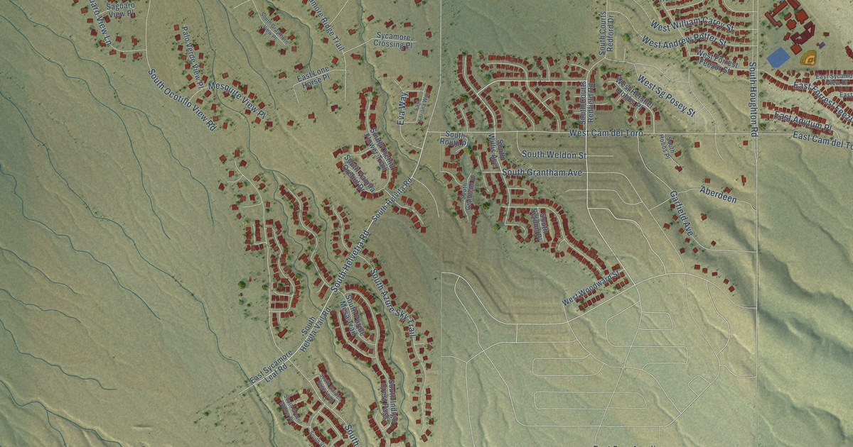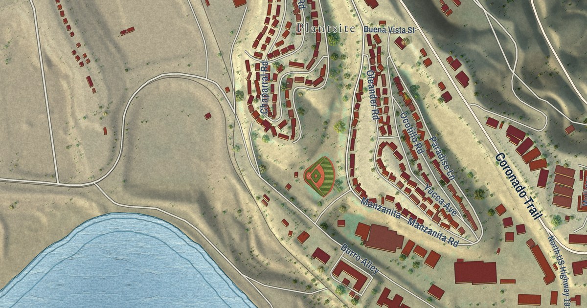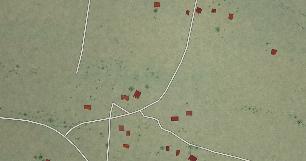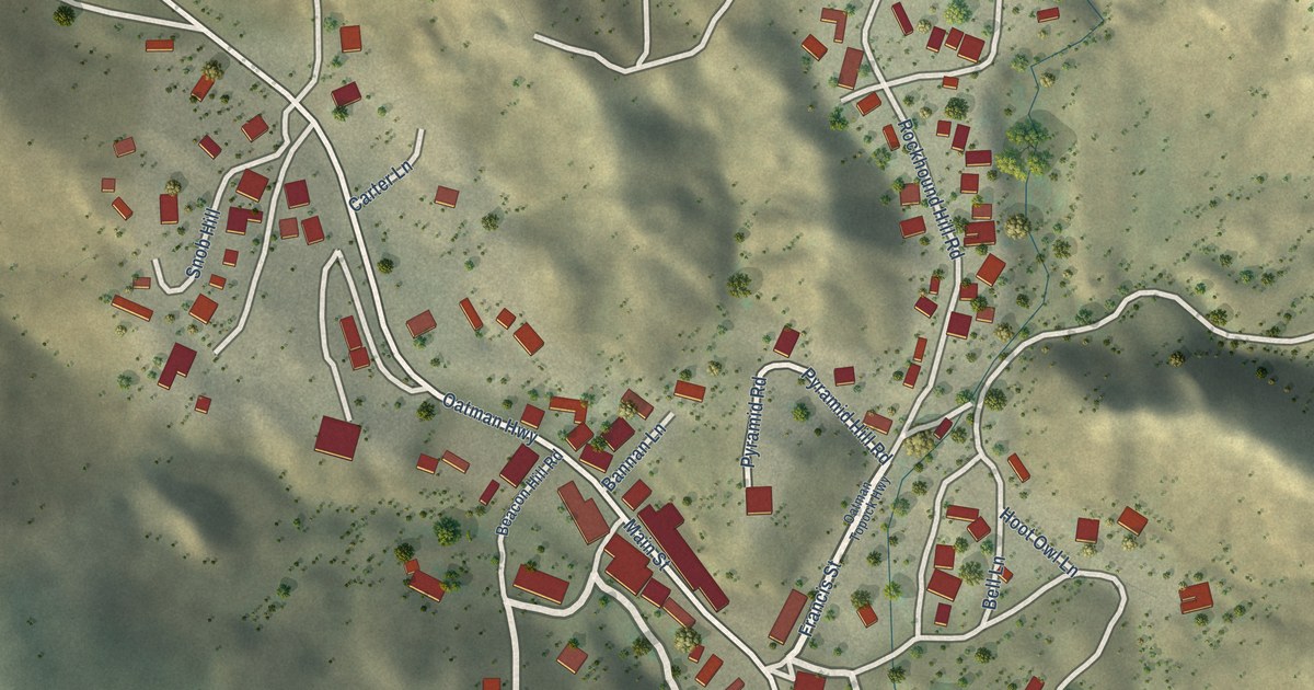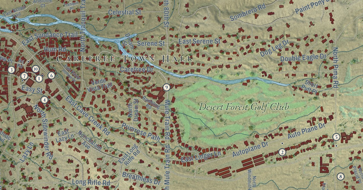
This beautifully detailed map of Carefree, Arizona was created in 2026 using aerial imagery combined with modern topographical, census, street and landmark data. It’s a one-of-a-kind view of Carefree that combines accurate data with a vintage aesthetic. The map shows every building in its true location, many of the roads carry their names, and the shaded topographic relief shows the shape of the land.
See the Carefree, Arizona map on a wall
The Carefree map as an 18 x 24 inch print in a black frame.

Explore an aerial view of Carefree, Arizona
On the map you’ll find Carefree Town Hall, Carefree Foothills, Desert Forest Golf Club, and East Stagecoach Pass, along with Grapevine Road, El Sendero Road, Rising Sun Road, North 80th Street, Mule Train Road, Serene Street, North Mule Train Road, North Boulder Drive, and more. If you look closely you can even find your house accurately drawn in its correct location. Zoom in on the preview to look for yours.
Did you know this piece of Carefree, Arizona history?
Business partners K.T. Palmer and Tom Darlington planned Carefree in the mid-1950s as a master-planned community. Land sales began in 1955, and the first homes went up in 1958. The town incorporated in 1984 so that Scottsdale could not annex it.
Take a closer look at the Carefree map
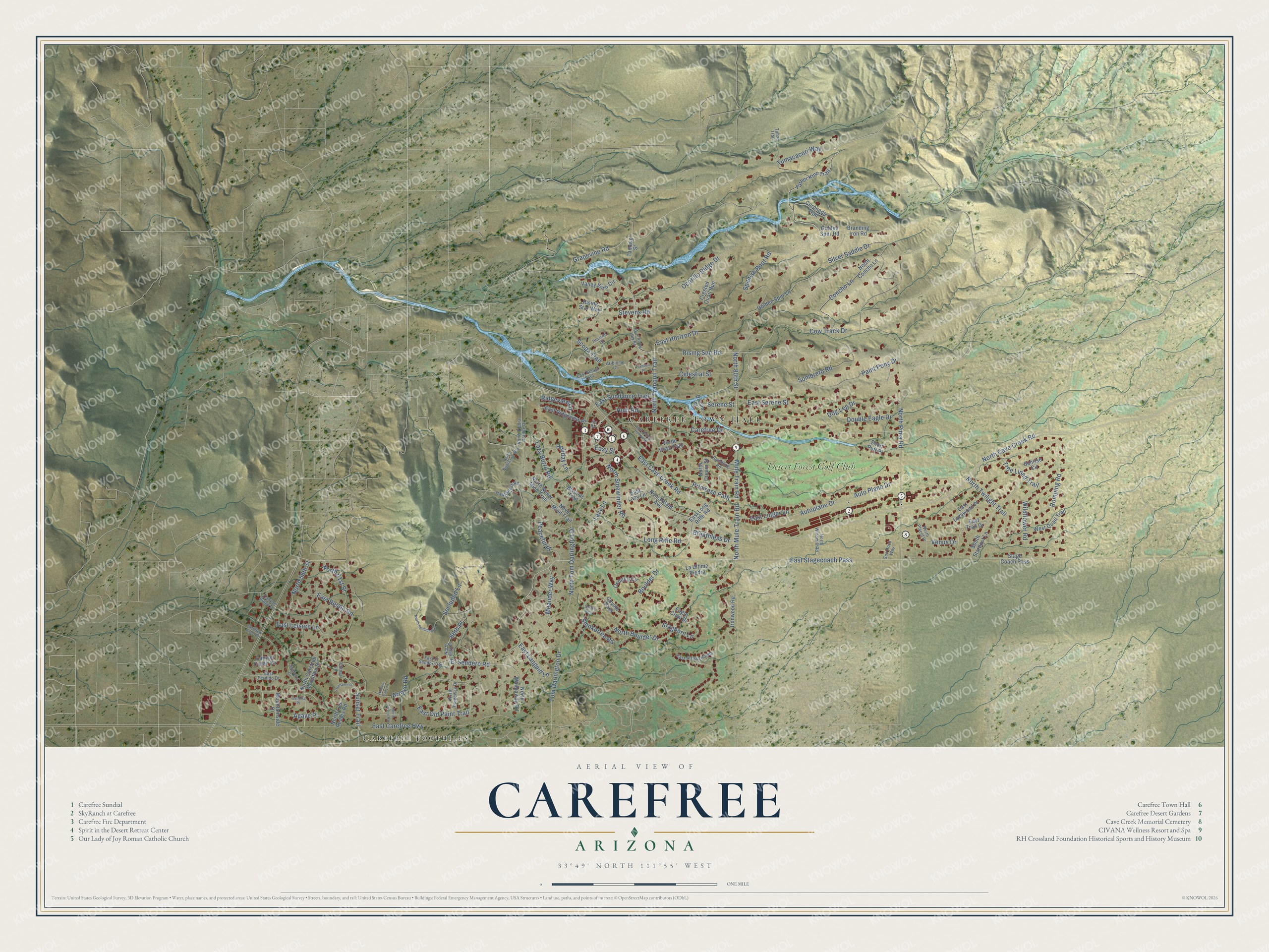
Click to explore a larger preview. The digital watermark does not appear on printed maps.
Street and place names on the Carefree, Arizona map
These names are printed on the map of Carefree, Arizona.
Places: Carefree Town Hall, Carefree Foothills and Desert Forest Golf Club.
Streets and roads: East Stagecoach Pass, Grapevine Road, El Sendero Road, Rising Sun Road, North 80th Street, Mule Train Road, Serene Street, North Mule Train Road, North Boulder Drive, East Linger Lane, Carefree Drive, Cow Track Drive.
More street names, A to Z
66th Place, Agave Place, Aribiome Court, Arroyo Road, Auto Plane Drive, Autoplane Drive, Bivouac Trail, Boulder Drive, Branding Iron Road, Breathless Drive, Canotia Place, Canyon Creek Circle, Canyon Ridge Drive, Celestial Street, Chino Lane, Concho Lane, Coronado Trail, Coyote Pass, Crested Quail Run, Dog Leg Drive, Double Eagle Drive, Dream Street, Eagle Claw Drive, East Arroyo Hondo, East Carefree Highway, East Cave Creek Road, East El Sendora Road, East Happy Hollow Drive, East Horizon Drive, East Languid Lane, East Lazy Lane, East Lazywood Place, East Leisure Lane, East Long Rifle Road, East New River Road, East Old Paint Trail, East Perdido Drive, East Restin Road, East Ridgeview Place, East Scopa Trail, East Serene Street, East Sundance Trail, East Trail Drive, Easy Street, Father Kino Trail, Golden Spur Lane, Golden Spur Road, Hawksnest Road, Hidden Canyon, Holiday Lane, Horizon Drive, Ho Road, Hum Road, Ironwood Road, La Ultima Piedra, Lazy Burro Road, Lazy Lane, Long Rifle Road, Meander Way, Mountainside Drive, Never Mind Trail, Nonchalant Avenue, North 58th Street, North 61st Street, North 66th Place, North Arroyo Road, North Carefree Mountain Drive, North Cave Creek Road, North Concho Lane, North Dream Street, North Los Reales Road, North Never Mind Trail, North Nighthawk Way, North Piedra Grande Drive, North Pima Road, North Placid Place, North Ridgeway Drive, North Rising Sun Road, North Secluded Lane, North Sidewinder Road, North Tom Darlington Drive, North Tranquil Trail, North Twilight Trail, North Whileaway Road, North Windmill Road, Ocotillo Circle, Ocotillo Ridge Drive, Paint Pony Drive, Peaceful Place, Primrose Path, Quails Nest, Rambling Road, Ridgeview Lane, Rising Star Way, Romping Road, Scopa Trail, Secluded Lane, Short Putt Place, Silver Saddle Drive, Smoketree Road, Sombrero Road, Sophora Drive, South Stardust Lane, Spanish Boot Road, Stage Coach Pass, Staghorn Lane, Stevens Road, Sunrise Circle, Sun Rock Way, Sunset Trail, Tamayo Street, Tom Darlington Drive, Tranquil Place, Tree Lined Trail, Tubac Trail, Tumacacori Way, Valley View Circle, Venus Drive, Verde Vista Trail, West Quail Trail, Wildflower Road.
This beautifully detailed map of Carefree makes an attractive addition to your office, library, or den, and it can even be used to teach children the geography and history of the area. It also makes a great gift for anyone with Carefree roots. When you’re done exploring, click here to get your copy of the Carefree map.