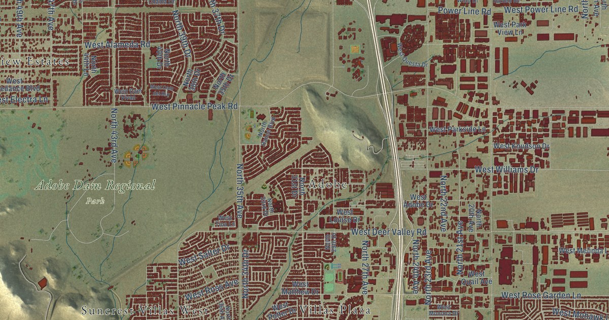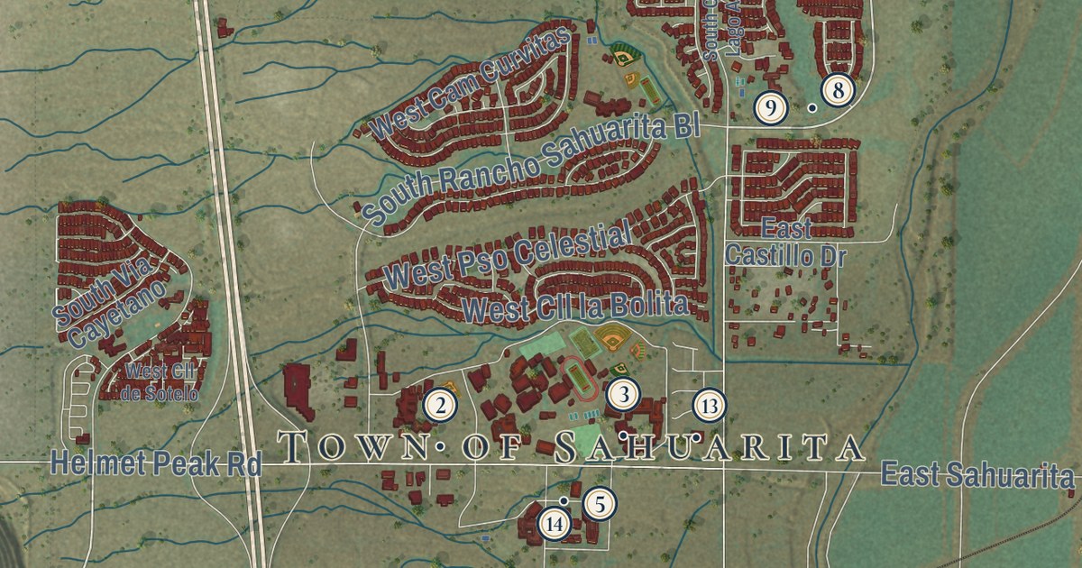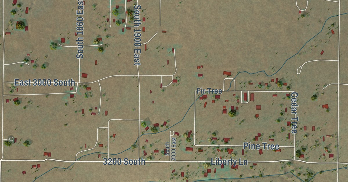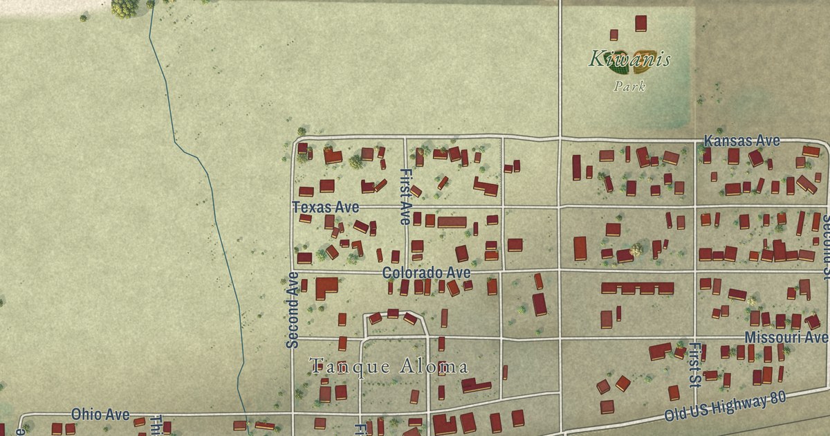
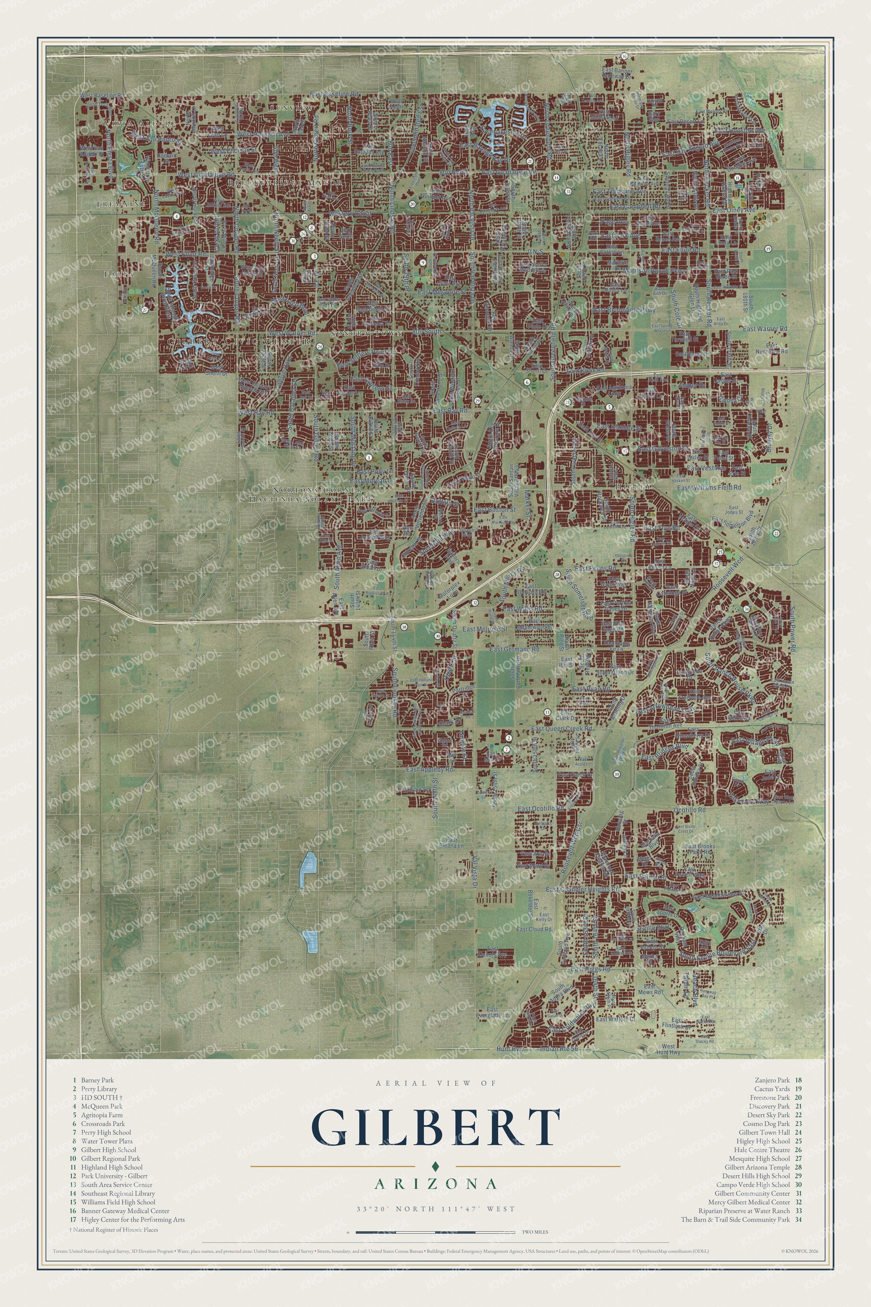
This beautifully detailed map of Gilbert, Arizona was created in 2026 using aerial imagery combined with modern topographical, census, street and landmark data. It’s a one-of-a-kind view of Gilbert that combines accurate data with a vintage aesthetic. The map shows every building in its true location, many of the roads carry their names, and the shaded topographic relief shows the shape of the land.
See the Gilbert, Arizona map on a wall
The Gilbert map as an 18 x 24 inch print in a black frame.

Explore an aerial view of Gilbert, Arizona
On the map you’ll find Gilbert Civic Center, Vista Alegre, Sunview, Hacienda Solano Park, Higley, Falfa, Breckenridge Manor, Tremaine, Sonora Town, Nortons Corner, and Roosevelt Wcd, along with South Higley Road, and more. If you look closely you can even find your house accurately drawn in its correct location. Zoom in on the preview to look for yours.
Did you know this piece of Gilbert, Arizona history?
William Gilbert, known as Bobby, gave land to the Arizona Eastern Railway in 1902 for a line between Phoenix and Florence. The town that grew there carries his name. Gilbert grew as a farm town. From 1911 until the late 1920s, people called it the Hay Capital of the World.
Take a closer look at the Gilbert map
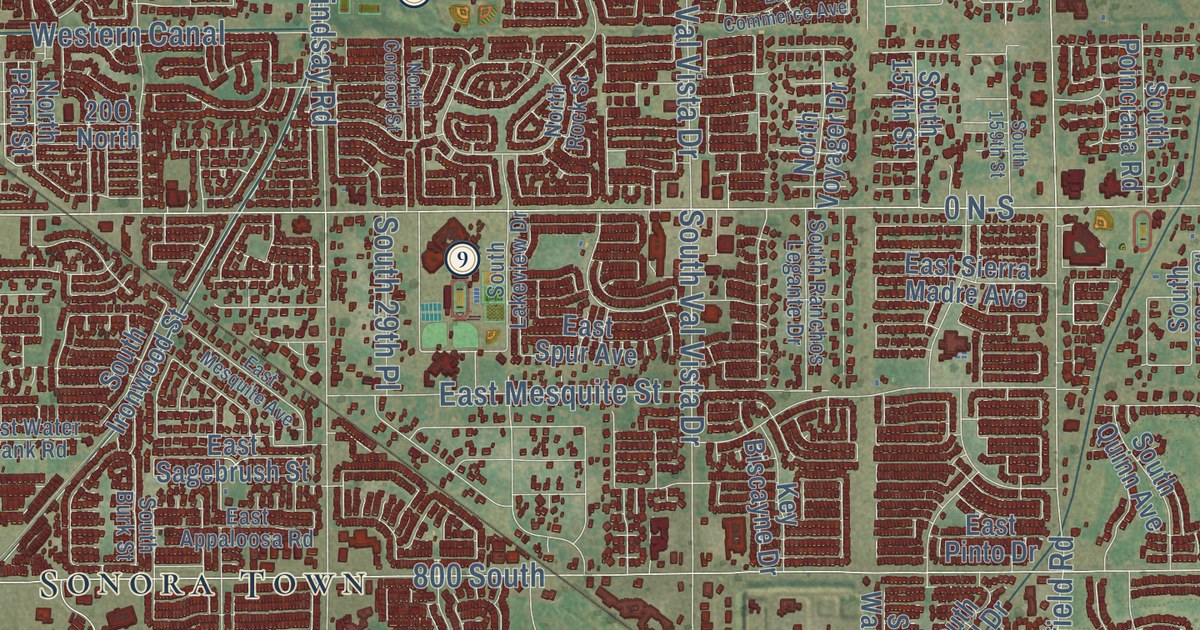
Click to explore a larger preview. The digital watermark does not appear on printed maps.
Street and place names on the Gilbert, Arizona map
These names are printed on the map of Gilbert, Arizona.
Places: Gilbert Civic Center, Vista Alegre, Sunview, Hacienda Solano Park, Higley, Falfa, Breckenridge Manor, Tremaine, Sonora Town and Nortons Corner.
Streets and roads: South Higley Road, Roosevelt Wcd, South Greenfield Road, South Val Vista Drive, East Baseline Road, South Recker Road, South Power Road, South Lindsay Road, East Pecos Road, East Ray Road, East Germann Road, East Warner Road.
More street names, A to Z
0 E-W, 0 N-S, 164th Street, 400 West, 450 North, 800 East, 800 North, 800 South, 1500 North, 1600 East, Andre Avenue, Banning Street, Bautista Road, Beach Boulevard, Bluejay Drive, Bosal Drive, Buffalo Street, Cambridge Street, Carob Drive, Clark Drive, Colonial Street, Consolidated Csr, Country Lane, East Agritopia Loop, East Allen Avenue, East Andre Avenue, East Appaloosa Road, East Appleby Road, East Apricot Lane, East Aris Drive, East Arrowhead Trail, East Azalea Court, East Banner Gateway Drive, East Barbarita Avenue, East Bart Street, East Baylor Lane, East Betsy Lane, East Bloomfield Parkway, East Blue Sage Road, East Blue Spruce Lane, East Bonanza Road, East Boston Street, East Boxelder Street, East Bridges Boulevard, East Brisa Drive, East Brooks Farm Road, East Bruce Avenue, East Buffalo Street, East Calistoga Drive, East Campbell Road, East Carob Drive, East Carriage Court, East Cathy Drive, East Chandler Heights Road, East Clark Drive, East Cloud Road, East Coldwater Boulevard, East Commerce Avenue, East Cotton Lane, East Country Plaza South, East Cullumber Street, East Cypress Street, East Daniel Drive, East Del Rio Street, East Desert Lane, East Douglas Avenue, East Dublin Street, East Dubois Avenue, East Eleana Lane, East Elgin Street, East Elliot Road, East Elona Drive, East Encinas Avenue, East Erie Street, East Everglade Lane, East Ficus Way, East Flintlock Drive, East Flower Street, East Ford Avenue, East Fruitvale Avenue, East Frye Road, East Gail Drive, East Galveston Street, East Guadalupe Road, East Haskell Street, East Haven Crest Drive, East Holland Park Drive, East Hopkins Road, East Houston Avenue, East Ibis Street, East Ivanhoe Street, East Jasper Drive, East Jones Street, East Joseph Way, East Jude Lane, East Julian Drive, East Juniper Avenue, East Kelly Drive, East Kent Avenue, East Kesler Lane, East Knox Road, East Lakeside Drive, East Libra Street, East Linda Lane, East Lines Lane, East Lowell Avenue, East Maplewood Street, East Marlene Drive, East Mead Drive, East Meadowview Drive, East Melody Drive, East Melrose Street, East Mesquite Avenue, East Mesquite Street, East Mews Road, East Mia Lane, East Millbrae Lane, East Morgan Drive, East Muirfield Street, East Nunneley Road, East Ocotillo Road, East Olive Avenue, East Olney Avenue, East Orchid Lane, East Oxford Lane, East Page Avenue, East Palmer Street, East Palo Verde Street, East Park Avenue, East Parkview Drive, East Pinto Drive, East Pony Lane, East Portola Valley Drive, East Powell Way, East Queen Creek Road, East Raleigh Bay Drive, East Rawhide Street, East Redfield Road, East Reins Road, East Riggs Road, East Rivulon Boulevard, East Robin Lane, East Ryan Road, East Sagebrush Street, East San Angelo Avenue, East San Remo Avenue, East Santa Fe Lane, East Settlers Point Drive, East Sherri Drive, East Sierra Madre Avenue, East Silo Drive, East Sipapu Drive, East Somerton Boulevard, East Sports Drive, East Spring Wheat Lane, East Spur Avenue, East Spur Road, East Stacey Road, East Stone Crest Drive, East Strawberry Drive, East Superstition Drive, East Susan Drive, East Terrace Avenue, East Thornton Avenue, East Toledo Street, East Tremaine Avenue, East Tulsa Street, East Turley Street, East Turnbull Street, East Vallejo Court, East Vermont Drive, East Vest Avenue, East Village Parkway, East Water Tank Road, East Watford Court, East Watford Drive, East Williams Field Road, East Willis Road, East Wyatt Way, East Yeager Drive, Freestone Parkway, Frye Road, Garden Circle, Gary Way, Geronimo Court, Granite Street, Hamilton Court, Harvard Street, Harwell Road, Highlnad Hawks Drive, Hunt Highway, Indian Route 56, Jasper Drive, Joseph Way, Joslyn Lane, Key Biscayne Drive, Lark Drive, Marbella Boulevard, Marble Street, Market Street, Marlene Drive, Mead Drive, Merlot Street, Mia Lane, Morrison Ranch Parkway, Motorplex Loop, Nielson Street, North Ash Street, North Beebe Street, North Bluejay Drive, North Burk Street, North Cole Drive, North Colorado Street, North Concord Street, North Cooper Road, North El Dorado Drive, North Falcon Drive, North Fiesta Boulevard, North Gilbert Road, North Greenfield Road, North Higley Road, North Horne Street, North Lake Park Drive, North Lindsay Road, North McQueen Road, North Meadows Drive, North Mondel Drive, North Neely Street, North Nielson Street, North Oak Street, North Palm Street, North Park Village Drive, North Recker Road, North Riata Street, North Rock Street, North Saddle Street, North San Benito Drive, North Shore Lane, North Ski Court, North Tech Boulevard, North Tucana Lane, North Val Vista Drive, North Voyager Drive, Ocotillo Road, Olive Avenue, Orleans Drive, Page Avenue, Park Avenue, Partridge Drive, Quartz Street, Quin Avenue, Rachael Way, Ranch House Parkway, Richard Lane, Roosevelt Wcd Csr, Runaway Bay Place, Sailors Way, Seville Boulevard, Shamrock Estates Road, South 29th Place, South 131st Street, South 138th Street, South 140th Street, South 142nd Street, South 144th Street, South 147th Place, South 148th Street, South 154th Street, South 156th Street, South 157th Street, South 158th Street, South 159th Street, South 162nd Street, South 163rd Place, South 163rd Street, South 164th Street, South 165th Place, South 172nd Street, South 178th Street, South 180th Street, South Adora Boulevard, South Allen Avenue, South Ashland Ranch Road, South Ash Street, South Atherton Boulevard, South Autumn Drive, South Balboa Drive, South Banning Drive, South Beebe Street, South Bluejay Drive, South Burk Street, South Canal Drive, South Catalina Street, South Cole Drive, South Colt Drive, South Concord Street, South Cooper Road, South Coronado Road, South Crestview Drive, South Cupertino Drive, South De Anza Boulevard, South Delmar Court, South Elm Street, South Falcon Drive, South Follett Way, South Freeman Drive, South Gilbert Road, South Granite Street, South Griswold Street, South Heritage Drive, South Highland Glen Lane, South Ironwood Street, South Islands Drive West, South Jeffry Street, South Key Biscayne Drive, South Lakeview Drive, South Layton Lakes Boulevard East, South Martingale Road, South McQueen Road, South Mercy Road, South Mustang Drive, South Napa Lane, South Neely Street, South Nielson Street, South Ocean Drive, South Parkcrest Street, South Pico Street, South Poinciana Road, South Porter Street, South Portland Avenue, South Posse Trail, South Quartz Street, South Quinn Avenue, South Ranch House Parkway, South Ranchos Legante Drive, South Regional Park Drive, South Reseda Street, South Riata Street, South Roanoke Street, South Rockwell Street, South Roles Drive, South Rome Street, South Saddle Street, South Sandstone Street, South Santan Village Parkway, South Seville Boulevard East, South Soboba Street, South Somerset Boulevard, South Sorrell Lane, South Star Canyon Drive, South Tatum Lane, South Tucana Lane, South Velvendo Drive, South Wade Drive, South Wanda Drive, South Western Skies Drive, Spectrum Way, Stampede Drive, Star Drive, Tatum Lane, Twelve Oaks, Val Vista Drive, Village Parkway, Virginia Street, Walnut Road, West Baseline Road, West Candlewood Lane, West Coast Drive, West Country Estates Avenue, West Elliot Road, West Encinas Street, Western Canal, West Gail Drive, West Guadalupe Road, West Houston Avenue, West Hunt Highway, West Iris Drive, West Juniper Avenue, West Lago Boulevard, West Laurel Avenue, West Leah Lane, West Loma Vista Street, West Palo Verde Street, West Ray Road, West San Angelo Street, West San Pedro Street, West Scott Avenue, West Sherri Drive, West Straford Avenue, West Warner Road, Willet Street, Wilson Way, Wren Drive.
This beautifully detailed map of Gilbert makes an attractive addition to your office, library, or den, and it can even be used to teach children the geography and history of the area. It also makes a great gift for anyone with Gilbert roots. When you’re done exploring, click here to get your copy of the Gilbert map.