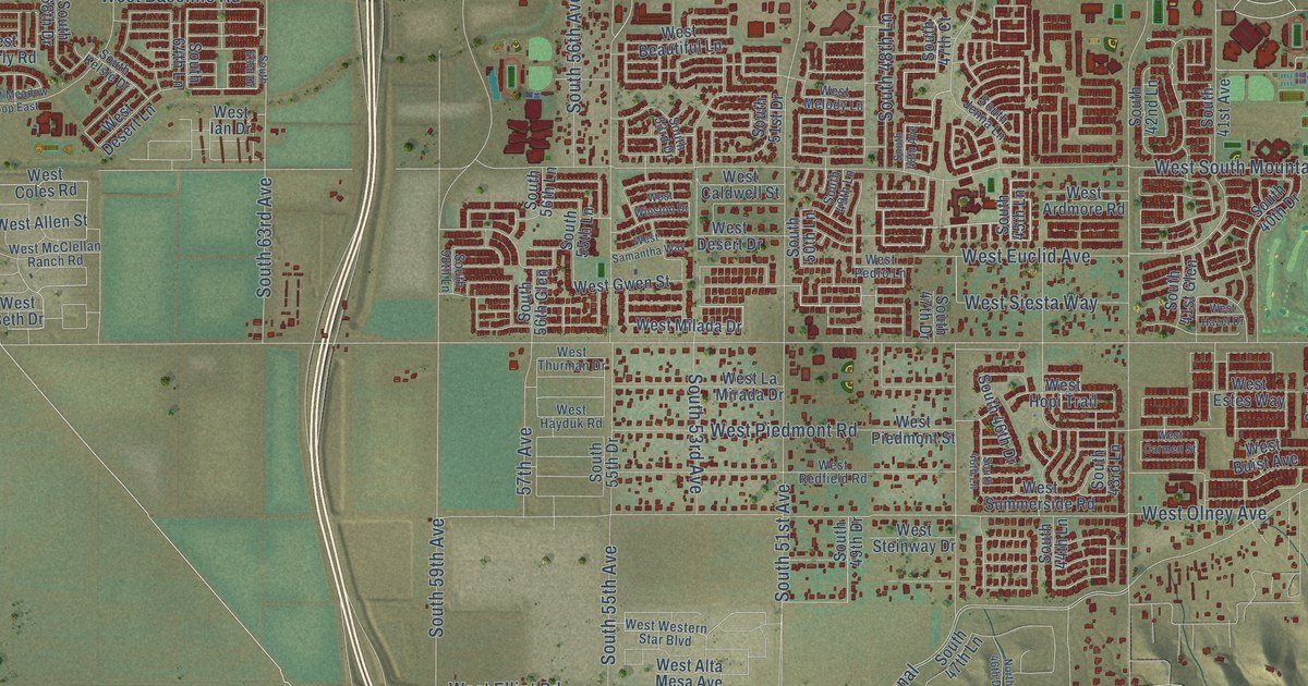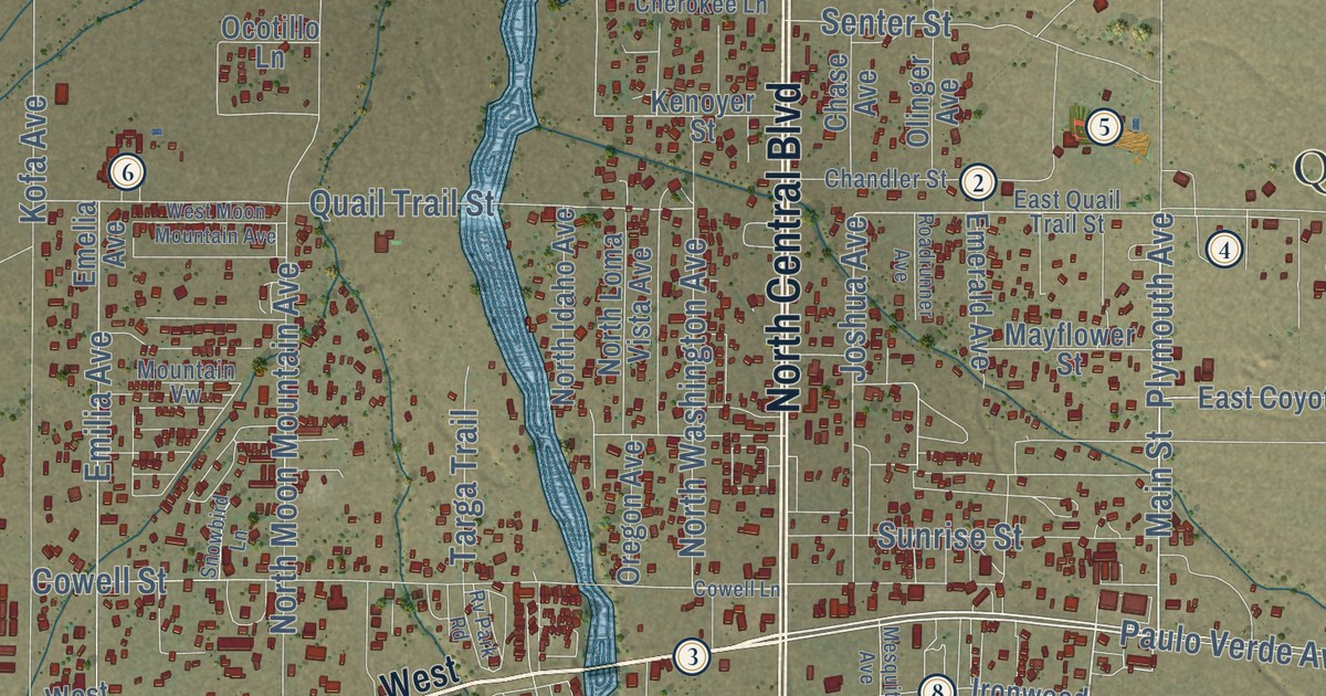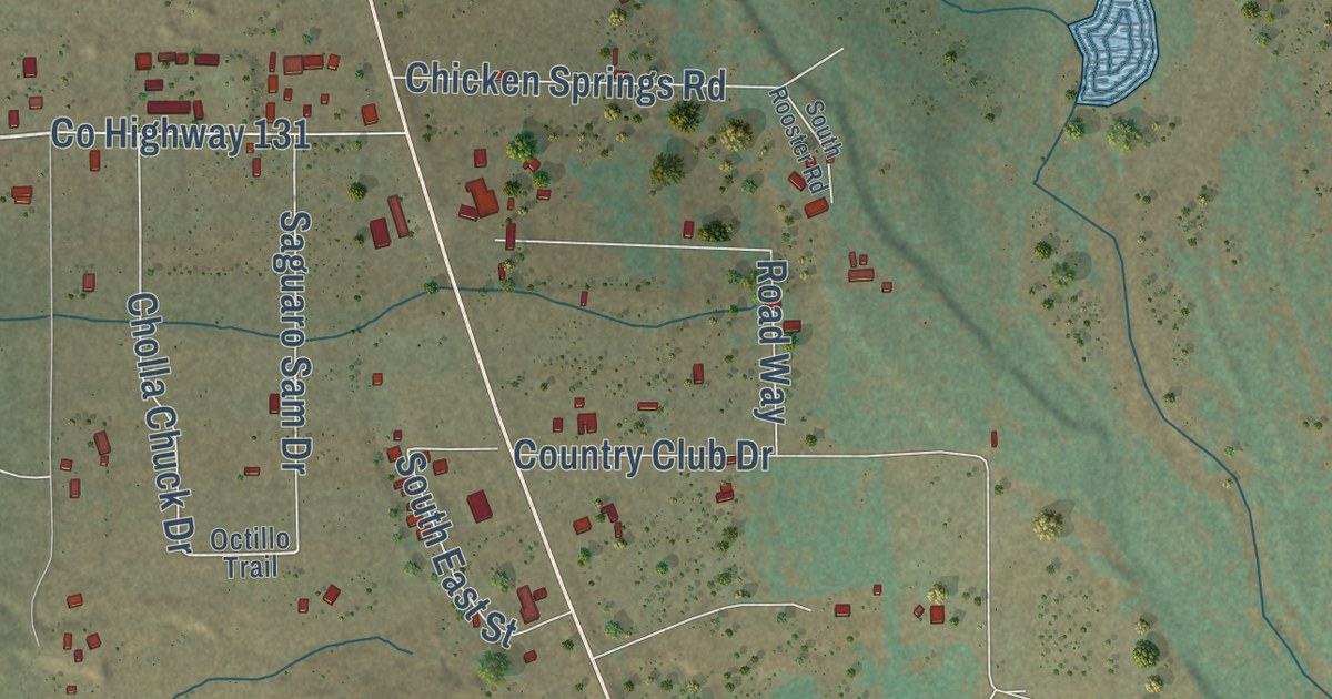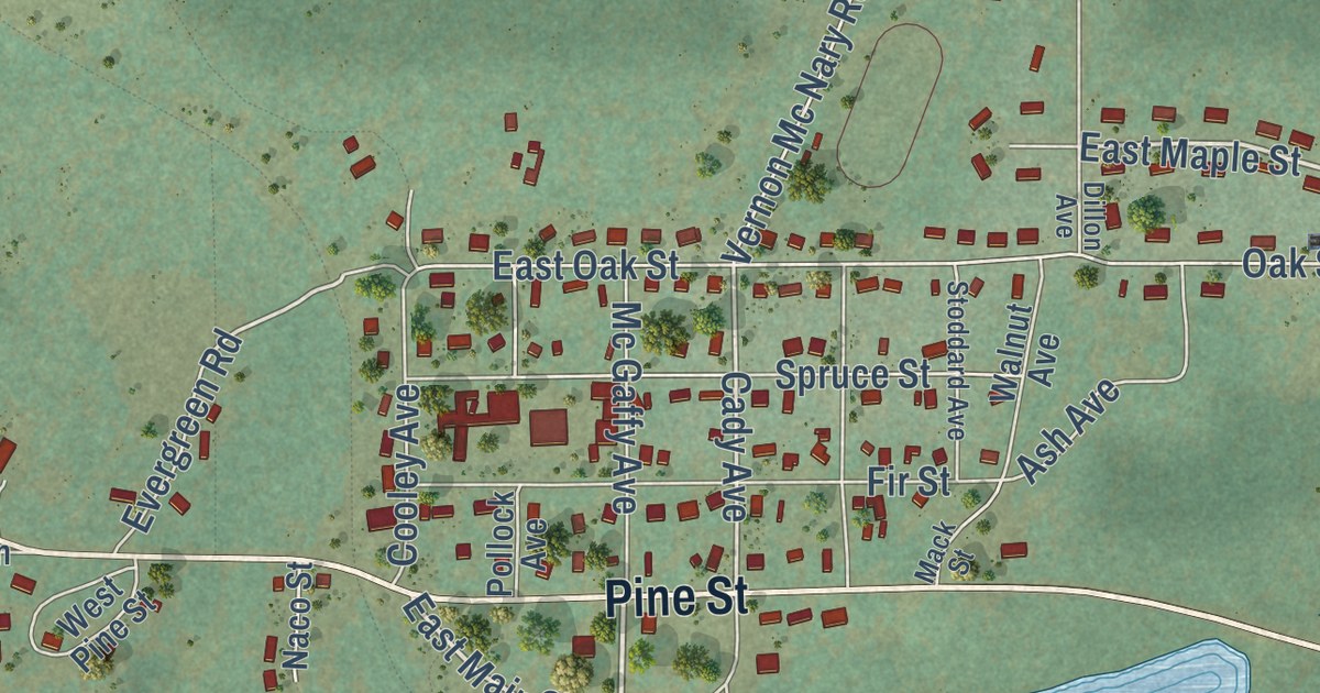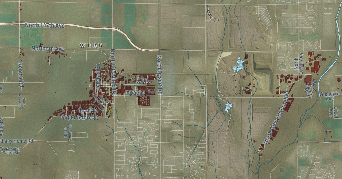
This beautifully detailed map of Glendale, Arizona was created in 2026 using aerial imagery combined with modern topographical, census, street and landmark data. It’s a one-of-a-kind view of Glendale that combines accurate data with a vintage aesthetic. The map shows every building in its true location, many of the roads carry their names, and the shaded topographic relief shows the shape of the land.
See the Glendale, Arizona map on a wall
The Glendale map as an 18 x 24 inch print in a black frame.

Explore an aerial view of Glendale, Arizona
On the map you’ll find Glendale City Hall, Arrowhead Ranch, Fennemore, Marlborough Meadows, La Fontana Heights, Lexington Place, Windsor Square, Webb, Belaire Manor, Chaparral, San Miguel, Mountain View Meadows, and more. If you look closely you can even find your house accurately drawn in its correct location. Zoom in on the preview to look for yours.
Did you know this piece of Glendale, Arizona history?
William John Murphy finished the Arizona Canal in 1885, bringing water to bare desert. Two years later he formed a land company and chose the name Glendale for the tract. In 1891 he helped bring 70 Brethren families here to start a temperance colony. Its ban on alcohol drew still more settlers.
Take a closer look at the Glendale map
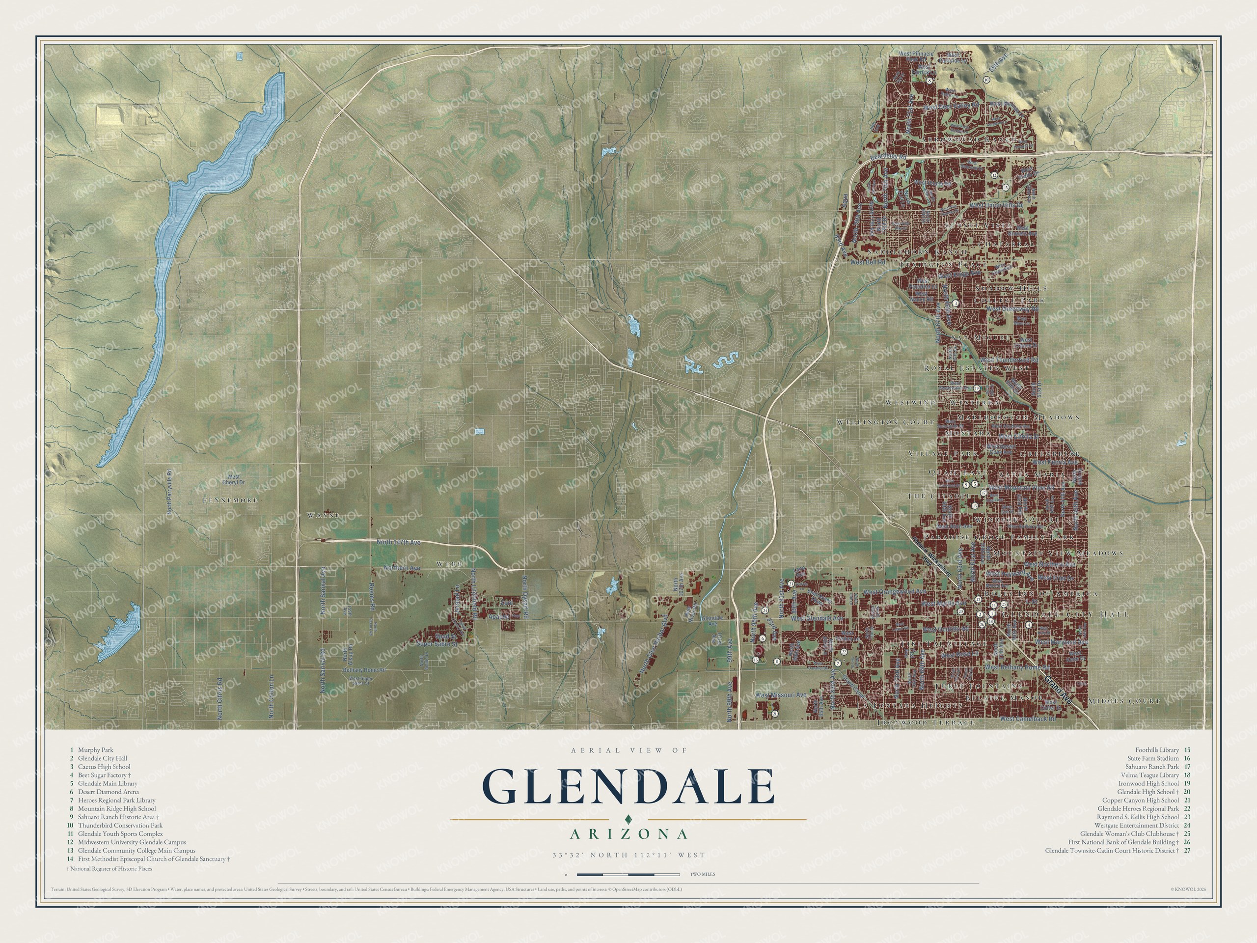
Click to explore a larger preview. The digital watermark does not appear on printed maps.
Street and place names on the Glendale, Arizona map
These names are printed on the map of Glendale, Arizona.
Places: Glendale City Hall, Arrowhead Ranch, Fennemore, Marlborough Meadows, La Fontana Heights, Lexington Place, Windsor Square, Webb, Belaire Manor, Chaparral, San Miguel, Mountain View Meadows, Wellington Court, Midges Court, Santa Maria, The Citadel, Paradise Grove Family Park, Village Park, Royal Estates West, Shadow Hills, Roles Inn of America, Wayne, Greenbriar, Tiki Tai Village, Saddlehorn Ranch, Westerra, Montara, Sunset Vista, College Park, Three Fountains, Ironwood Terrace, Westwind and Quail Lane.
Streets and roads: Grand Avenue, West Glendale Avenue, North 67th Avenue, West Bethany Home Road, North 63rd Avenue, North 61st Avenue, West Camelback Road, West Maryland Avenue, North 71st Avenue, West Ocotillo Road, West Orangewood Avenue, North 75th Avenue.
More street names, A to Z
59th Avenue, 71st Avenue, 76th Avenue, 83rd Avenue, 89th Avenue, 93rd Avenue, 99th Avenue, 101st Avenue, 159th Avenue, Apache, Aqua, Beardsley Road, Bethany Home Road, Carole Lane, Emil Rovey Parkway, Fighter Country Avenue, Glendale Avenue, Grand Canal, Hopi, Jerstad Lane, L-Street, Lane Avenue, New River Road, North 44th Avenue, North 44th Drive, North 45th Avenue, North 47th Avenue, North 49th Avenue, North 51st Drive, North 52nd Avenue, North 53rd Avenue, North 55th Avenue, North 55th Drive, North 57th Avenue, North 58th Drive, North 59th Avenue, North 61st Drive, North 63rd Drive, North 64th Drive, North 65th Avenue, North 66th Avenue, North 68th Avenue, North 68th Drive, North 69th Avenue, North 70th Avenue, North 71st Lane, North 73rd Avenue, North 73rd Drive, North 75th Drive, North 76th Drive, North 77th Avenue, North 77th Drive, North 78th Avenue, North 79th Avenue, North 79th Drive, North 79th Lane, North 83rd Avenue, North 83rd Lane, North 85th Avenue, North 89th Avenue, North 91st Avenue, North 95th Avenue, North 99th Avenue, North 107th Avenue, North 147th Avenue, North Alsup Road, North Ammo Drive, North Citrus Road, North Cotton Lane, North Dysart Road, Northern Avenue, North Glen Harbor Boulevard, North Litchfield Road, North Perryville Road, North Reems Road, North Sarival Avenue, North Sarival Road, Olive, Phoenix-Wickenburg Highway, Reems Road, Spad Street, Super Sabre Street, West Abraham Lane, West Alice Avenue, West Altadena Avenue, West Barbara Avenue, West Behrend Drive, West Bell Road, West Cavalier Drive, West Cheryl Drive, West Cholla Street, West Colter Street, West Crocus Drive, West Deer Valley Road, West Desert Cove Avenue, West Eva Street, West Frier Drive, West Greenway Road, West Grovers Avenue, West Hayward Avenue, West Ironwood Drive, West Keim Drive, West Kings Avenue, West Krall Street, West Lamar Road, West Maui Lane, West Melinda Lane, West Missouri Avenue, West Morten Avenue, West Mountain View Road, West Myrtle Avenue, West Nancy Road, West Northern Avenue, West Oraibi Drive, West Paradise Lane, West Parkside Lane, West Patrick Lane, West Peoria Avenue, West Pinnacle Peak Road, West Robin Lane, West Rose Garden Lane, West Rose Lane, West Sunnyside Drive, West Super Sabre Street, West Sweetwater Avenue, West Talavi Boulevard, West Thunderbird Road, West Tonopah Drive, West Tuckey Lane, West Union Hills Drive, West Utopia Road, West Villa Rita Drive, West Villa Theresa Drive, West Vogel Avenue, Zuni.
This beautifully detailed map of Glendale makes an attractive addition to your office, library, or den, and it can even be used to teach children the geography and history of the area. It also makes a great gift for someone who left Glendale and still calls it home. When you’re done exploring, click here to get your copy of the Glendale map.