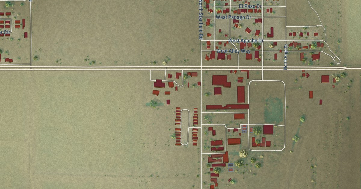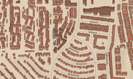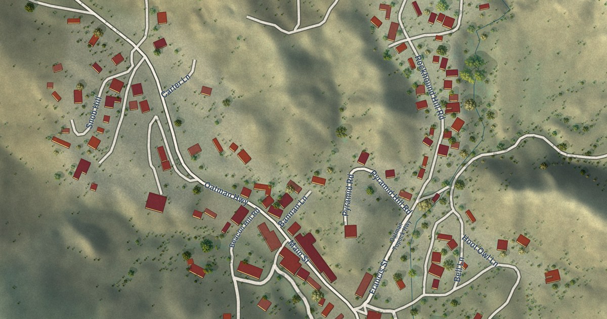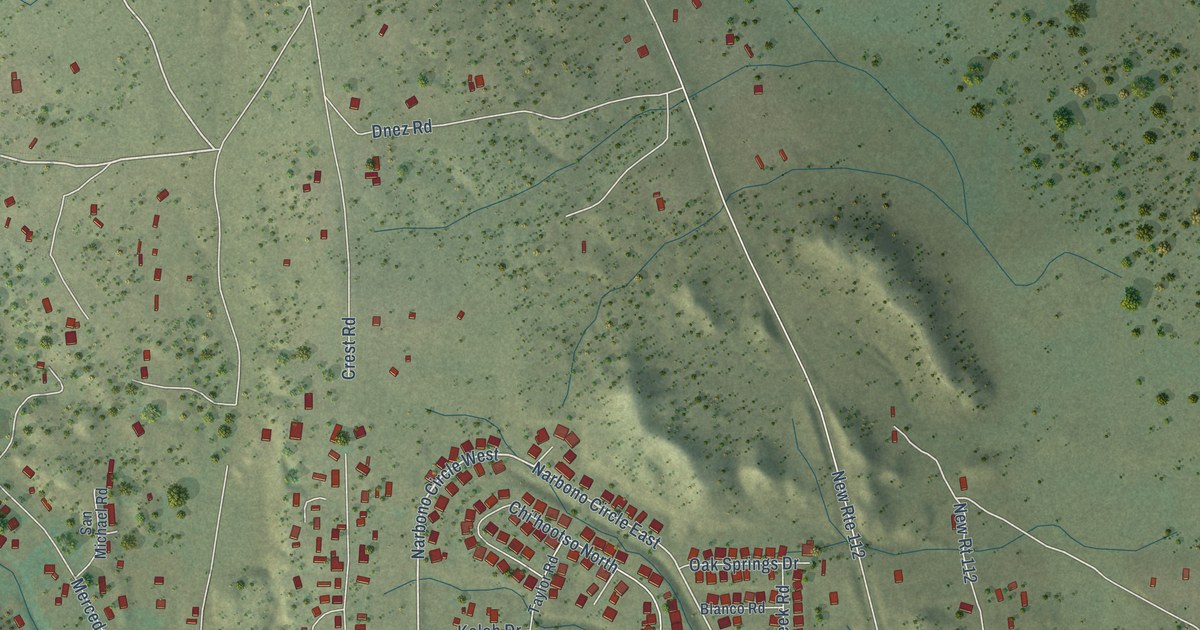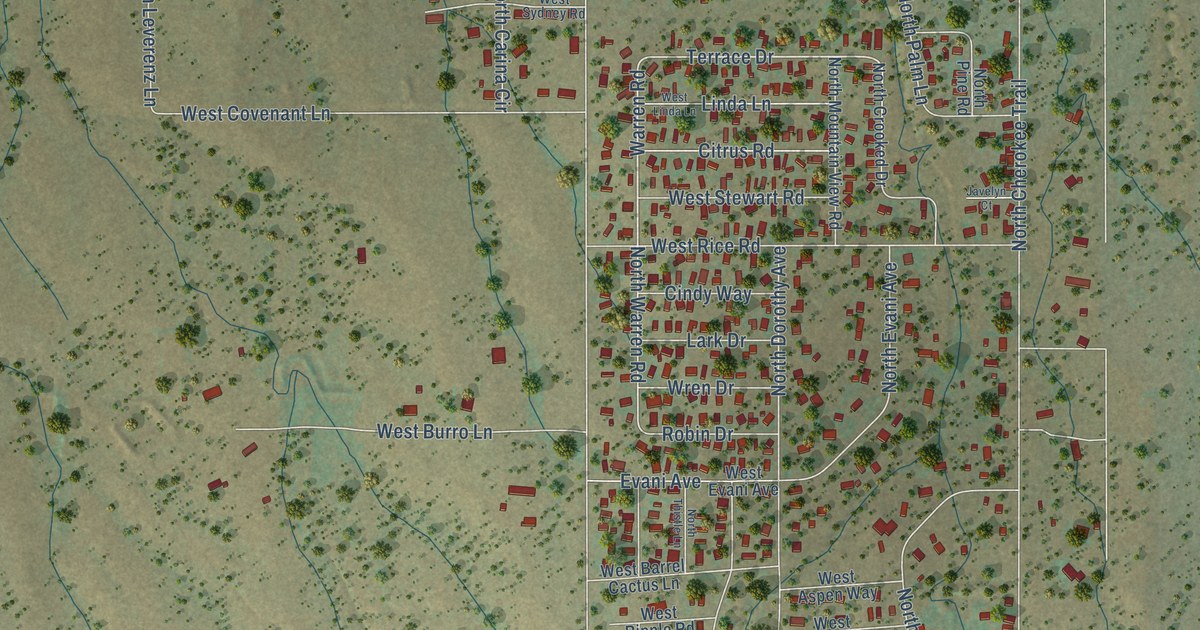
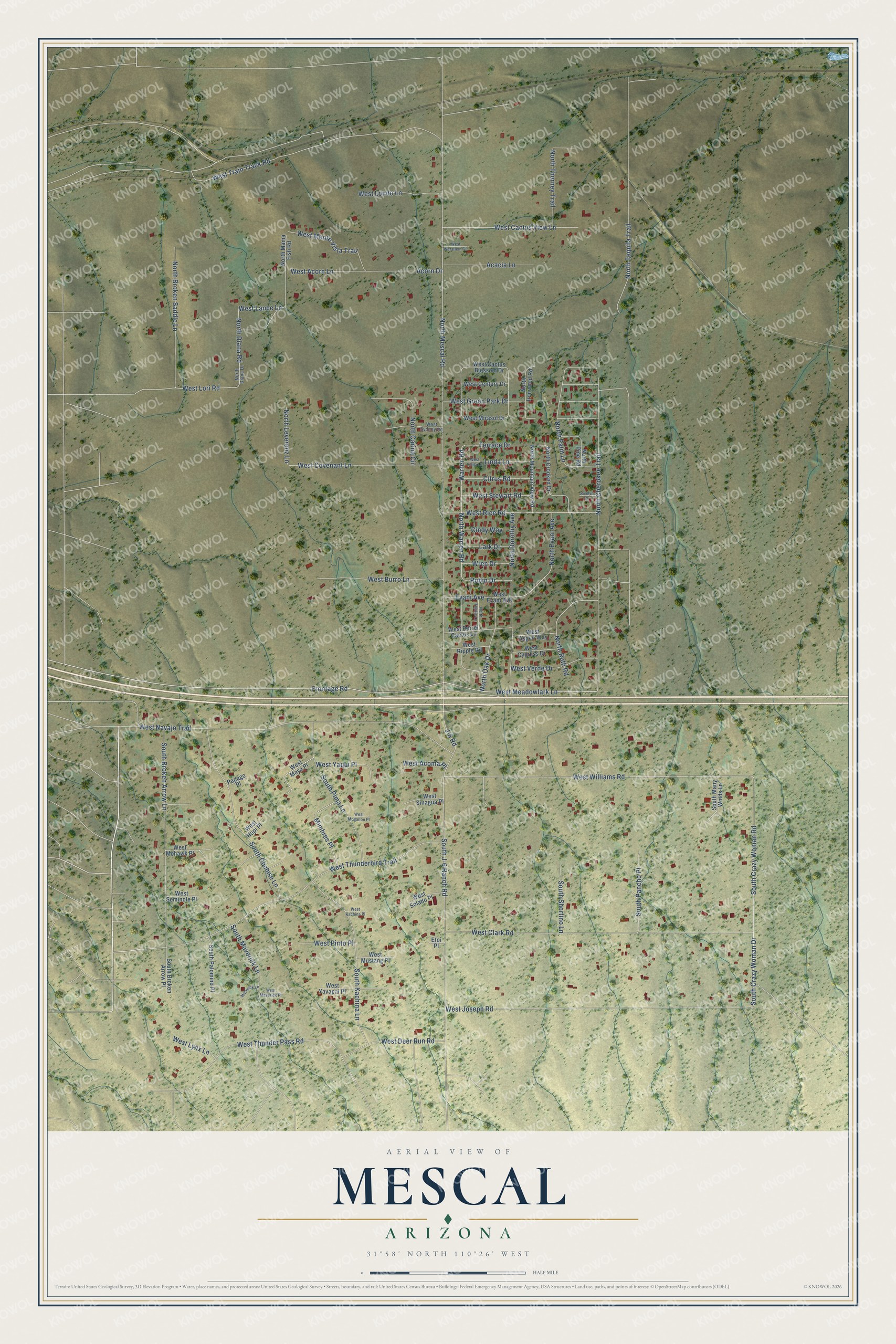
This beautifully detailed map of Mescal, Arizona was created in 2026 using aerial imagery combined with modern topographical, census, street and landmark data. It's a modern aerial view of Mescal in Cochise County, Arizona, that combines modern data with a vintage aesthetic. The roads feature printed names, and if you look closely you can find your exact house accurately shown in its correct location.
Explore an aerial view of Mescal, Arizona
On this map you'll find West Meadowlark Lane, South Crazy Woman Road, West Williams Road, South Crazy Woman Drive, Terrace Drive, North Warren Road, Warren Road, West Lori Road, J-6 Road, West Navajo Trail, Acorn Drive, North Diana Road, and more. Each red shape is a building, so zoom in on the preview and look for yours.
Mescal is a community in Cochise County. The Census Bureau counted 1,751 people here in 2020. Mescal sits about 2 miles east of J-Six Ranchettes, 7 miles northwest of Benson and 16 miles east of Vail. The map prints the town name in its title panel, with the coordinates below it.
Take a closer look at the Mescal map
Names on this map
These names are printed on this map.
Streets and roads: West Meadowlark Lane, South Crazy Woman Road, West Williams Road, South Crazy Woman Drive, Terrace Drive, North Warren Road, Warren Road, West Lori Road, J-6 Road, West Navajo Trail, Acorn Drive, North Diana Road.
More street names, A to Z
Acacia Lane, Cindy Way, Citrus Road, Etoi Place, Evani Avenue, Frontage Road, Javelyn Court, Lark Drive, Linda Lane, Maverick Lane, Mimbres Place, North Broken Saddle Lane, North Carina Circle, North Cherokee Trail, North Crooked Drive, North Diana Drive, North Dorothy Avenue, North Evani Avenue, North Ironwood Road, North Leverenz Lane, North Mama Fish Road, North Mescal Road, North Mountain View Road, North Oak Drive, North Palm Lane, North Pine Road, North Ruth Road, North Tequila Trail, North Thistle Lane, North Thorney Trail, Papago Place, Robin Drive, South Broken Arrow Lane, South Broken Arrow Place, South Cochise Lane, South J-6 Ranch Road, South Kachina Lane, South Many Winds Lane, South Maverick Lane, South Palomino Place, South Pancho Place, South Pima Lane, South Shortino Lane, West Acoma Place, West Acorn Lane, West Aspen Way, West Barrel Cactus Lane, West Burro Lane, West Cactus Blossom Drive, West Cactus View Lane, West Century Drive, West Clark Road, West Covenant Lane, West Cypress Drive, West Deer Run Road, West Evani Avenue, West Green Park Drive, West Hopi Place, West Joseph Road, West Kachina Place, West Lance Lane, West Linda Lane, West Londo Lane, West Lynx Lane, West Maverick Place, West Maya Place, West Mirasol Drive, West Mogallon Place, West Mohawk Place, West Monte Vista Trail, West Mustang Place, West Pinto Place, West Rice Road, West Ripple Road, West Seminole Place, West Sinagua Place, West Solado Place, West Stewart Road, West Sydney Road, West Thunderbird Trail, West Thunder Pass Road, West Train Track Road, West Verde Drive, West Werstlein Circle, West Yaqui Place, West Yavapai Place, Wren Drive.
See it on a wall
The Mescal map as a framed print. Swipe for more.


Created by KNOWOL in 2026. The buildings are small red shapes, the roads carry their printed names, and shaded relief shows the shape of the land. The title panel reads "AERIAL VIEW OF MESCAL, ARIZONA" with 31°58' NORTH 110°26' WEST.
Hang it in the hallway, the office or the cabin, or give it to someone who left Mescal and still calls it home. Open the preview and look for a street you know. See sizes and frames for the Mescal map.