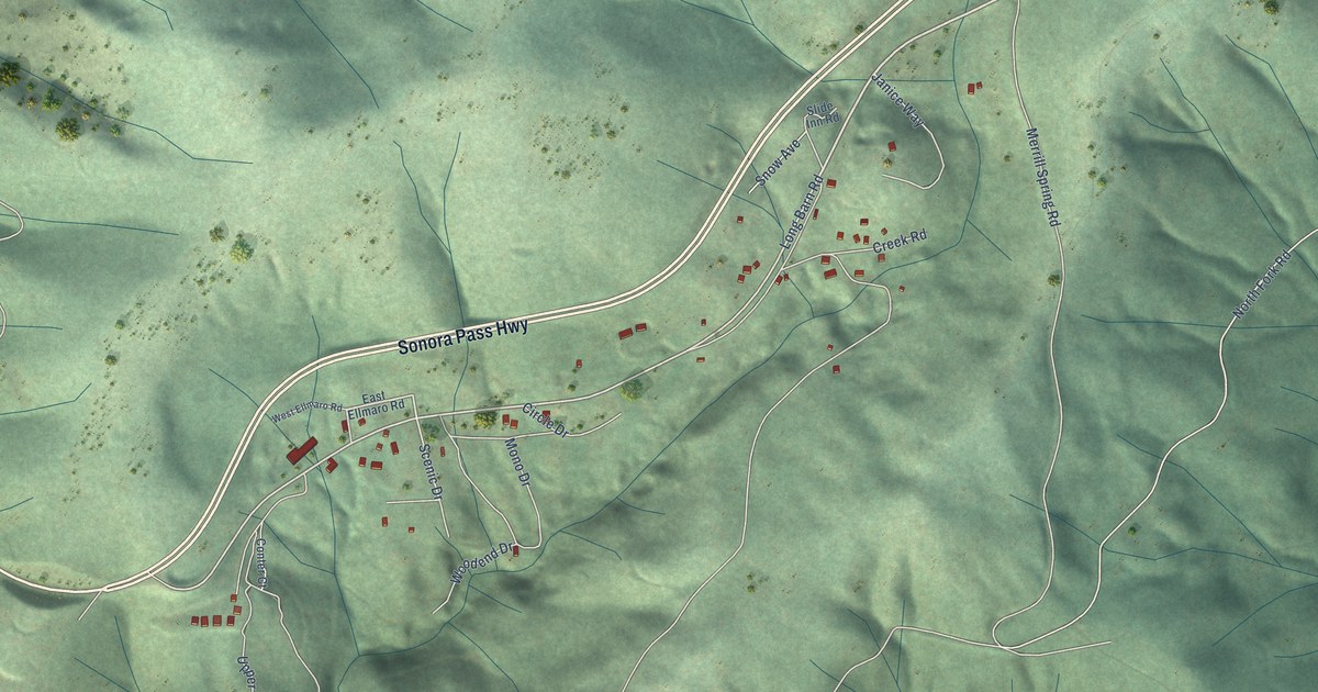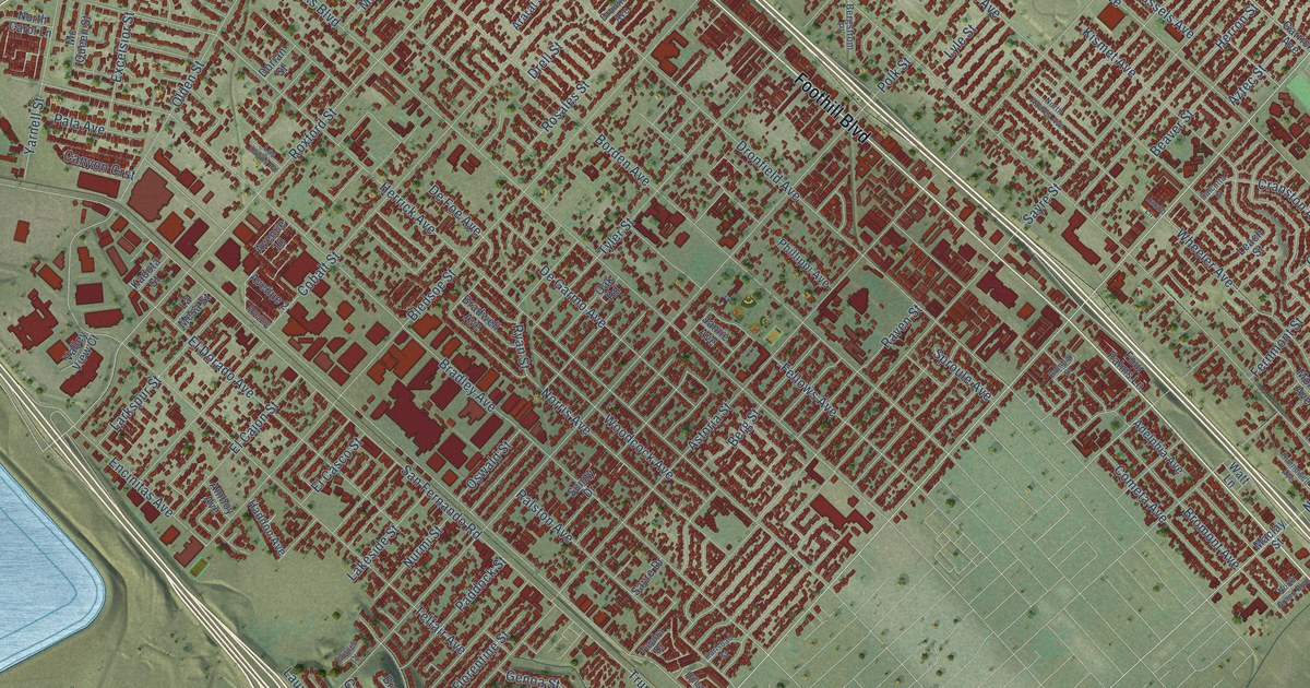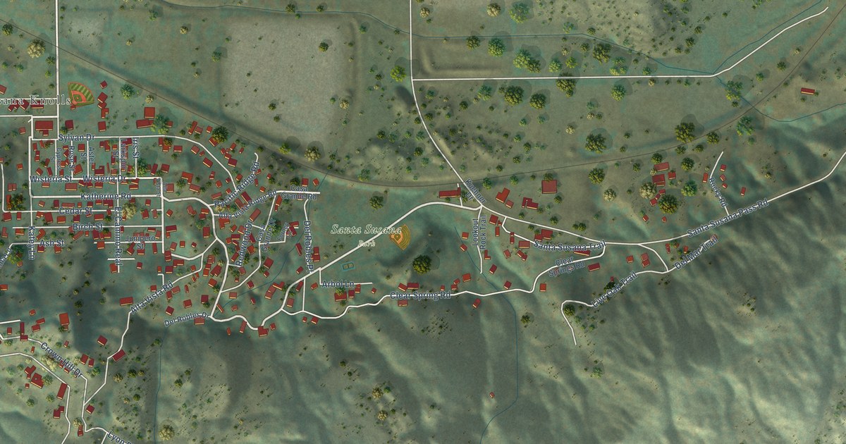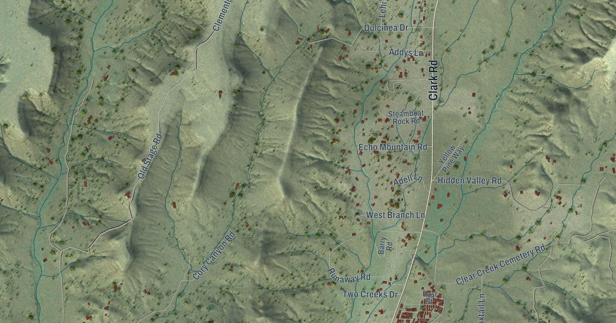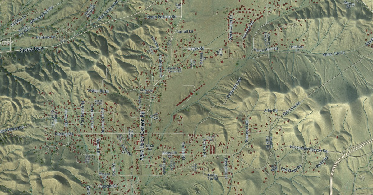
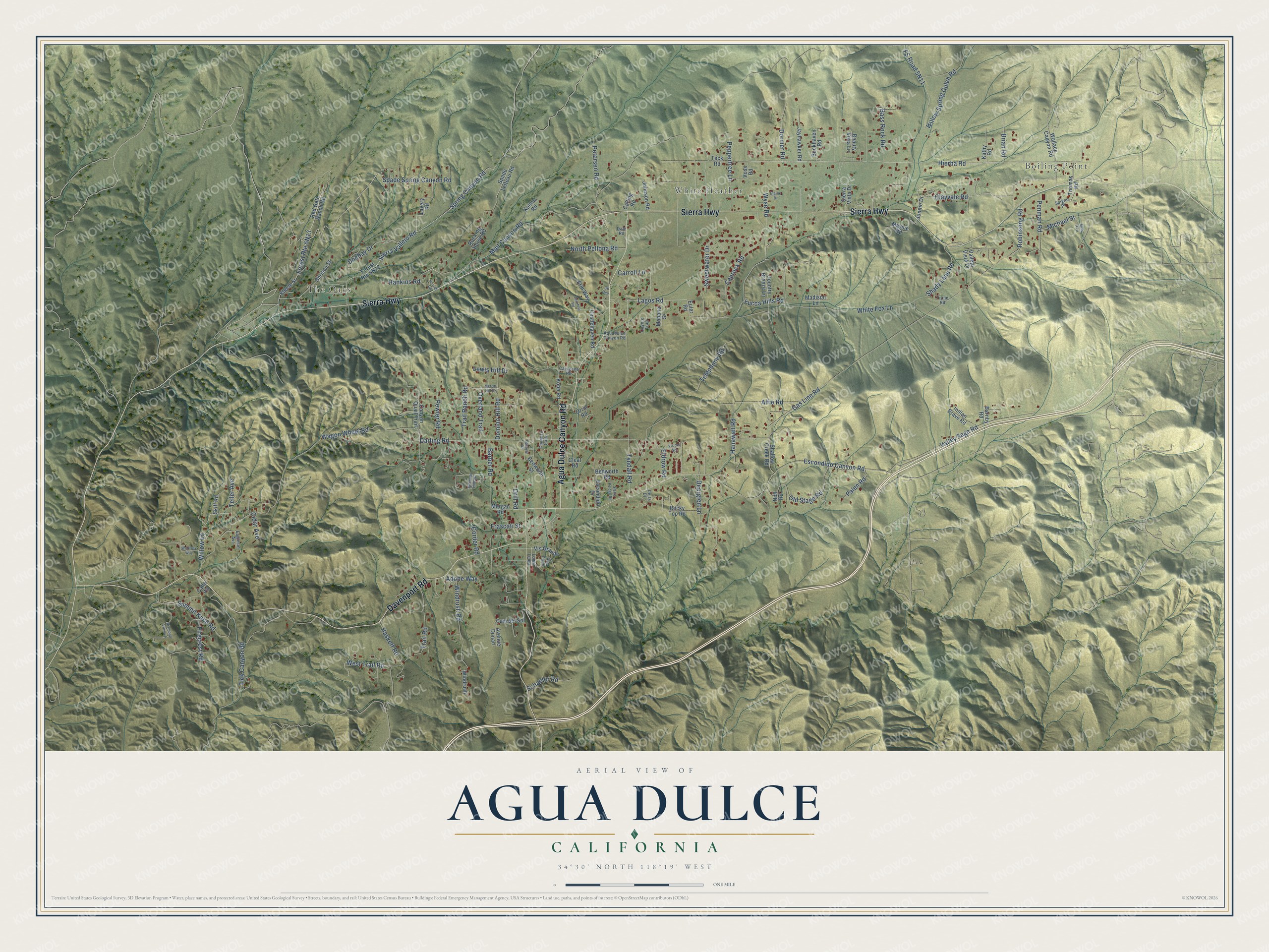
This beautifully detailed map of Agua Dulce, California was created in 2026 using aerial imagery combined with modern topographical, census, street and landmark data. It's a modern aerial view of Agua Dulce in Los Angeles County, California, that combines modern data with a vintage aesthetic. The roads feature printed names, and if you look closely you can find your exact house accurately shown in its correct location.
Explore an aerial view of Agua Dulce, California
On this map you'll find Boiling Point, The Oaks, White Heather, Sierra Highway, Agua Dulce Canyon Road, Davenport Road, Hierba Road, Wyse Road, Tyndall Road, Clayvale Road, Lagos Road, Escondido Canyon Road, and more. Each red shape is a building, so zoom in on the preview and look for yours.
Agua Dulce has a story worth telling. Agua Dulce means sweet water. When Mary Johnson Wright's family came to homestead in 1914, there were no roads, only shrubs and manzanita. Her father and brothers spent three days bringing the family from Sawtelle in an open mud wagon pulled by horses, then cleared the land by hand and built a one room house. At Fremont Pass the road was so narrow and steep that they unloaded the wagon and carried the furniture over the pass piece by piece. That's from the Santa Clarita Valley Signal.
Agua Dulce is a community in Los Angeles County. The Census Bureau counted 3,451 people here in 2020.
Take a closer look at the Agua Dulce map
Names on this map
These names are printed on this map.
Places: Boiling Point, The Oaks and White Heather.
Streets and roads: Sierra Highway, Agua Dulce Canyon Road, Davenport Road, Hierba Road, Wyse Road, Tyndall Road, Clayvale Road, Lagos Road, Escondido Canyon Road, Darling Road, White Fox Lane, Sierra Vallejo Road.
More street names, A to Z
Adobe Way, Alfie Road, Aquadulce Canyon Road, Avenue Donari, Barber Road, Barnby Road, Bass Rock Road, Beauty Vista Lane, Bedrock Hills Drive, Bedworth Road, Bedworth Street, Brian Road, Buckhaven Road, Calle Vis, Calling Road, Cam del Sol, Canyon Quail Trail, Caprock Road, Cardeene Road, Carroll Lane, Castlehaven Road, Chamizo Calle, Chrisco Street, Cidar Avenue, Cleat Road, Cll Dee, Corder Road, Country Breeze Lane, Coyote Trail, Dale Road, Deerglen Lane, Deitz Drive, Diamond View Lane, Doebay Drive, Domino Hill Road, Dormer Road, Drill Road, Eagleset Avenue, Elaine Drive, Eldrow Road, Erin Way, Escondido Drive, Euler Road, Firecrest Road, Frascati Street, Gas Line Road, Hanawalt Road, Hankins Road, Haskett Road, Indian Brave Road, Jayhawker Road, Johnson Road, Jonnie Drive, Kathy Road, Kobe Road, Koontz Road, Lavery Road, Lewis Hill Drive, Loma Linda, Mabana Street, Madison Lane, Mayme Road, Merritt Hill Drive, Michael Street, Mills Avenue, Mint Canyon Road, Morgan Road, Noll Road, North Pellona Road, Old Stage Road, Orrin Road, Overland Trail, Palen Road, Penbyrn Road, Penman Road, Peppertree Lane, Petersen Road, Pewter Road, Red Gate Ranch Road, Rio Poco, Robinsong Road, Rocking Horse Road, Rocky Top Road, Rozich Road, Schaefer Road, Shady Lane Road, Shallow Creek Road, Sierra Pelona Road, Sierra Vista Drive, Skiff Road, Spade Letteau Road, Spade Spring Canyon Road, Spigno Place, Spring Canyon Road, Steele Street, Summit Knoll Road, Sweetwater Drive, Teck Road, Telephone Road, Teller Avenue, Territory Road, Thomas Road, Tick Canyon Road, Trail Ranch Road, Trail Road, Trane Road, Vallejo Vista Drive, Valley Sage Road, Vis del Sol, Vis Grande, Voss Road, Wagon Wheel Road, Wallace Canyon Road, West Trail Road, Willow Lane, Willow Spring Gulch Road, Windrush, Windrush Road, Woolsey Way, Yucca Hills Road.
See it on a wall
The Agua Dulce map as a framed print. Swipe for more.


Created by KNOWOL in 2026. The buildings are small red shapes, the roads carry their printed names, and shaded relief shows the shape of the land. The title panel reads "AERIAL VIEW OF AGUA DULCE, CALIFORNIA" with 34°30' NORTH 118°19' WEST.
It looks right in a kitchen, an office or a den, and it's a gift for anyone who grew up in Agua Dulce or moved away. Open the preview and find your street. See sizes and frames for the Agua Dulce map.