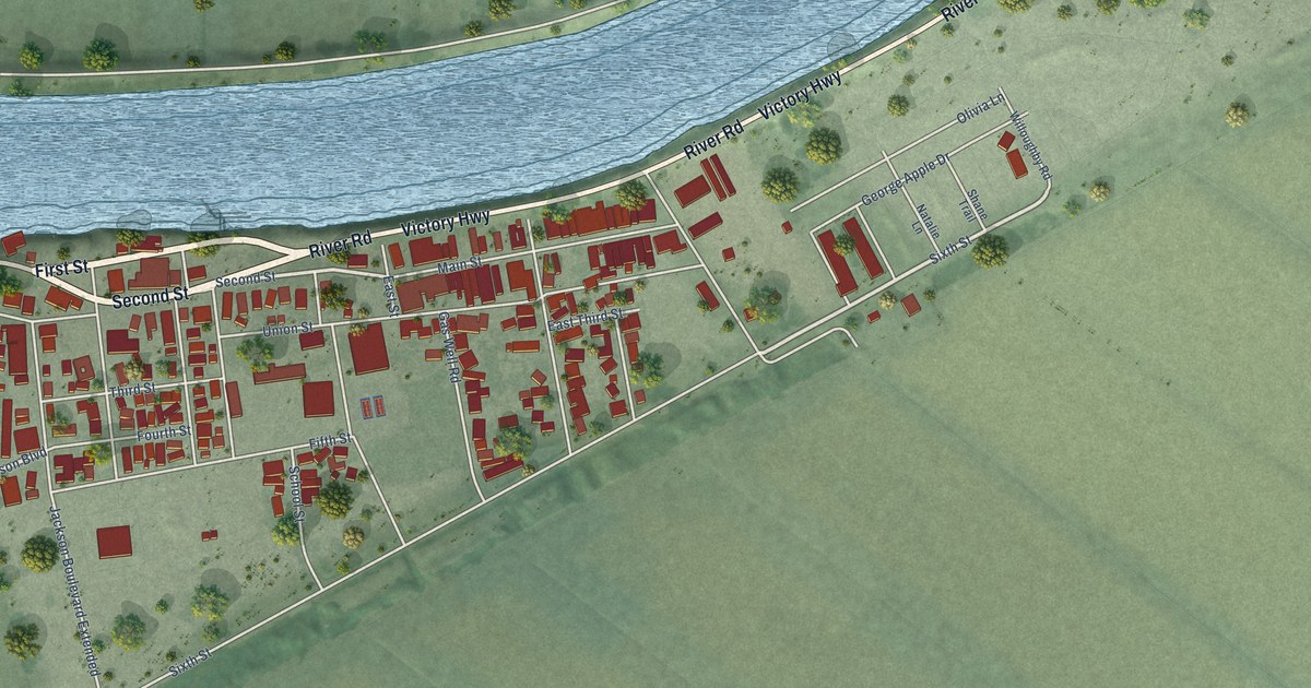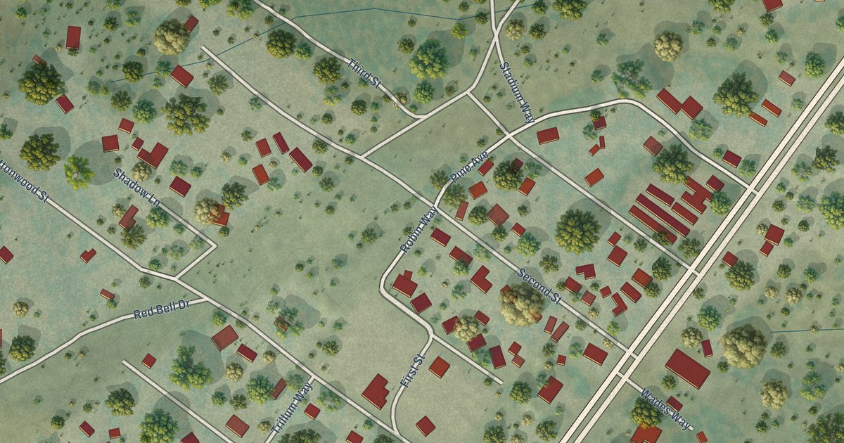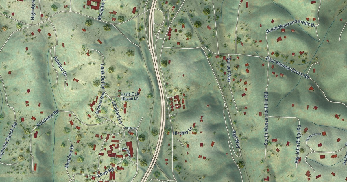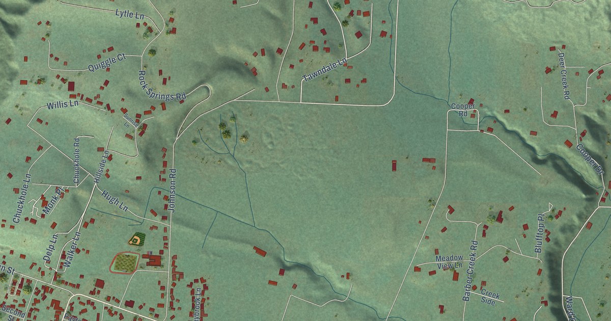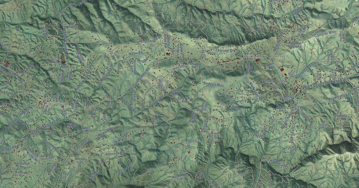
This beautifully detailed map of Pleasant Valley, California was created in 2026 using aerial imagery combined with modern topographical, census, street and landmark data. It’s a one-of-a-kind view of Pleasant Valley that combines accurate data with a vintage aesthetic. The map shows every building in its true location, many of the roads carry their names, and the shaded topographic relief shows the shape of the land.
Explore an aerial view of Pleasant Valley, California
On the map you’ll find Sierra Springs, Tiger Lily, Avinsino Corner, Cedar Grove, Rancho del Sol, and El Dorado Fwy, along with Camino Heights, Pleasant Valley Road, Bucks Bar Road, Mount Aukum Road, Alameda Road, County Highway E16, and more. If you look closely you can even find your house accurately drawn in its correct location. Zoom in on the preview to look for yours.
Did You Know?
From Internet Archive: "Afterward Rose built a corral at Pleasant Valley and established a trading post there."
Pleasant Valley is a community in El Dorado County.
Take a closer look at the Pleasant Valley map
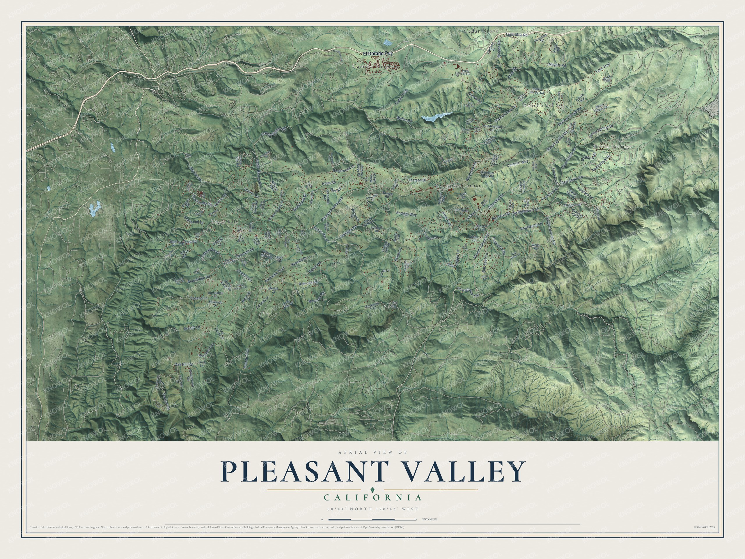
Names on this map
These names are printed on this map.
Places: Sierra Springs, Tiger Lily, Avinsino Corner, Camino Heights, Cedar Grove and Rancho del Sol.
Streets and roads: El Dorado Fwy, Pleasant Valley Road, Bucks Bar Road, Mount Aukum Road, Alameda Road, County Highway E16, Oak Hill Road, Starkes Grade Road, Sly Park Road, Snows Road, Eight Mile Road, Metate Trail.
More street names, A to Z
Abbey Road, Abel Road, Alida Street, Arch Lane, Beau Val Lane, Big Cut Road, Big Oak Court, Big Oak Road, Blue Ridge Road, Bodega Way, Braden Road, Brandy Lane, Brewers Hill Road, Buckaroo Trail, Bucks Bar Circle, Bull Head Lane, Byecroft Road, Calamity Lane, Caldwell Drive, Campini Way, Camp Nauvoo Road, Cantrell Lane, Canyon Falls Road, Cedar Oak Road, Cedar Ravine Road, China Camp Drive, Chisholm Trail, Chrome Ridge Road, Clear Creek Road, Cosens Lane, Cottontrail Road, Country Lane, County Highway 116, Coyote Hill Road, Crestline Drive, Dayton Lane, Delos Lane, Demyhig Lane, Denny Lane, Diablo View Court, Diam Drive, Dollhouse Road, Doty Lane, Dusty Lane, Eagle Canyon Road, Elderwood Lane, Escondito Circle, Espina Loma Drive, Fairglade Road, Five Spot Road, Fort Jim Road, Frank Bailey Lane, Fuji Court, Gemstone Road, Glory Hole Drive, Gold Dust Drive, Greenhills Road, Grizzly Run, Heagey Hill Road, Heartland Road, Hidden Hollow Drive, Holm Road, Horizon Court, Horizon Drive, Horseshoe Lane, Jamal Way, Jeff Road, Kearns Road, Kincade Drive, Kreig Road, Kruk Trail, Larkin Mine Road, Leisure Lane, Leisure View Road, Linda Lane, Locke Road, Lofty View Road, Los Cerros Drive, Lynx Trail, Maidu Trail, Manx Road, Matti Court, Meander Lane, Metate Court, Meyers Road, Michael Way, Mineral Way, Moccasin Trail, Moon Flower Lane, Moon Lake Drive, Nashville Trail, Nawi Trail, Newtown Road, Nowalk Drive, Oak Leaf Circle, Palace Lane, Paradise Lane, Park Hill Drive, Peace Trail, Pennyroyal Drive, Ponderhill Way, Pretty Good Road, Puerta del Sol, Puerta del Sol Road, Quarry Road, Raccoon Road, Rainbow Ridge Road, Ranch Road, Raven Lane, Red Dog Drive, Red Robin Road, Ridgewood Drive, Rimrock Road, Ringold Road, Rivendale Road, Rocky Ridge Road, Roc Road, Sagittarius Road, Savage Road, Saw Mill Road, Shangri la Lane, Sharon Lane, Sherwood Lane, Shooting Star Road, Sierra Springs Drive, Sigwart Drive, Silverado Drive, Silver Ridge Lane, Skyridge Road, Sofar Road, Spencers Road, Springer Road, Still Meadow Road, Sunrey Road, Taxi Lane, Tender Trail, Terras Path, Thorson Drive, Thundercloud Lane, Timber Lane, Treasure Rock Lane, Trellis Trail, Tulip Court, Turkey Feather Trail, Twitchell Road, Tya Lane, Valley Vista Drive, Victory Mine Road, View Point Drive, Vogelsang Lane, Wagon Trail, Weber Road, Wells Road, Westley Road, Wilderness Way, Windlestraw Road, Winterhill Drive, Wish Upon Way, Wisteria Road, Wochanga Way, Woodland Drive, Yarrow Drive, Zandonella Road, Zig Zag Lane.
See it on a wall
The Pleasant Valley map as a framed print. Swipe for more.


This beautifully detailed map of Pleasant Valley makes an attractive addition to your office, library, or den, and it can even be used to teach children the geography and history of the area. It also makes a great gift for someone who left Pleasant Valley and still calls it home. When you’re done exploring, click here to get your copy of the Pleasant Valley map.