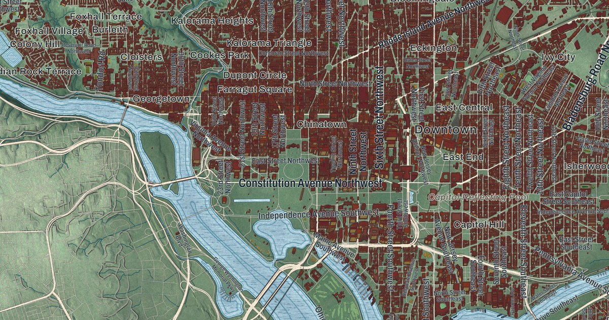
If you've lived in D.C., whether for four years of college, a job on the Hill or your whole life, this is the whole city on one sheet, from Chevy Chase down to Congress Heights. It's a modern aerial view of Washington, District of Columbia, made from modern data with a vintage artistic feel. The hills are shaded in soft green, more than 180,000 buildings are drawn in deep red, and the Potomac and Anacostia Rivers meet just south of Capitol Hill. From across the room it's a red diamond on green hills. Up close, you can find your own block. Explore the print options for Washington, D.C.
From Georgetown to Anacostia, block by block
Start at the Capitol Reflecting Pool, named near the middle of the sheet. Constitution Avenue runs west from it along the north side of the National Mall, and Independence Avenue runs along the south side. Keep going west to the Potomac, then follow the river upstream to Georgetown. From there, Dupont Circle, Adams Morgan and Columbia Heights step off to the northeast, and Chevy Chase, Friendship Heights and Cleveland Park fill the top left corner. Back at the Reflecting Pool, Capitol Hill sits just to the east. Cross the Anacostia River from there and you'll find Anacostia, Congress Heights, Fort Dupont and Deanwood.
The Mall and the rivers aren't labeled, but you can't miss them. Not every neighborhood has a label either. Each dark red shape is a building, though, so zoom in on the preview and look for your block.
Why Washington is a diamond with a corner missing
The Constitution allowed a federal district of up to ten miles square, and the Residence Act, passed on July 16, 1790, put it on the Potomac. In February 1791 the surveyor Andrew Ellicott started at Jones Point in Alexandria and ran his first line northwest at a 45-degree angle. That's why the district sits on the map as a diamond instead of a square.
Ellicott brought in Benjamin Banneker to make the astronomical observations. Banneker was a free Black man who'd taught himself astronomy. About every mile, the crew set a sandstone marker. The side facing the district was carved "Jurisdiction of the United States," and the opposite side "Virginia" or "Maryland." According to the stones' National Register nomination, most of them are still out there, many inside small iron fences put up by the Daughters of the American Revolution.
Now look at the diamond on this map. The original square crossed the Potomac into Virginia, taking in the town of Alexandria and what's now Arlington. In 1846 the federal government gave that Virginia side back, so the red stops at the river. Arlington lies across the Potomac, though it isn't labeled on this print. On the Maryland side the old survey lines are still the border, and Western Avenue, Eastern Avenue and Southern Avenue run right along them. Follow those three avenues around the sheet and you're tracing the line Ellicott's crew marked in stone.
A gift for anyone who's lived between Georgetown and Anacostia
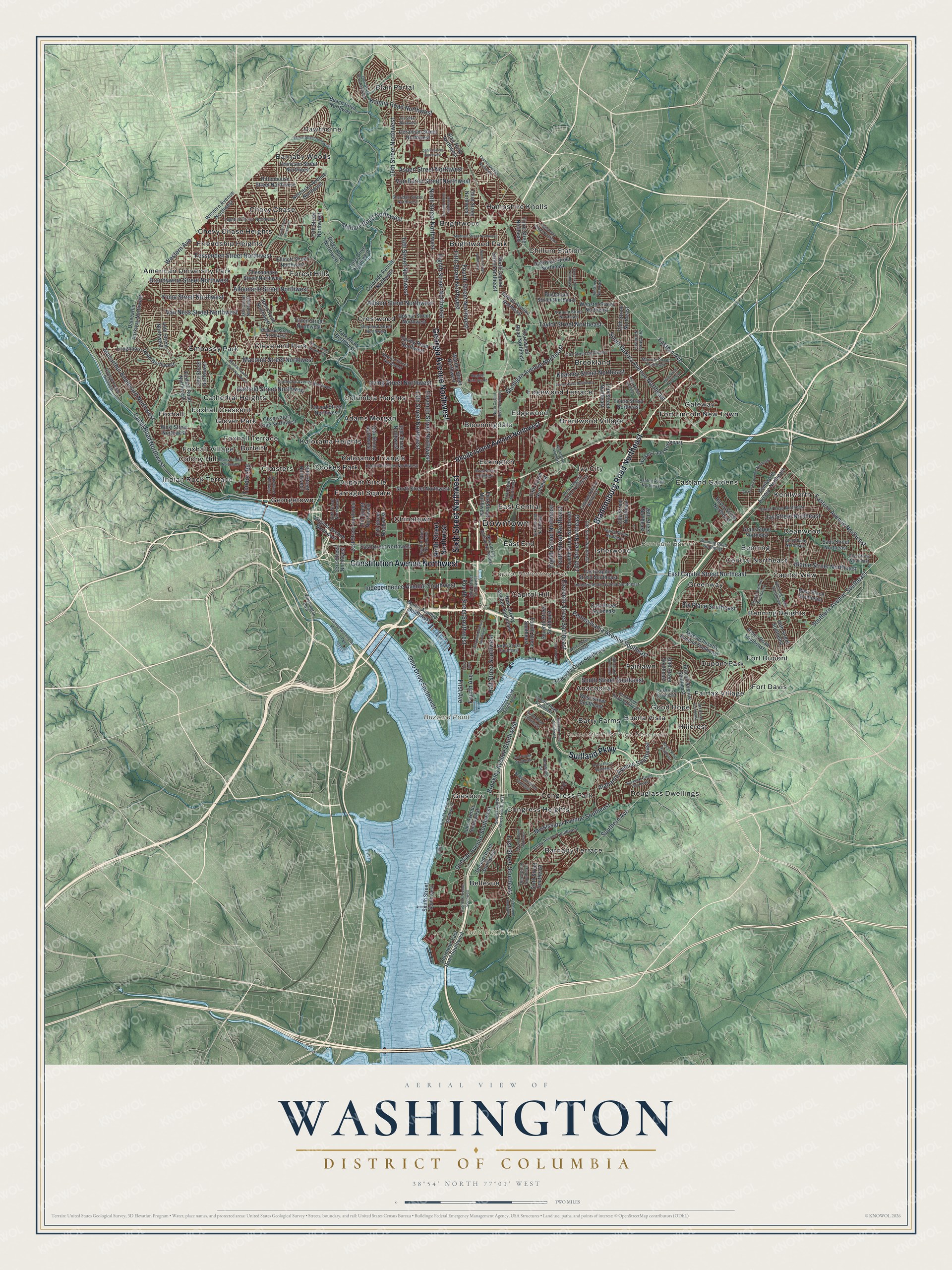
Created by KNOWOL in 2026, this map of Washington makes a handsome addition to an office, a den or a living room. The shaded hills come from USGS elevation data. The title panel reads "Aerial View of Washington, District of Columbia," with the coordinates 38°54' North, 77°01' West and a two-mile scale bar.
It's a thoughtful gift for a new graduate, a colleague leaving town after a posting, or anyone who grew up here and moved away. Open the preview, zoom in and find the streets you know. Shop the Washington, D.C. map.