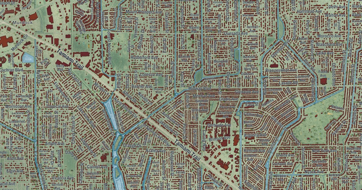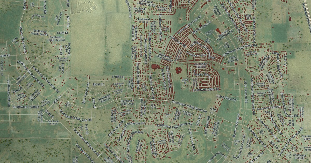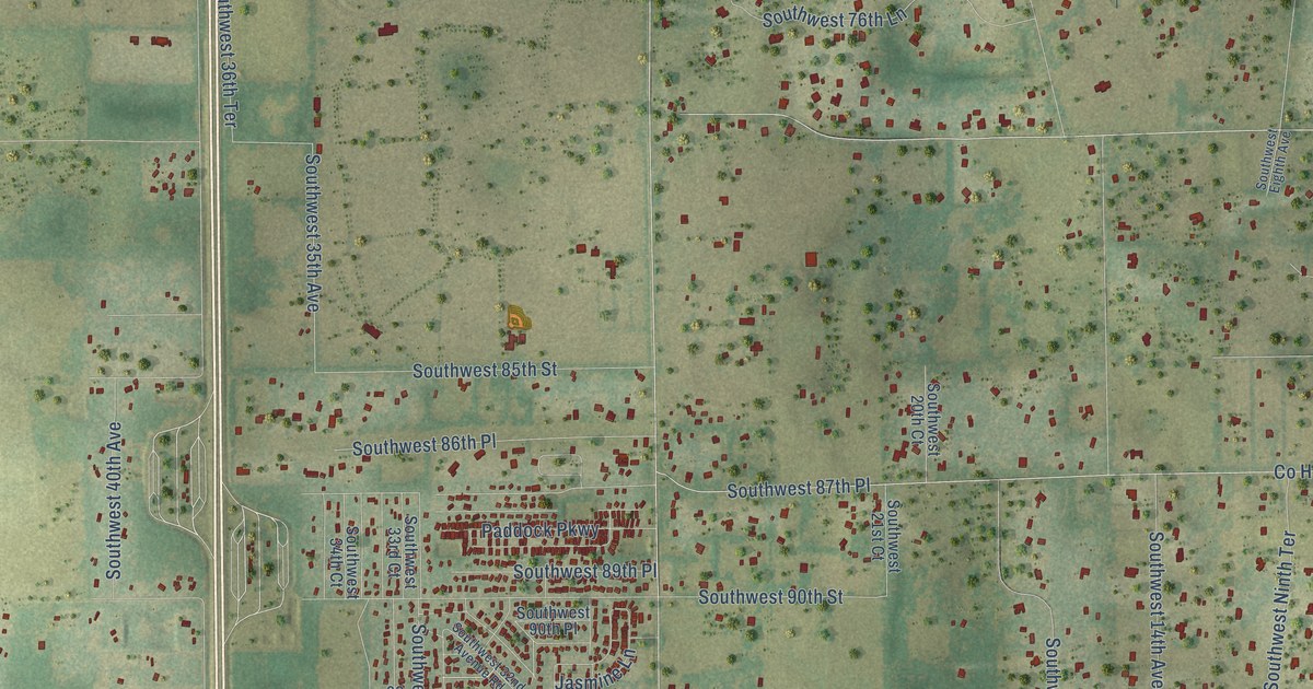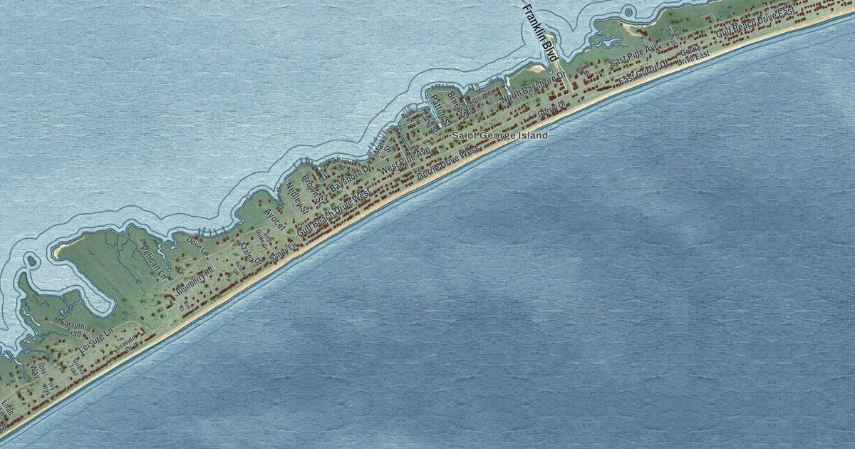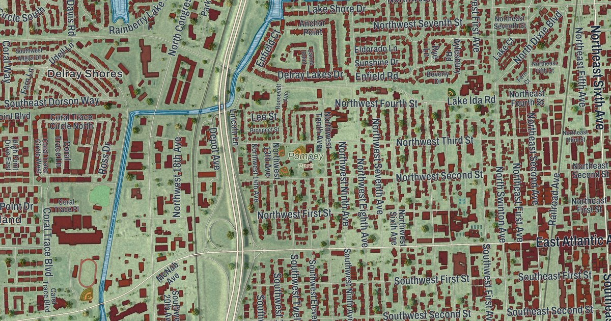
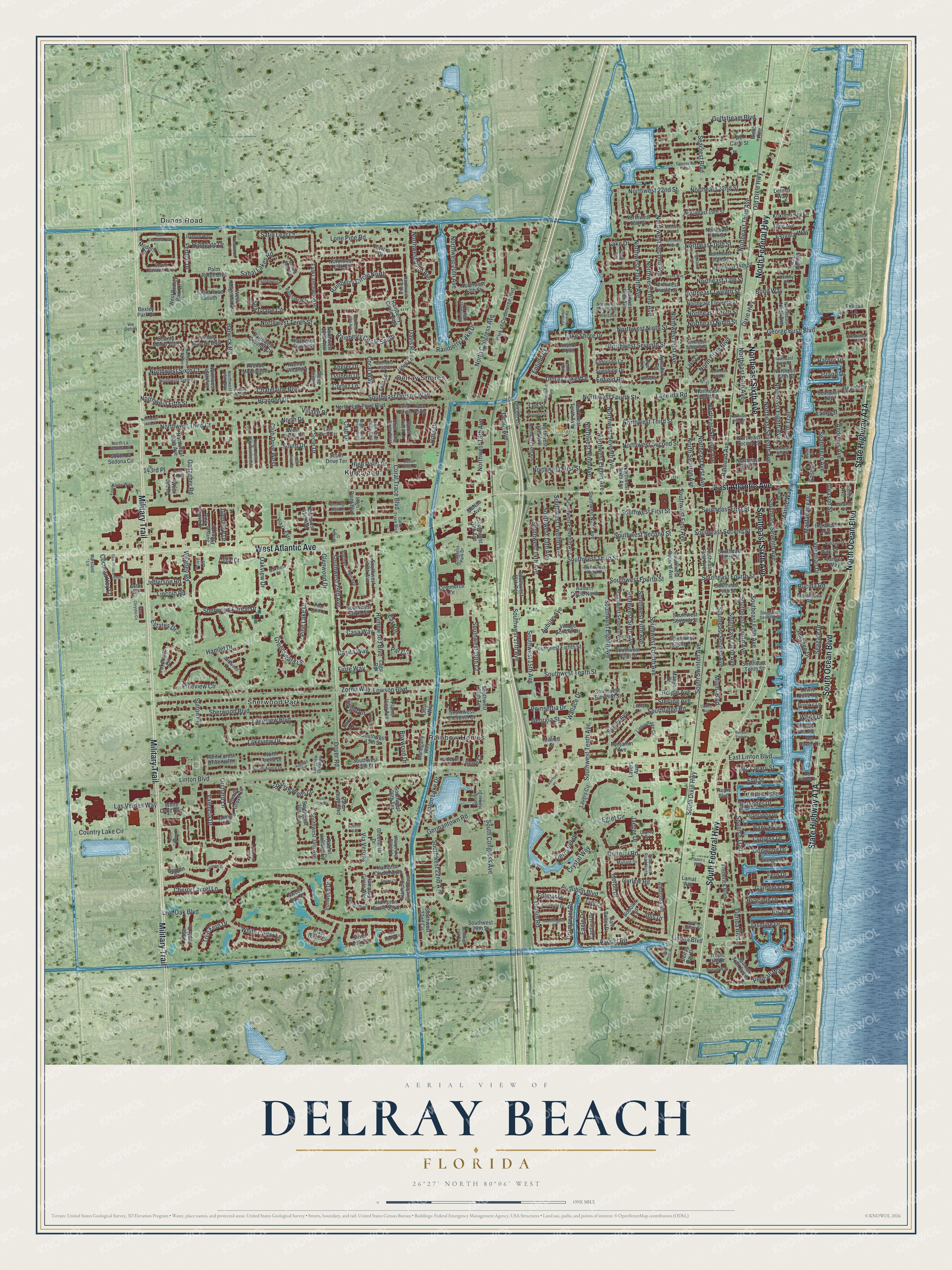
This beautifully detailed map of Delray Beach, Florida was created in 2026 using aerial imagery combined with modern topographical, census, street and landmark data. It’s a one-of-a-kind view of Delray Beach that combines accurate data with a vintage aesthetic. The map shows every building in its true location, many of the roads carry their names, and the shaded topographic relief shows the shape of the land.
Explore an aerial view of Delray Beach, Florida
On the map you’ll find Tropic Isle, Pompey Park, Delray Shores, Kingsland, Rainbow Homes, and Sherwood Park, along with Dunes Road, East Atlantic Avenue, Northeast Sixth Avenue, South Ocean Boulevard, North Ocean Boulevard, South Federal Highway, and more. If you look closely you can even find your house accurately drawn in its correct location. Zoom in on the preview to look for yours.
Did You Know?
In 1894 Michigan Congressman William S. Linton bought land here and sold plots for a farming town. The settlement was named for him. A hard freeze in 1898 drove many settlers away, and Linton left too. In 1901 the town took a new name, Delray, after a neighborhood in Detroit.
Take a closer look at the Delray Beach map
Names on this map
These names are printed on this map.
Places: Tropic Isle, Pompey Park, Delray Shores, Dunes Road, Kingsland, Rainbow Homes and Sherwood Park.
Streets and roads: East Atlantic Avenue, Northeast Sixth Avenue, South Ocean Boulevard, North Ocean Boulevard, South Federal Highway, Military Trail, West Atlantic Avenue, North Federal Highway, Southeast Sixth Avenue, Northeast Second Avenue, Northwest Second Street, South Swinton Avenue.
More street names, A to Z
51st Terrace South, 133rd Road South, 143rd Place, Albatross Road, Albatross Road North, Allamanda Drive, Allen Avenue, Anchor Point, Andrews Avenue, Angler Drive, Astor Circle, Auburn Avenue, Auburn Circle North, Audubon Boulevard, Augusta Circle, Avenue de Gien, Avenue Montressor, Avenue Villandry, Avocet Road, Aylesbury Road, Banyan Drive, Banyan Tree Lane, Barwick Road, Basin Drive, Bay Street, Beach Drive, Benjamin Avenue, Beverly Drive, Bexley Park Drive, Bloods Grove Circle, Bobolink Road, Bolender Drive, Bond Way, Bosun Way, Boxwood Drive, Brandon Drive, Brooks Lane, Bucida Road, Canal Point Way, Canoe Point, Cardinal Drive, Carl Bolter Drive, Carol Trace Boulevard, Casa Way, Casita Way, Catherine Drive, Chatelaine Boulevard, Cherry Laurel Lane, Circle Drive, Citrus Way, Club Drive, Club Drive West, Coconut Key Lane, Collins Avenue, Commerce Drive, Congress Park Drive, Coral Trace Boulevard, Coral Trace Circle North, Coral Trace Circle West, Coral Trace Lane, Coral Trace Place, Coral Way, Cormorant Road, Cortez Lane, Country Lake Circle, Country Manors Boulevard, County Manor Boulevard, Crestwood Drive, Crystal Way, Curlew Road, Cypress Drive, Danson Way, Davis Road, De Carie Street, Del Harbour Drive, Del Haven Drive, Delmar Way, Delray Bay Drive, Delray Lakes Drive, Denery Lane, Depot Avenue, Devon Court, Dixie Highway, Dogwood Drive, Dolphin Drive, Dotterel Road, Dover Road, Duke Lane, Dunlin Road, Eagle Circle, Eagle Drive, East Circle Terrace, East Drive, East Lancewood Place, East Linton Boulevard, East Road, Egret Circle, Eldorado Lane, Enfield Court, Enfield Road, Estates Drive, Estuary Trail, Estuary Way, Evergreen Drive, Eve Street, Fenton Drive, Fern Court, Fern Drive, Fern Lane, Fiore Way, Fladell's Way, Flame Vine Avenue, Florida Boulevard, Fountains Way, Foxpointe Circle, Frederick Boulevard, Fulmar Drive, Gallagher Road, Gallinule Drive, Garden Drive, Gardenia Drive, George Bush Boulevard, Georgia Street, Germantown Road, Gleason Street, Glenview Drive, Glenwood Drive, Greenbriar Drive, Greensward Lane, Grove Way, Gulfstream Boulevard, Hamlet Drive, Hammock Circle, Hampton Circle East, Hampton Circle North, Hampton Circle South, Hampton Circle West, Harbor Drive, Heron Drive, Hibiscus Lane, Highgate Drive, Highland Lane, High Point Boulevard, High Point Drive, High Point Drive East, High Point Drive West, High Point Way Southeast, Homewood Boulevard, Hummingbird Drive, Hyacinth Drive, Ibis Drive, Ilene Court, Ingraham Avenue, Iris Drive, Ironwood Drive, Island Drive, Jaeger Drive, Jasmine Drive, Jefferson Road, Knight Lane, Kokomo Key Lane, Lago Road, Laing Street, Lake Court, Lake Drive, Lake Ida Road, Lakeland Drive, Lake Shore Drive, Lakeview Boulevard, Lakeview Drive, Lakeview Gardens, Lamat Avenue, Langer Way, Las Verdes Way, Laurelwood Lane, Lavers Avenue, Lavers Circle, Lee Street, Lewis Cove Road, Lincoln Lane, Lincoln Road, Lindell Boulevard, Linton Boulevard, Linton Lake Drive, Linton Ridge Circle, Live Oak Boulevard, Lone Pine Road, Lowson Boulevard, Lucky Lane, Macfarlane Drive, Mahogany Way, Majestic Palm Way, Mallard Drive, Mango Drive, Marine Way, Markland Lane, Mc Cleary Street, McNab Avenue, Melaleuca Road, Miami Boulevard, Milfred Street, Miramar Drive, Modern Drive, Nassau Street, Needham Court, North Arelia Drive, North Citation Drive, North Classical Boulevard, North Congress Avenue, North Dixie Boulevard, North Drive, Northeast 13th Street, Northeast 14th Street, Northeast 15th Street, Northeast 16th Street, Northeast 17th Street, Northeast 19th Street, Northeast 22nd Street, Northeast Eighth Avenue, Northeast Eleventh Street, Northeast Fifth Avenue, Northeast Fifth Court, Northeast Fifth Street, Northeast First Avenue, Northeast First Court, Northeast First Street, Northeast Fourth Street, Northeast Ninth Avenue, Northeast Ninth Street, Northeast Second Street, Northeast Seventh Avenue, Northeast Seventh Street, Northeast Sixth Street, Northeast Tenth Street, Northeast Third Avenue, Northeast Third Street, Northeast Twelfth Street, North High Point Boulevard, North La Sedona Circle, North Latitude Circle, North Lee Road, North Swinton Avenue, Northwest 13th Avenue, Northwest 13th Street, Northwest 14th Avenue, Northwest 15th Street, Northwest 16th Street, Northwest 17th Street, Northwest 18th Avenue, Northwest 18th Street, Northwest 19th Terrace, Northwest 20th Avenue, Northwest 22nd Avenue, Northwest 22nd Street, Northwest 23rd Lane, Northwest 29th Avenue, Northwest 32nd Avenue, Northwest 41st Avenue, Northwest 45th Way, Northwest 46th Avenue, Northwest 49th Avenue, Northwest 50th Avenue, Northwest Eighth Avenue, Northwest Eighth Street, Northwest Eleventh Street, Northwest Fifth Avenue, Northwest Fifth Street, Northwest First Avenue, Northwest First Street, Northwest Fourth Avenue, Northwest Fourth Street, Northwest Ninth Avenue, Northwest Ninth Road, Northwest Ninth Street, Northwest Second Avenue, Northwest Seventh Avenue, Northwest Seventh Court, Northwest Seventh Street, Northwest Sixth Avenue, Northwest Sixth Court, Northwest Sixth Street, Northwest Tenth Avenue, Northwest Tenth Street, Northwest Third Avenue, Northwest Third Court, Northwest Third Drive, Northwest Third Street, Northwest Twelfth Street, Oakview Court, Oakview Drive, Old Dixie Highway, Orchard Lane, Osprey Drive, Palm Cove Boulevard, Palm Forest Drive North, Palm Ridge Boulevard, Palm Square, Palm Trail, Par Circle, Park of Commerce Boulevard, Peer Lane, Pelican Lane, Pelican Way, Pine Grove Drive, Pine Lake Court, Pine Lake Drive, Pine Lane, Pineview Circle, Place Tavant, Poinsettia Drive, Preserve Drive, Prive Circle, Prospect Street, Rabbit Hollowe Circle, Railroad Avenue, Rainberry Circle East, Rainberry Circle North, Rainberry Circle South, Rainberry Lake Drive, Red Maple Circle, Regal Court, Reigle Avenue, Rhodes Villa Avenue, River Birch Circle, Riverside Way, Riviera Drive, Roosevelt Avenue, Rose Apple Drive, Ross Drive, Rye Lane, Sabal Lakes Road, Salerno Way, Salina Avenue, San Juan Drive, Satin Leaf Court, Seabreeze Avenue, Seacrest Boulevard, Seagate Drive, Sea Grape Circle, Seasage Drive, Seaspray Avenue, Sherwood Boulevard, Sherwood Forest Drive, Silver Oak Circle, South Arelia Drive, South Classical Boulevard, South Congress Avenue, South Dixie Highway, South Drive, South Drive Circle, South Drive Terrace, Southeast Dorson Way, Southeast Fifth Avenue, Southeast Fifth Street, Southeast First Avenue, Southeast First Street, Southeast Fourth Avenue, Southeast Fourth Street, Southeast Second Avenue, Southeast Second Street, Southeast Seventh Avenue, Southeast Seventh Street, Southeast Tenth Street, Southeast Third Avenue, Southeast Third Street, South La Sedona Circle, Southridge Road, Southwest 13th Avenue, Southwest 13th Street, Southwest 14th Avenue, Southwest 15th Avenue, Southwest 15th Street, Southwest 15th Terrace, Southwest 17th Avenue, Southwest 20th Avenue, Southwest 20th Court, Southwest 20th Terrace, Southwest 21st Terrace, Southwest 22nd Avenue, Southwest 22nd Circle, Southwest 26th Terrace, Southwest 27th Avenue, Southwest 28th Avenue, Southwest 29th Avenue, Southwest 29th Street, Southwest 35th Avenue, Southwest 36th Avenue, Southwest Angler Drive, Southwest Eighth Avenue, Southwest Eighth Court, Southwest Eighth Street, Southwest Eleventh Avenue, Southwest Eleventh Court, Southwest Eleventh Street, Southwest Fifth Avenue, Southwest First Avenue, Southwest First Street, Southwest Fourth Avenue, Southwest Fourth Street, Southwest Ninth Avenue, Southwest Ninth Street, Southwest Second Avenue, Southwest Second Street, Southwest Seventh Avenue, Southwest Seventh Street, Southwest Sixth Avenue, Southwest Sixth Street, Southwest Tenth Avenue, Southwest Tenth Street, Southwest Third Court, Southwest Third Street, Southwest Twelfth Avenue, Spanish Trail, Spanish Trail South, Spanish Wells Drive, Spodak Drive, Spring Harbor Drive, Sterling Avenue, Sundy Avenue, Sunset Pines Drive, Sunshine Drive, Sutton Place, Sweet Bay Drive, Tangerine Trail, Tierra Verde, Tree Fern Drive, Tropic Boulevard, Tropic Isle Drive, Udell Lane, Valencia Drive, Venetian Drive, Verawood Lane, Via D' Este, Via Delray, Via Verona, Village Drive, Village Square Circle, Wallace Drive, Waterford Place, Webb Avenue, West Bexley Park Drive, West Chrystie Circle, West Circle Terrace, West High Point Court, West Lee Road, West Magnolia Circle, Whatley Road, Whispering Oaks Lane, White Cedar Lane, White Drive, White Oaks Boulevard, Wildwood Drive, Zorno Way.
See it on a wall
The Delray Beach map as a framed print. Swipe for more.


This beautifully detailed map of Delray Beach makes an attractive addition to your office, library, or den, and it can even be used to teach children the geography and history of the area. It also makes a great gift for anyone who grew up in Delray Beach or moved away. When you’re done exploring, click here to get your copy of the Delray Beach map.