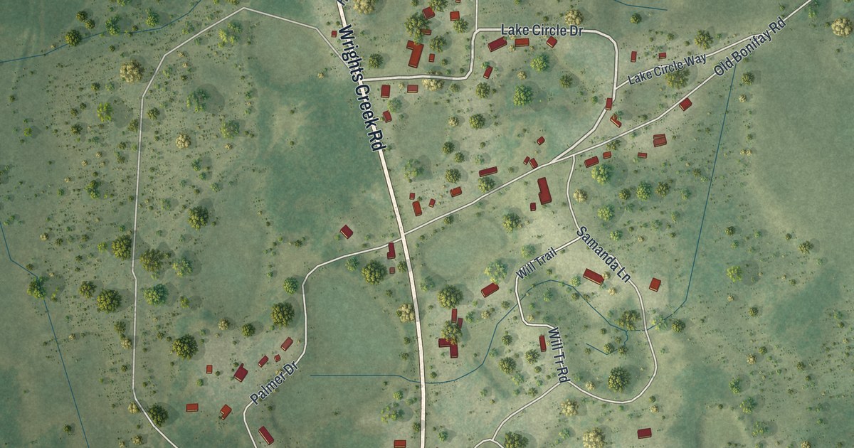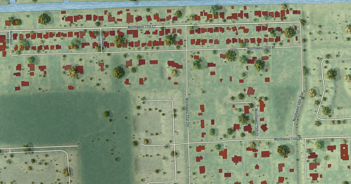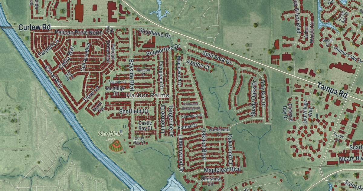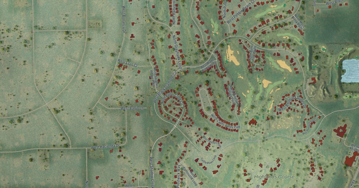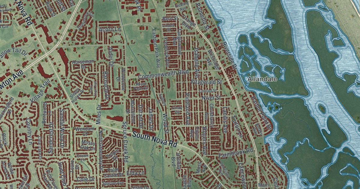
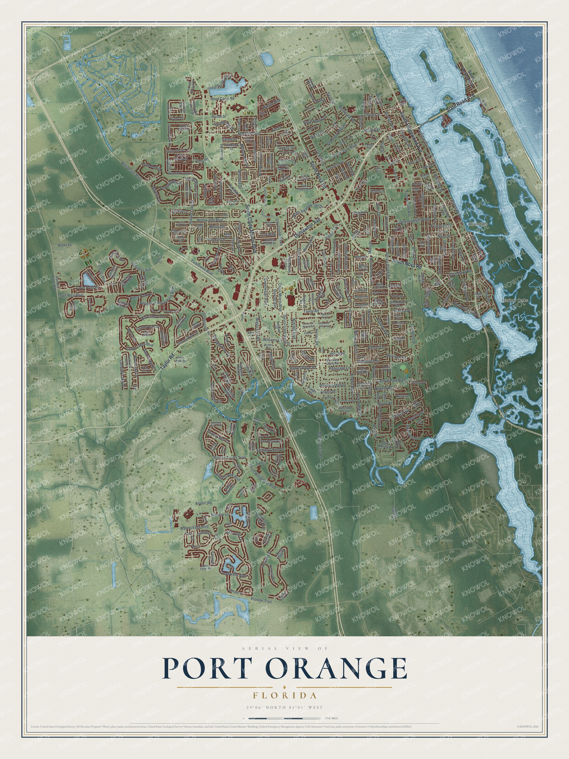
This beautifully detailed map of Port Orange, Florida was created in 2026 using aerial imagery combined with modern topographical, census, street and landmark data. It’s a one-of-a-kind view of Port Orange that combines accurate data with a vintage aesthetic. The map shows every building in its true location, many of the roads carry their names, and the shaded topographic relief shows the shape of the land.
Explore an aerial view of Port Orange, Florida
On the map you’ll find Harbor Oaks and Allandale, along with Dunlawton Avenue, Taylor Road, South Ridgewood Avenue, South Nova Road, South Clyde Morris Boulevard, State Road A1A, Halifax Drive, South Williamson Boulevard, Colony Road, Airport Road, and more. If you look closely you can even find your house accurately drawn in its correct location. Zoom in on the preview to look for yours.
Did You Know?
After the Civil War, John Milton Hawks settled Port Orange and brought freed African Americans to run his sawmill. Esther Hawks opened an integrated school in the area. The colony soon struggled, and most colonists left. Those who remained are remembered in the neighborhood called Freemanville.
Take a closer look at the Port Orange map
Names on this map
These names are printed on this map.
Places: Harbor Oaks and Allandale.
Streets and roads: Dunlawton Avenue, Taylor Road, South Ridgewood Avenue, South Nova Road, South Clyde Morris Boulevard, Halifax Drive, South Williamson Boulevard, Colony Road, Airport Road, Orange Street, Boggs Ford Road, McDonald Road.
More street names, A to Z
Abbott Farms Road, Acacia Drive, Acorn Lane, Adrianne Court, Alcorn Road, Alder Drive, Alexander Avenue, Aloha Terrace, Amici Court, Anita Street, Antigua Drive, Apache Boulevard, Arash Circle, Areca Palm Drive, Armin Court, Aruna Drive, Autumn Trail, Azalea Pointe Drive, Bald Eagle Drive, Banbury Drive, Barnacle Drive, Barrows Dairy Road, Bayridge Lane, Bear Corn Run, Bent Oak Drive, Bentwood Lane, Bern Street, Beth Court, Big Crane Loop, Birch Mountain Road, Biro Drive, Black Duck Drive, Blake Drive, Blue Sky Drive, Bourbon Street, Boyte Street, Brandy Hills Drive, Breaks Way, Breckenridge Drive, Brittany Avenue, Broken Bow Lane, Brooks Lane, Bruner Road, Buttermilk Lane, Calistoga Circle, Calliope Avenue, Cambridge Drive, Canal View Boulevard, Canna Court, Caramel Avenue, Carmody Lake Drive, Casey Lane, Casper Avenue, Cedar Street, Central Park Boulevard, Chamale Lane, Charles Street, Chelsea Way, Chickadee Drive, Chris Drive, Christiancy Avenue, Cindy Circle, Circle Drive, City Center Circle, City Center Drive, City Center Parkway, Clara Street, Clear Lake Drive, Clyde Morris Boulevard, Coconut Palm Circle, Cole Drive, Commonwealth Boulevard, Conrad Street, Coquina Shores Lane, Coraci Boulevard, Country Lane, Country Manor Drive, Country Walk Drive, Cove Point Road, Craig Court, Crane Feather Drive, Crane Lakes Boulevard, Crane Point Drive, Creekwater Boulevard, Crooked Pine Road, Crown Lane, Crystal Creek Drive, Cypress Springs Parkway, Dairy Court, Dalford Road, Deer Springs Road, Del Mar Drive, Del Rio Drive, Devon Street, Dexter Drive North, Dogwood Road, Dorsiere Avenue, Downing Drive, Durant Drive, Eagle Claw Drive, East Fox Place, Eastport Park Way, Eddie Drive, Eddy Lane, Edna Drive, Elda Lane, Ernest Drive, Esplanade Avenue, Estero Loop, Fairway Cove Drive, Fall Drive, Farmbrook Road, Ferncliff Drive, Fern Park Drive, Ferri Circle, Fiano Drive, Fifth Street, Fitzgerald Street, Fleming Avenue, Floral Springs Boulevard, Foggy Lane, Forest Branch Drive, Forough Circle, Fox Hound Drive, Franklin Drive, Freda Lane, Frederick Avenue, Frederick Lake Drive, Georgia Peach Avenue, Gladys Street, Golden Gate Circle, Golf Villa Drive, Greenbriar Avenue, Greenfield Drive, Grove View Lane, Half Moon Drive, Hamlet Drive, Harbor Point Drive, Harms Way, Hawks Ridge Road, Hensel Hill Drive East, Hensel Hill Drive West, Hensel Road, Herbert Street, Heron Pond Drive, Hickory in the Wood, Hickory Lane, Hidden Lake Drive, Highpoint Drive, Hills Boulevard, Hockney Court, Holiday Boulevard, Holly in the Wood, Horseman Drive, Hoyt Drive, Hudson Lane, Hugh Street, Hunt Club Trail, Hutchinson Street, Hyde Park Drive, Irish Lane, Iron Gate Circle, Isabelle Avenue, Jackson Street, James Drive, Jasmine Vine Drive, Kendrew Drive, Kings Way, Kon Tiki Terrace, Lafayette Street, Lancewood Drive, Landis Avenue, Leisure Circle, Lemon Street, Leslie Drive, Lex Court, Linden Street, Loblolly Lane, Lone Oak Drive, Long Grove Lane, Longlake Drive, Madeline Avenue, Main Street, Manhattan Way, Marshfield Drive, Martin Road, Martins Dairy Road, Mayfair Lane, McGinnis Avenue, Mellisa Drive, Merrimac Drive, Merryvale Lane, Miles Drive, Mockingbird Drive, Mofid Lane, Moonpenny Circle, Moon Rise Drive, Mori Court, Moss Avenue, Mossy Oak Lane, Nantucket Island Drive, Nash Lane, Nature View Circle, Needles Drive, Newton Road, Niloufar Lane, Niver Street, Nixon Lane, Nob Hill Boulevard, North Greenway Drive, North Swallow Tail Drive, Oak Forest Circle, Oak Place, Oak River Drive, Oak Street, Oakwater Lane, Old Hammock Road, Old Sugar Mill Road, Orange Avenue, Orange Boulevard, Osprey Drive, Osprey Nest Lane, Overlook Trail, Oxbow Bend Lane, Oxford Drive, Palm Castle Drive, Palmetto Street, Paria Court, Park Ridge Circle, Park Ridge Drive, Park Street, Peggy Drive, Pelham Drive, Pendrey Drive, Peterson Lane, Pham Drive, Pheasant Run Court, Pine Forest Trail West, Pineland Avenue, Pioneer Trail, Plantation Home Way, Poinciana Avenue, Powers Avenue, Pringle Road, Promenade Circle, Prospect Point Drive, Raintree Drive, Ranier Circle, Red Stag Drive, Red Tail Drive, Reed Canal Road, Regency Drive, Reillys Road, Renaissance Drive, Renegade Lane, Renner Road, Richel Drive, Riverside Drive, Riverwood Drive, Rocko Road, Rogers Avenue, Rolling Hills Drive, Roscoe Turner Trail, Royal Grove Lane, Royal Palm Circle, Rusty Circle, Ruth Street, Rutter Road, Sabal Creek Boulevard, Sabal Hammock Circle, Sabal Point Circle, Saint Regis Way, Saint Thomas Court, Samms Avenue, Sanctuary Garden Boulevard, Sandcrest Drive, Sandle Wood Drive, Sandpine Haven Lane, Sandy Palm Drive, Santa Monica Drive, Sauls Street, Sawgrass Point Drive, Scott Street, Secret Lake Drive, Secret River Trail, Selin Circle, Sequoia Drive, Shady Creek Lane, Shoreline Drive, Siesta Key Circle, Silver Creek Run, Sixth Street, Sleepy Hollow Drive, Smokerise Boulevard, Socha Way, South Moon Trail, South Peninsula Drive, Southport Drive, Southwinds Drive, Sparton Avenue, Spruce Creek Road, Spruce Creek Woods Drive, Spruce Point Circle, Sterling Chase Drive, Stewart Avenue, Stillwood Court, Stonybrook Circle, Sugar House Drive, Summertrees Road, Summer Trees Road, Sunrise Oaks Drive, Sunset Cove Drive, Surrey Park Drive, Swan Lake Drive, Sweetwater Boulevard, Sydney Street, Tanglewood Avenue, Tara Marie Lane, Tarleton Lane, Tarry Town Trail, Taylor Avenue, Third Avenue, Third Street, Tomoka Farms Road, Tortoise Creek Lane, Touchstone Circle, Touro Drive, Town Park Drive, Town West Boulevard, Tracy Drive, Trailwood Drive, Tributory Lane, Tropic Drive, Tula Drive, Tumblebrook Drive, Tumbler Drive, Turton Lane, Upland Drive, Victoria Garden Boulevard, Victory Lane, Victorys Path Trail, Viking Drive, Villages of Royal Palm Boulevard, Village Trail, Vintage Lane, Virginia Avenue, Wales Avenue, Walton Boulevard, Ward Lake Drive, Waters Edge Boulevard, Weeping Elm Circle, Wellfield Drive, Wendam Court, West Bayshore Drive, West Fox Place, Westport Drive, Westridge Avenue, West Samms Avenue, Whiporwill Drive, Whipporwill Drive, White Acres Lane, White Place, Williams Lane, Williamson Boulevard, Willow Run Boulevard, Winding Ridge Lane, Windsor Drive, Wingate Trail, Woodcliff Road, Woodcove Drive, Woodlake Drive, Woodpoint Terrace, Wood Street, Yorktowne Boulevard, York Way.
See it on a wall
The Port Orange map as a framed print. Swipe for more.


This beautifully detailed map of Port Orange makes an attractive addition to your office, library, or den, and it can even be used to teach children the geography and history of the area. It also makes a great gift for anyone with Port Orange roots. When you’re done exploring, click here to get your copy of the Port Orange map.