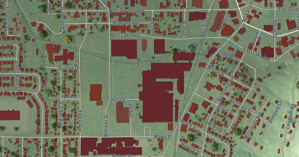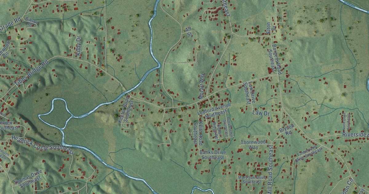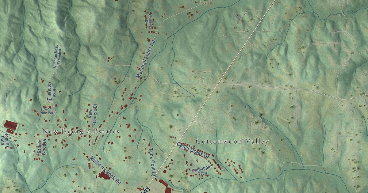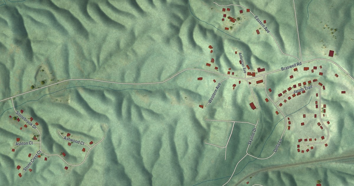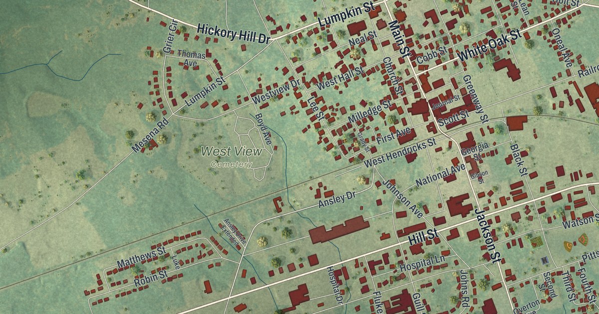
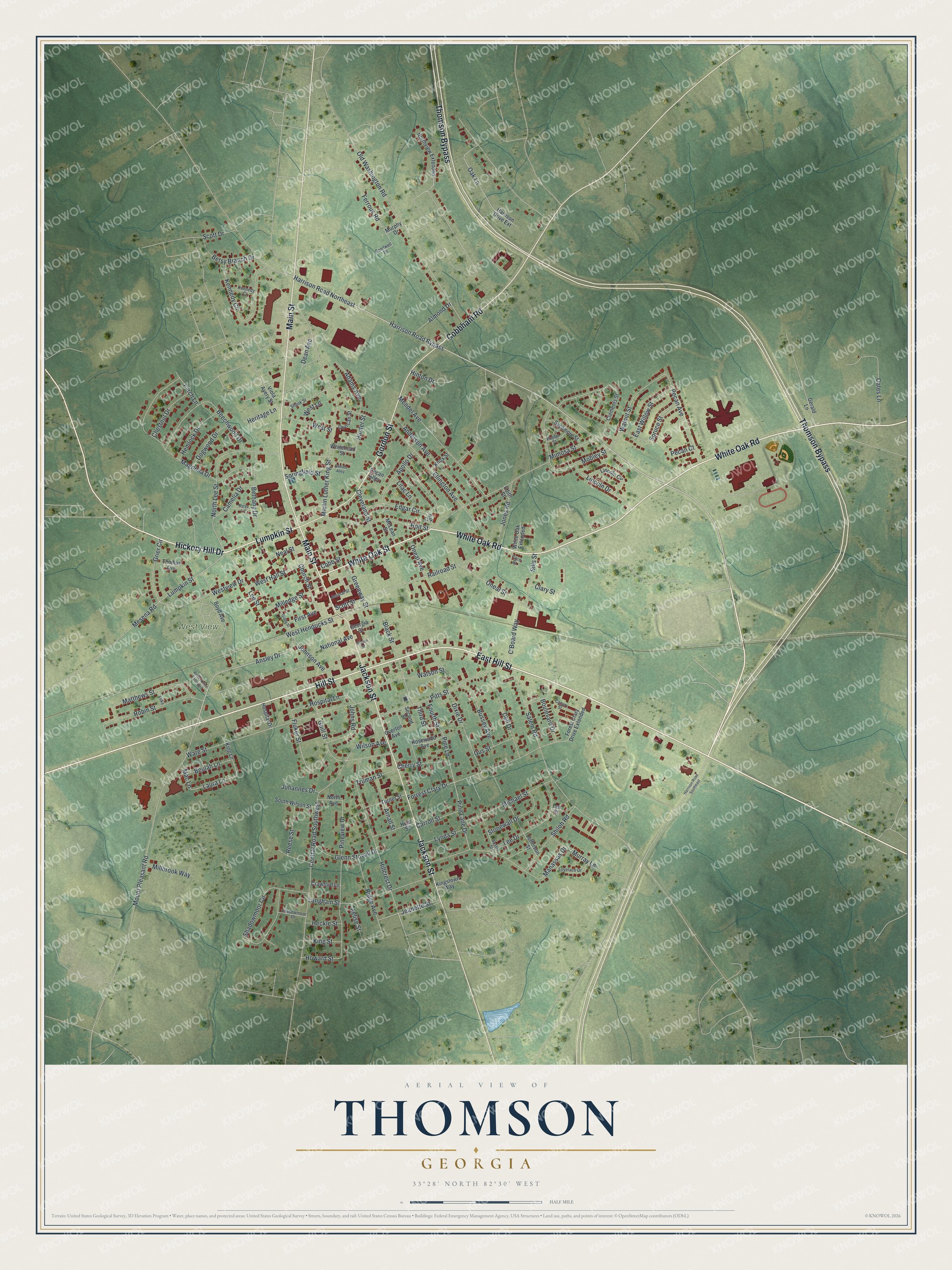
This beautifully detailed map of Thomson, Georgia was created in 2026 using aerial imagery combined with modern topographical, census, street and landmark data. It’s a one-of-a-kind view of Thomson that combines accurate data with a vintage aesthetic. The map shows every building in its true location, many of the roads carry their names, and the shaded topographic relief shows the shape of the land.
Explore an aerial view of Thomson, Georgia
On the map you’ll find West View Cemetery, along with White Oak Road, Hickory Hill Drive, Lumpkin Street, White Oak Street, Main Street, and more. If you look closely you can even find your house accurately drawn in its correct location. Zoom in on the preview to look for yours.
Did You Know?
Thomson began in 1837 as a Georgia Railroad depot. Its first name was Slashes. In 1853 the town took the name of John Edgar Thomson, an official of the railroad. It became seat of the new McDuffie County in 1870.
Take a closer look at the Thomson map
Names on this map
These names are printed on this map.
Places: West View Cemetery.
Streets and roads: White Oak Road, Hickory Hill Drive, Lumpkin Street, White Oak Street, Main Street, Hill Street, East Hill Street, Gordon Street, Jackson Street, Thomson Bypass, Cobbham Road, Ansley Drive.
More street names, A to Z
Adams Avenue, Aelise Street, Almond Drive, Anderson Avenue, Ansley Drive Extended, Apollo Drive, Arnall Street, Austin Street, Beechwood Drive, Bethany Drive, Betsy Branch Drive, Beulah Lane, Black Street, Boulevard Drive, Boyd Avenue, Bussey Avenue, C'Board Way, Camelia Drive, Canary Street, Carroll Street, Central Road Southwest, Cherry Street, Chestnut Drive, Church Street, Clary Street, Clements Street, Cleveland Street, Cobb Street, Crawford Lane, Dean Avenue, Dell Drive, Dixie Drive, Dogwood Drive, Duncan Street, East Willow Street, Edgar Circle, Edith Street, Ellington Avenue, Ferrous Road, First Avenue, Fluker Street, Forest Clary Drive Extended, Forrest Clary Drive, Fourth Street, Georgia Street, Gerald Lane, Gibson Street, Glenn Stovall Drive, Grady Street, Greenway Street, Grier Circle, Guill Street, Gus Street, Harrison Drive Extension, Harrison Road Bypass, Harrison Road Northeast, Harrison Road Southeast, Heckle Street, Hemlock Drive, Heritage Lane, Hillcrest Drive, Hinton Drive, Holt Street, Hospital Drive, Hospital Lane, Howard Street, Hunter Street, Hunt Street, Jeanette Street, Jefferson Street, Johannes Drive, Johnson Avenue, Johns Road, Jones Road, Journal Street, Kennedy Circle, Kennedy Court, King Lane, Kingstown Way, King Street, Knox Street, Langham Street, Larch Lane, Laura Lane, Lee Court, Lee Drive, Lee Street, Lilac Lane, Lincoln Circle, Lincoln Drive, Lovelace Drive, Luke, Lynda Street, Mac Lane, Magnolia Drive, Manassas Drive, Martin Luther King Street, Matthews Street, McLean Street, Mendel Avenue, Mesena Road, Michael Street, Millbrook Way, Milledge Street, Mimosa Street, Mobley Street, Mount Pleasant Road, Murphy Drive, Murray Lane, National Avenue, Neal Street, North Avenue, North Lee Street, Northview Extended, Oak Court, Oak Lane, Oates Lane, Old Washington Road, Oneal Avenue, Oneal Street, Overton Avenue, Pace Street, Pecan Alley, Pecan Avenue, Pecan Court, Pine Lane, Pine Lane Drive, Pineview Drive, Pitts Street, Poplar Street, Railroad Street, Reese Street, Reeves Alley, Ridge Avenue, Robin Street, Rose Lane, Rosewood Avenue, Salem Road, Sandwell Drive, Scott Drive, Scott Street, Second Street, Shadowmoor Circle, Shadowmoor Drive, Shank Street, Shiloh Road, Sills Street, South Wilson Street, Springfield Street, Spruce Street, Stonewall Drive, Sycamore Street, Third Street, Thomas Avenue, Truman Street, Turner Street, Viola Avery Street, Walnut Street, Ware Street, Watson Street, West Hall Street, West Hendricks Street, West Lane, West Street, Westview Drive, Whitehead Street, White Oak Extended, Wilson Avenue.
See it on a wall
The Thomson map as a framed print. Swipe for more.


This beautifully detailed map of Thomson makes an attractive addition to your office, library, or den, and it can even be used to teach children the geography and history of the area. It also makes a great gift for anyone with Thomson roots. When you’re done exploring, click here to get your copy of the Thomson map.