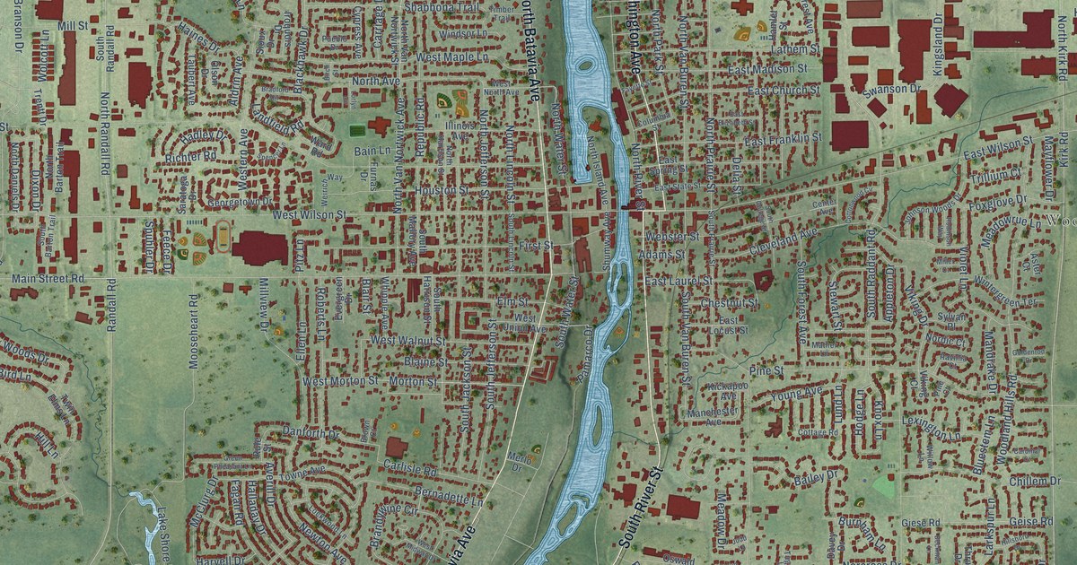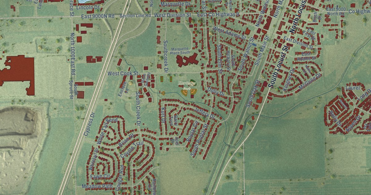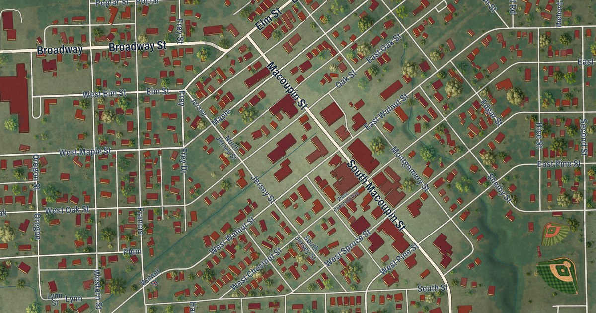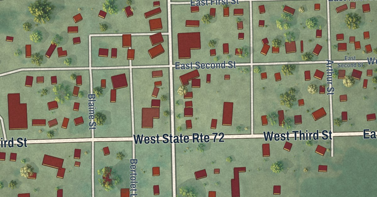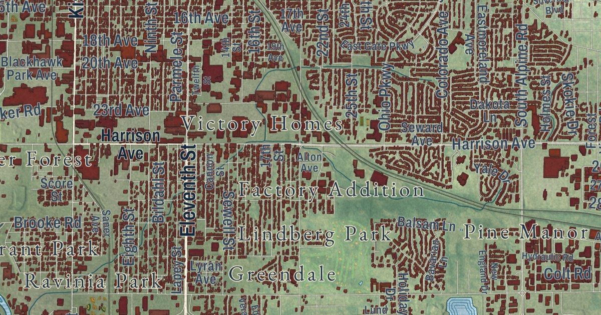
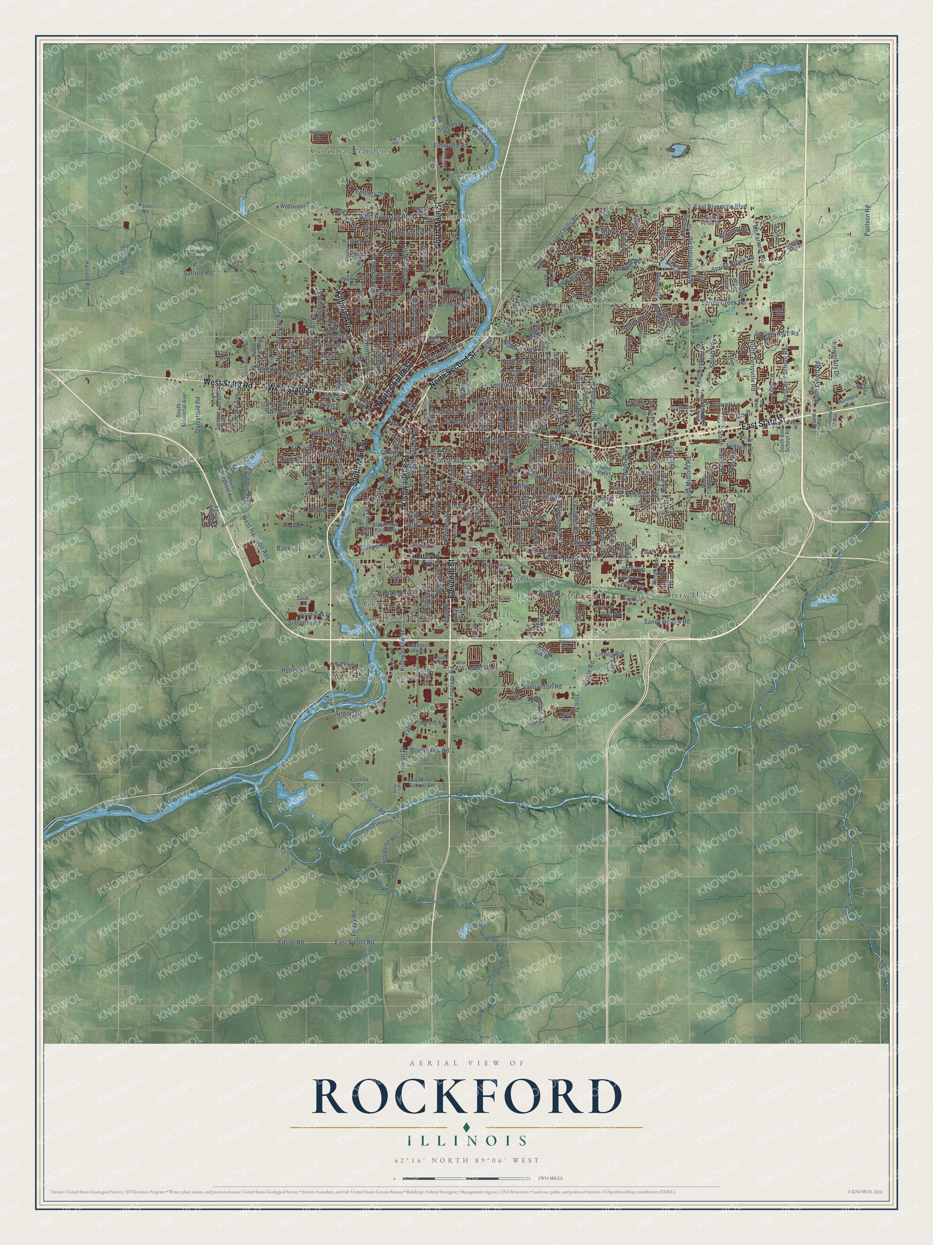
This beautifully detailed map of Rockford, Illinois was created in 2026 using aerial imagery combined with modern topographical, census, street and landmark data. It’s a one-of-a-kind view of Rockford that combines accurate data with a vintage aesthetic. The map shows every building in its true location, many of the roads carry their names, and the shaded topographic relief shows the shape of the land.
Explore an aerial view of Rockford, Illinois
On the map you’ll find Anna Page Park, Searls Park, Colonial Gardens, Coventry Hills, Factory Addition, Grant Park, Green View Heights, Greendale, Harrison Avenue Gardens, Jonesville, Lindberg Park, Pine Manor, and more. If you look closely you can even find your house accurately drawn in its correct location. Zoom in on the preview to look for yours.
Did you know this piece of Rockford, Illinois history?
From the 1877 History of Winnebago County, Illinois: "The first mail bag received at Rockford was unaccompanied by a key, and consequently could not be opened, and was sent back."
Take a closer look at the Rockford map
Street and place names on the Rockford, Illinois map
These names are printed on the map of Rockford, Illinois.
Places: Anna Page Park, Searls Park, Winnebago Court, Colonial Gardens, Coventry Hills, Lindberg Park, Samuelson Corners, River Forest, Ruby, Ravinia Park, Pine Manor, Greendale, Factory Addition, Victory Homes, Jonesville, Grant Park, Alpine Park and Blackhawk Park.
Streets and roads: East State Street, South Main Street, West State Street, West State Road, North Second Street, North Church Street, Kishwaukee Street, Eleventh Street, North Main Street, Kilburn Avenue, Harrison Avenue, Spring Creek Road.
More street names, A to Z
13th Street, 14th Street, 15th Avenue, 15th Street, 16th Avenue, 16th Street, 17th Avenue, 17th Street, 18th Avenue, 18th Street, 19th Avenue, 19th Street, 20th Avenue, 20th Street, 22nd Street, 23rd Avenue, 23rd Street, 24th Street, 25th Street, 26th Avenue, 26th Street, 27th Avenue, 27th Street, 28th Avenue, 29th Street, 35th Street, 39th Avenue, Airport Drive, Alida Street, Alpine Road, Alton Avenue, American Road, Andrews Street, Anee Drive, Argus Drive, Arline Avenue, Arnold Avenue, Arthur Avenue, Ashby Trail, Ashton Villa, Auburn Street, Balsam Lane, Banks Street, Bavarian Lane, Beale Court, Bell Avenue, Belmont Boulevard, Beltline Road, Bienterra Trail, Bildahl Street, Biltmore Chase, Blackhawk Park Avenue, Blackhawk Road, Bluffside Drive, Boeing Drive, Bradley Road, Braur Parkway, Brendenwood Road, Broadway, Brooke Road, Brown Avenue, Browns Beach Road, Camlin Avenue, Camp Elmwood Road, Cannon Street, Capital Drive, Carol Court, Cedar Street, Cessna Drive, Charles Street, Chelsea Avenue, Christina Street, Clifton Avenue, Clinton Street, Cody Lane, College Avenue, Colorado Avenue, Colt Road, Columbia Parkway, Concord Avenue, Condon Road, Coolidge Place, Crane Drive, Creek Bend, Crescent Drive, Crofton Drive, Crosby Street, Cunningham Street, Custer Avenue, Daisyfield Road, Dakota Lane, Davis Street, Day Avenue, Dierks Drive, Dorchester Drive, Dorset Drive, East Edson Road, East Gate Parkway, Eastmoreland Avenue, Easton Parkway, East Riverside Boulevard, Eaton Drive, Eddy Avenue, Edgemont Street, Edson Road, Ed Vera Drive, Eighth Street, Elm Street, Elmwood Road, Elva Lane, Embury Drive, Fairview Avenue, Fairview Boulevard, Falcon Drive, Falcon Road, Fawnridge Drive, Featherstone Road, Fincham Drive, Fireside Drive, Ford Avenue, Forest Hills Road, Forest View Avenue, Forest View Road, Foster Avenue, Fourth Avenue, Fremont Street, Friday Road, Frontage Road, Fulton Avenue, Garden Lane, Garrett Lane, Glenwood Avenue, Grand Cape Road, Green Street, Greenwood Avenue, Grove Street, Guilford Road, Halsted Road, Harlem Boulevard, Harrison Road, Heidi Lane, Hemlock Lane, Hermitage Trail, Hiatt Drive, Highcrest Road, Highridge Road, Hill Street, Holiday Drive, Holmes Street, Huffman Boulevard, Hulin Street, Hunter Avenue, Hydraulic Road, Indiana Avenue, Innsbruck Drive, Iris Avenue, Jackson Street, Jacoby Place, James Avenue, Jonquil Place, Kay Avenue, Kent Street, Kings Highway, King Street, Kristi Lane, Landstrom Road, Lapey Street, Larson Avenue, La Salle Avenue, Latham Street, Lee Street, Leonard Road, Linden Road, Lookout Drive, Loomis Street, Lund Avenue, Lyford Road, Lyran Avenue, Madron Road, Marsh Avenue, McFarland Road, McLain Avenue, Meadow View Lane, Meridian Road, Mila Avenue, Milford Avenue, Mill Road, Modesto Drive, Montague Road, Morgan Street, Morsay Drive, Myott Avenue, Nadine Avenue, Nelson Boulevard, Newburg Road, New England Drive, New Milford School Road, Ninth Street, North Alpine Road, North Avenue, North Avon Street, North Bell School Road, North Central Avenue, North Chicago Avenue, North Court Street, North Day Avenue, Northern Avenue, North Horsman Street, North Johnston Avenue, North Junction Road, Northline Drive, North Longwood Street, North Lyford Road, North Mulford Road, North Oak Knolls Avenue, North Perryville Road, North Pierpont Avenue, North Prospect Street, North Rockton Avenue, North Trainer Road, North Willard Avenue, North Winnebago Street, Oak Grove Lane, Ogilby Road, Ohio Parkway, Olden Oak Drive, Onyx Parkway, Orchard Avenue, Packard Parkway, Palo Verde Drive, Paris Avenue, Park Avenue, Parmele Street, Paulson Road, Pelham Road, Pelley Road, Pepper Drive, Phelps Avenue, Pierce Avenue, Porter Road, Post Drive, Prairie Road, Preston Street, Price Street, Quaker Road, Regents Park Road, Regina Lane, Reid Farm Road, Research Parkway, Ridge Avenue, Rockwell Street, Roncevalles Avenue, Rose Avenue, Ross Lane, Rote Road, Route 99, Roxbury Road, Royal Avenue, Rural Street, Safford Road, Sage Drive, Samuelson Road, Sandhutton Avenue, Sandy Hollow Road, Saner Avenue, Sauber Avenue, Sauk Lane, Scarlet Oak Drive, School Street, Score Street, Searles Avenue, Second Avenue, Seminary Street, Sentinel Road, Seventh Street, Seward Avenue, Sewell Street, Shaw Street, Shaw Woods Drive, Shelford Lane, Shelly Drive, Shepherd Trail, Shiloh Road, Shirley Road, Show Place Drive, Simpson Road, Sixth Avenue, Skokie Drive, Skylark Drive, Sonoma Road, South Alpine Road, South Bell School Road, South Bend Road, South Central Avenue, South Fifth Street, South Memorial Avenue, South Mulford Road, South Pierpont Avenue, Southrock Drive, South Springfield Avenue, South Trainer Road, Sovereign Boulevard, Spring Brook Road, Spring Lake Drive, Springwheat Street, Sterling Drive, Steven's Ridge, Stony Creek Way, Strathmoor Drive, Tay Street, Tenth Street, Tesa Road, Thoren Lane, Tivoli Drive, Toft Street, Trenton Avenue, Triton Avenue, Tulip Lane, Turner Street, Twelfth Avenue, Twelfth Street, University Drive, Uram Lane, Vassar Road, Verona Drive, Walton Street, Ware Avenue, Ware Road, Warren Avenue, Welty Avenue, West Harrison Avenue, West Riverside Boulevard, West Street, Westwood Lane, Williamsburg Road, Willoubhby Avenue, Willow Lane, Winthrop Lane, Wood Road, Woods Drive, Yale Drive, Yonge Street.
See the Rockford, Illinois map on a wall
The Rockford map as an 18 x 24 inch print in a black frame.

This beautifully detailed map of Rockford makes an attractive addition to your office, library, or den, and it can even be used to teach children the geography and history of the area. It also makes a great gift for someone who left Rockford and still calls it home. When you’re done exploring, click here to get your copy of the Rockford map.