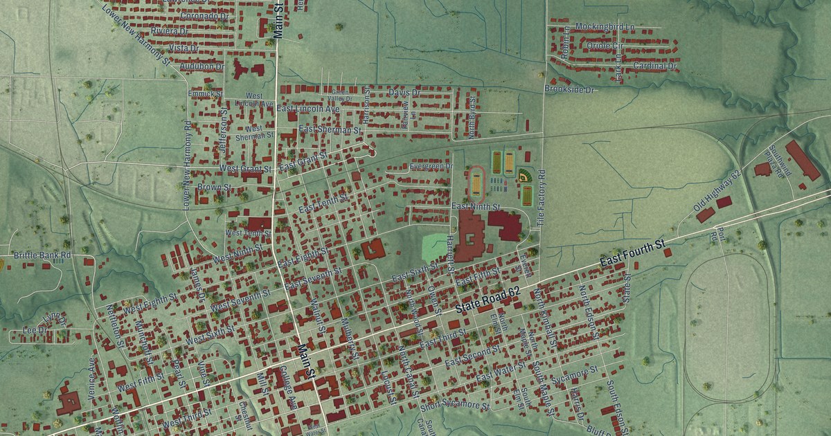
This beautifully detailed map of Mount Vernon, Indiana was created in 2026 using aerial imagery combined with modern topographical, census, street and landmark data. It’s a one-of-a-kind view of Mount Vernon that combines accurate data with a vintage aesthetic. The map shows every building in its true location, many of the roads carry their names, and the shaded topographic relief shows the shape of the land.
Explore an aerial view of Mount Vernon, Indiana
On the map you’ll find Brittlebank Park, along with State Road 69, Main Street, State Road 62, West Fourth Street, East Fourth Street, Parke Street, East Grant Street, West Grant Street, West Second Street, East Second Street, Greenbrier Drive, and more. If you look closely you can even find your house accurately drawn in its correct location. Zoom in on the preview to look for yours.
Did you know this piece of Mount Vernon, Indiana history?
From the Indiana Gazetteer: "Mount Vernon, the Seat of Justice of Posey county, was first settled in 1803, by Andrew McFadin, and the site where the town stands was long known by the name of McFadin's Bluff."
Take a closer look at the Mount Vernon map
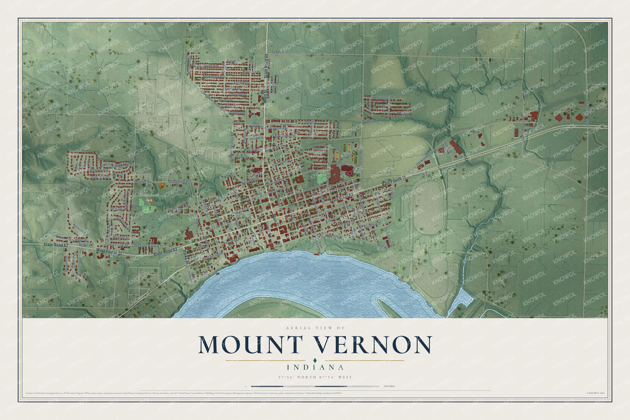
Street and place names on the Mount Vernon, Indiana map
These names are printed on the map of Mount Vernon, Indiana.
Places: Brittlebank Park.
Streets and roads: State Road 69, Main Street, State Road 62, West Fourth Street, East Fourth Street, Parke Street, East Grant Street, West Grant Street, West Second Street, East Second Street, Greenbrier Drive, Brittle Bank Road.
More street names, A to Z
Allyn Drive, Audubon Drive, Barter Street, Bluff Road, Bridges Lane, Brookside Drive, Brown Street, Cardinal Drive, Cherry Hills Drive, Chestnut Street, Clover Street, College Avenue, Coronado Drive, Country Club Road, Davis Drive, Dogwood Place, East Eighth Street, East Fifth Street, East Lincoln Avenue, East Ninth Street, East Seventh Street, East Sherman Street, East Sixth Street, East Tenth Street, East Third Street, East Water Street, Emmick Street, Estate Drive, Everett Street, Evergreen Drive, Fairview Lane, Glen Eagles Drive, Greenbrier Circle, Green Valley Drive, Grenada Street, Harriett Street, Harris Drive, Harrison Street, Hawthorne Drive, Hereford Drive, James Drive, Jefferson Street, Kennedy Drive, Lakeview Drive, Lark Lane, Lawrence Drive, Lee Drive, Locust Street, Lower New Harmony Road, Lower New Harmony Street, Lynn Drive, Magnolia Drive, Mann Street, Mill Street, Mockingbird Lane, Mulberry Street, Munchoff Street, Nettleton Street, North Byrd Street, North Canal Street, North Cherry Lane, North Edson Street, North Elm Street, North Kimball Street, North Maple Street, North Wood Street, Odonnell Road, Ohio Street, Old Highway 62, Old Orchard Road, Old State Highway 62, Oriole Circle, Owen Street, Parkridge Drive, Pearl Street, Pinehurst Drive, Pleasant Valley Drive, Port Road, Raintree Drive, Riviera Drive, Robin Lane, Roosevelt Drive, Seibert Lane, Short Sycamore Street, Smith Road, South Canal Street, South Edson Street, South Elm Street, South Leonard Road, South Maple Street, South Parke Street, Southwind Avenue, Southwind Plaza Road, State Street, Sunset Drive, Sycamore Street, Tanglewood Drive, Terrace Drive, Tile Factory Road, Venice Avenue, Vine Street, Vista Drive, Walnut Street, Washington Avenue, West Eighth Street, Western Hills Drive, West Fifth Street, West Lincoln Avenue, West Ninth Street, West Ridge Drive, Westridge Drive, West Seventh Street, West Sherman Street, West Sixth Street, West Tenth Street, West Third Street, West Water Street, Westwood Drive, William Keck Bypass, Wolflin Street.
See the Mount Vernon, Indiana map on a wall
The Mount Vernon map as an 18 x 24 inch print in a black frame.

This beautifully detailed map of Mount Vernon makes an attractive addition to your office, library, or den, and it can even be used to teach children the geography and history of the area. It also makes a great gift for someone who left Mount Vernon and still calls it home. When you’re done exploring, click here to get your copy of the Mount Vernon map.