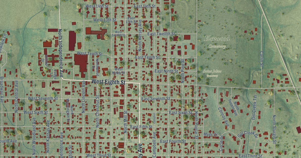
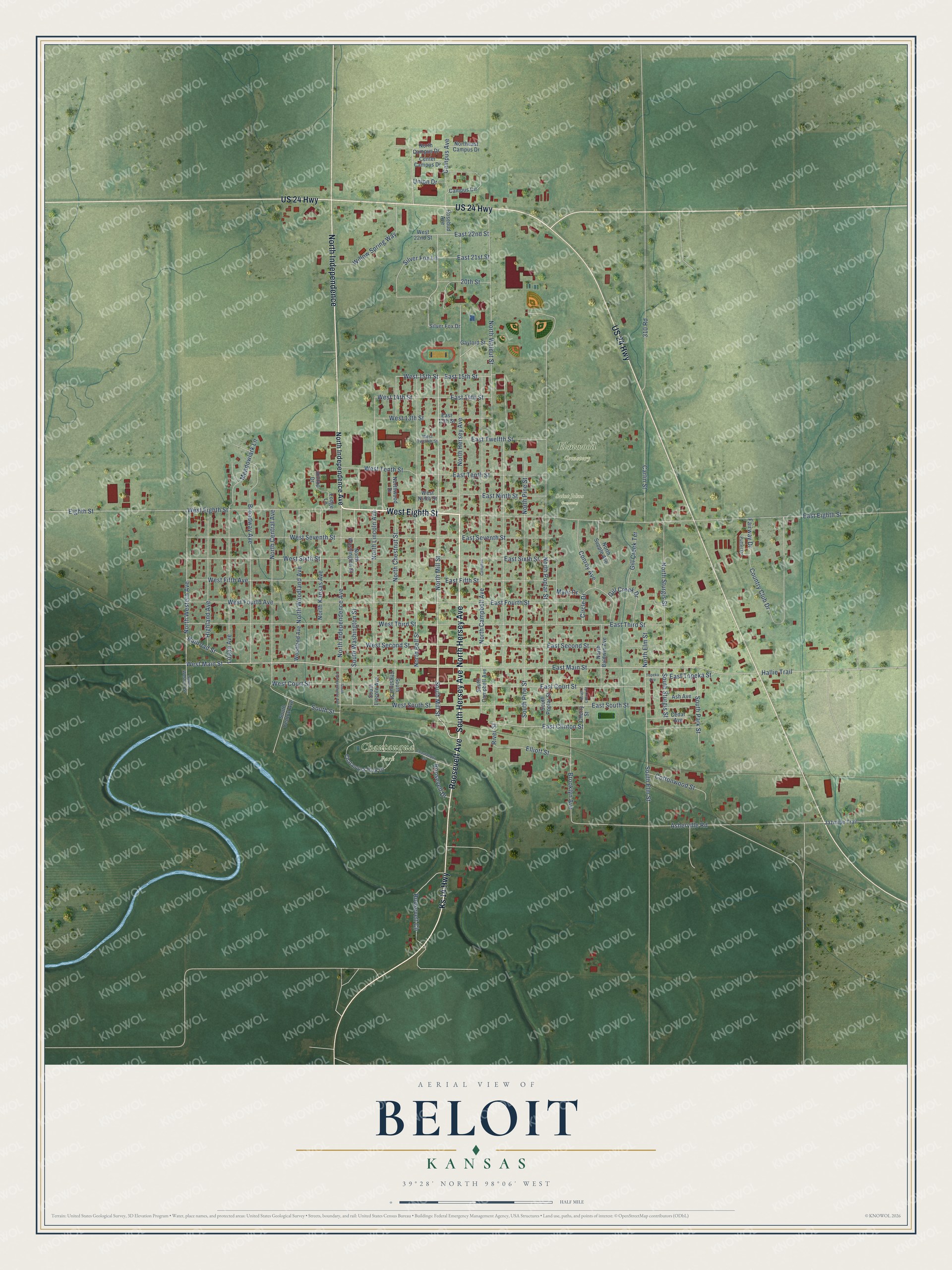
This beautifully detailed map of Beloit, Kansas was created in 2026 using aerial imagery combined with modern topographical, census, street and landmark data. It's a modern aerial view of Beloit in Mitchell County, Kansas, that combines modern data with a vintage aesthetic. The roads feature printed names, and if you look closely you can find your exact house accurately shown in its correct location.
Explore an aerial view of Beloit, Kansas
On this map you'll find Chautauqua Park, Elmwood Cemetery, Saint Johns Cemetery, North Hersey Avenue, South Hersey Avenue, West Eighth Street, Ks 14 Highway, North Independence, Roosevelt Avenue, South Mill Street, West Main Street, North Mill Street, and more. Each red shape is a building, so zoom in on the preview and look for yours.
Beloit has a story worth telling. The Kansas State Teachers College puts it this way: "The town was named Willow Springs in 1868 for a nearby fresh water springs surrounded by willows. Because there was a post office of such a name in Douglas County, the name was changed to Beloit for Beloit, Wisconsin."
Beloit is a city in Mitchell County. The Census Bureau counted 3,404 people here in 2020.
Take a closer look at the Beloit map
Names on this map
These names are printed on this map.
Places: Chautauqua Park, Elmwood Cemetery and Saint Johns Cemetery.
Streets and roads: North Hersey Avenue, South Hersey Avenue, West Eighth Street, Ks 14 Highway, US 24 Highway, North Independence, Roosevelt Avenue, South Mill Street, West Main Street, North Mill Street, West 15th Street, North Western Avenue.
More street names, A to Z
20th Street, 310 Road, Ash Avenue, Asherville Road, Broadway Avenue, Brooklyn Avenue, Campbell, Campus Avenue, Campus Circle, Carlin Street, Cedar Avenue, Center Campus Drive, Chatauqua Park Drive, Chautauqua Drive, Cherry Street, Circle Drive, Conroy Avenue, Cottonwood Street, Country Club Drive, East 13th Street, East 14th Street, East 15th Street, East 21st Street, East 22nd Street, East Clinton Street, East Court Street, East Eighth Street, East Fifth Street, East Fourth Street, East Main Street, East Ninth Street, East Second Street, East Seventh Street, East Sixth Street, East South Street, East Tenth Street, East Third Street, East Topeka Street, East Twelfth Street, Eighth Street, Elliott Street, Fairway Drive, Gaylord Street, Gill Creek Drive, Gill Creek Terrace, Hallie Trail, Highland Avenue, Hilltop Drive, Jazmine Trail, Lodge Lane, Logan Avenue, Meadowlark Lane, Myer Drive, North Baldwin Avenue, North Bell Street, North Campbell Avenue, North Campus Drive, North Central Avenue, North Chestnut Street, Northeast Campus Drive, North Elm Street, North Independence Avenue, North Kansas Avenue, North Lincoln Avenue, North Pine Street, North Poplar Street, North Sturgis Street, North Supple Avenue, North Walnut Street, North Washington Street, Northwood Drive, North Woodland Avenue, Putter Drive, Railroad Street, River Street, Roosevelt Circle, Roosevelt Drive, Rosebud Avenue, Silver Fox Drive, Silver Fox Lane, South Campbell Avenue, South Central Avenue, South Cherry Street, South Chestnut Street, South Elm Street, South Independence Avenue, South Lincoln Avenue, South Park Street, South Pine Street, South Poplar Street, South Street, South Sturgis Street, South Washington Street, South Western Street, Topeka Avenue, Union Drive, West 13th Street, West 14th Street, West 22nd Street, West Court Street, West Fifth Avenue, West Fourth Avenue, West Ninth Street, West Second Street, West Seventh Street, West Sixth Street, West South Street, West Tenth Street, West Third Street, West Twelfth Street, Willow Spring Way, Woodland Avenue.
Created by KNOWOL in 2026. The buildings are small red shapes, the roads carry their printed names, and shaded relief shows the shape of the land. The title panel reads "AERIAL VIEW OF BELOIT KANSAS" with 39°28' NORTH 98°06' WEST.
It looks right in a kitchen, an office or a den, and it's a gift for anyone who grew up in Beloit or moved away. Open the preview and find your street. See sizes and frames for the Beloit map.