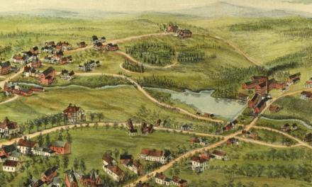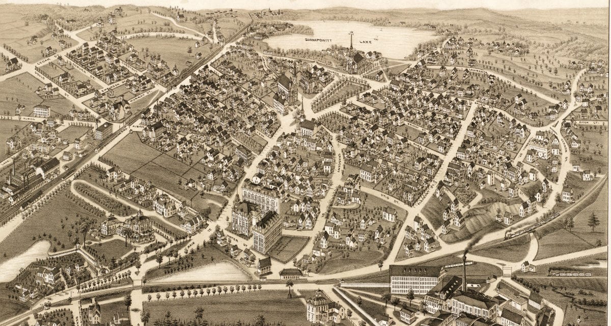
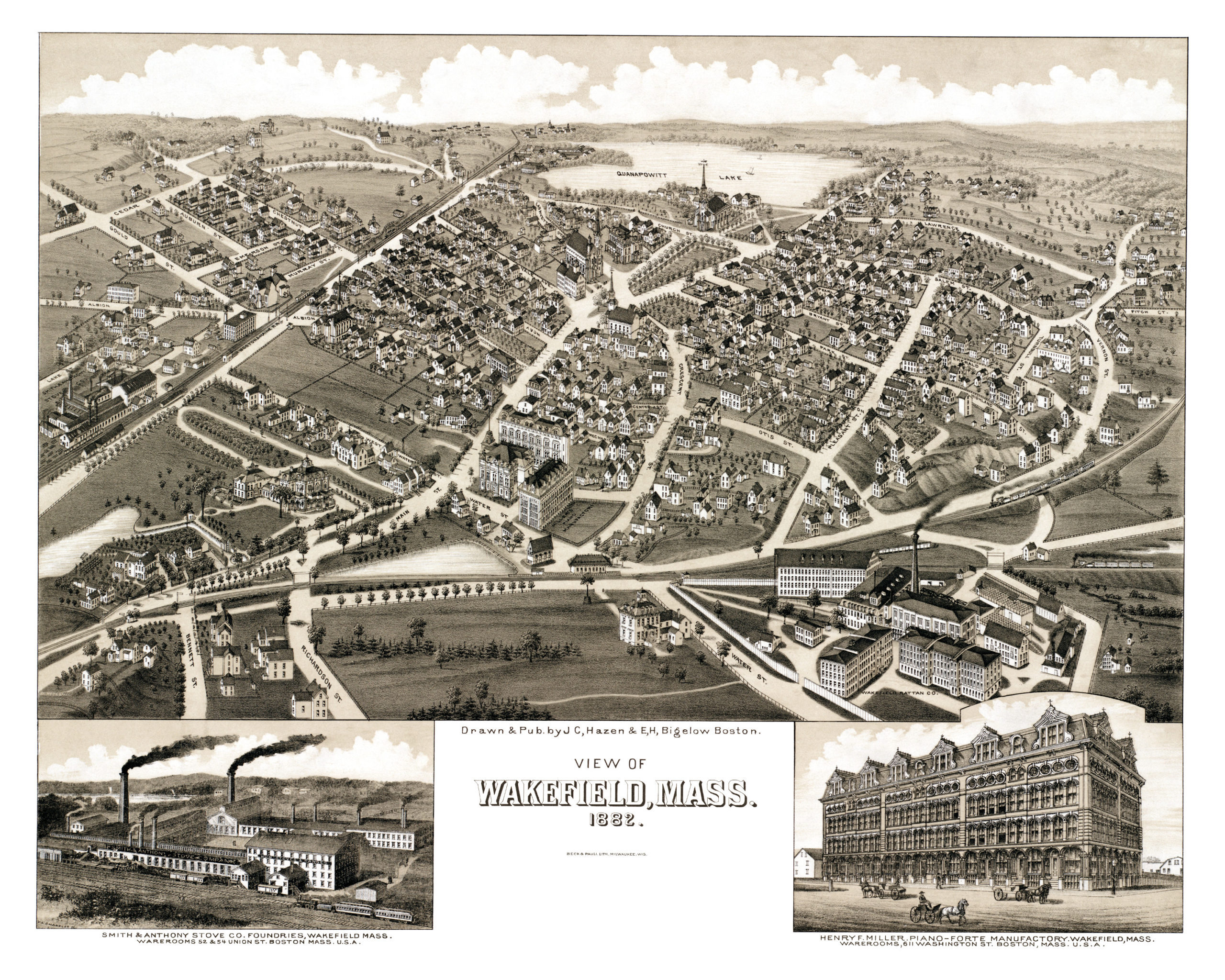
This old map of Wakefield, Massachusetts was created in 1882 by J.C. Hazen, a prominent 19th century map maker. His detailed drawing depicts Wakefield as it was, including street names and old landmarks.
Landmarks on the map include Miller’s Piano Factory, Smith & Anthony Stove Company Foundry, Wakefield Rattan Company, Quanapowitt Lake, and the Boston & Maine Railroad Station.
This historic map of Wakefield has been restored by KNOWOL. Reproductions of the map are available here.
Bird’s Eye View of Wakefield, Mass in 1882
This beautiful old map of Wakefield will make an attractive addition to your office, library, or den, and can even be used to teach children the geography and history of the area. When you’re done exploring, click here to get yours.