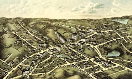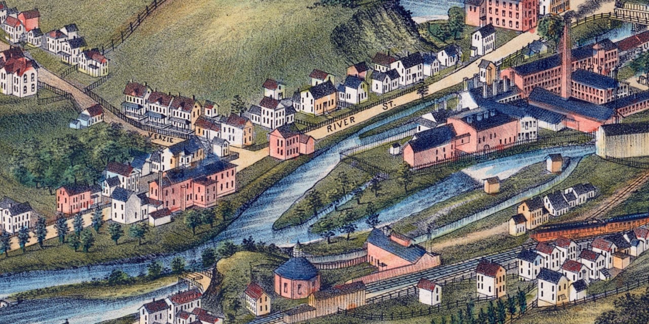
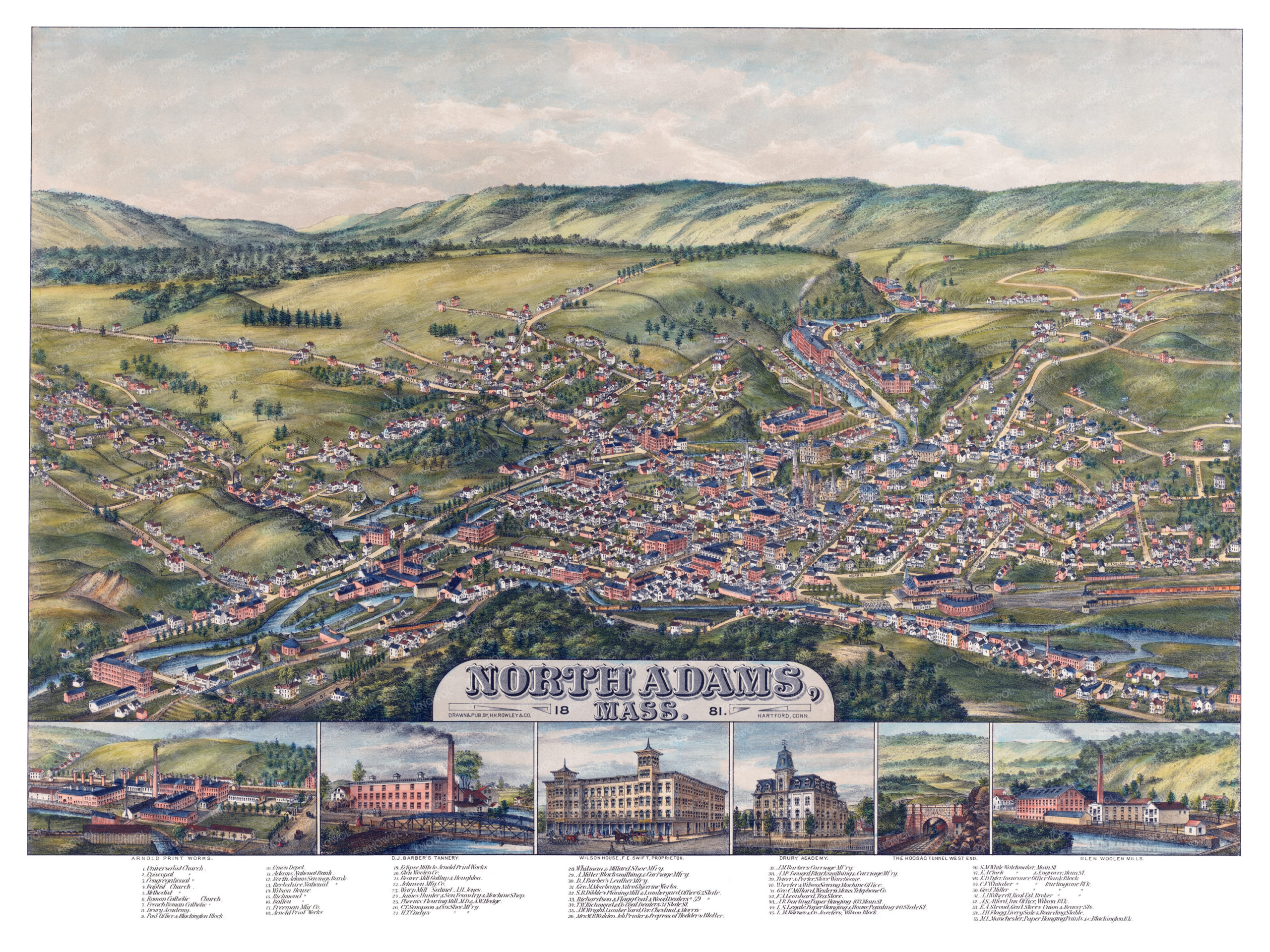
This historic map of North Adams, Massachusetts was created in 1881 by H.H. Rowley, a prominent 19th century map maker. The map shows a bird’s eye view of the area as it used to be, including street names and old landmarks.
Landmarks on the map include Barber’s Carriage Manufactory, Wheeler & Wilson Sewing Machines, Stroud’s General Store, Mowbray’s Nitroglycerin Works, Phoenix Flouring Mill, Adams National Bank, Drury Academy, multiple churches, and more.
This historic map of North Adams has been restored by KNOWOL. Reproductions of the restored map are available here.
Historic Old Map of North Adams, Massachusetts from 1881
This vintage map of North Adams makes an attractive addition to your office, library, or den, and can even be used to teach children the geography and history of the area. When you’re done exploring, click here to get your copy of the restored map.