If you grew up in Allenville, or you have family on its quiet blocks, this map puts the whole village on one sheet. It's a modern aerial view of Allenville in Cape Girardeau County, Missouri, made from modern data with a vintage feel. The little grid of streets sits in the middle of the print, with about 80 buildings drawn in red. Green fields spread out on every side. A stream winds in tight loops just south of town, and a wide blue river cuts across the bottom right corner.
Whitewater Street, Penney Street and Old Rock Road
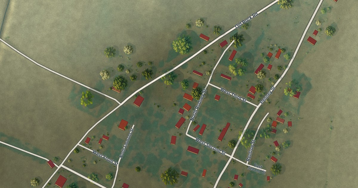
Start on the left edge of the sheet, where Whitewater Street comes in from the fields. Follow it east. It crosses a low green channel and heads into the village. Once you're in town, the short streets have names. Look for West Front Street, West Second Street and West Third Street. North Rodney Street, South Rodney Street, North Emmons Street and South Emmons Street are printed there too.
Now look to the right side of town. Penney Street comes down from the northeast toward the middle of the village. Renfroe Street runs north and south near the center. On the east side you'll also find East Front Street and East Second Street. At the top of town, Old Rock Road heads out to the top right corner. Many of the roads are named, and each red shape is a building, so zoom in on the preview and look for yours.
Allenville's 2020 Census count and the stream below town
Allenville is a village in Cape Girardeau County. The 2020 Census counted 95 people here. In a village this size, you can count the buildings along each block. Trees are drawn one by one around the yards. The low ground near town is shaded a darker green. Below the village, the stream bends back on itself in a deep S-curve through the fields, then runs on toward the bottom of the sheet.
For anyone with roots along Whitewater Street in Allenville
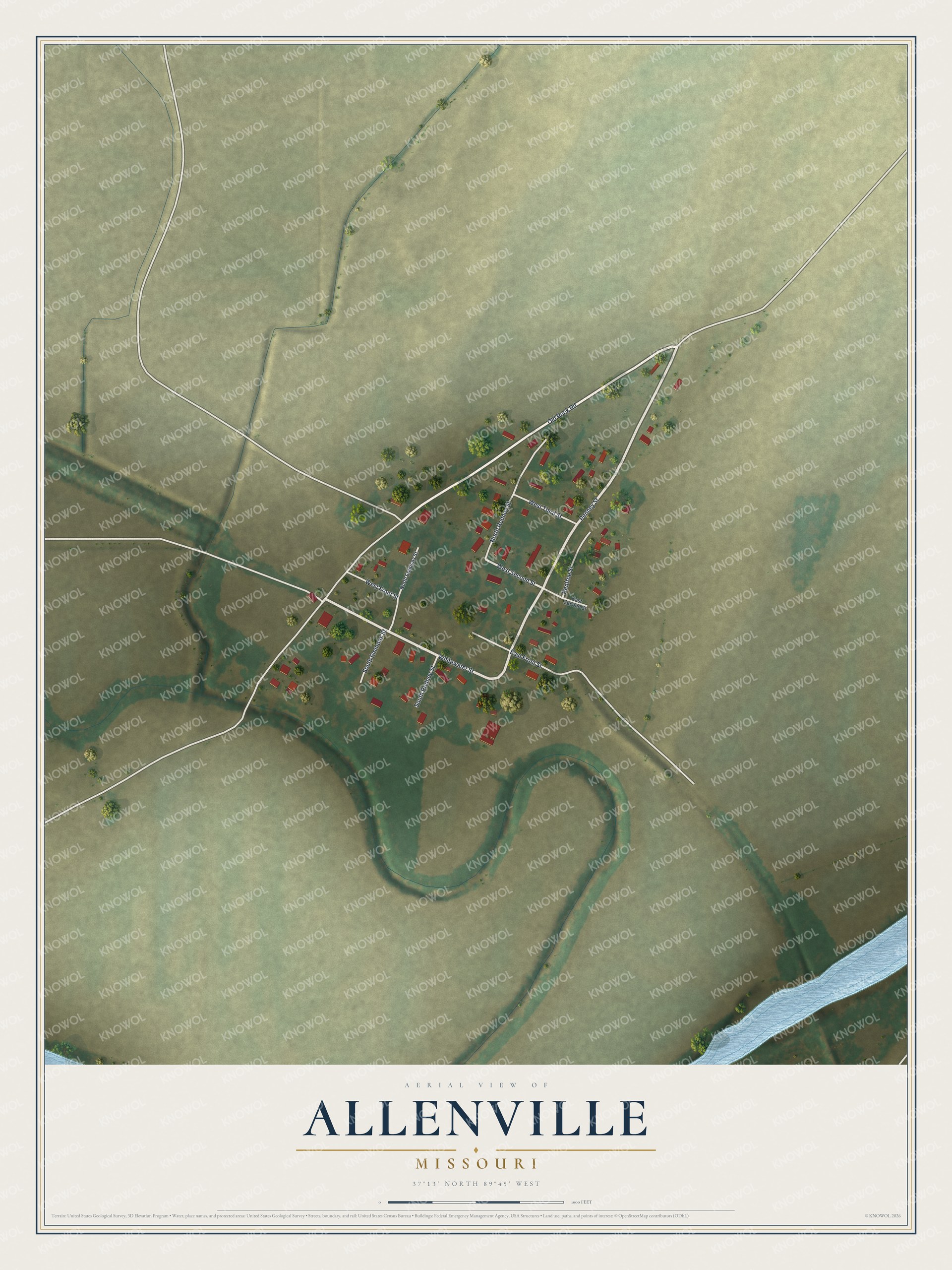
Created by KNOWOL in 2026, this Allenville map shows pale roads and red buildings on soft green fields, inside a cream border. The terrain comes from USGS elevation data, and the streets come from Census Bureau records. The title panel reads "Aerial View of Allenville, Missouri" with 37°13' North, 89°45' West and a scale bar.
Hang it in a kitchen, a den or a home office. It's a good gift for someone who grew up near Whitewater Street and lives far away now, or for a family with roots in Cape Girardeau County. Open the preview and follow Whitewater Street into town. See sizes and frames for the Allenville map.