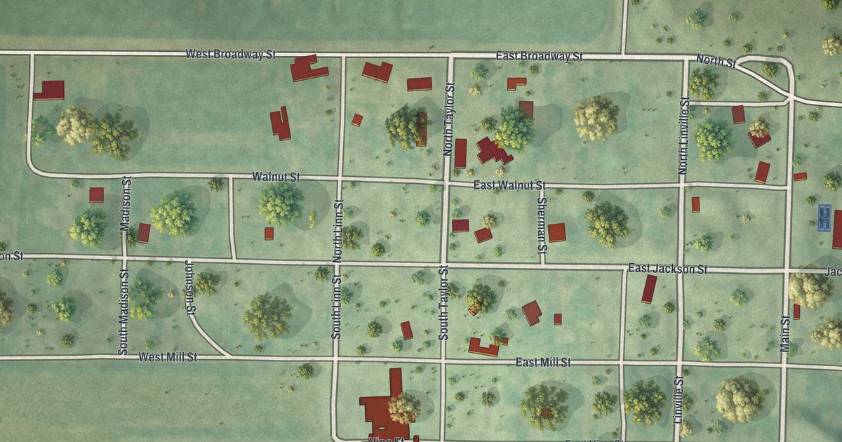
If you grew up in Graham or still have family here, this map was made with you in mind. It's a modern aerial view of Graham in Nodaway County, Missouri, built from current map data with a soft vintage style. The town's small grid of streets sits between West Broadway Street and Sycamore Street. State Highway Zz runs north out of town through wide farm fields. A winding creek with wooded banks runs down the right side of the sheet.
Main Street and the Streets of Graham
On this map you'll find Main Street, East Broadway Street, West Broadway Street, East Jackson Street, West Jackson Street, Walnut Street, East Mill Street, Vine Street, Sycamore Street, Church Street, North Taylor Street, Linville Street, State Highway Zz, Echo Road, and more. Each red shape is a building, so zoom in on the preview and look for yours.
How a Lame Horse Brought Isaac Hogan to Graham
Graham's story starts with a lame horse. The 1882 history of Nodaway County tells it. In the spring of 1839, Isaac Hogan rode north with a small party. With him were Daniel Hogan, Richard Taylor and Robert M. Stewart. Taylor had married a sister of the Hogans. They crossed a stream now called Elkhorn and made camp about half a mile south of Graham. The next morning one of the horses was lame. So they went hunting and looked over the land. They liked what they saw. In the book's words, "They had found a country that they would be glad to call home."
Isaac Hogan was from Tennessee. He built a cabin near a place later called Brown's Spring, just south of the village. The book says it was the only cabin north of the Nodaway River at the time. Much of this account came from Dr. J. W. Morgan, one of the county's earliest pioneers. On the print, look past Sycamore Street to the green fields below town. The old history places that first camp about half a mile south of Graham.
Simpson's College on East Jackson Street
Graham has a place on the National Register of Historic Places. Simpson's College, at 515 East Jackson Street, was listed in 1978. East Jackson Street runs through the middle of the town grid on the map, so you can find the street it stands on.
Keep Graham and Nodaway County Close
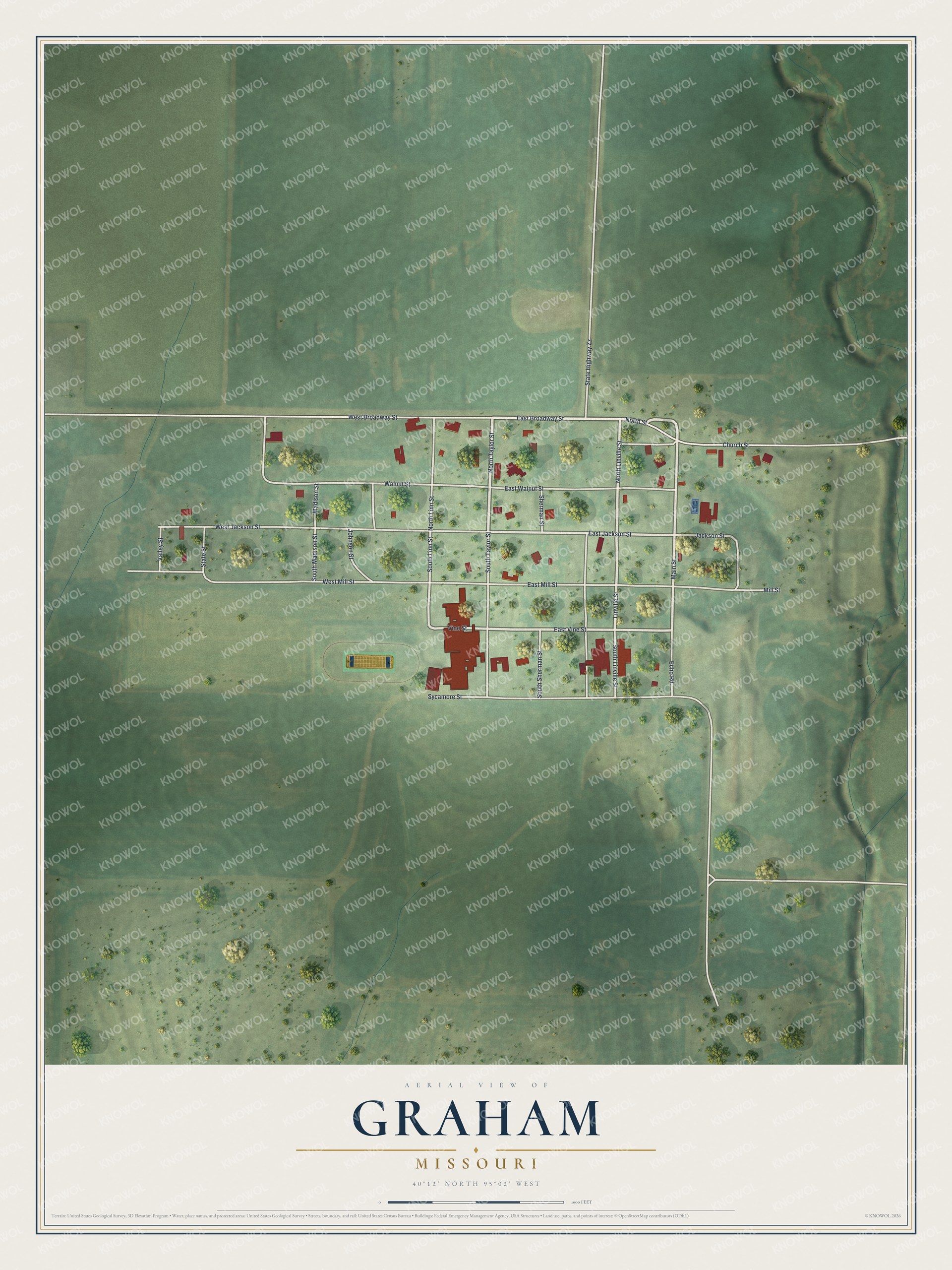
Created by KNOWOL in 2026, the print shows Graham from above in soft greens, with pale roads, dark red buildings and small round trees scattered across the fields. The title panel at the bottom reads "Aerial View of Graham, Missouri" with the coordinates 40°12' North 95°02' West.
It fits a living room, a hallway, a den or a home office. It's a good gift for anyone who knows Simpson's College on East Jackson Street, or who moved away and still thinks about Main Street. Open the preview and find your own block. See sizes and frames for the Graham map.