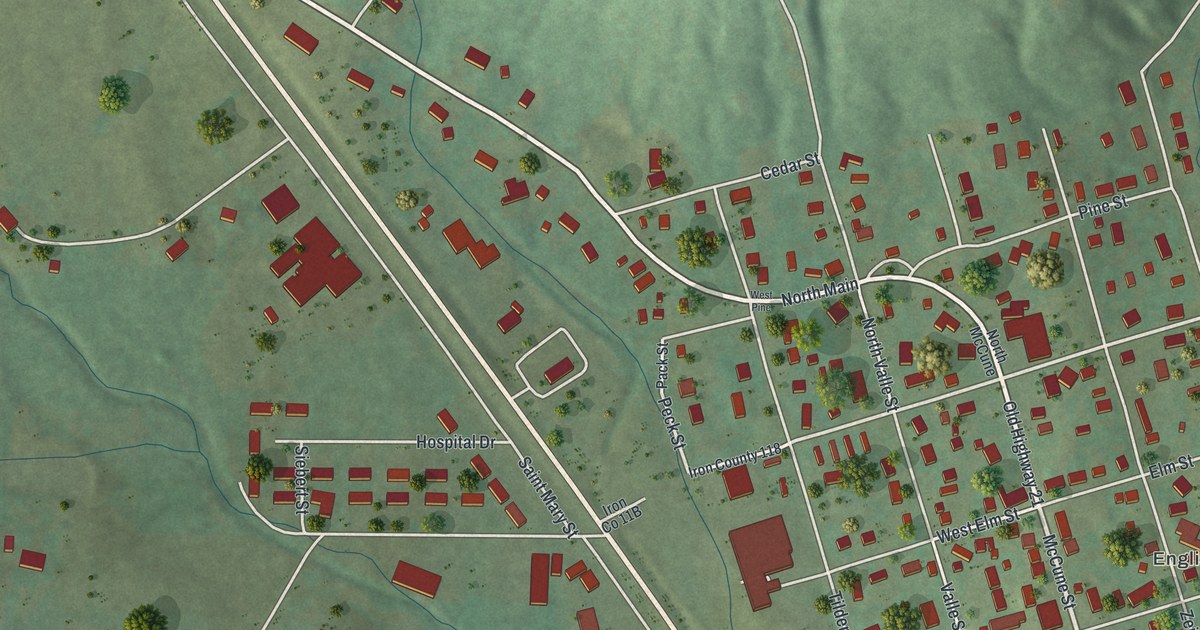
If you grew up in Pilot Knob or still have family near Old Highway 21, this map gives you plenty to find. It's a modern aerial view of Pilot Knob in Iron County, Missouri, built from modern data and given a vintage feel. More than 560 buildings are drawn in dark red, and the green hills are shaded so each ridge stands out. Old Highway 21 cuts across the sheet from corner to corner. The town's small grid of streets sits just east of it.
Old Highway 21, McCune Street and English Town
Start at the top left corner, where Old Highway 21 comes onto the sheet. Follow it southeast. Odelia and Short Street branch off near the top. Then McCune Street splits away to the east and leads into the town grid. Mulberry, Elm, Walnut, Pine and Maple Streets cross the grid from west to east. Valle, Bogy and Zeigler Streets run north and south. English Town is printed on the east side of the grid, near Lucas Street and Oak Street.
Zeigler Street is home to Immanuel Evangelical Lutheran Church, listed on the National Register in 1979. Now go back to Old Highway 21. Hospital Drive sits just west of the road. Keep heading southeast, and Main Street runs south from the grid beside you. Near Duree, look for the Battle of Pilot Knob State Historic Site label, just south of the town. Industrial Drive and Hickory Street sit near the bottom right. On the west side, Grittiya Street, Price Street and Sunrise Lane head south through the fields. Many roads are labeled, and each red shape is a building, so zoom in on the preview and look for yours.
The Battle of Pilot Knob in 1864
The Battle of Pilot Knob was fought on September 27, 1864. The State Historical Society of Missouri tells the story. Confederate Major General Sterling Price came into Missouri with about 12,000 men. He wanted to take St. Louis. About 3,000 of his men had no weapons. So he went after the Union arsenal at Fort Davidson, near the town of Pilot Knob. It was a six-sided earthen fort with a moat and four big guns. The post guarded the St. Louis and Iron Mountain Railroad and the iron mines nearby. Iron ore from those mines helped build Union ironclad gunboats.
Just 1,447 Union men held the fort. About 150 were civilian volunteers, among them white men, free Black men and enslaved Black men. Most had never been in a battle. The fight began at 2 p.m. and went on for about four hours. Confederate cannons fired from Shepherd Mountain. Then the first wave crossed about 1,200 yards of open ground under heavy fire. Two more attacks followed. The last one reached the fort's moat before it was driven back. It was one of the bloodiest battles in Missouri's history. On the map, a rail line runs down the right side, and the historic site label sits just west of it.
For someone who knows McCune Street in Pilot Knob
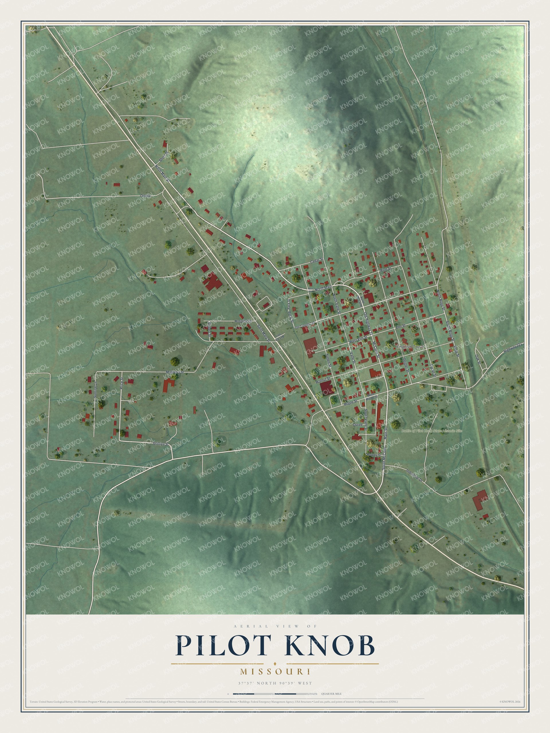
Created by KNOWOL in 2026, this Pilot Knob map fits a den, an office or a front hall. The hills are shaded from USGS elevation data, and the buildings stand out in deep red against soft green. The title panel reads "Aerial View of Pilot Knob, Missouri" with 37°37' North, 90°39' West and a quarter-mile scale bar.
It makes a thoughtful gift for someone who grew up near English Town, has family in Iron County or knows the story of the Battle of Pilot Knob State Historic Site. Open the preview, follow Old Highway 21 into town and find a block you know. See sizes and frames for the Pilot Knob map.