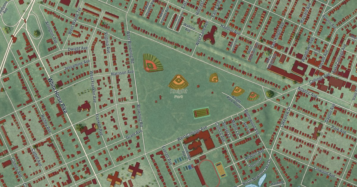
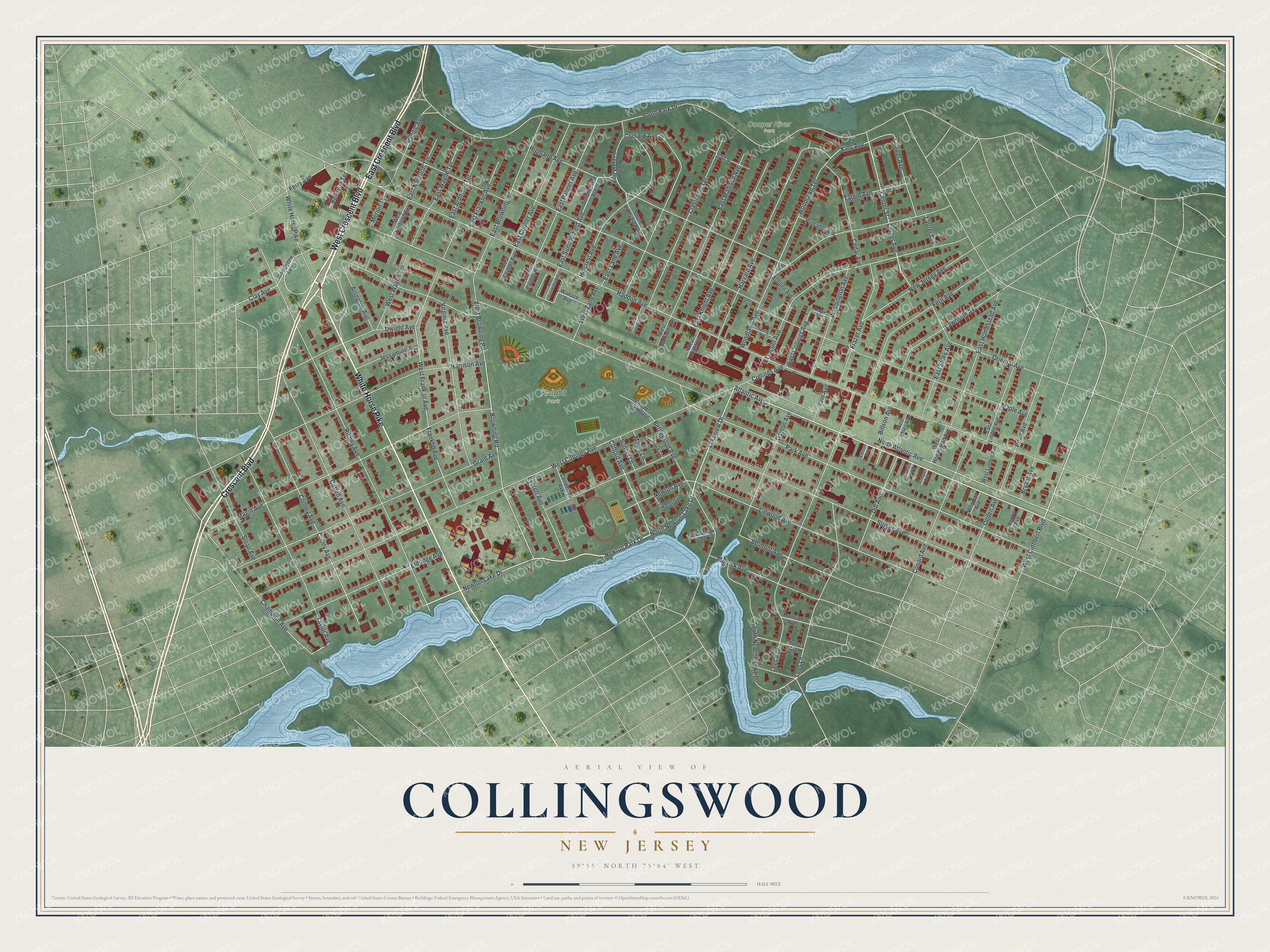
This beautifully detailed map of Collingswood, New Jersey was created in 2026 using aerial imagery combined with modern topographical, census, street and landmark data. It’s a one-of-a-kind view of Collingswood that combines accurate data with a vintage aesthetic. The map shows every building in its true location, many of the roads carry their names, and the shaded topographic relief shows the shape of the land.
Explore an aerial view of Collingswood, New Jersey
On the map you’ll find Cooper River Park and Knight Park, along with White Horse Pike, West Crescent Boulevard, Crescent Boulevard, East Crescent Boulevard, Atlantic Avenue, West Cuthbert Boulevard, Lakeview Drive, North Newton Lake Drive, Newton Lake Drive, Newton Park Drive, and more. If you look closely you can even find your house accurately drawn in its correct location. Zoom in on the preview to look for yours.
Did You Know?
Much of Collingswood was once a farm owned by the Collings family, and the borough carries their name. It became a borough in 1888. That year, resident Edward Collings Knight, a wealthy sugar and railroad magnate, gave the land for Knight Park. He was a descendant of the Collings family.
Take a closer look at the Collingswood map
Names on this map
These names are printed on this map.
Places: Cooper River Park and Knight Park.
Streets and roads: White Horse Pike, West Crescent Boulevard, Crescent Boulevard, East Crescent Boulevard, Atlantic Avenue, West Cuthbert Boulevard, Lakeview Drive, North Newton Lake Drive, Newton Lake Drive, Newton Park Drive, Colford Avenue, North Atlantic Avenue.
More street names, A to Z
20th Street, Allen Lane, Arlington Avenue, Autumn Avenue, Bellevue Terrace, Belmont Avenue, Bettlewood Avenue, Billson Avenue, Browning Road, Bryant Avenue, Cambridge Avenue, Cattell Avenue, Cedar Avenue, Center Avenue, Center Street, Champion Avenue, Chelsea Avenue, Clay Avenue, Collings Avenue, Comley Avenue, Comly Avenue, Conard Avenue, Conger Avenue, Cooper Avenue, Crestmont Terrace, Curtis Avenue, Dayton Avenue, Dill Avenue, Dwight Avenue, East Ardmore Terrace, East Browning Road, East Collings Avenue, East Coulter Avenue, East Franklin Avenue, East Homestead Avenue, East Knight Avenue, East Linden Avenue, East Madison Avenue, East Narberth Terrace, East Palmer Avenue, East Stiles Avenue, East Summerfield Avenue, East Wayne Terrace, East Zane Avenue, Edison Avenue, Eldridge Avenue, Everett Avenue, Fern Avenue, Ferry Avenue, Franklin Avenue, Frazer Avenue, Garfield Avenue, Grant Avenue, Haddon Avenue, Harding Terrace, Harrison Avenue, Harvard Avenue, Highland Avenue, Hillcrest Avenue, Irvin Avenue, Jessamine Avenue, King Avenue, Knight Park House, Lakeshore Drive, Laurel Avenue, Lawnside Avenue, Lees Avenue, Lees Lane, Lincoln Avenue, Linwood Avenue, Magill Avenue, Mansion Avenue, Maple Avenue, Maple Lane, Maple Terrace, Merion Terrace, Merrick Avenue, New Jersey Avenue, Newton Avenue, North Vineyard Boulevard, Ogden Avenue, Oriental Avenue, Pacific Avenue, Park Avenue, Penn Avenue, Princeton Avenue, Richey Avenue, Sloan Avenue, South Newton Lake Drive, South Park Drive, South Vineyard Boulevard, Spring Avenue, Stokes Avenue, Summerfield Avenue, Sunset Lane, Tatem Avenue, Taylor Avenue, Virginia Avenue, Wallace Avenue, Washington Avenue, Wesley Avenue, West Browning Road, West Collings Avenue, West Coulter Avenue, West Franklin Avenue, West Gorman Avenue, West Homestead Avenue, West Knight Avenue, West Linden Avenue, West Madison Avenue, West Narberth Terrace, West Palmer Avenue, West Stiles Avenue, West Summerfield Avenue, West Wayne Terrace, West Zane Avenue, Whitman Avenue, Woodlawn Avenue, Woodlawn Terrace, Woodlynne Avenue.
See it on a wall
The Collingswood map as an 18 x 24 inch print in a black frame.

This beautifully detailed map of Collingswood makes an attractive addition to your office, library, or den, and it can even be used to teach children the geography and history of the area. It also makes a great gift for someone who left Collingswood and still calls it home. When you’re done exploring, click here to get your copy of the Collingswood map.