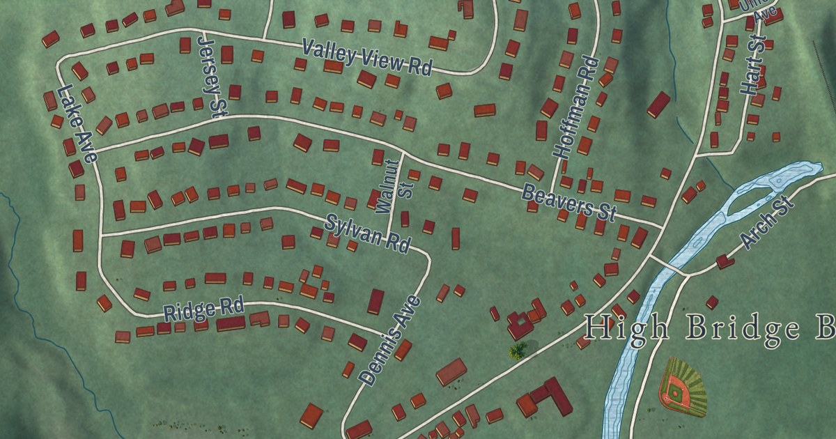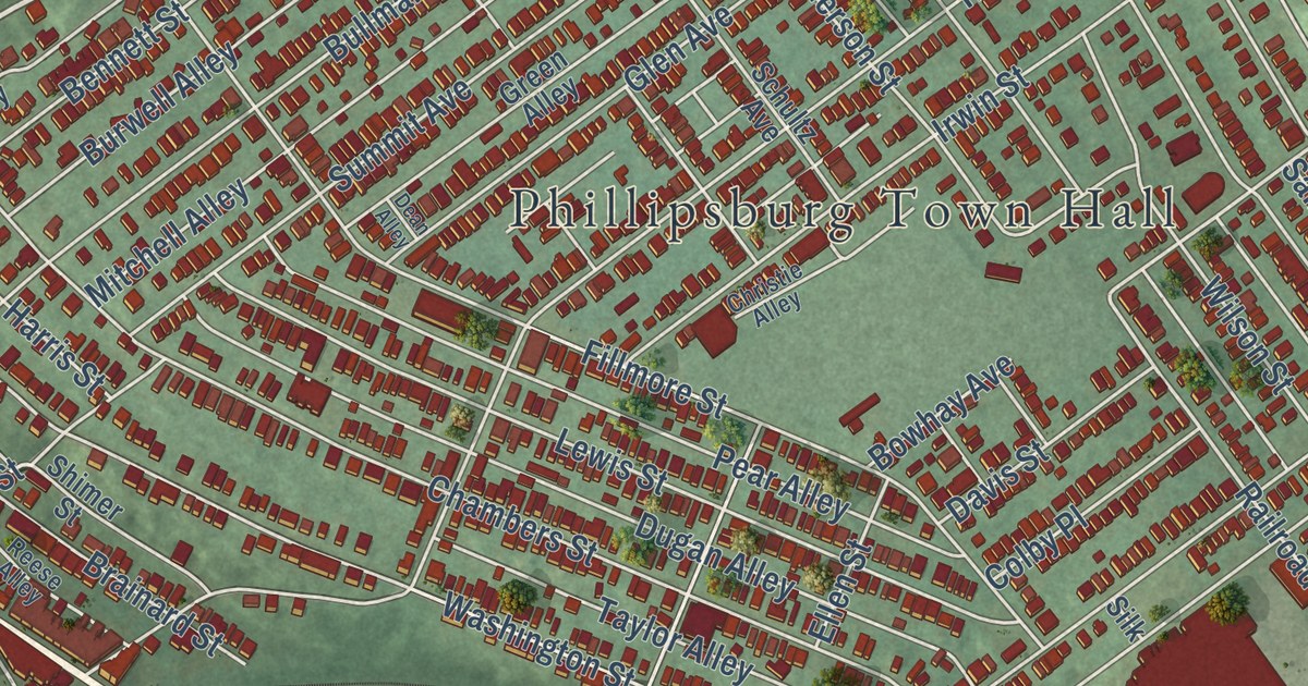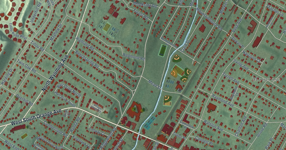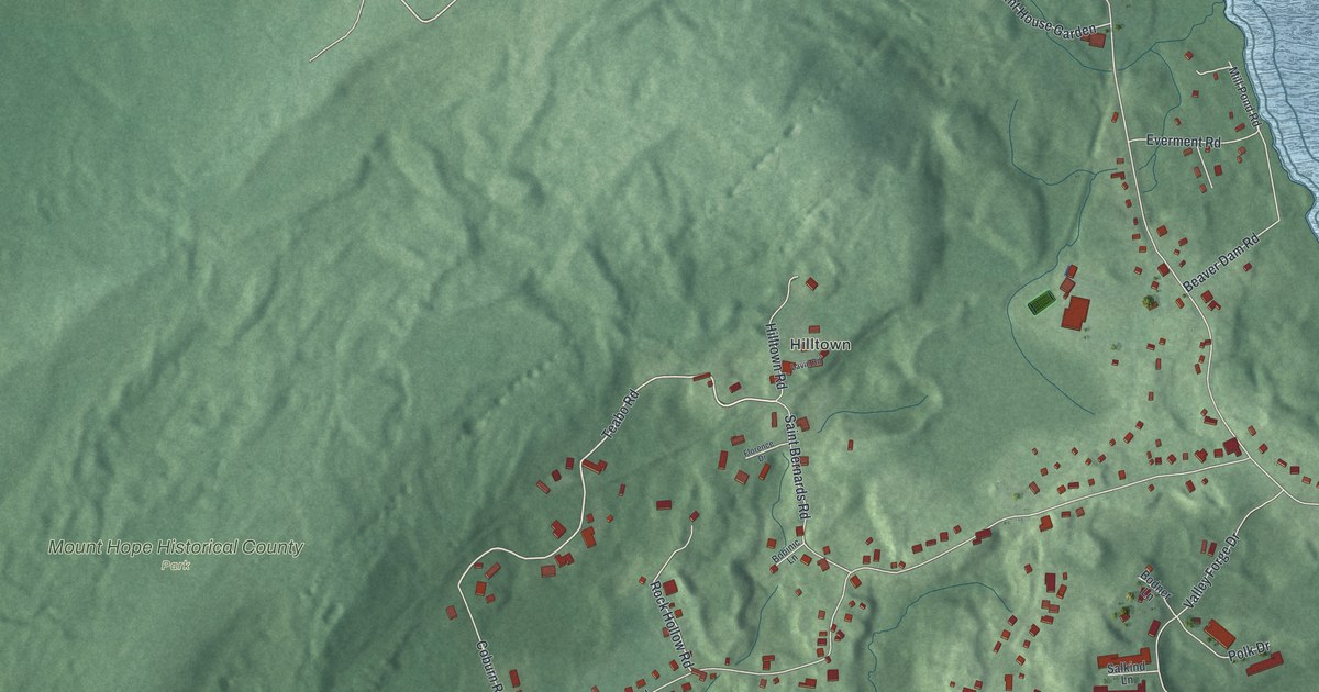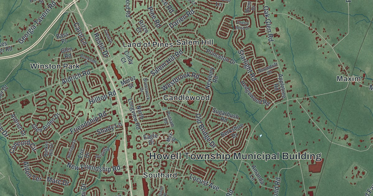
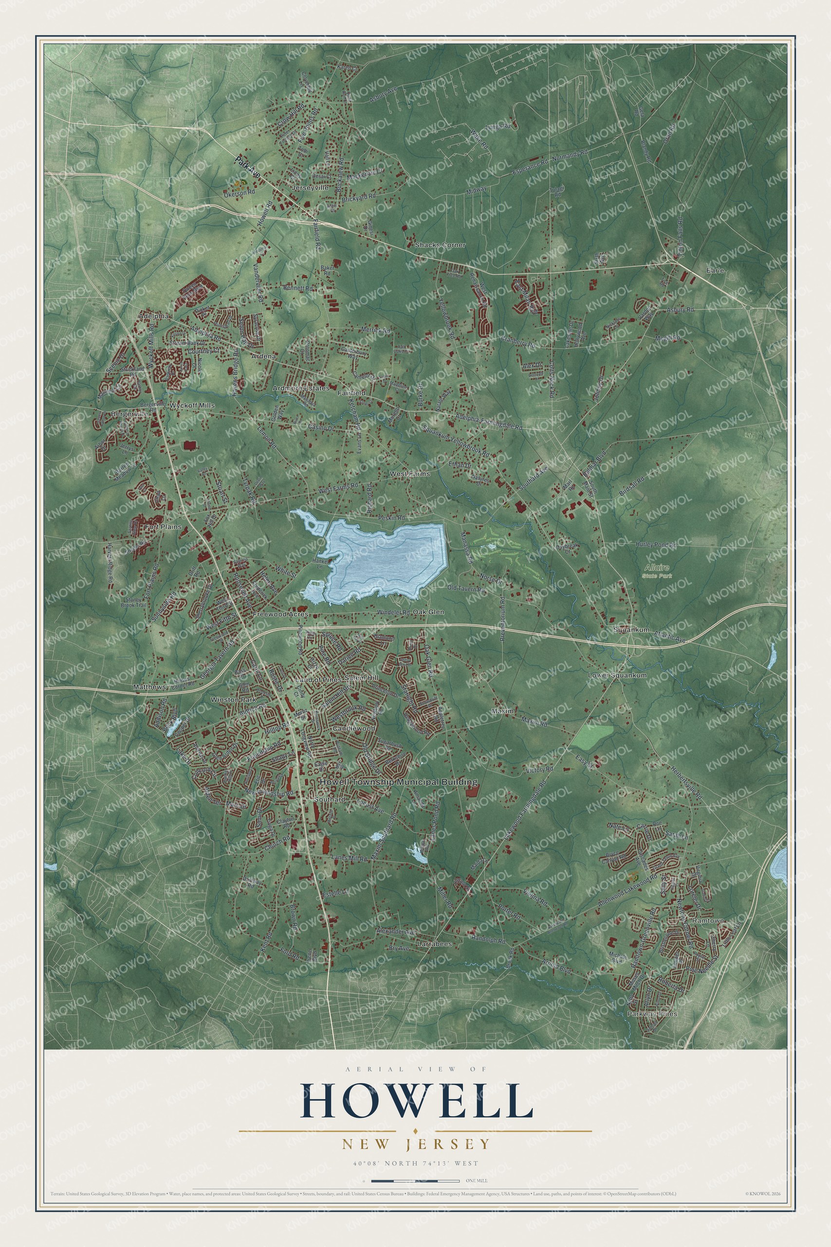
This beautifully detailed map of Howell, New Jersey was created in 2026 using aerial imagery combined with modern topographical, census, street and landmark data. It’s a one-of-a-kind view of Howell that combines accurate data with a vintage aesthetic. The map shows every building in its true location, many of the roads carry their names, and the shaded topographic relief shows the shape of the land.
Explore an aerial view of Howell, New Jersey
On the map you’ll find Howell Township Municipal Building, Parkway Pines, Ramtown, Allaire State Park, Adelphia, Ardena, Ardmore Estates, Bergerville, Candlewood, Earle, Fairfield, Fort Plains, and more. If you look closely you can even find your house accurately drawn in its correct location. Zoom in on the preview to look for yours.
Did You Know?
Howell Township was formed in 1801 from part of Shrewsbury Township. It honors Richard Howell, who was the third Governor of New Jersey from 1794 to 1801. In 1822, James P. Allaire bought the local iron furnace and called it the Howell Works. It turned bog iron into pig iron for his ironworks.
Take a closer look at the Howell map
Names on this map
These names are printed on this map.
Places: Howell Township Municipal Building, Parkway Pines, Ramtown, Allaire State Park, Adelphia, Ardena, Ardmore Estates, Bergerville, Candlewood, Earle, Fairfield, Fort Plains, Freewood Acres, Jerseyville, Land of Pines, Larrabees, Lower Squankum, Matthews, Maxim, Oak Glen, Salem Hill, Shacks Corner, Southard, Squankum, West Farms, Winston Park and Wyckoff Mills.
Streets and roads: Park Avenue, Adelphia Road, Lakewood Farmingdale Road, Adelphia-Farmingdale Road, Havens Bridge Road, Lemon Road, Wake Road, Peskin Road, Atlantic Avenue, Casino Drive, Colts Neck Road, Yellowbrook Road.
More street names, A to Z
Addison Road, Alden Terrace, Aldrich Drive, Aldrich Road, Alexander Avenue, Alex Drive, Allenwood Lakewood Road, Amanda Lane, Appletree Road, Arbor Drive, Arlyn Drive, Arnold Boulevard, Asbury Avenue, Asbury Road, Baker Road, Barren Meadow Lane, Bass Place, Belmar Boulevard, Bennett Road, Bergerville Road, Berkshire Drive, Bernard Drive, Birdsall Road, Blandy Road, Bock Boulevard, Brent Drive, Brickyard Road, Bristlecone Drive, Brook Road, Brookside Drive, Brown Road, Brunswick Drive, Bry Avenue, Bryce Canyon Road, Buckalew Road, Bunker Hill Drive, Burke Drive, Camelot Drive, Canterbury Way, Carol Lane, Carrie Drive, Cascades Avenue, Chad Lane, Charles Street, Cherry Bend Drive, Cherry Lane, Church Road, Cindy Court, Clayton Road, Cloverhill Lane, Concord Circle, Cooper Drive, Corsa Italia, Courtney Court, Cranberry Road, Crest Drive, Crow Hill Road, Darien Road, Daybreak Court, Deerpath Drive, Desai Court, Devlin Way, Diamond Lane, Drift Road, Driftway Road, Eagle Drive, East Milan Boulevard, Easy Street, Eric Drive, Esperance Road, Estelle Lane, Ethan Drive, Evans Lane, Fairfield Road, Five Points Road, Ford Road, Fort Plains Road, Fox Hill Drive, Frederick Avenue, Freewood Street, Friendship Road, Gela Road, Georgia Tavern Road, Ginesi Drive, Gladiola Drive, Glen Arden Drive, Glen Road, Golden Way, Grand Teton Avenue, Hankel Lane, Harbor Circle, Harvest Ridge Road, Hedgewood Road, Helen Avenue, Herbertsville Road, Heritage Drive, Higgins Court, Hilltop Road, Hollywood Avenue, Howell Road, Hulses Corner Road, Hurley Pond Road, Industrial Court, Irene Boulevard, Jerrys Lane, Johnny Drive, Juniper Place, Karen Court, Katie Court, Kent Road, Ketcham Road, Kirsten Drive, Lake Drive, Lakeside Drive, Lakewood Allenwood Road, Lanes Mill Road, Lanes Pond Road, Lincoln Street, Lions Court, Little Leaf Lane, Locust Avenue, Lorelei Drive, Lunga Road, Mackenzie Court, Madeline Court, Maida Lane, Manaqua Road, Manassa Road, Marc Drive, Mariners Cv, Marl Road, Maxim Road, Maxim Southard Road, Max Place, Megill Road, Merrick Road, Michele Boulevard, Midway, Miller Road, Mistaire Place, Morello Court, Moroz Street, Moses Milch Drive, Natale Way, Nate Lane, Natures Drive, Netty Street, Newbury Road, New Friendship Road, Newtons Corner Road, Nicklaus Lane, Nicole Court, Normandy Road, Norse Drive, North Longview Road, Oak Glen Road, Oak Tree Road, Okerson Road, Old Bridge Drive, Old Tavern Road, Oran Road, Parkway Drive, Peter Forman Drive, Picket Place, Pine Needle Street, Pine Road, Pinewood Road, Plumstead Drive, Pointe of Woods Drive, Poplar Street, Porter Road, Potomac Court, Preventorium Road, Princeton Drive, Putnam Road, Quail Run Court, Queen Anne Boulevard, Ramtown-Greenville Road, Randolph Road, Richard Road, River Drive, Rizzo Court, Roberta Drive, Roe Lane, Roosevelt Avenue, Rustic Drive, Salem Hill Road, Salerno Way, Sally Street, Sami Drive, Sandy Lane, Sarah Lane, Scenic Drive, Seattle Slew Drive, Seton Hall Drive, Shady Lane, Sherrybrooke Drive, Sixth Avenue, Snowdrift Drive, Snyder Road, Southard Avenue, South Main Street, Spruce Hollow Drive, Spruce Road, Squankum Yellowbrook Road, Starlight Road, Stoney Brook Trail, Stream Bank Drive, Strickland Road, Stuart Street, Sugarbush Road, Sunnyside Road, Sunset Drive, Syracuse Drive, Tall Oaks Court, Tice Road, Tinton Falls Road, Tioga Drive, Tobi Court, Tudor Drive, Tulagi Road, Twin Hill Court, Tyler Court, Tyrpak Road, Vail Lane, Valley Road, Vanderveer Road, Vardon Way, Victory Road, Vienna Road, Violet Circle, Virginia Drive, Westbrook Road, West Farms Road, West Fifth Street, West Renaissance Road, West Third Street, White Street, Willow Avenue, Wilson Drive, Windeler Road, Wyckoff Mills Road.
See it on a wall
The Howell map as an 18 x 24 inch print in a black frame.

This beautifully detailed map of Howell makes an attractive addition to your office, library, or den, and it can even be used to teach children the geography and history of the area. It also makes a great gift for someone who left Howell and still calls it home. When you’re done exploring, click here to get your copy of the Howell map.