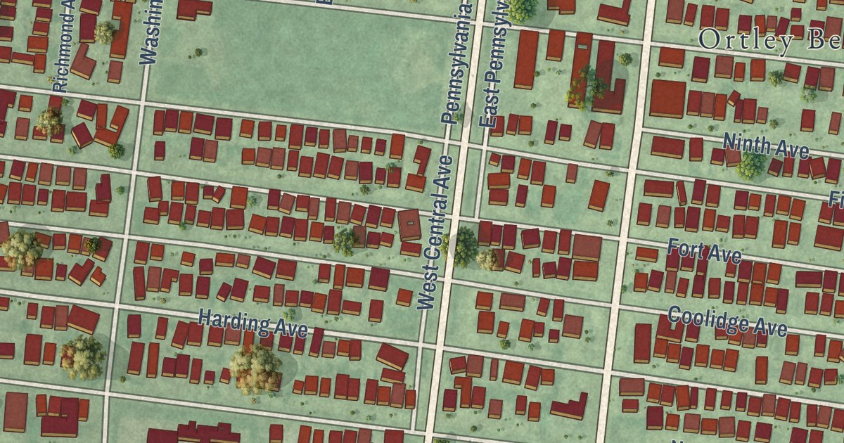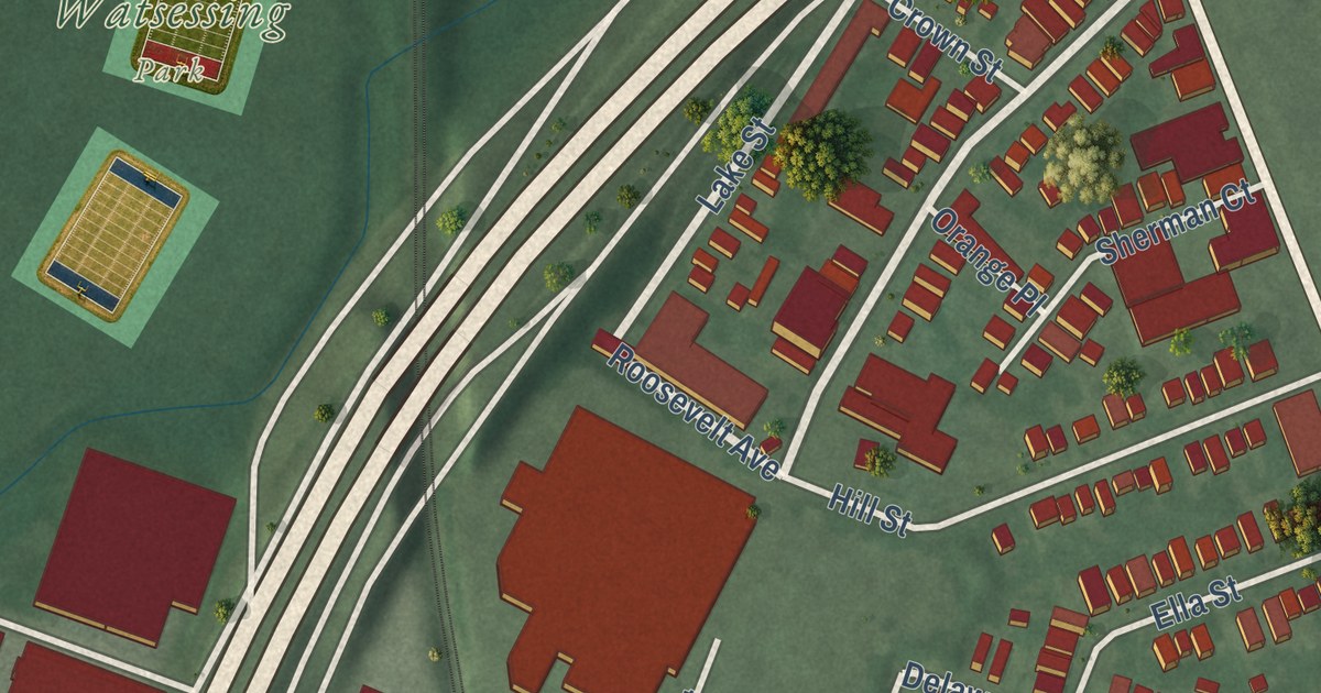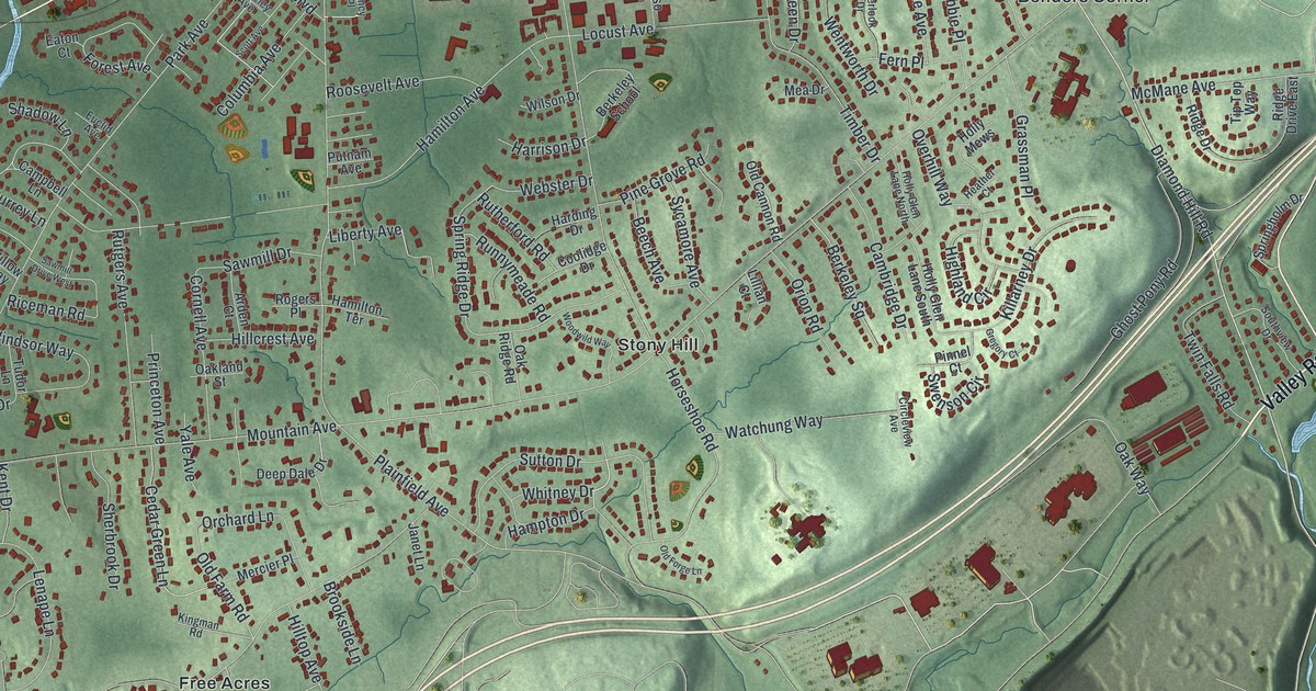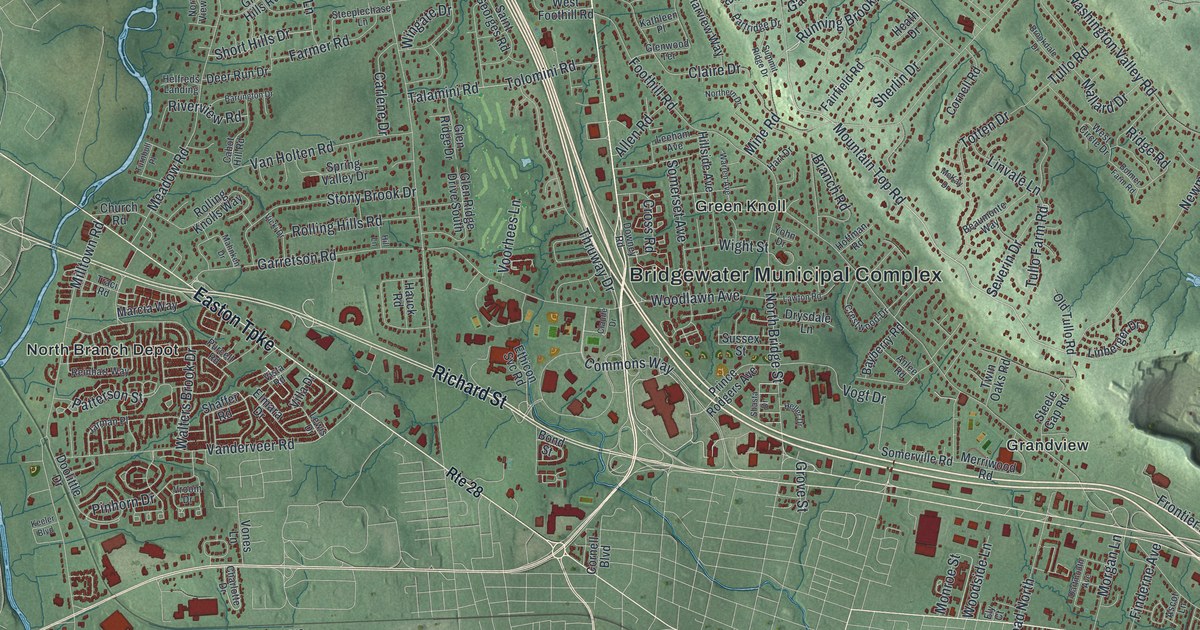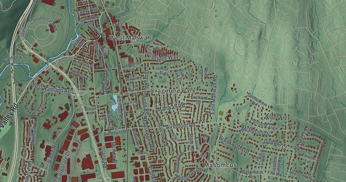
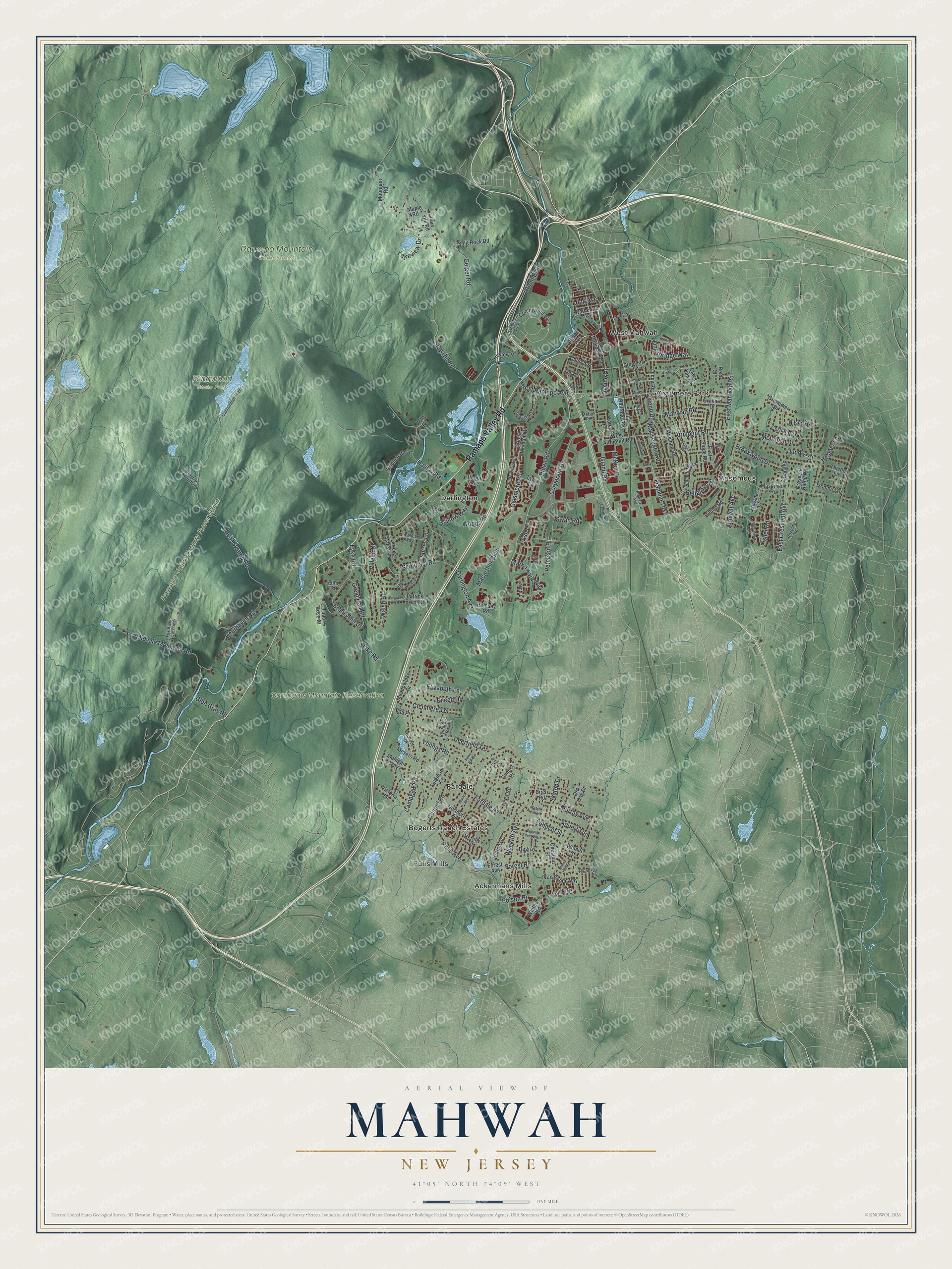
This beautifully detailed map of Mahwah, New Jersey was created in 2026 using aerial imagery combined with modern topographical, census, street and landmark data. It’s a one-of-a-kind view of Mahwah that combines accurate data with a vintage aesthetic. The map shows every building in its true location, many of the roads carry their names, and the shaded topographic relief shows the shape of the land.
Explore an aerial view of Mahwah, New Jersey
On the map you’ll find Ackermans Mills, Cragmere Park, Darlington, Fardale, Masonicus, Ramapo Mountain State Forest, and Ringwood State Park, along with Franklin Turnpike, Ridge Road, Pulis Avenue, Deerhaven Road, Campgaw Road, and more. If you look closely you can even find your house accurately drawn in its correct location. Zoom in on the preview to look for yours.
Did You Know?
Ford opened its Mahwah Assembly plant in 1955. When finished, it was the biggest car factory of its kind in America. Workers built 6 million cars before the last one left the line on June 20, 1980. Local sports teams are still called the Thunderbirds to honor the plant.
Take a closer look at the Mahwah map
Names on this map
These names are printed on this map.
Places: Campgaw Mountain Reservation, Ramapo Mountain State Forest, Ramapo Valley County Reservation, Ringwood State Park, Ackermans Mills, Bogerts Ranch Estates, Cragmere Park, Darlington, Fardale, Masonicus, Pulis Mills and West Mahwah.
Streets and roads: Ramapo Valley Road, Franklin Turnpike, Ridge Road, Pulis Avenue, Deerhaven Road, Campgaw Road, Stag Hill Road, Bear Swamp Road, Macarthur Boulevard, East Crescent Avenue, Island Road, Wyckoff Avenue.
More street names, A to Z
Airmont Avenue, Airmount Road, Appert Terrace, Armour Road, Ash Drive, Bayberry Drive, Bedford Road, Bellgrove Drive, Birch Road, Black Oak Lane, Brams Hill Drive, Bridle Path Lane, Brookwood Drive, Cannonball Trail, Catherine Avenue, Chapel Road, Chestnut Street, Church Street, Continental Boulevard, Corporate Drive, Cortland Trail, Crescent Ridge Road, Crocker Mansion Drive, Darlington Avenue, Deerfield Terrace, Degraaf Court, Degray Terrace, Devine Drive, Devon Court, Donner Court, Dundee Court, East Mahwah Road, East Slope Road, Edison Road, Eileen Drive, Elizabeth Lane, Fardale Avenue, Fawn Hill Drive, Feldman Court, Fike Road, Finn Court, First Street, Fisher Road, Flaming Arrow Road, Forest Avenue, Forest Hill Road, Forest Road, Fox Lane, Fox River Crossing, Fyke Road, Geiger Road, Glasgow Terrace, Glasmere Road, Glen Gray Road, Glenmere Terrace, Great Hall Road, Green Mountain Road, Grenadier Drive, Halifax Road, Hampshire Road, Heather Lane, Herlihy Drive, Hilltop Road, Hines Avenue, Hopper Court, Hutton Drive, Industrial Avenue, Jacobean Way, Karen Drive, Kingsbridge Way, King Street, Kohout Drive, Lakeview Drive, Larch Lane, Lawrence Road, Lehman Street, Long Avenue, Lower Pine Drive, Lydia Lane, Mahwah Road, Malcolm Road, Maple Avenue, Maple Road, Mark Twain Way, Masonicus Road, Maysenger Road, McIntosh Drive, McKee Drive, Meadowlake Drive, Meyers Road, Micik Lane, Midvale Mountain Road, Miller Road, Moffat Road, Mohigan Way, Morris Avenue, Mountain Road, Murray Avenue, Nilsen Avenue, North Central Avenue, Northerly Drive, North Railroad Avenue, Oak Terrace, Old Oak Drive, Olney Road, Orchard Drive, Orient Boulevard, Orient Way, Osborne Court, Oweno Road, Patrick Brem Court, Peterson Place, Pine Hill Road, Plum Terrace, Polo Lane, Poplar Avenue, Prince Road, Ramapo Mountains, Ramsey Road, Reid Court, Riverview Drive, Roxbury Road, Rutherford Road, Seminary Road, Skytop Drive, South Railroad Avenue, Split Rock Road, Stephens Lane, Storms Drive, Surrey Lane, Swan Road, Third Street, Thistle Lane, Trommel Drive, Tudor Rose Court, Vail Place, Van Bolen Way, Victoria Lane, Village Drive, Vista View Drive, Walnut Street, Walnut Street West, Walsh Drive, Wanamaker Avenue, Watch Hill Road, West Airmount Road, Westervelt Lane, West Ramapo Avenue, West Road, Whitney Road, Willow Way, Winding Trail, Woods Road, York Street, Youngs Road.
See it on a wall
The Mahwah map as an 18 x 24 inch print in a black frame.

This beautifully detailed map of Mahwah makes an attractive addition to your office, library, or den, and it can even be used to teach children the geography and history of the area. It also makes a great gift for anyone who grew up in Mahwah or moved away. When you’re done exploring, click here to get your copy of the Mahwah map.