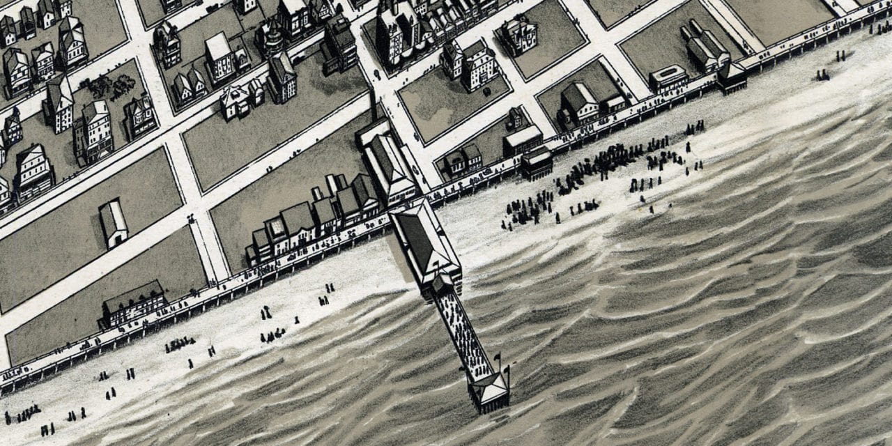
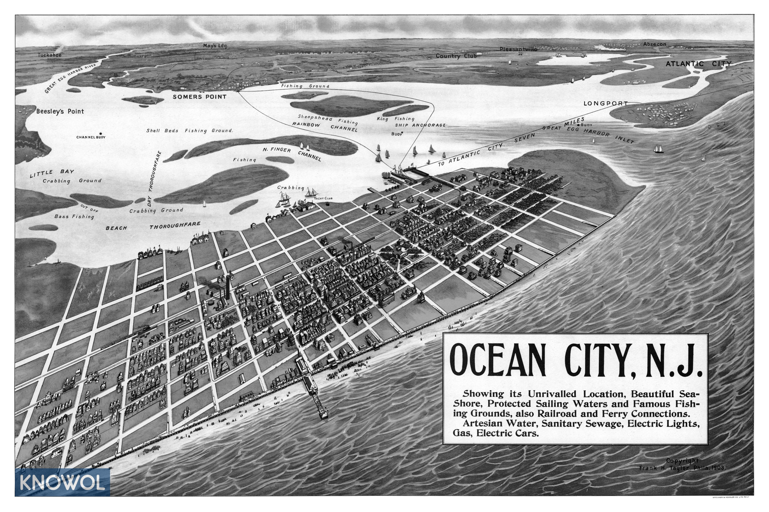
This historic map of Ocean City, New Jersey was created in 1903 by Frank H. Taylor, a prominent 19th century map maker. The map shows a bird’s eye view of the town as it used to be, including street names and old landmarks.
Landmarks on the map include Rainbow Channel, Shell Beds Fishing Ground, Somers Point, Tuckahoe, Beesley’s Point, Little Bay, Crabbing Grounds, Yacht Club, and more. The map was used for promoting Ocean City’s “Unrivalled Location, Beautiful Seashore, Protected Sailing Waters and Famous Fishing Grounds…”
This historic map of Ocean City was restored by KNOWOL. Reproductions of the restored map are available here.
Bird’s Eye View of Ocean City, NJ in 1903
This old map of Ocean City makes an attractive addition to your office, library, or den and can even be used to teach children the geography and history of the area. When you’re done exploring, click here to get your copy.