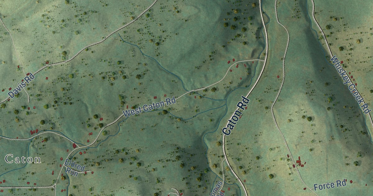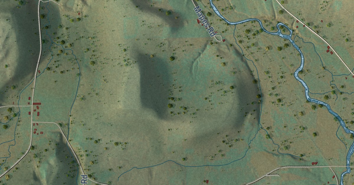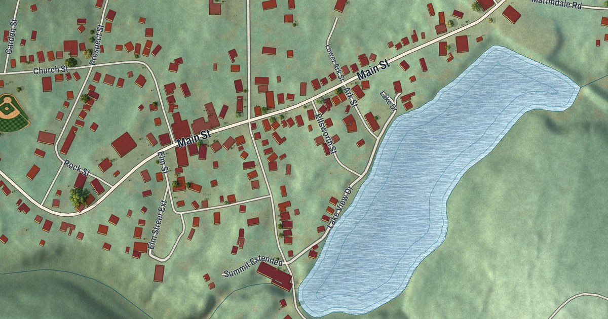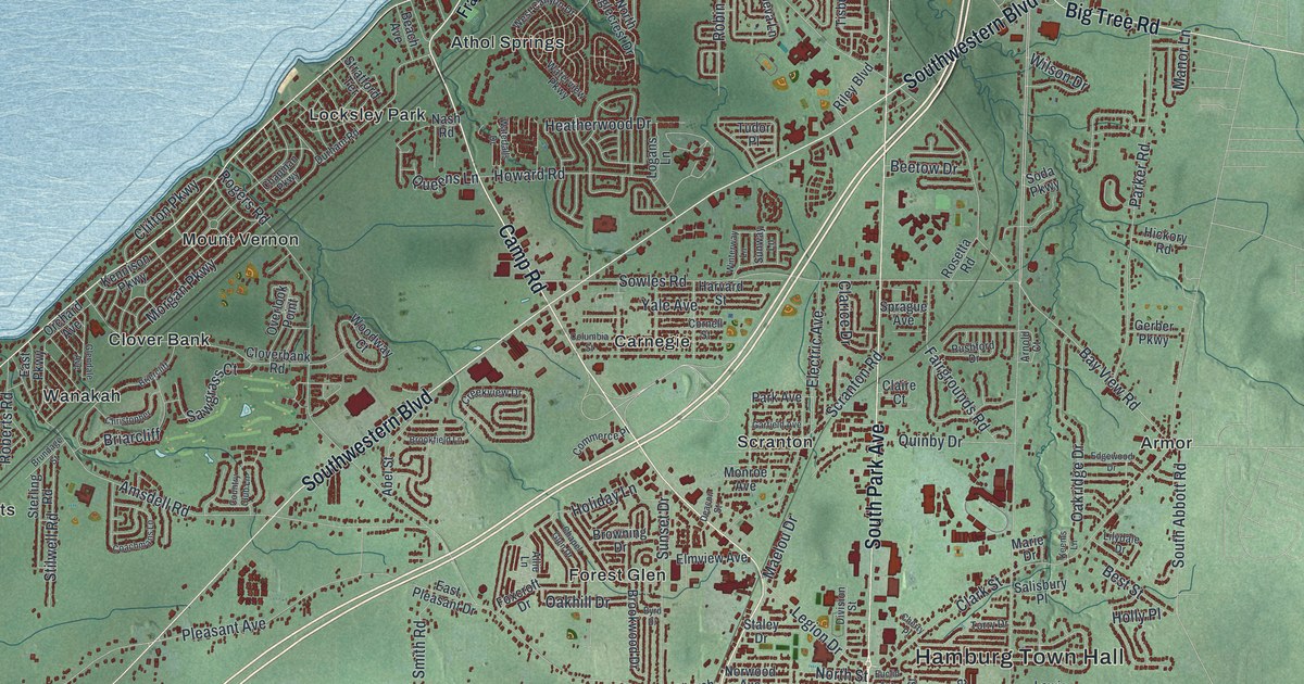
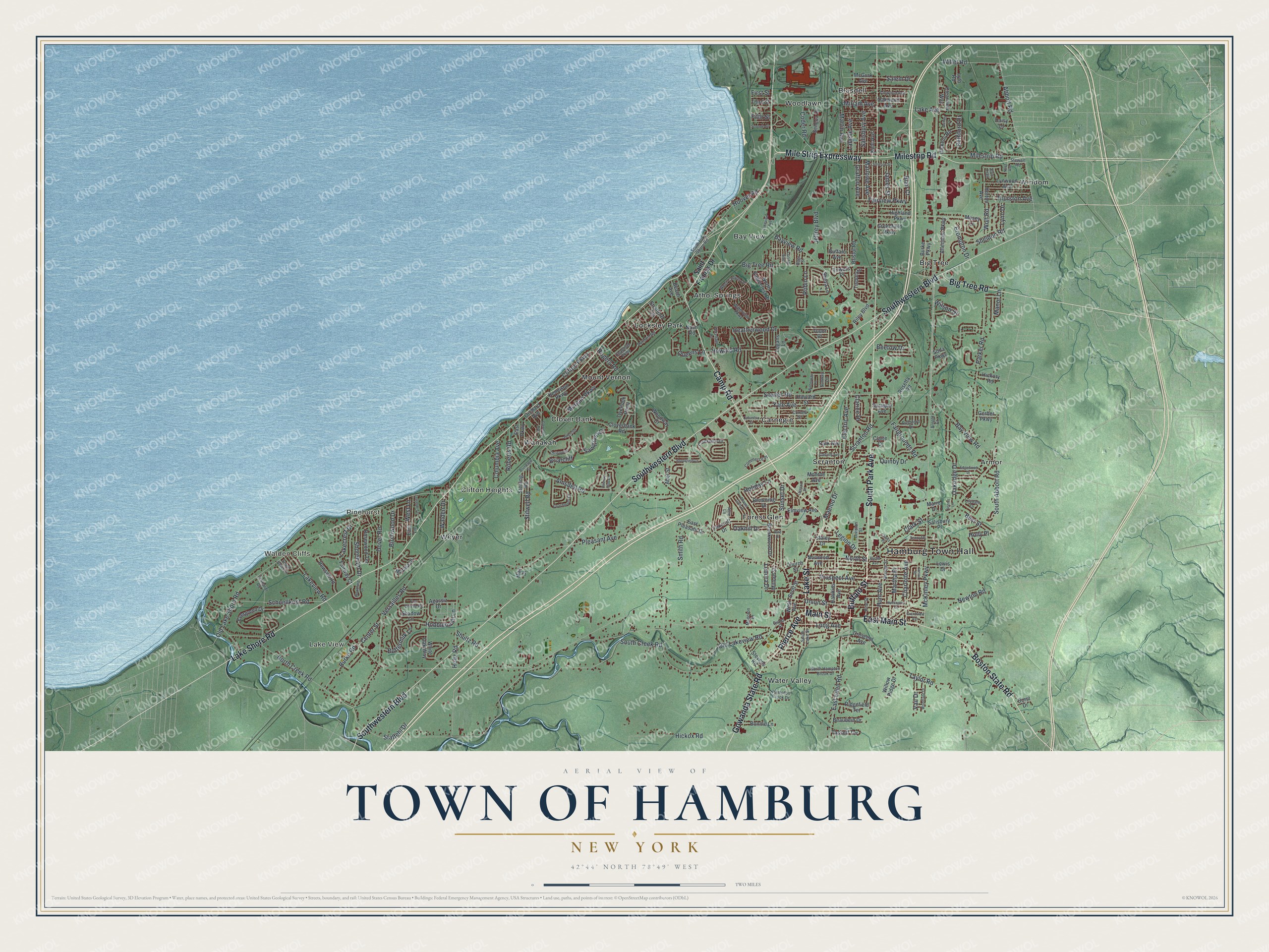
This beautifully detailed map of the Town of Hamburg, New York was created in 2026 using aerial imagery combined with modern topographical, census, street and landmark data. It’s a one-of-a-kind view of the Town of Hamburg that combines accurate data with a vintage aesthetic. The map shows every building in its true location, many of the roads carry their names, and the shaded topographic relief shows the shape of the land.
Explore an aerial view of the Town of Hamburg, New York
On the map you’ll find Hamburg Town Hall, Walden Cliffs, Lake View, Pinehurst, Armor, and Athol Springs, along with Buffalo Street, Main Street, Lake Street, Camp Road, and more. If you look closely you can even find your house accurately drawn in its correct location. Zoom in on the preview to look for yours.
Did You Know?
During the Canadian uprising of 1837 to 1839, the people of Hamburg sided with the rebels. About 400 recruits planned to cross Lake Erie one winter night and invade Canada. New York State militia stopped them before they could go. That’s from the 1940 WPA guide to New York.
Take a closer look at the Town of Hamburg map
Names on this map
These names are printed on this map.
Places: Hamburg Town Hall, Walden Cliffs, Lake View, Pinehurst, Armor, Athol Springs, Bay View, Big Tree, Blasdell, Carnegie, Clifton Heights, Clover Bank, Forest Glen, Locksley Park, Mount Vernon, Scranton, Wanakah, Water Valley, Weyer, Windom and Woodlawn.
Streets and roads: Buffalo Street, Main Street, Lake Street, Camp Road, East Main Street, Pierce Avenue, South Park Avenue, Boston State Road, Lake Shore Road, Southwestern Boulevard, Mile Strip Expressway, Gowanda State Road.
More street names, A to Z
Abbott Road, Abel Street, Agassiz Drive, Allendale Parkway, Allie Lane, Amsdell Road, Arnold Court, Ashley Drive, Bay View Road, Bayview Road, Beach Avenue, Beaubein Drive, Beetow Drive, Best Street, Bethford Drive, Big Tree Road, Birchwood Drive, Blair Court, Bonnie Lane, Briarcliff, Briercliff, Bristol Road, Brompton Drive, Brookfield Lane, Brookwood Drive, Browning Drive, Brundage Street, Buffalo Avenue, Burke Parkway, Burke Road, Buttermilk Lane, Byrd Drive, Center Street, Chapel Glen Drive, Chapman Parkway, Charlotte Avenue, Cherry Place, Christopher, Church Street, Claire Court, Clarice Drive, Clark Street, Clearview Way, Clifton Parkway, Cloverbank Road, Coachmans Lane, Coder Road, Columbia Avenue, Columbia Street, Commerce Place, Cornell Street, Country Club Lane, Creekview Drive, Crescent Avenue, Daisy Lane, Deacon Street, Dickens Road, Division Street, Dorst Drive, Dover Road, Durham Road, East Eden Road, East Lane, East Parkway, East Pleasant Drive, Eckhardt Road, Edgewood Drive, Electric Avenue, Elmview Avenue, Eric Trail, Euclid Avenue, Evans Street, Evergreen Drive, Fairgrounds Road, Fairview Parkway, Fairway Court, Fifth Street, First Street, Fox Chase Road, Foxcroft Drive, Garfield Avenue, George Street, Gerber Parkway, Glendale Avenue, Grafton Avenue, Grandview Avenue, Greenfield Parkway, Hampton Brook Drive, Harvard Street, Hawkins Avenue, Heatherwood Drive, Heltz Road, Hewson Road, Hickory Road, Hickox Road, Highland Parkway, Hobblebush Lane, Holiday Lane, Holly Place, Hoover Road, Horton Avenue, Howard Road, Hunt Avenue, Huntington Court, James Street, Janice Place, Jeffrey Boulevard, Johnson Street, Keems Lane, Kennison Parkway, Kent Avenue, Labelle Avenue, Lake Avenue, Lakecrest Drive, Lakeview Avenue, Lakeview Road, Legion Drive, Lenora Drive, Lewis Drive, Lilydale Drive, Linwood Avenue, Logans Lane, Long Avenue, Loring Avenue, Lynn Drive, Lynwood Avenue, Lyth Road, Maelou Drive, Manor Lane, Marie Drive, Marina Drive, Marlowe Avenue, Martha Place, Martin Avenue, May Drive, McGurk Avenue, McKinley Parkway, Milestrip Road, Milford Street, Miriam Avenue, Moncton Drive, Monroe Avenue, Morgan Parkway, Mosey Lane, Nash Road, Newton Road, Niles Avenue, North Creek Road, North Eaglecrest Drive, North Hampton Brook Drive, North Street, Norwood Avenue, Oakhill Drive, Oakridge Drive, Oakwood Avenue, Old Lake Shore Road, Old Lakeview Road, Orchard Avenue, Overlook Point, Park Avenue, Parker Road, Pine Street, Pleasant Avenue, Prospect Avenue, Queens Lane, Quinby Drive, Ridgefield Terrace, Riggs Street, Riley Boulevard, Roberts Road, Robin Lane, Rogers Road, Rosetta Road, Rosewood Terrace, Rushford Drive, Saint Francis Drive, Salem Drive, Salisbury Avenue, Salisbury Place, Sawgrass Court, Schoellkopf Road, Scott Street, Scranton Road, Seneca Drive, Seventh Street, Shadow Lane, Sheldon Road, Sheva Lane, Shoreham Drive, Shultz Road, Smith Road, Soda Parkway, South Abbott Road, South Bend Lane, South Creek Road, South Lake Shore Road, South Lake Street, Sowles Road, Sprague Avenue, Staffehl Drive, Staley Drive, Sterling Road, Stevens Road, Stewart Road, Stilwell Road, Stratford Terrace, Sunset Drive, Sunway Lane, Tasseff Terrace, Taylor Road, Third Street, Thurston Avenue, Tisbury Lane, Torry Drive, Towers Place, Truscott Terrace, Tudor Place, Union Street, Vail Drive, Versailles Road, Walden Drive, Waterfalls Drive, Waterview Parkway, West Avenue, West Canyon Drive, West Lane, White Oak Way, Willet Road, Willow Ridge Drive, Wilson Drive, Winterway Lane, Wolf Road, Woodford Drive, Woodland Drive, Woodway Court, Yale Avenue.
See it on a wall
The Hamburg map as a framed print. Swipe for more.


This beautifully detailed map of the Town of Hamburg makes an attractive addition to your office, library, or den, and it can even be used to teach children the geography and history of the area. It also makes a great gift for anyone who grew up in the Town of Hamburg or moved away. When you’re done exploring, click here to get your copy of the Town of Hamburg map.