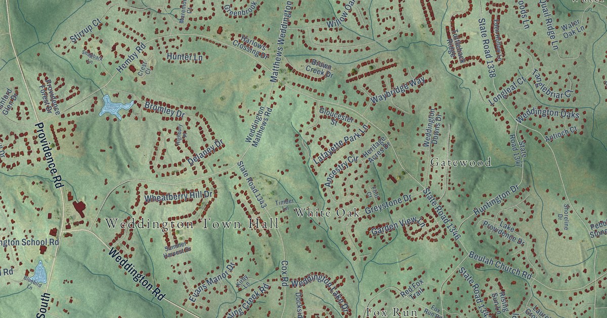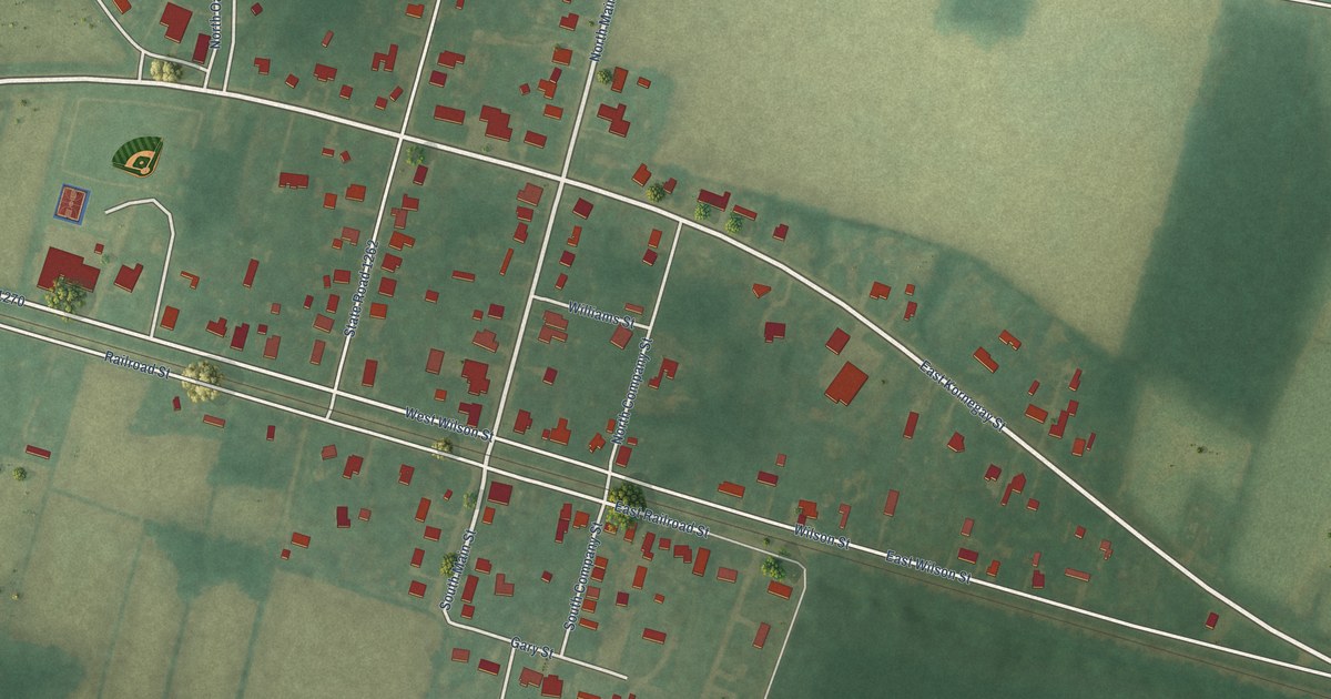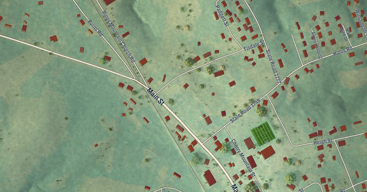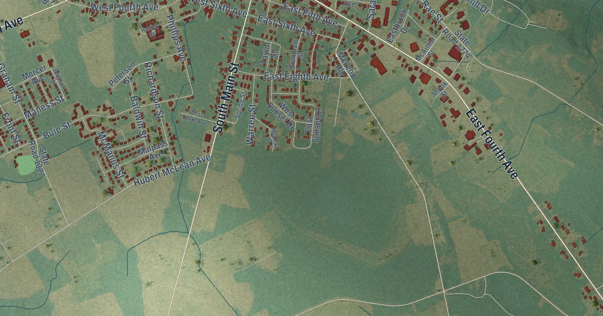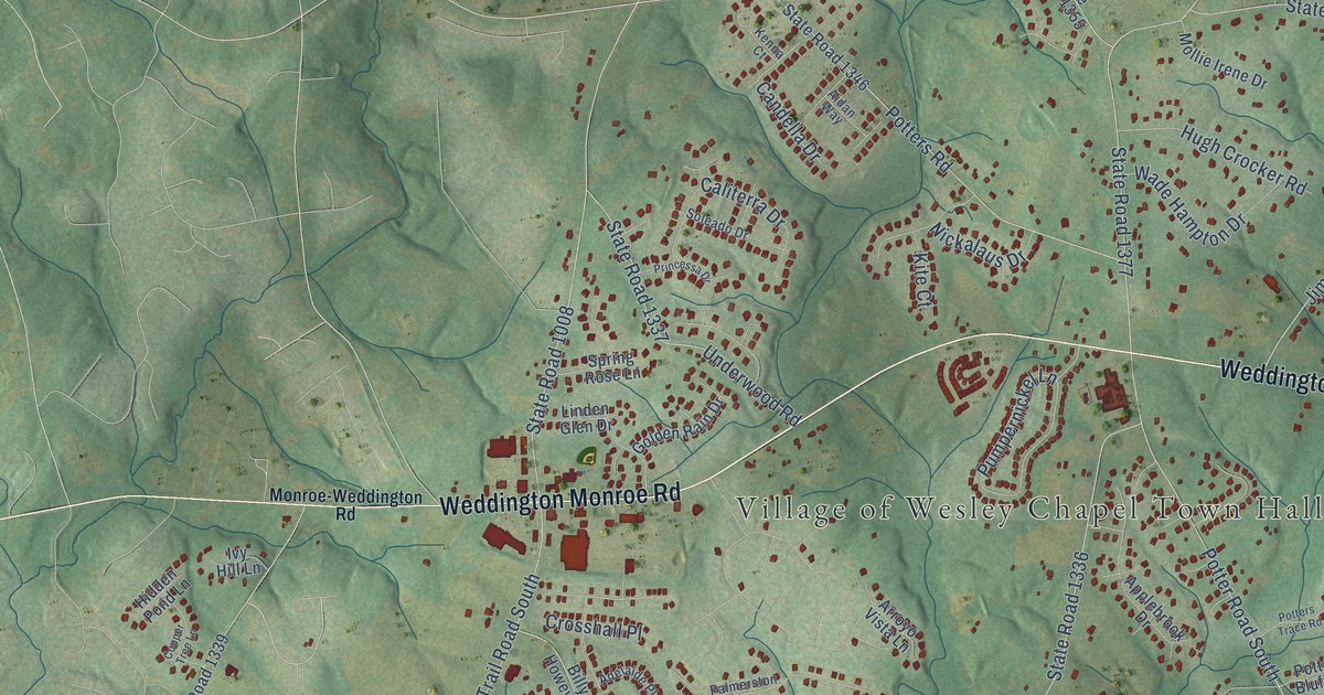
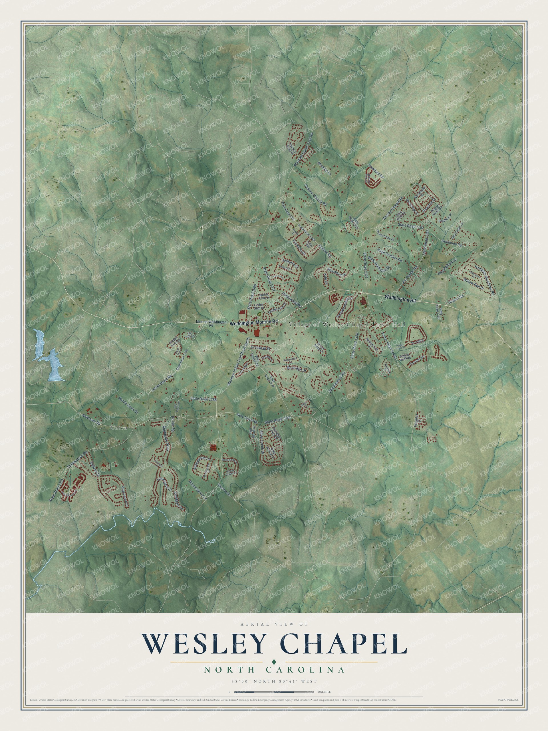
This beautifully detailed map of Wesley Chapel, North Carolina was created in 2026 using aerial imagery combined with modern topographical, census, street and landmark data. It's a modern aerial view of Wesley Chapel in Union County, North Carolina, that combines modern data with a vintage aesthetic. The roads feature printed names, and if you look closely you can find your exact house accurately shown in its correct location.
Explore an aerial view of Wesley Chapel, North Carolina
On this map you'll find Village of Wesley Chapel Town Hall, Union, Weddington Road, Weddington Monroe Road, State Road 1008, New Town Road, State Road 1315, State Road 1162, Waxhaw Indian Trail Road South, Waxhaw Indian Trail Road, Newtown Road, State Road 1377, and more. Each red shape is a building, so zoom in on the preview and look for yours.
Wesley Chapel has a story worth telling. The Village of Wesley Chapel puts it this way: "The abandoned campground provided the site for the first church in Wesley Chapel, and gave the community its name. Now called the Wesley Chapel United Methodist Church, this venerable religious organization dates to 1832. The church itself was named for John Wesley (1703-1791), the founder of Methodism."
Wesley Chapel is a village in Union County. The Census Bureau counted 8,681 people here in 2020.
Take a closer look at the Wesley Chapel map
Names on this map
These names are printed on this map.
Places: Village of Wesley Chapel Town Hall and Union.
Streets and roads: Weddington Road, Weddington Monroe Road, State Road 1008, New Town Road, State Road 1315, State Road 1162, Waxhaw Indian Trail Road South, Waxhaw Indian Trail Road, Newtown Road, State Road 1377, Wesley Chapel Road, Chambwood Road.
More street names, A to Z
Abbeywood Drive, Adelaide Place, Aidan Way, Airport Road, Applebrook Drive, Applegate Parkway, Arroyo Vista Lane, Billy Howey Road, Birmingham Lane, Bloomsberry Lane, Bradford Place, Brookmeade Drive, Butler Court, Byrum Road, Caliterra Drive, Candella Drive, Carly Scott Drive, Chandlers Field Drive, Conaway Court, Copper Tree Lane, Cottonwood Circle, Crestgate Drive, Crosshall Place, Curling Creek Drive, Cuthbertson Road, Deep Hollow Court, Dobson Drive, Golden Rain Drive, Goldmine Road, Greengate Lane, Hampton Meadows Road, Hawfield Road, Hidden Pond Lane, High Brook Drive, Houston Drive, Hudson Church Road, Hugh Crocker Road, Hunters Point Drive, Ivy Hill Lane, Jim Parker Road, Kenna Court, Kite Court, Lester Davis Road, Linden Glen Drive, Lowergate Drive, Mollie Irene Drive, Monroe-Weddington Road, Myrtle Davis Drive, Nickalaus Drive, Palmerston Lane, Parkside Drive, Pilgrim Forest Drive, Potter Road South, Potters Bluff Road, Potters Road, Potters Trace Road, Princessa Drive, Pumpernickel Lane, Ranelagh Drive, Red Cedar Lane, Shannon Road, Silver Creek Drive, Soleado Drive, Spring Rose Lane, Sr-1000, State Road 1321, State Road 1329, State Road 1335, State Road 1336, State Road 1337, State Road 1339, State Road 1346, State Road 1348, State Road 1355, State Road 1357, State Road 1388, Torrens Drive, Underwood Road, Vaugelas Court, Wade Hampton Drive, Waynewood Drive, Wesley Landing Road, Willow Ridge Lane, Willow Run Drive, Will Plyler Road, Winding Lane, Woodhurst Drive, Woodridge Drive, Woodwinds Drive.
Created by KNOWOL in 2026. The buildings are small red shapes, the roads carry their printed names, and shaded relief shows the shape of the land. The title panel reads "AERIAL VIEW OF WESLEY CHAPEL NORTH CAROLINA" with 35°00' NORTH 80°41' WEST.
It looks right in a kitchen, an office or a den, and it's a gift for anyone who grew up in Wesley Chapel or moved away. Open the preview and find your street. See sizes and frames for the Wesley Chapel map.