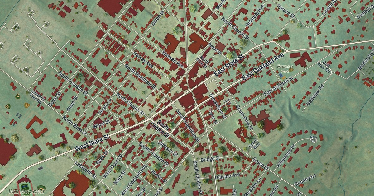
If you grew up in Doylestown, work downtown or still have family near Main and State, this map gives you a lot to find. It's a modern aerial view of Doylestown Borough, the county seat of Bucks County, Pennsylvania, made from modern data with a vintage artistic feel. Buildings are drawn in deep red on soft green hills. They pack in tightest where the old roads cross in the middle of town. The sheet runs from Cross Keys at the top down past War Memorial Park to the streets around Green Street. Explore the print options for the Borough of Doylestown, Bucks County.
From Main and State up to Cross Keys
Start in the middle of town, where South Main Street meets West State Street and East State Street. It's the thickest knot of red on the sheet. Follow East State Street to the northeast. East Oakland Avenue splits off just below it, and Burpee Park is printed a little south of that. Keep going on East State Street and you'll reach Chapman Park on the right side of the map. Now go back to the center and head north on North Main Street. Doylestown Borough Hall is labeled just off it, and Doylestown Cemetery is printed to the east. North Main Street runs up to Cross Keys at the top, where Swamp Road crosses it and heads east as East Swamp Road. Back at the center, West State Street runs southwest toward War Memorial Park and Memorial Drive. Many of the roads are labeled, and each red shape is a building, so zoom in on the preview and look for yours.
That crossing is older than the town. In 1745, William Doyle went to court at Newtown to ask for a license to keep a public house. Fourteen neighbors signed his petition. It said there was no public house within five miles. His place stood "between two great roads," one from Durham to Philadelphia and one from Wells' ferry, the spot now called New Hope. Those two roads are Main and State streets today. For close to thirty years, the place was just a crossroads known as "Doyle's tavern." The oldest use of the town's name that the 1876 history of Bucks County could find was on a 1777 map drawn by British army engineers. They spelled it "Doyltown."
That history was written by W.W.H. Davis and printed in Doylestown. A state marker says Davis lived on East Court Street for 51 years. East Court Street is printed on the map, a short walk north of East State Street. Back in Doyle's day, the line between New Britain and Warwick townships ran where Court Street is now. Doylestown was picked as the county seat in 1812. Nobody knows exactly where Doyle's tavern stood. Davis thought it was most likely right at the crossing, where it could catch travelers on both roads.
For someone who knows Main and State in Doylestown
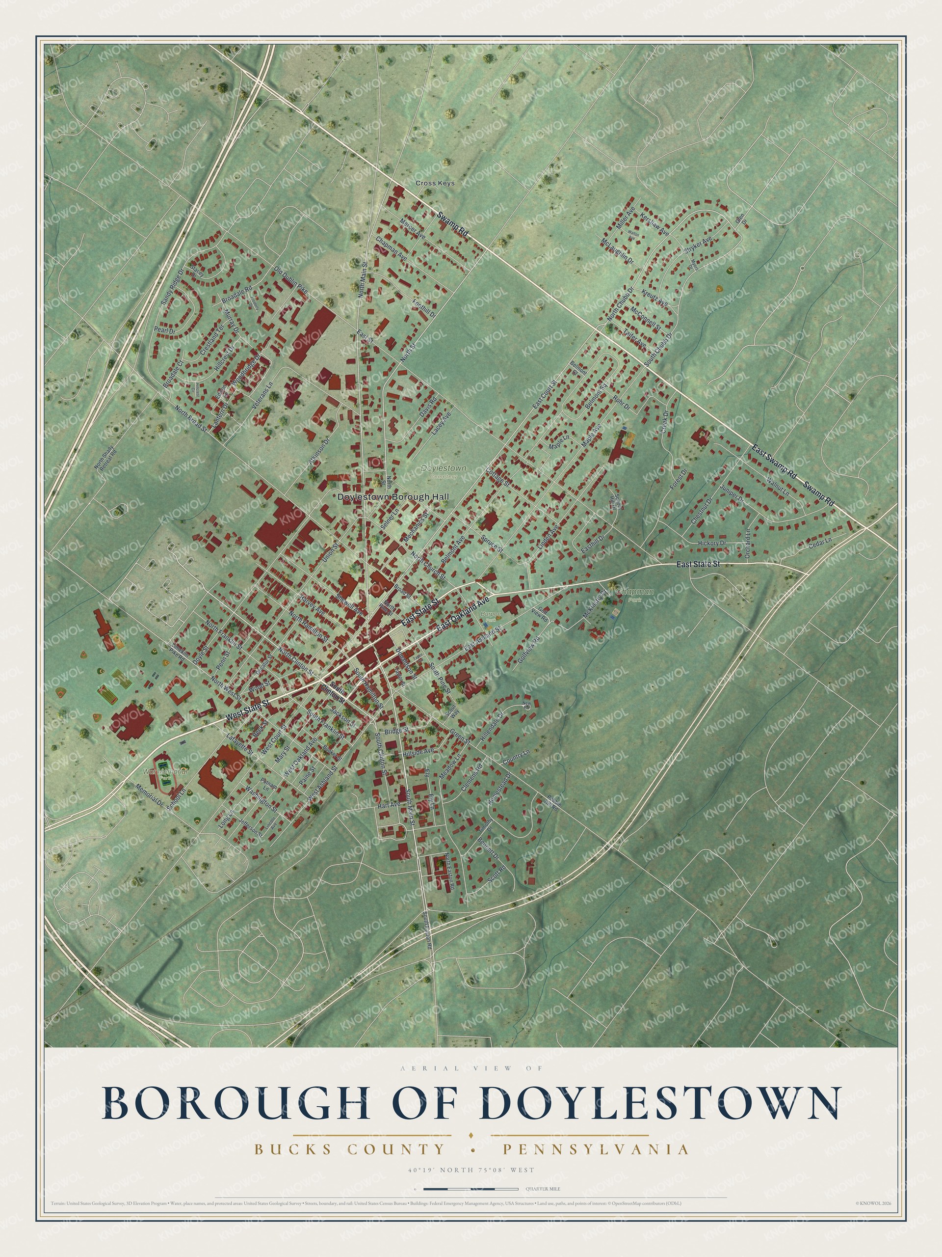
Created by KNOWOL in 2026 from geographic records of roads, buildings and terrain, this Doylestown map shows the borough in deep red over shaded green hills. The hill shading comes from USGS elevation data. The title panel reads "Aerial View of Borough of Doylestown," with "Bucks County • Pennsylvania" below it, the coordinates 40°19' North, 75°08' West and a quarter-mile scale bar.
It fits an office, a kitchen or a front hall, anywhere someone can stop and trace a walk into town. It's a thoughtful gift for someone who grew up here and moved away, or for family who still live a few blocks from Main and State. Open the preview, find the crossing in the middle and follow a road out to a street you know. Shop the Borough of Doylestown, Bucks County, Pennsylvania map.