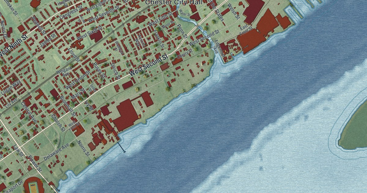
If you grew up in Chester, worked along the river, or still have family near Chester City Hall, this map gives you plenty to find. It's a modern aerial view of the City of Chester in Delaware County, Pennsylvania, made from modern data and given a vintage artistic feel. More than 13,000 buildings are drawn in deep red over soft green hills. The city runs along the Delaware River, which isn't labeled, from Keystone Road in the lower left to Morton Avenue in the upper right. Chester Park, Deshong Park and Crozer Park are all named. Explore the print options for City of Chester, Delaware County.
From Chester City Hall to Chester Park and South Chester
Start at Chester City Hall, printed just right of center. Avenue of the States runs past it from north to south. Just east, Industrial Highway follows the river, and the biggest red buildings on the sheet line the shore. Near Harrahs Boulevard, a state marker remembers Sun Shipbuilding. During World War II it was the largest single shipyard in the world, with more than 35,000 workers. Now head north on Madison Street. It passes Deshong Park and keeps going up the sheet to Chester Park near the top. Upland Street runs right beside it, and Houston Street and Edgmont Avenue cross the hill above.
Back downtown, follow West Second Street southwest along the water. A state marker on West Second Street, at Calvary Baptist Church, says Martin Luther King Jr. lived in Chester for three years. He graduated from Crozer Theological Seminary in 1951. Keep heading southwest and South Chester is printed a few blocks inland. Past it, Highland Avenue runs down to Seaport Drive by the river. West Ninth Street and West Fourth Street run southwest too, farther from the shore. Crozer Park sits in the middle of the sheet, where Kerlin Street meets Upland Avenue. Many roads are labeled, and each red shape is a building, so zoom in on the preview and look for yours.
When William Penn's ship, the Welcome, anchored off the mouth of Chester Creek in October 1682, this town wasn't called Chester. It was Upland. Two travelers in 1679 had called it "a small village of Swedes." An old story says Penn renamed it the day he landed. He turned to a friend named Pearson and asked what to call the place. Pearson said "Chester," after his home city in England. Henry Graham Ashmead didn't believe it. In his 1884 History of Delaware County, Pennsylvania, he pointed out that Penn dated a letter "Upland" the day after he arrived. No record of this Pearson was ever found among the early settlers, and the tale first showed up in print more than 100 years later. Ashmead joked that Friend Pearson would someday claim to be the man who swallowed the first oyster, too.
So where did the name come from? Penn's letter of December 16, 1682, is the first record of it. It says an Assembly was held at "Chester, alias Upland." Ashmead thought Penn picked the name for the English settlers, since most of them came from Cheshire. The old name hung on in everyday talk for nearly 75 years. You can still find the word on this map. Upland Street runs north from downtown, and Upland Avenue crosses the middle of the sheet by Crozer Park. Chester Creek isn't labeled, but you can follow it as it winds down through the city. It meets the river just below Chester City Hall, and the Welcome anchored off its mouth.
For anyone from Edgmont Avenue, South Chester or West Ninth Street
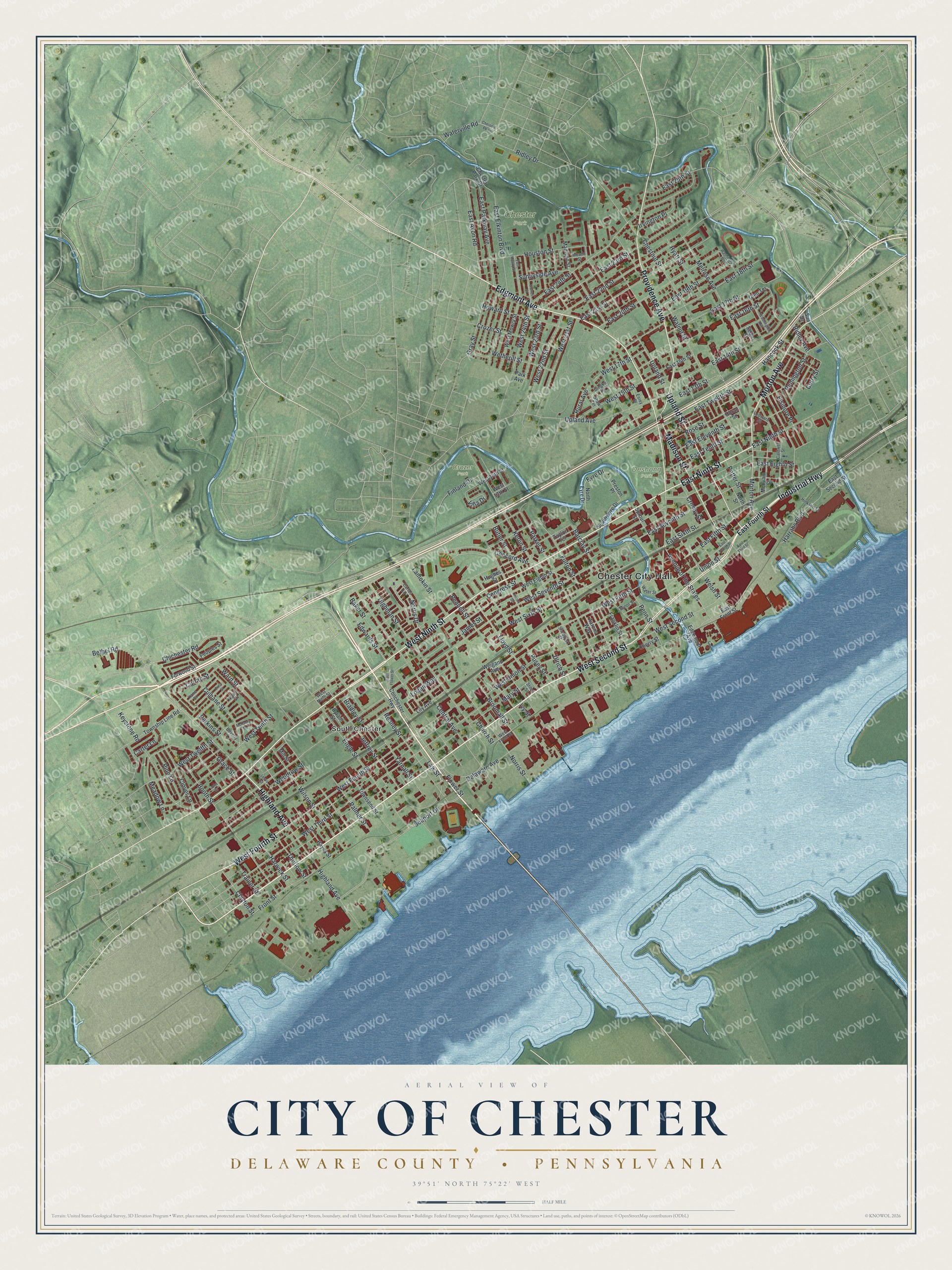
Created by KNOWOL in 2026, this Chester map shows the hills shaded from USGS elevation data, with red buildings, pale roads and the blue river laid over green. The title panel reads "Aerial View of" above "City of Chester," then "Delaware County, Pennsylvania." It gives the coordinates 39°51' North, 75°22' West, with a half-mile scale bar.
It suits a living room, a home office or a front hall where family walks past every day. It's a good gift for someone who grew up in Chester and moved away, or for a parent who still lives in South Chester or up near Chester Park. Open the preview, zoom in and find the block you know. Shop the City of Chester, Delaware County, Pennsylvania map.