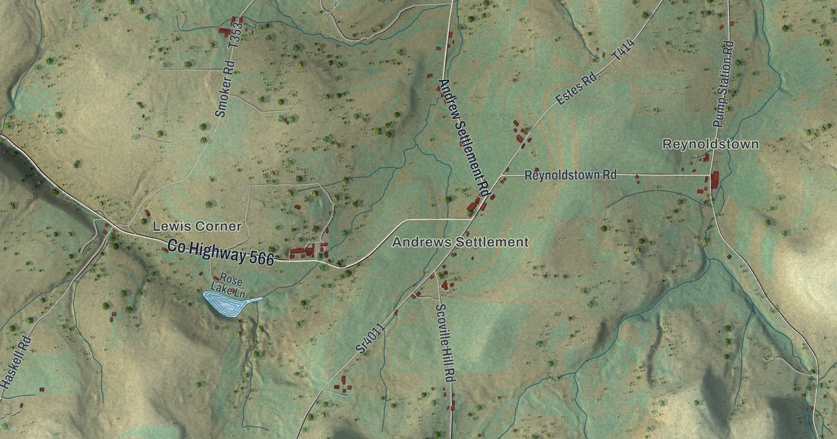
If you grew up in Genesee, farm out near Kinney or Ellisburg, or drive Gold Road down to Harmontown, this map covers the whole township. It's a modern aerial view of Genesee Township in Potter County, Pennsylvania, made from modern data with a vintage artistic feel. The hills are shaded in sand and soft green, creeks run down every hollow, and more than 900 buildings are marked in red, most of them strung along the valley roads. Explore the print options for Genesee.
Ellisburg Road, Gold Road and Harmontown
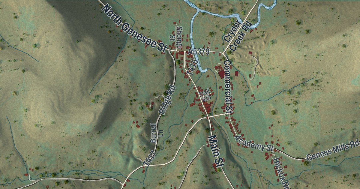
Start at the top right, where Main Street, North Genesee Street and Commercial Street make the one real cluster of streets on the map. The village itself isn't labeled. Cryder Creek Road heads north out of it. Follow Main Street south and it becomes Gold Road, which runs down the right side of the sheet past Hickox and Whitney Hill Road, all the way to Harmontown near the bottom right. Hickox-Ulysses Road runs south from Hickox, just to the east. Back at the village, Ellisburg Road takes the valley south through the middle of the map to Ellisburg. From there Andrew Settlement Road heads southwest, Rag Hill Road heads east to Gold Road, and Pumpstation Road runs south. Estes Road is a short east-west road just below them. Over in the top left, Kinney sits on Kinney Road, with O'Donnell Road, Mc Hale Road and French Rooney Road close by and Dogtown Road angling across below. Lots of roads are named, some only by township number, and each red mark is a building. Zoom in on the preview and look for yours.
Ellisburg is where the water and the roads meet. A county history from 1890 puts it at the confluence of the head streams of the west branch of the Genesee, on the roads that ran to Coudersport and Raymond's Corners. In 1836 the only buildings there were Richard Ellis's house and his grist mill, which he built in return for a large land bonus. By 1870 the Stannard and Dickinson hotels, a schoolhouse, a sawmill, the Ellis store and Ellis's harness shop lined the roads. The streams aren't labeled, but you can see several of them coming together in the valleys around the Ellisburg label.
The same history mentions the Waterman House at Genesee Forks, which opened on December 25, 1886, with a party of 147 couples.
A Genesee Township map for Ellisburg and Hickox families
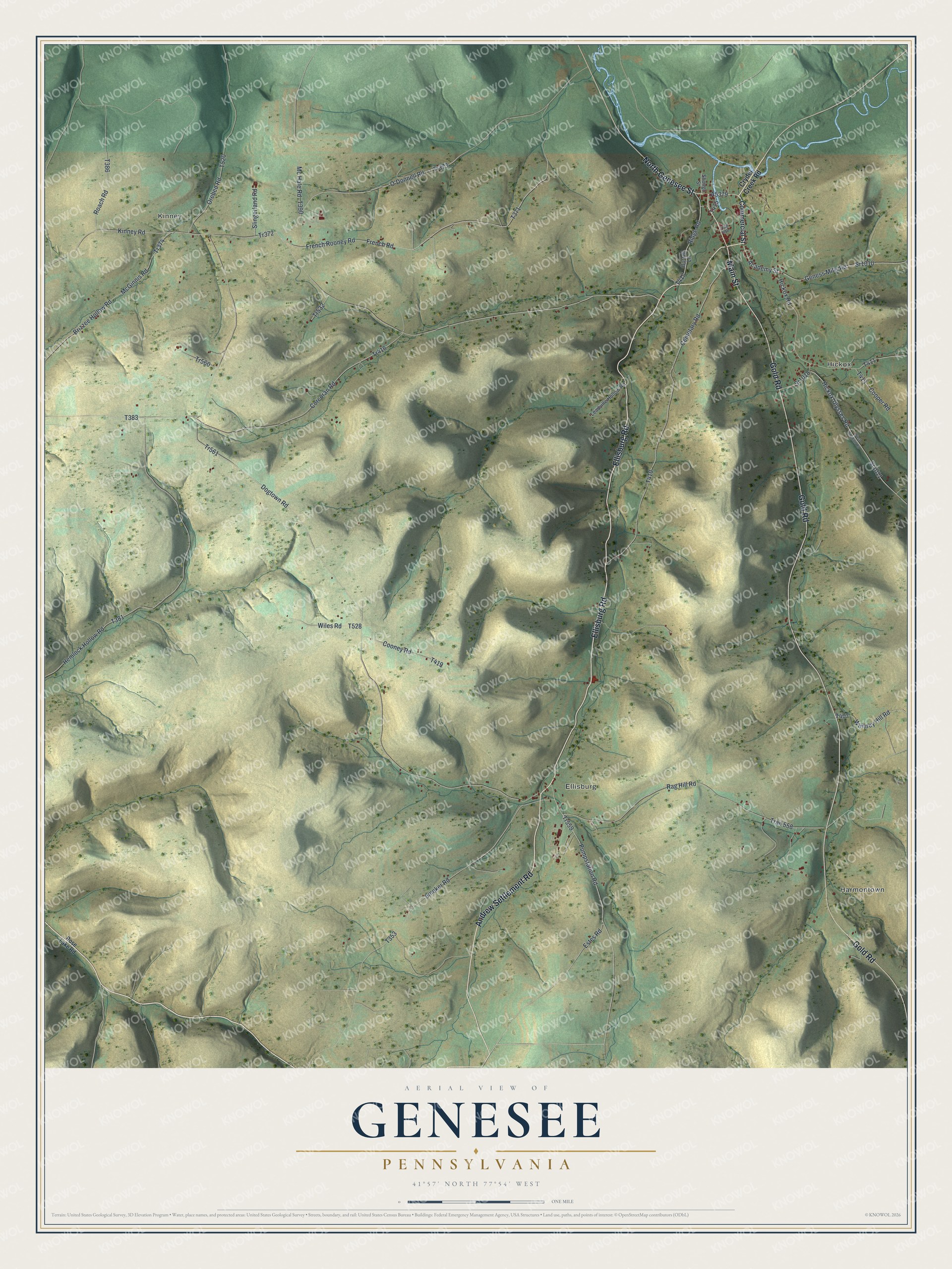
Created by KNOWOL in 2026, this map of Genesee suits a farmhouse kitchen, a den or an office. The shape of the land comes from USGS elevation data and the roads from Census Bureau records. The title panel reads "Aerial View of Genesee, Pennsylvania," with the coordinates 41°57' North, 77°54' West and a one-mile scale bar.
For someone who grew up in Genesee Township or still has family out on Gold Road or Ellisburg Road, it's an easy gift to get right. Open the preview, zoom in and look for the house at the end of your road. Shop the Genesee, Pennsylvania map.