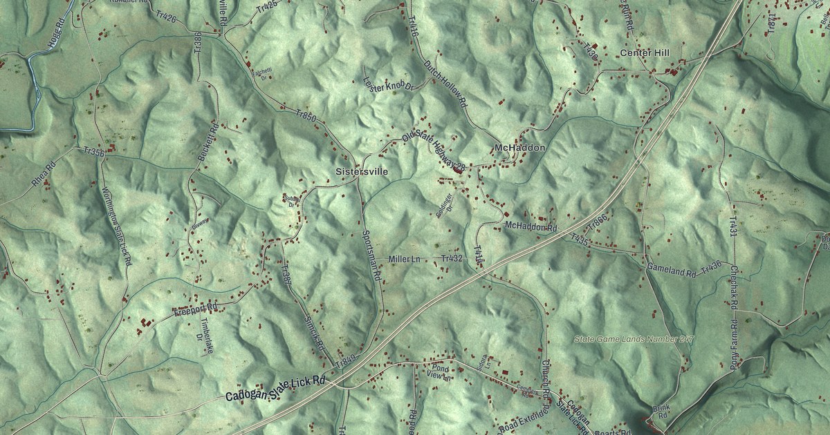
If you grew up out along Cadogan Slate Lick Road or still have family near Center Hill, this print puts the whole township on one sheet. It's a modern aerial view of North Buffalo Township in Armstrong County, Pennsylvania, drawn from modern data and given a vintage look. Green, shaded hills fill the sheet, cut by deep hollows and small creeks. A wide blue river curves down the right side and across the bottom, with West Ford City close by its bank. Small red buildings sit along the back roads, at McHaddon, Sistersville and Center Hill.
Center Hill, McHaddon and Glade Run Road
On this map you'll find Cadogan Slate Lick Road, Ford City Road, Glade Run Road, Freeport Road, Church Road, Sisterville Road, Old State Highway 28, Claypoole Road, Center Hill, McHaddon, Sistersville, West Ford City, State Game Lands Number 247, and more. Each red shape is a building, so zoom in on the preview and look for yours.
Williamsburgh, the Town on Glade Run
North Buffalo Township was formed in 1847. That year the state split what was left of old Buffalo Township into North and South Buffalo. But settlers had come long before that. In 1794, Samuel and William Green were granted land along the Allegheny River. Green family tracts soon ran along the river and up Glade Run. There were five of them, and people came to call the area "the Green settlement." That's how the 1883 History of Armstrong County tells it.
William Green settled on the lower tract, where Glade Run crosses the land. In 1802 he laid out a town there, on the river hill. He named it Williamsburgh. It covered about 15 acres, and each lot was a quarter of an acre. A lot was to sell for about two dollars. The history says only one sale is known. A man named Hollander bought that lot and built a house on it. Glade Run Road is printed on the map, near the creek where William Green's town was laid out. The river still bends past the hills where the Greens settled.
A Print of North Buffalo Township
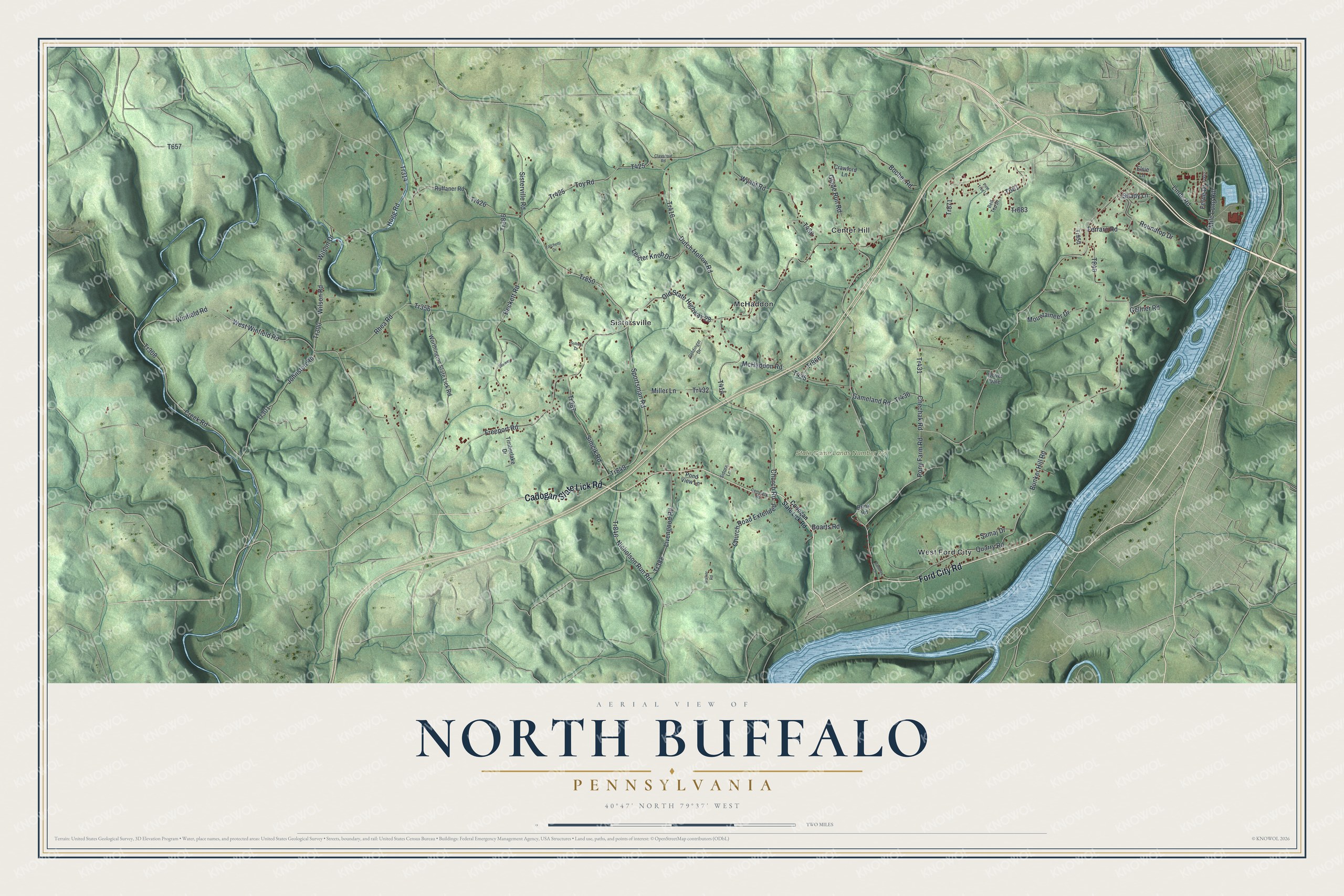
Created by KNOWOL in 2026, this print shows North Buffalo's hills in soft shaded green, with the river in blue and buildings as small red shapes. The title panel at the bottom reads Aerial View of North Buffalo, Pennsylvania, with the coordinates 40°47' North 79°37' West.
It suits a den, a hallway, an office or a family room. It's a gift for someone who grew up near Center Hill, or for a family that moved away from West Ford City. Open the preview and find your road. See sizes and frames for the North Buffalo map.