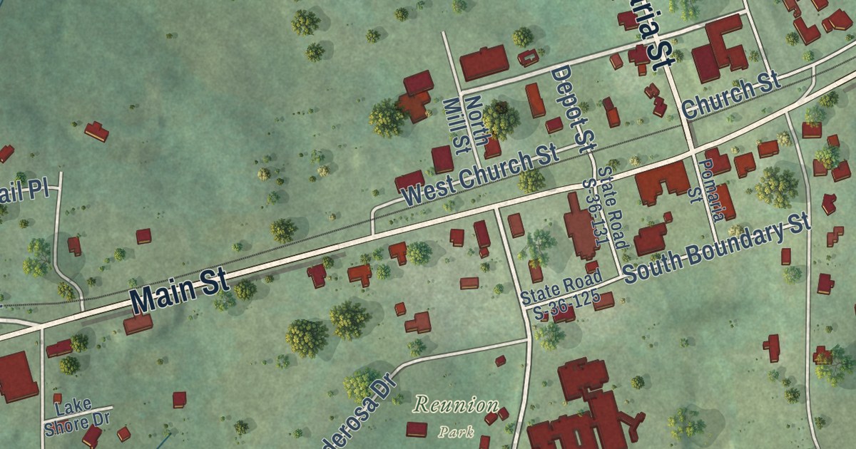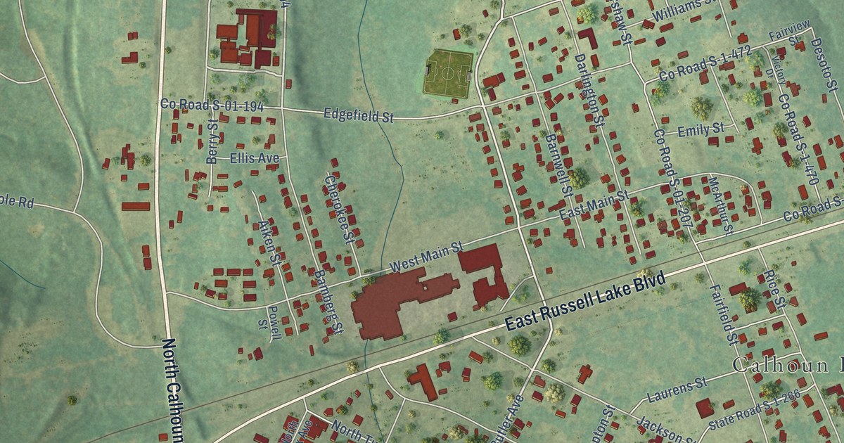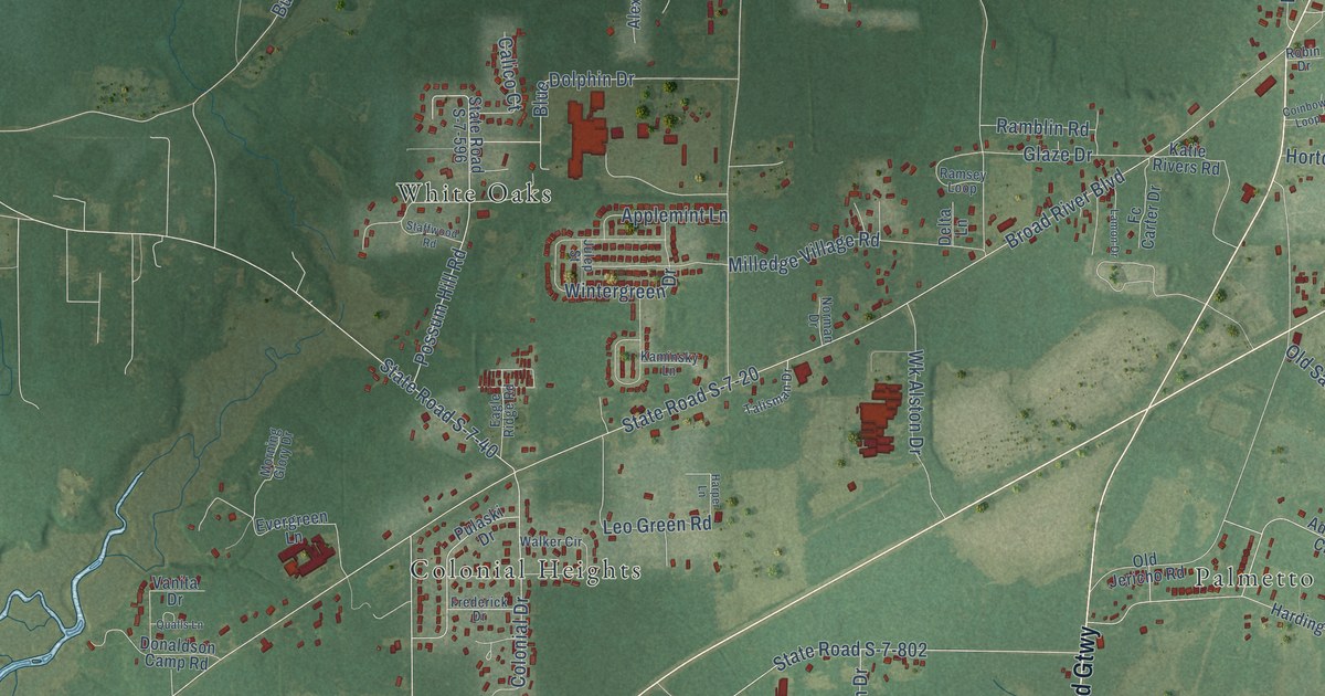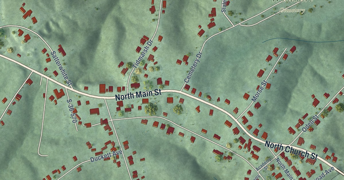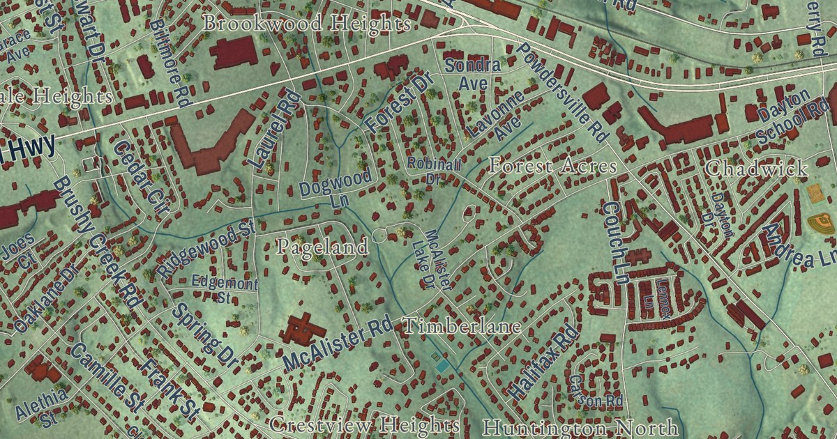
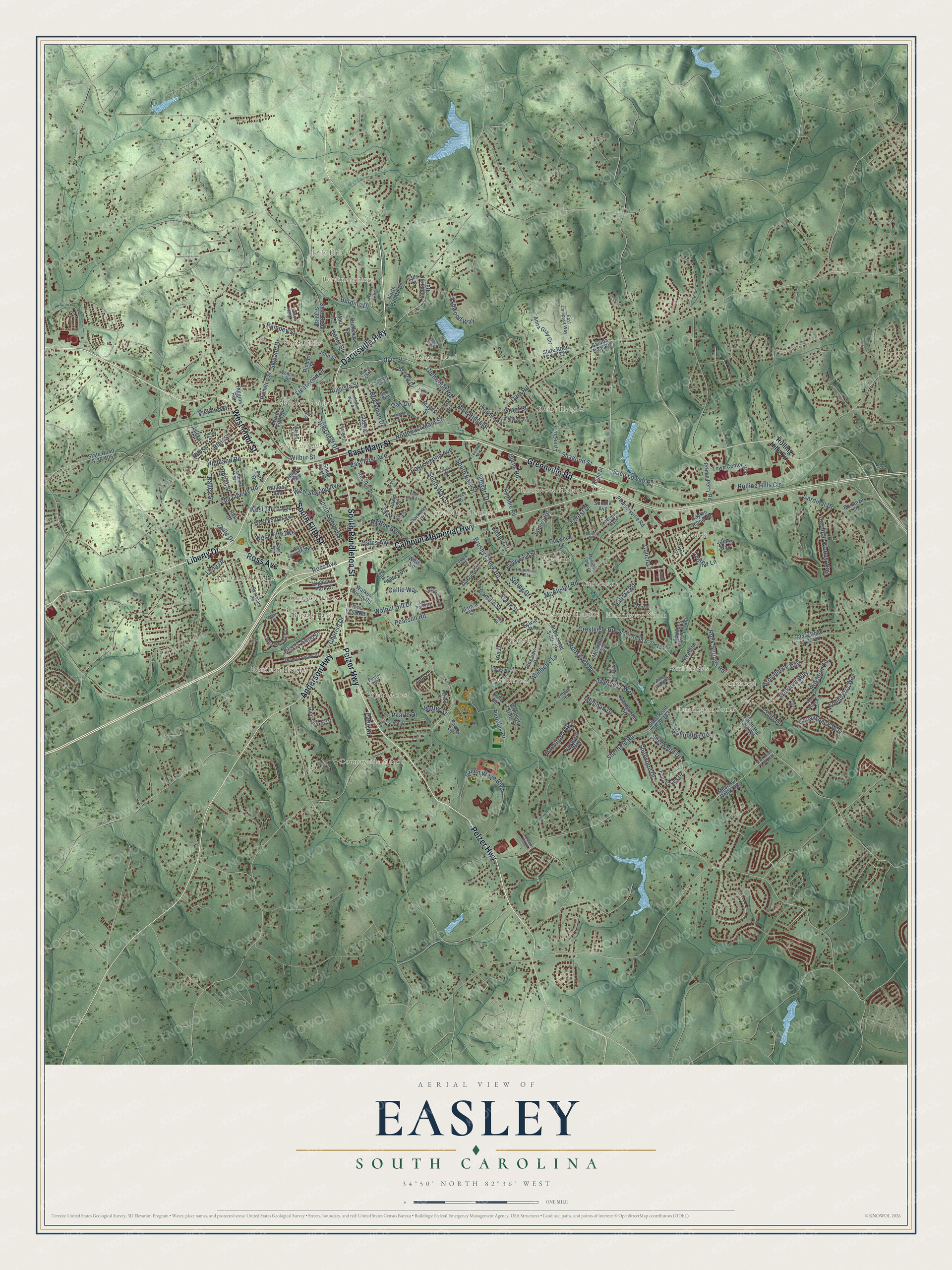
This beautifully detailed map of Easley, South Carolina was created in 2026 using aerial imagery combined with modern topographical, census, street and landmark data. It’s a one-of-a-kind view of Easley that combines accurate data with a vintage aesthetic. The map shows every building in its true location, many of the roads carry their names, and the shaded topographic relief shows the shape of the land.
Explore an aerial view of Easley, South Carolina
On the map you’ll find Burdine Springs, North Hills, Avondale Heights, Botany Park, Brookwood Heights, Canaan Land, Chadwick, Countryside Manor, Crestview Heights, Elaine Heights, Forest Acres, Glenwood, and more. If you look closely you can even find your house accurately drawn in its correct location. Zoom in on the preview to look for yours.
Did you know this piece of Easley, South Carolina history?
From Scencyclopedia.org: "Many would have thought the new town would be named for Holcombe, who became the first depot agent, but Holcombe asked that it be named for William King Easley, an attorney who was born in Pickens County near the Greenville County line."
Take a closer look at the Easley map
Street and place names on the Easley, South Carolina map
These names are printed on the map of Easley, South Carolina.
Places: Easley City Hall, Burdine Springs, North Hills, Countryside Manor, Huntington South, Brookwood Heights, McDaniel Heights, Twinbrook, Chadwick, Crestview Heights, Elaine Heights, Avondale Heights, Hamilton Heights, Canaan Land, Wyatt Acres, Huntington North, Kingsberry, Pageland, Yorkwood, Forest Acres, Marshall Heights, Botany Park, Smithfields, Timberlane, Holly Hill, Oak Creek and Cherokee Forest.
Streets and roads: East Main Street, Pelzer Highway, South Pendleton Street, Liberty Drive, West Main Street, South Fifth Street, Dacusville Highway, Greenville Road, Calhoun Memorial Highway, Ross Avenue, Anderson Highway, Olive Street.
More street names, A to Z
Alethia Street, Allan Street, Andrea Lane, Anna Gray Circle, Anzio Street, Arcadian Lane, Arlington Avenue, Asbury Circle, Ashwood Way, Audubon Acres Trail, Augusta Street, Barr Street, Bell Street, Beverly Drive, Biltmore Road, Blair Street, Blue Ridge Street, Bonanza Lane, Brighton Circle, Brockman Drive, Brushy Creek Road, Burdine Drive, Burns Road, Callie Way, Camille Street, Canvasback Way, Cardinal Drive, Cardinal Woods Way, Carnoustie Drive, Carson Road, Cedar Circle, Charles Street, Cherish Drive, Clay Street, Couch Lane, Court Drive, Crenshaw Street, Crestview Road, Dam Road, Dayton Drive, Dayton School Road, Dogwood Lane, East Compass Way, East First Avenue, Eastpark Way, East Second Avenue, East Third Avenue, Echo Circle, Edenberry Way, Edgemont Street, Ellenburg Drive, Fleetwood Drive, Folger Avenue, Forest Drive, Four Lakes Drive, Frank Street, Freeman Road, Front Street, Gilliland Avenue, Glazner Street, Glen Laurel Drive, Glenwood Road, Grace Avenue, Grant Street, Green Wave Boulevard, Grigsby Avenue, Halifax Road, Hamilton Parkway, Hamilton Street, Henry Street, Highland Park Court, Highland Road, Hill Crest Drive, Hill Street, Inverness Way, Iris Drive, Jade Lane, James Way, Joes Court, John Street, Katherine Street, Ketura Drive, King Circle, Lakeshore Drive, Laurel Road, Lavonne Avenue, Lena Drive, Lenhardt Road, Lennox Lane, Light Spring Road, Lily Pond Place, Linden Hall Lane, Longview Terrace, Lucky Street, Luke Court, Lutsen Drive, Lynn Circle, Mad Lane, Mayes Street, McAlister Lake Drive, McAlister Road, McArthur Street, McBee Avenue, Meadow Ridge Road, Medinah Drive, Mountain View Drive, Nalley Street, North Ballard Drive, Northeast Main Street, North Fifth Street, North Fourth Street, Oak Circle, Oaklane Drive, Oates Avenue, Old Liberty Road, Pantel Drive, Park Drive, Parker Lane, Park Way, Parkway Drive, Patio Road, Pearle Drive, Pearson Road, Peoples Drive, Phillips Avenue, Pickens Street, Pine Ridge Drive, Pine Street, Pineview Drive, Players Drive, Pleasant Hill Drive, Pope Field Road, Powdersville Road, Prince Perry Road, Providence Way, Rampey Street, Richard Street, Ridgewood Street, Riding Park Lane, Riggins Road, Rivers Edge Drive, Robinall Drive, Rockmont Road, Rock Springs Road, Rolling Hills Circle, Roosevelt Drive, Roper Street, Russell Street, Ruth Drive, Sabra Drive, Saco Lowell Road, Sadie Drive, Saint Lo Circle, Saluda Dam Road, Selsea Drive, Shagood Street, Sheffield Road, Shefwood Drive, Sherwood Drive, Sitton Hill Farm Road, Skyland Drive, Sondra Avenue, South East Street, South First Street, South Second Street, South Way Street, Spirit Mountain Lane, Spring Drive, State Road S-39-28, State Road S-39-29, State Road S-39-81, State Road S-39-106, State Road S-39-133, State Road S-39-134, State Road S-39-148, State Road S-39-221, Stegall Road, Stewart Drive, Sylvia Road, Thames Valley Drive, Town Center Way, Turner Street, Utility Street, Walker Ellison Road, Walnut Hill Drive, Walter Street, Ware Lane, Wellington Road, West Fifth Avenue, West Fourth Avenue, West Second Avenue, West Seventh Avenue, West Sundance Drive, West Third Avenue, Wexford Way, Whitmire Road, Wilbur Street, Wimberly Farms Lane, Wimberly Lane, Zion Street.
See the Easley, South Carolina map on a wall
The Easley map as an 18 x 24 inch print in a black frame.

This beautifully detailed map of Easley makes an attractive addition to your office, library, or den, and it can even be used to teach children the geography and history of the area. It also makes a great gift for anyone with Easley roots. When you’re done exploring, click here to get your copy of the Easley map.