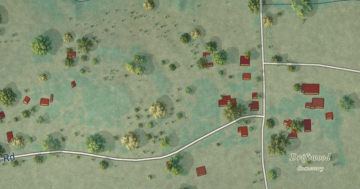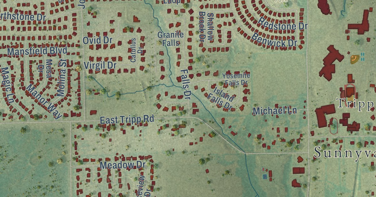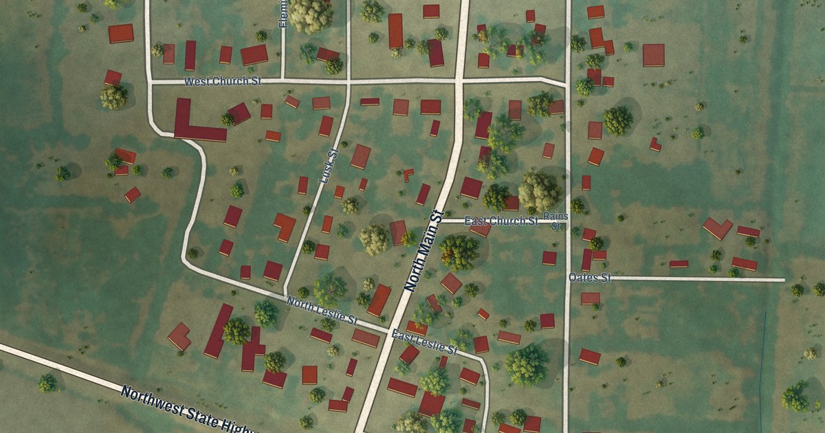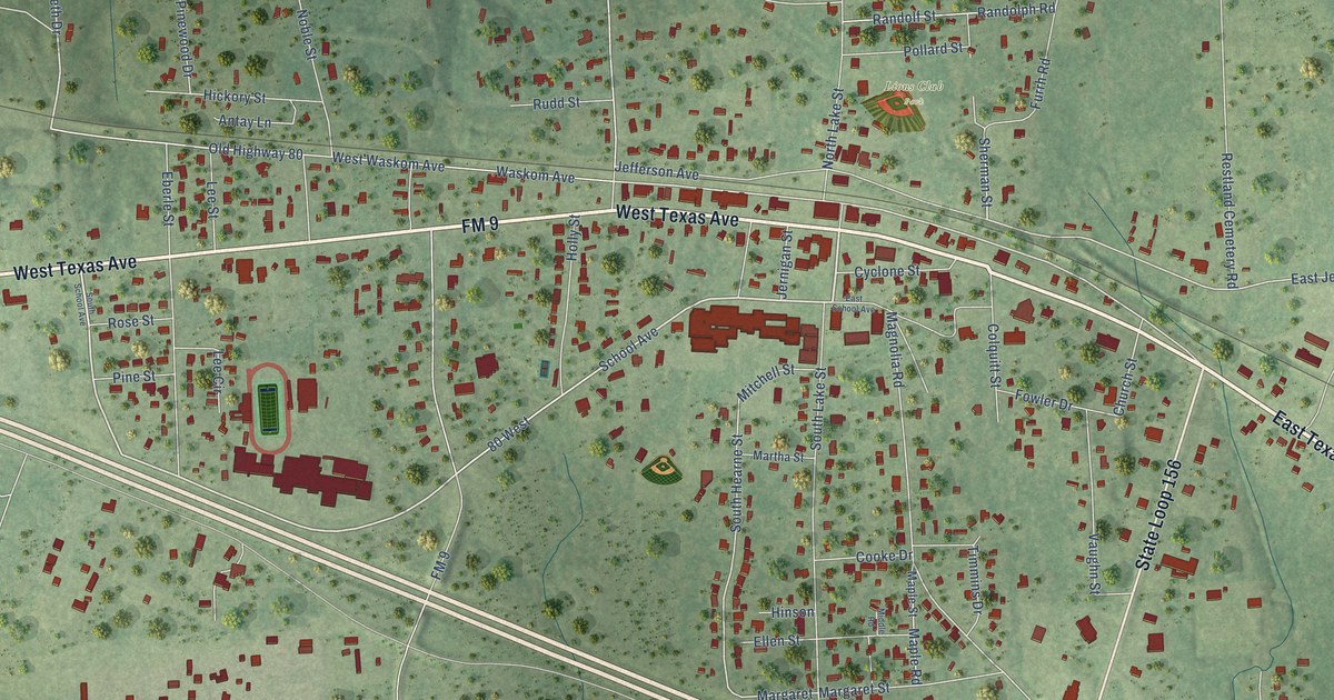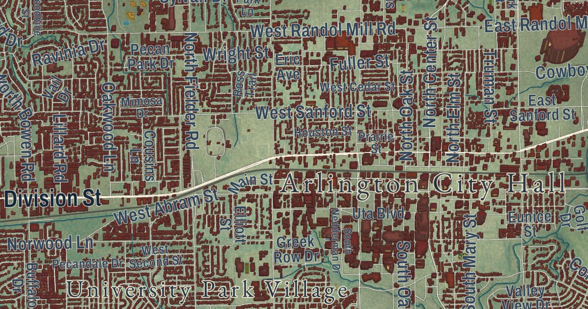
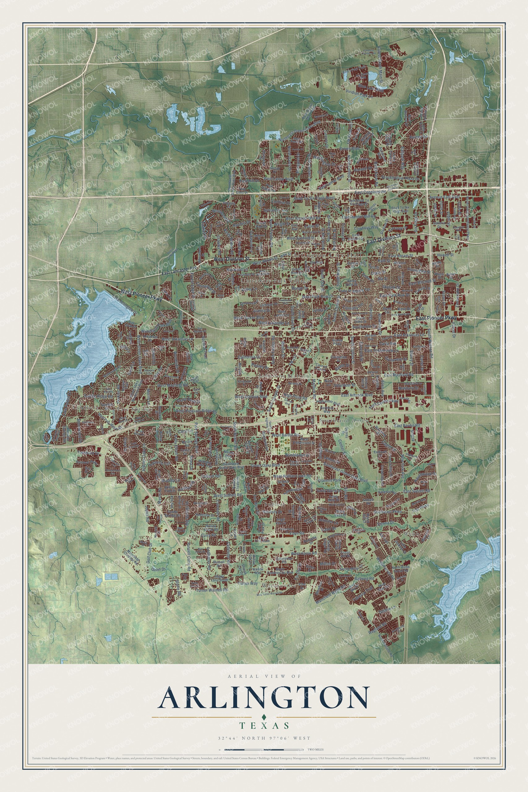
This beautifully detailed map of Arlington, Texas was created in 2026 using aerial imagery combined with modern topographical, census, street and landmark data. It’s a one-of-a-kind view of Arlington that combines accurate data with a vintage aesthetic. The map shows every building in its true location, many of the roads carry their names, and the shaded topographic relief shows the shape of the land.
Explore an aerial view of Arlington, Texas
On the map you’ll find Arlington City Hall, Johnsons Station, Lindberg, Southland Acres, Sublett, Tate Springs, University Park Village, Watsonville, and Webb, along with West Pioneer Parkway, East Pioneer Parkway, East Division Street, and more. If you look closely you can even find your house accurately drawn in its correct location. Zoom in on the preview to look for yours.
Did you know this piece of Arlington, Texas history?
From the Handbook of Texas: "Arlington is halfway between Dallas and Fort Worth in eastern Tarrant County. It was founded in 1876 on the Texas and Pacific Railway as a market town for the surrounding farms but was not officially incorporated until 1884."
Take a closer look at the Arlington map
Street and place names on the Arlington, Texas map
These names are printed on the map of Arlington, Texas.
Places: Arlington City Hall, Watsonville, Southland Acres, Lindberg, Webb, Sublett, University Park Village, Johnsons Station, Tate Springs and Cravens Park.
Streets and roads: West Pioneer Parkway, East Pioneer Parkway, East Division Street, West Division Street, Green Oaks Boulevard, Northeast Green Oaks Boulevard, Southeast Green Oaks Boulevard, West Mayfield Road, West Green Oaks Boulevard, East Mayfield Road, South Center Street, South Watson Road.
More street names, A to Z
105th Street, 106th Street, 107th Street, 109th Street, 110th Street, 111th Street, 113th Street, Aires Drive, Allen Avenue, Altman Drive, Ambercrest Drive, Amhurst Drive, Andalusia Trail, Angel Fire Lane, Arbrook Boulevard, Arkansas Lane, Ascension Boulevard, Atherton Street, Augusta Lane, Avenue East East, Avonhill Drive, Bahar Drive, Baird Farm Road, Ballpark Way, Ballweg Road, Bama Drive, Bardin Road, Basil Drive, Bay Club Drive, Beckett Drive, Belton Drive, Benge Drive, Bent Oaks Drive, Betsy Ross Drive, Bever Boulevard, Big Springs Drive, Bird's Fort Trail, Blackberry Drive, Blue Duck Trail, Blue Forest Drive, Blue Lake Boulevard, Blue Sky Drive, Boardwalk, Bowman Springs Road, Bradley Lane, Bratcher Drive, Briarwood Boulevard, Bridgewater Drive, Bridlegate Drive, Bridle Oaks Drive, Bright Star Trail, Brookhollow Plaza Drive, Brookleaf Drive, Brown Boulevard, Browning Drive, Bryan Drive, Buffalo Drive, Burney Road, Calender Road, Caliente Drive, California Lane, Callender Road, Calloway Cemetery Road, Caplin Drive, Carla Avenue, Carol Lane, Carter Drive, Carter Street, Castle Road, Catalo Lane, Cavendish Drive, Celtic Drive, Center Street, Central Park Drive, Chaperito Trail, Cherry Sage Drive, Church Street, Circle Drive, Cloverdale Street, Cochise Drive, Coke Drive, Collard Road, Colony Drive, Colorado Lane, Colson Drive, Concord Drive, Connally Terrace, Cool Springs Drive, Cornfield Drive, Corporate Drive West, Country Club Road, Cousins Lane, Cowboys Way, Craig Hanking Drive, Creekridge Drive, Creek Valley Drive, Crest Drive, Cross Bend Drive, Crowley Road, Crownpoint Lane, Curry Road, Curt Drive, Dale Drive, Dalworth Avenue, Daniel Drive, Dartmouth Drive, David Lane, Debbie Lane, Delk Drive, Design Road, Doolittle Drive, Dottie Lynn Parkway, Duff Drive, East Abram Street, East Arbrook Boulevard, East Arkansas Lane, East Bardin Road, East Copeland Road, East Inwood Street, East Lamar Boulevard, East Lancaster Avenue, East Mitchell Street, East Park Row Drive, East Randol Mill Road, East Road To Six Flags Street, East Sanford Street, East Sublett Road, East Timberview Lane, Eden Road, Elbe Drive, Elk Trail, Elliott Street, Enchanted Bay Boulevard, Endicott Drive, Enterprise Plc, Eric Avenue, Esquire Drive, Euless South Main Street, Eunice Street, Exchange Drive, Findlay Drive, Firethorn Drive, FM 157, FM Road 157, Fonda Drive, Forest Bend Drive, Forest Edge Drive, Forest Hollow Lane, Forest Park Drive, Forum Drive, Fossil Hill Drive, Fox Court, Fox Creek Trail, Fox Glen Drive, Fox Hunt Drive, Fox Run Road, Franklin Drive, Fuller Street, Furrs Street, Galleria Drive, Gary Lane, Gentle Springs Drive, George Finger Road, Gibbins Road, Gillon Drive, Glynn Oaks Drive, Golf Club Drive, Golf Drive, Goliad Drive, Grace Street, Grants Parkway, Greek Row Drive, Green Oaks Boulevard West, Guinevere Street, Guinn Drive, Half Moon Drive, Halifax Drive, Hardisty Drive, Hardy Place, Harmon Terrace, Harwell Drive, Harwood Road, Havenbrook Drive, Havenwood Drive, Hickory Hill Drive, Hidden Oaks Lane, Highbank Drive, Highlander Boulevard, High Point Road, Hillcrest Drive, Hillside Drive, Hollow Creek Road, Holly Brook Lane, Homestead Road, Houston Street, Howell Street, Iberis Drive, Ida Street, Ijaz Drive, Indian Trail, Indigo Lane, Island Bay Drive, Ivy Charm Way, Janann Avenue, Jennifer Lane, Jewell Drive, Joplin Road, Joyce Street, Juanita Drive, Kelly Elliott Road, Ken Avenue, Kent Drive, Kimberly Drive, Kingfisher Lane, Kiowa Drive, Kr Lane, Kyle Drive, Lake Arlington Drive, Lakehill Court, Lake Jackson Drive, Lake Powell Drive, Landers Lane, Lanette Lane, Larkspur Drive, Larry Lane, Lavon Creek Lane, Ledbetter Road, Lee Drive, Legacy Point Drive, Legend Road, Legends Way, Lemon Drive, Lester Drive, Lillard Road, Lincoln Drive, Lindberg Drive, Lindblad Court, Little Road, Lynbrook Lane, Lynda Lane, Lynnwood Drive, Lyra Lane, Mainsail Lane, Main Street, Mandy Way, Mansfield Cardinal Road, Mansfield Road, Mansfield Webb Road, Maple Leaf Drive, Marble Drive, Margaret Drive, Marie Terrace, Matlock Road, McKamy Oaks Trail, Meadow Lane, Median Way, Medlin Drive, Melear Drive, Melia Drive, Melissa Street, Merritt Way, Milton Drive, Mimosa Drive, Misty Brook Drive, Misty Crest Drive, Monties Lane, Moore Terrace, Morris Lane, Muirfield Drive, Mule Deer Drive, Murwick Drive, Myers Road, Natches Drive, Newbury Drive, New York Avenue, Nicki Lane, North Bowen Road, North Center Street, North Collins Street, North Cooper Street, North Davis Drive, North Elm Street, North Fielder Road, North Great Southwest Parkway, North Holland Road, North Oak Street, North Webb Ferrell Road, Northwest Green Oaks Boulevard, Norwood Lane, Oak Brook Road, Oakwood Lane, Office Park Drive, Osage Drive, Osprey Drive, Paisley Drive, Park Hill Drive, Park Lane, Park Ridge Terrace, Park Run Drive, Park Springs Boulevard, Park Street, Partners Way, Pecandale Drive, Pecan Park Drive, Pennsylvania Avenue, Perkins Place, Perkins Road, Petra Drive, Peyco Drive South, Pin Oak Lane, Plaza Street, Pleasant Ridge, Plumeria Drive, Polo Club Drive, Ponselle Drive, Portofino Drive, Potomac Parkway, Prairie Street, Purdue Drive, Quail Lane, Queen Elizabeth, Racquet Club Drive, Ragland Road, Ravinia Drive, Rebecca Lane, Red Coat Lane, Redstone Drive, Reever Street, Remynse Drive, Rickey Lane, Road To Six Flags East, Road To Six Flags West, Roberts Circle, Rose Brown May Parkway, Ross Trail, Russell Curry Road, Russell Road, Ruth Street, Saddle Ridge Road, Salem Drive, San Ramon Drive, Scots Legacy Drive, Seneca Drive, Shadydale Drive, Shady Lane South, Sharon Lee Drive, Sharpshire Lane, Sherry, Sherry Street, Shorewood Drive, Shoshoni Drive, Sienna Drive, Silkcrest Trail, Silo Road, Six Flags Drive, Skylark Drive, Snowy Owl Street, Solano Drive, South Bowen Road, South Collins Street, South Commercial Boulevard, South Cooper Street, South Davis Drive, Southeast Parkway, South Fielder Road, South Highway 157, South Mary Street, Southmoor Drive, South Nedderman Drive, South Oak Street, Southwest Green Oaks Boulevard, Southwind Drive, Southwood Boulevard, Spanish Trail, Spring Miller Court, Stadium Drive, Stadium Drive East, Station Drive, Steeplewood Trail, Storie Road, Sublett Road, Sunflower Drive, Sunlight Drive, Sunrise Drive, Susan Drive, Sylvan Drive, Tabasco Trail, Tabor Drive, Taft Drive, Tatum Drive, Tcjc Parkway, Teal Ridge Drive, Tech Centre Parkway, Tempest Drive, Tennessee Trail, Tennis Villa Drive, Tharp Street, Timberlake Drive, Timber Terrace, Tin Cup Drive, Trail Crest Drive, Treepoint Drive, Truman Street, Truver Lane, Turf Club Drive, Turner Warnell Road, Turner Way, Twin Elms Drive, Twinhill Drive, Uta Boulevard, Vail Drive, Valleycrest Drive, Valley Lane, Valley Mills Drive, Valley Spring Drive, Valley View Drive, Valleywood Drive, Vintage Drive, Viridian Park Lane, Volunteer Drive, Walden Trail, Wanda Way, Washington Drive, Watch Hill Court, Waterside Drive, Waterview Drive, Waverly Drive, Waxwing Drive, Weaver Drive, Webb Ferrell Road, Wentworth Drive, West Abram Street, West Arbrook Boulevard, West Arkansas Lane, West Bardin Road, West Beady Road, West Cedar Street, West Embercrest Drive, West Harris Road, Westhaven Road, West Lamar Boulevard, West Lavender Lane, West Lovers Lane, West Lynn Creek Drive, West Nathan Lowe Road, West Park Row Drive, West Pleasant Ridge Road, West Poly Webb Road, West Randol Mill Road, West Sanford Street, West Second Street, West Shadow Drive, West Sublett Road, West Tucker Boulevard, West Turner Warnell Road, Westwood Drive, Wet North Wild Way, Wheatland Drive, Whistler Drive, Wild West Drive, Willow Bend Drive, Willow Oak Lane, Willow Tree Drive, Wimbledon Drive, Winding Hollow Lane, Woodbine Street, Woodford Drive, Woodland Park Boulevard, Woods Drive, Woodside Drive, Wright Street, Wynn Terrace.
See the Arlington, Texas map on a wall
The Arlington map as an 18 x 24 inch print in a black frame.

This beautifully detailed map of Arlington makes an attractive addition to your office, library, or den, and it can even be used to teach children the geography and history of the area. It also makes a great gift for someone who left Arlington and still calls it home. When you’re done exploring, click here to get your copy of the Arlington map.