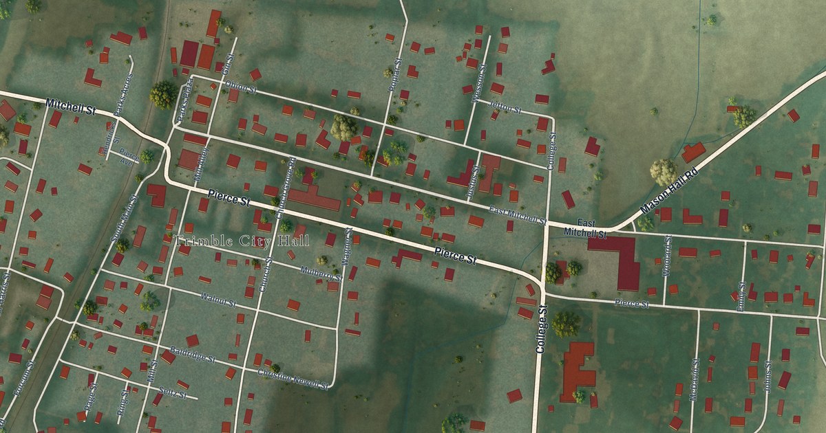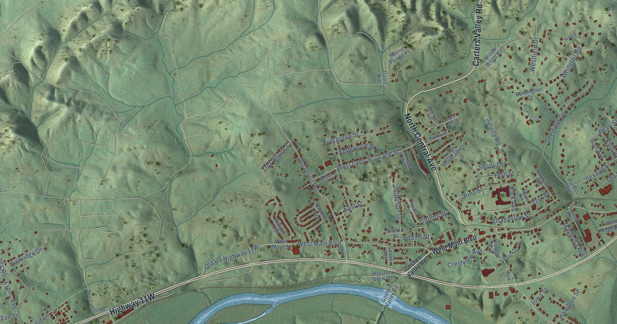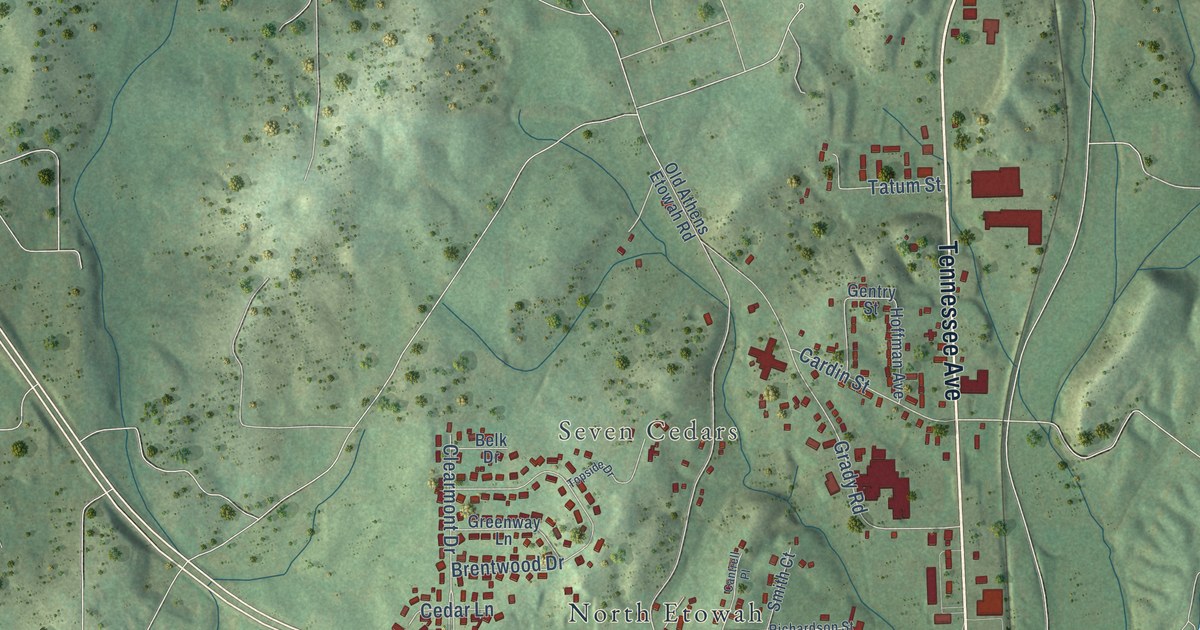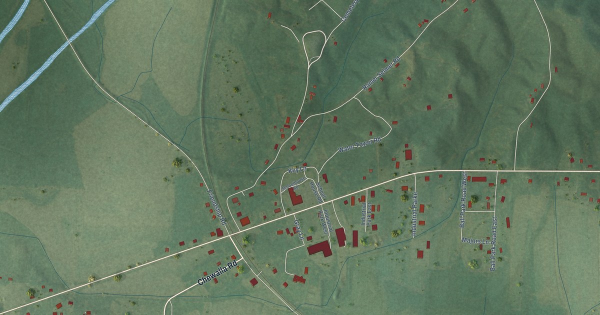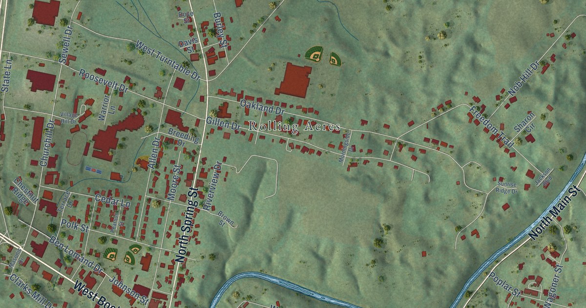
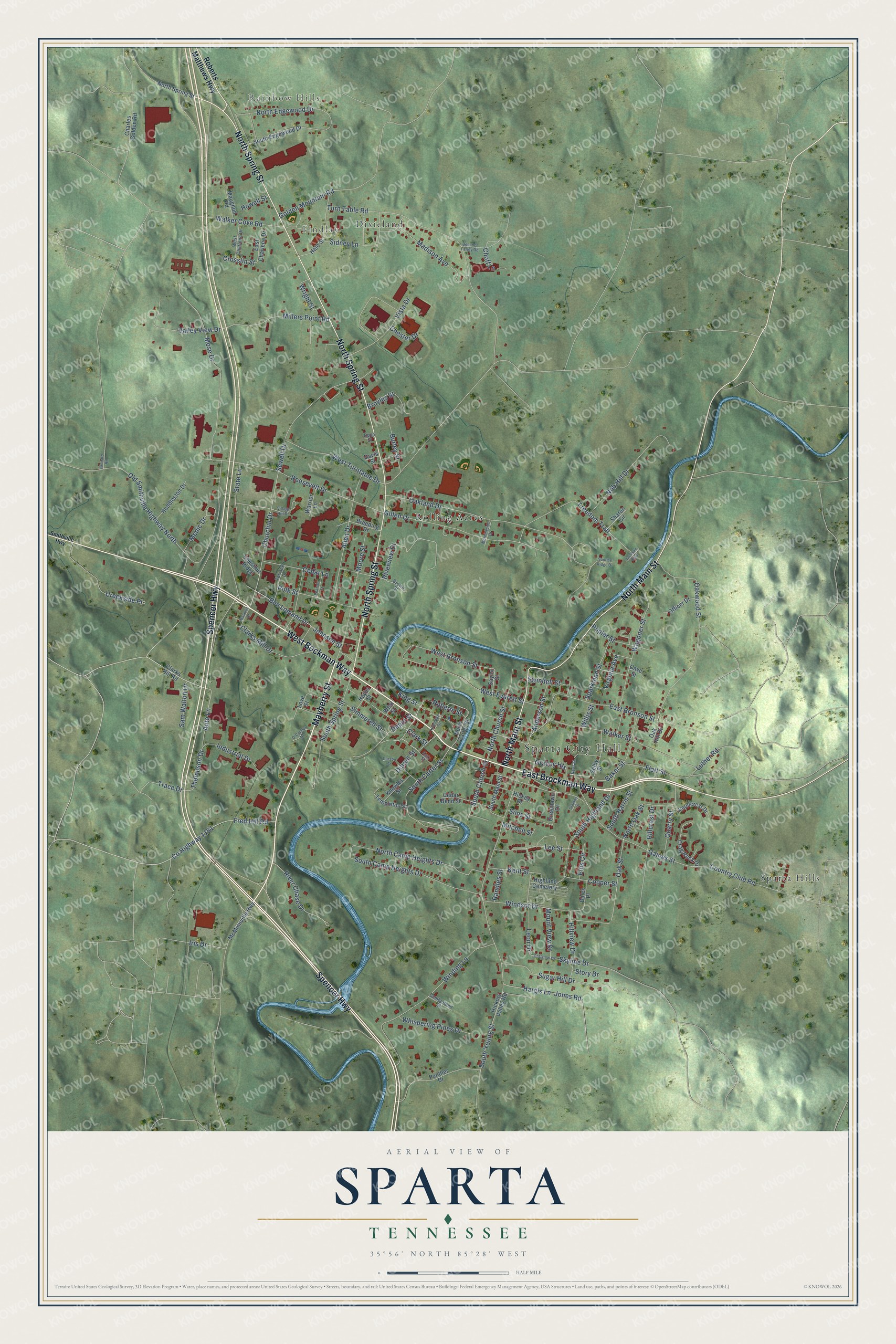
This beautifully detailed map of Sparta, Tennessee was created in 2026 using aerial imagery combined with modern topographical, census, street and landmark data. It's a modern aerial view of Sparta in White County, Tennessee, that combines modern data with a vintage aesthetic. The roads feature printed names, and if you look closely you can find your exact house accurately shown in its correct location.
Explore an aerial view of Sparta, Tennessee
On this map you'll find Sparta City Hall, Rainbow Hills, Findlay, Dixieland, Rolling Acres, Sparta Hills, West Bockman Way, East Brockman Way, Mayberry Street, North Main Street, Spencer Highway, North Spring Street, and more. Each red shape is a building, so zoom in on the preview and look for yours.
Here is a piece of Sparta history, in the words of the record. The Tennessee Encyclopedia puts it this way: "In 1809 the state legislature authorized the establishment of a county seat at Sparta. Commissioners Thomas Bounds, Benjamin Weaver, Aaron England, Turner Lane, James Fulkerson, Alexander Lowry, and Nicholas Gillentine laid out the town."
Sparta is a city in White County. The Census Bureau counted 4,998 people here in 2020.
Take a closer look at the Sparta map
Names on this map
These names are printed on this map.
Places: Sparta City Hall, Rainbow Hills, Findlay, Dixieland, Rolling Acres, Sparta Hills and Highland Cemetery.
Streets and roads: West Bockman Way, East Brockman Way, Mayberry Street, North Main Street, Spencer Highway, North Spring Street, Roberts Street, Churchill Drive, Auto Lane, South Highland Drive, County Highway 1161, North Oak Street.
More street names, A to Z
Allen Drive, Anderson Street, Baker Street, Beecher Farley Road, Ben Lomand Drive, Breeding Drive, Brown Street, Broyles Street, Burley Street, Carson Street, Cave Street, Cedar Bend Street, Cedar Lane, Charles Golden Road, Chester Drive, Chestnut Ridge, Choff Lane, Clarks Hill Road, Clarks Mill Drive, Clark Street, Cliffview Drive, Cooper Street, Country Club Road, Crag Rock Drive, Creekside Place, Crosslin Street, Cumberland Street, Dales Place, Davis Street, Depot Street, Dibrell Street, Dove Street, East Bronson Street, East Charlene Drive, Ellis Circle, Flatt Street, Fred Hill Road, Freedom Trail, Gaines Street, Gillen Drive, Golden Mountain Road, Gracey Heights, Greenlawn Drive, Hale Street, Hargis Lane, Hayes Street, Hickey Drive, Hickory Valley Road, Hillcrest Drive, Hillview Drive, Howell Street, Huddleston Drive, Industrial Drive, Iris Drive, Jackson Boulevard, Johnson Street, Jones Road, Katz Street, Kent Street, King Street, Kinnard Road, Klondyke Street, Knollcrest Drive, Knowles Street, Lee Street, Leon Drive, Love Street, Luther Road, Madison Avenue, Masonic Drive, Maughon Road, McMinnville Highway, Medic Drive, Millers Point Road, Mitchell Street, Moore Street, Morningside Drive, Mose Drive, Mount View Drive, Newt Street, Nob Hill Drive, North Camp Heights Drive, North Carter Street, North Church Street, North Edgewood Drive, O'Conner Drive, Oak Hill Drive, Oakland Drive, Oak Street, Oakwood Street, Officer Drive, Old Smithville Highway North, Panther Drive, Pearson Street, Polk Street, Poplar Street, Quarry Street, Randles Street, River Chase Drive, Riverview Drive, Roberts Matthews Highway, Roosevelt Drive, Sam Walton Drive, Saylor Street, Selby Street, Sewell Drive, Sharon Circle, Sidney Lane, Simmerell Street, Sims Street, Skyline Drive, Smithville Highway, South Camp Heights Drive, South Carter Street, South Church Street, South Edgewood Drive, South Harris Street, South Main Street, South Spring Street, South Young Street, Sparkman Street, Stamps Street, State Lane, Story Drive, Sugar Hill Drive, Sunrise Ridge Drive, Swindell Street, Templeton Street, Terrace Drive, Thompson Drive, Trace Drive, Turn Table Road, Valley View Drive, Village Hill Drive, Virginia Avenue, Vista Drive, Wagoner Street, Walker Cove Road, Walker Street, Warrior Lane, West Bronson Street, West Charlene Drive, West Everett Street, West Street, West Turntable Drive, Whispering Pines Drive, Willis Street, Winding Lane, Windsor Drive, Wright Street.
Created by KNOWOL in 2026. The buildings are small red shapes, the roads carry their printed names, and shaded relief shows the shape of the land. The title panel reads "AERIAL VIEW OF SPARTA TENNESSEE" with 35°56' NORTH 85°28' WEST.
It suits a den, a classroom or a front hall, and it makes a gift for anyone with Sparta roots. Open the preview and find the block you know. See sizes and frames for the Sparta map.