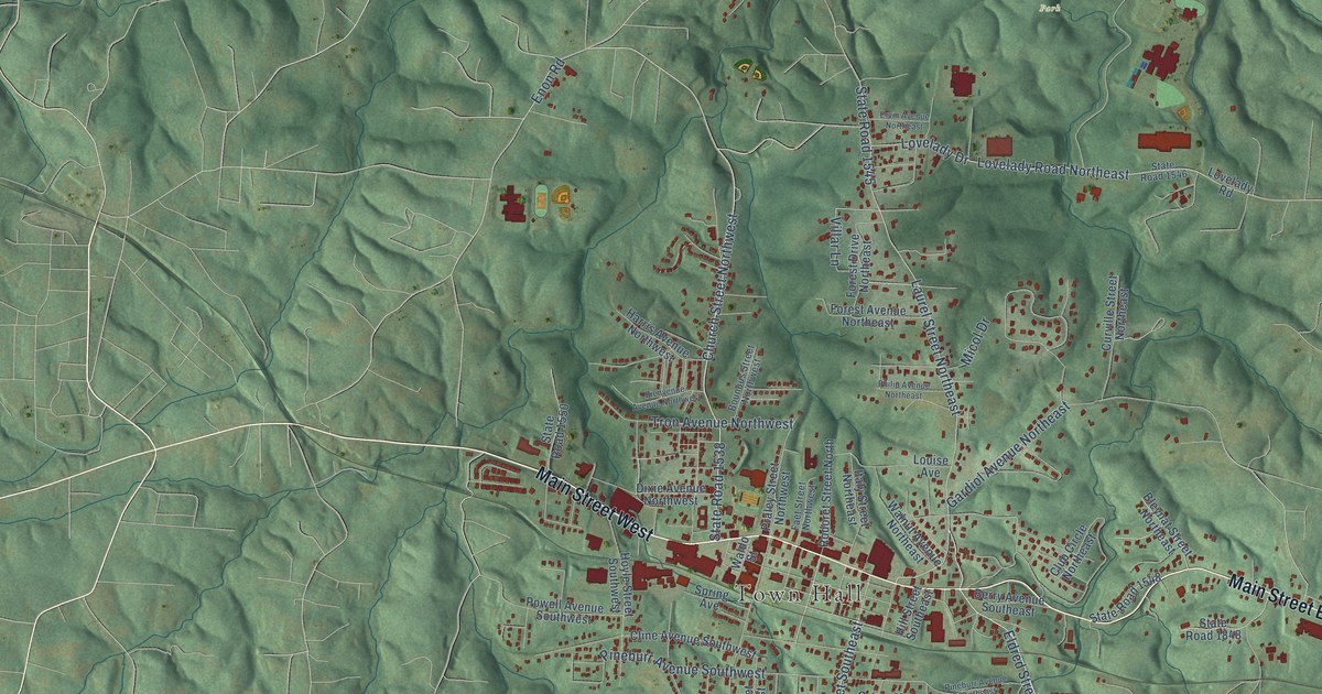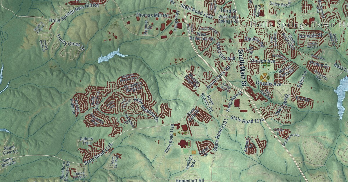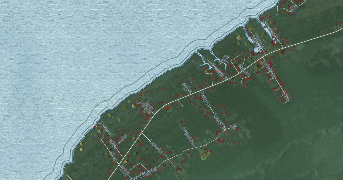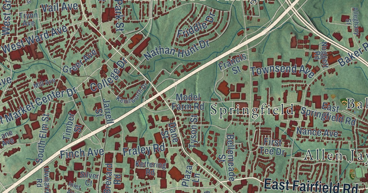
This beautifully detailed map of High Point, North Carolina was created in 2026 using aerial imagery combined with modern topographical, census, street and landmark data. It’s a one-of-a-kind view of High Point that combines accurate data with a vintage aesthetic. The map shows every building in its true location, many of the roads carry their names, and the shaded topographic relief shows the shape of the land.
Explore an aerial view of High Point, North Carolina
On the map you’ll find Gibson Park, Allen Jay, Archdale, Bakertown, Deep River, Florence, Lodonberry Estates, Melborne Heights, Oakview, Sherwood Village, and Springfield, along with Westchester Drive, and more. If you look closely you can even find your house accurately drawn in its correct location. Zoom in on the preview to look for yours.
Did you know this about High Point, North Carolina?
From Ncpedia.org: "High Point, in southwest Guilford County, is a center of the wood furniture industry in the United States."
Take a closer look at the High Point map
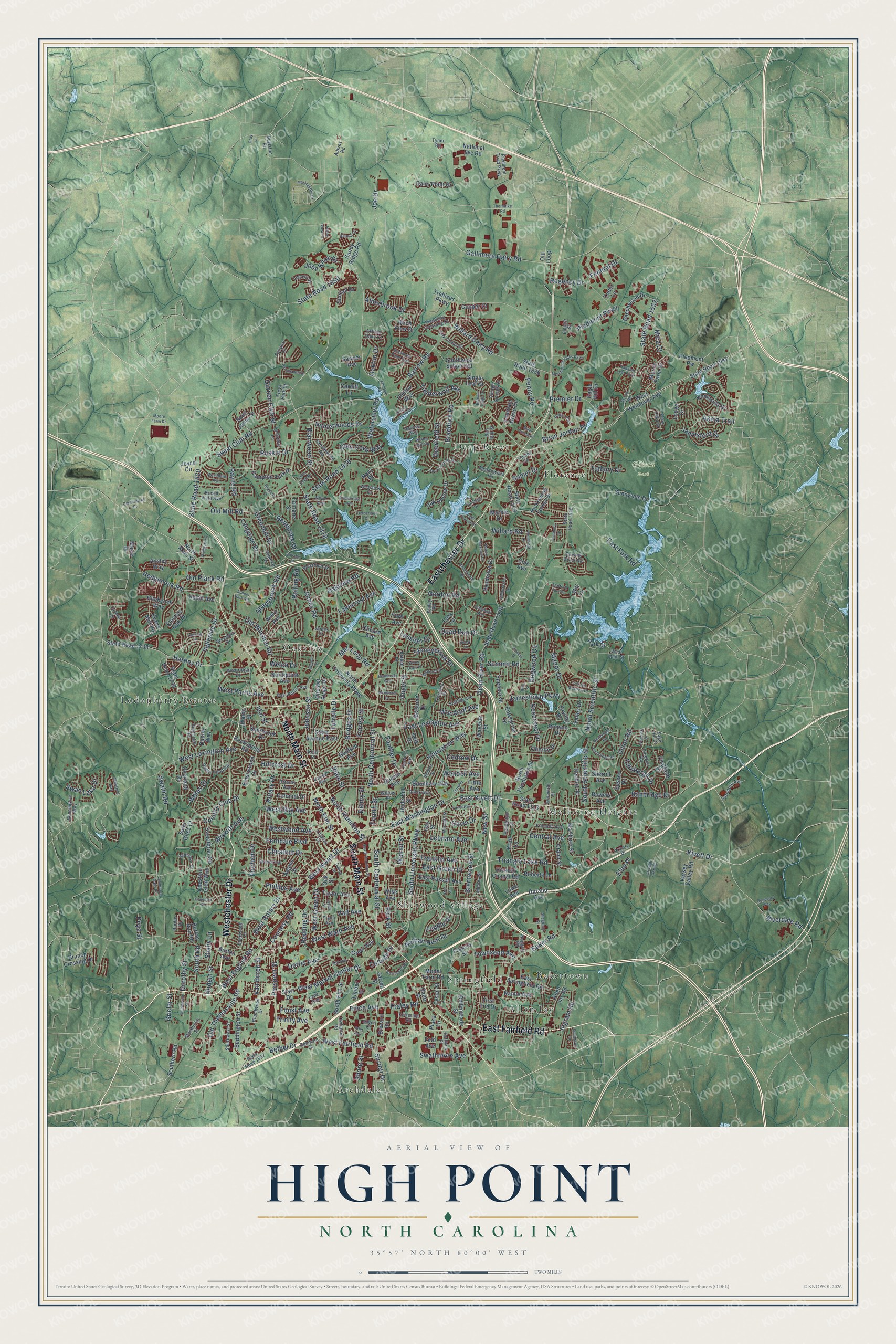
Street and place names on the High Point, North Carolina map
These names are printed on the map of High Point, North Carolina.
Places: Gibson Park, Archdale, Oakview, Melborne Heights, Allen Jay, Lodonberry Estates, Deep River, Springfield, Sherwood Village, Bakertown and Florence.
Streets and roads: Westchester Drive, East Fairfield Road, Eastchester Drive, North Main Street, South Main Street, East Kivett Drive, West Green Drive, South University Parkway, West English Road, West Market Center Drive, Dillon Road, Triangle Lake Road.
More street names, A to Z
Adams Street, Adkins Road, Akela Trail, Alamar Drive, Alderbrook Drive, Alleghany Street, Allen Jay Road, Anchoridge Avenue, Ansley Way, Arch Street, Arden Place, Armory Drive, Asbill Avenue, Ashton Oaks Court, Avery Avenue, Avondale Street, Baker Road, Banbridge Drive, Ban Oak Street, Barrow Road, Beacon Ridge Drive, Beaucrest Avenue, Beddington Street, Beechwood Drive, Bellemeade Street, Bennington Way, Bentbrook Drive, Bethel Drive, Birch View Drive, Blain Street, Blairwood Street, Blandwood Drive, Blessing Way, Boundary Avenue, Bowers Avenue, Boylston Road, Braddock Road, Branch Crossing Drive, Brandon Drive, Brentwood Street, Brevard Road, Brian Jordan Place, Briarcliff Drive, Bridges Drive, Buena Vista Avenue, Burton Avenue, Burton Run Road, Cambridge Oaks Drive, Candelar Drive, Cardiff Lane, Carolina Street, Cedrow Drive, Centerpiece Drive, Central Avenue, Chatfield Drive, Chester Ridge Drive, Chestnut Drive, Chestnut Glen Way, Chilton Way, Clinard Avenue, Cole Avenue, College Drive, Colonial Drive, Copper Court, Country Club Drive, Courtesy Road, Coventry Road, Cross Street, Dairy Point Drive, Dalton Street, Dandelion Drive, Dane Street, Davis Avenue, Deep River Road, Deerfield Street, Delk Drive, Delmar Lane, Denny Street, Derby Circle, Dogwood Circle, Dorothy Street, Dorris Avenue, Dunloy Way, Dunmore Court, Durand Avenue, Eagle Hill Drive, Earlham Place, East Fork Road, East Green Drive, East Lexington Avenue, East Parris Avenue, East Russell Avenue, East Springfield Road, East Washington Drive, Edgewood Drive, Edinburgh Drive, Election Oak Drive, Elon Place, Emerywood Drive, Empire Street, Enterprise Drive, Evans Mill Road, Fairlane Street, Fairport Court, Farm Lake Street, Federal Drive, Feld Avenue, Ferndale Boulevard, Finch Avenue, Firethorn Drive, First Tee Drive, Florham Drive, Forrest Street, Fountain Grove Drive, Fourth Street, Foust Avenue, Fraley Road, Francis Street, Franklin Avenue, Freya Park Drive, Friddle Drive, Friendly Avenue, Furniture Avenue, Futrelle Drive, Gallimore Dairy Road, Garden Club Street, Gavin Drive, Glen Cove Way, Gordon Road, Gordon Street, Grand Street, Grantham Drive, Gray Lane, Greenhill Drive, Greer Avenue, Griclar Street, Guilford Avenue, Guyer Street, Hampton Park Drive, Hanging Leaf Point, Hartley Drive, Havasu Way, Hay Street, Heathcliff Road, Hedgecock Road, Hedrick Avenue, Hendrix Street, Hickory Chapel Road, Hickswood Forest Drive, Hillcrest Drive, Hillside Drive, Hitchcock Way, Hodgin Street, Hunterwoods Drive, Idol Street, Imperial Drive, Ingleside Drive, Ingram Road, Inlet Avenue, Innovation Way, Jackson Lake Road, James Court, Jamesford Drive, James Road, Jamestown Parkway, Jarrell Street, Jeffery Lane Point, Joe Drive, John Knox Drive, Johnson Street, Joyce Circle, Kelly Place, Kendale Road, Kenilworth Drive, Kersey Valley Road, Kettering Road, Kivett Drive, Kroll Lane, Ladford Lane, Lakecrest Avenue, Lake Forest Drive, Lamb Avenue, Lamplight Way, Lane Avenue, Langdale Drive, Lansdowne Street, Lassiter Drive, Lazy Lane, Legacy Drive, Leonard Avenue, Lindale Drive, Lindsay Street, Little Avenue, Lodge Drive, Louise Avenue, Lowe Avenue, Lumsden Lane, Maize Drive, Mall Loop Road, Mandustry Street, Manley Street, Manor Drive, Marble Drive, Marblehead Drive, Marlboro Street, McGuinn Drive, Meadowlark Road, Mendenhall Oaks Parkway, Meredith Street, Mica Court, Mill Avenue, Mill Lane, Model Farm Road, Moore Farm Drive, Morris Farm Drive, Mossy Meadow Drive, Mulberry Lane, Nance Avenue, Nathan Hunt Drive, National Svc Road, Navy Place, New Street, Noble View Drive, North Centennial Street, North Elm Street, North Hamilton Street, North Pendleton Street, Northpoint Avenue, Northridge Road, North Scientific Street, North University Parkway, Nova Avenue, Nuggett Road, Oak Chase Drive, Oak Hollow Drive, Oak Street, Oakton Drive, Oakview Road, Oberlin Drive, Olde Eden Drive, Old Loop, Old Mill Road, Old Plank Road, Old Thomasville Road, Old Winston Road, Orville Drive, Otteray Avenue, Overland Drive, Pallas Way, Panther Drive, Park Drive, Park Street, Payne Road, Pendleton Street, Peninsula Drive, Pennfield Way, Penny Road, Phillips Avenue, Piedmont Crossing Drive, Piedmont Parkway, Piedmont Pw, Piedmont Triad Parkway, Pineburr Road, Plaza Lane, Pondhaven Drive, Premier Drive, Priya Street, Prospect Street, Quail Run Drive, Qubein Avenue, Queens Grant Road, Radford Street, Recovery Way, Redding Drive, Regency Drive, Rindle Drive, Ring Street, Riverdale Road, Rivermeade Drive, River Pointe Place, Roberts Lane, Robin Hood Road, Rockspring Road, Rolling Road, Rosecrest Drive, Rotary Drive, Runyon Drive, Ruskin Drive, Sage Hill Drive, Saint Giles Court, Saint Johns Street, Samet Drive, Sandlewood Road, Sandy Ridge Road, San Fernando Drive, Sawyer Avenue, School Park Road, Seven Oaks Place, Shadybrook Road, Shady Lane, Shalimar Drive, Sherbrook Drive, Sherrill Avenue, Shore Street, Silver Court, Single Leaf Court, Skeet Club Road, South Centennial Street, South Elm Street, Southern Road, South Hamilton Street, Southpark Drive, Southridge Road, South Road, South Scientific Street, Southwest School Road, Southwest Street, Spencer Street, Splitbrooke Drive, Stafford Run Court, Staley Road, Starfall Drive, Starr Drive, State Avenue East, State Road 1113, State Road 1523, State Road 1538, State Road 1541, State Road 1546, State Road 1552, State Road 1622, State Road 1738, State Road 1739, State Road 1818, State Road 1820, State Road 1829, State Road 1836, State Road 1850, Stoneybrook Drive, Suffolk Avenue, Summit Road, Sunnyvale Drive, Surrett Drive, Sussex Drive, Swaim Road, Swan Lake Drive, Swathmore Avenue, Sweetbriar Road, Sycamore Point Trail, Tarrant Road, Taylor Avenue, Thorndike Road, Timberlane Drive, Timber Street, Timberwolf Avenue, Tinsley Drive, Townsend Avenue, Trellises Parkway, Trinity Avenue, Tryon Avenue, Tudor Lane, Tutbury Drive, Tyner Road, Tyson Street, Underhill Street, Uwharrie Road, Vail Avenue, Valley Drive, Van Buren Street, Vickrey Meadow Drive, Village Springs Drive, Waldo Street, Wales Drive, Walnut Street, Warwick Drive, Waterview Road, Wayside Street, Weavil Street, Welch Drive, Wendell Avenue, Wesseck Drive, West Fairfield Road, Westfield Street, West Kivett Drive, West Lexington Avenue, West Main Street, Westover Drive, West Parris Avenue, West Ray Avenue, Westridge Drive, West Rotary Drive, West Ward Avenue, West Wendover Avenue, Westwood Avenue, Whites Mill Road, Wickliff Avenue, Willard Dairy Road, Willard Road, Willow Place, Wise Avenue, Woodruff Avenue, Wyndham Avenue, Wynnfield Drive, York Avenue.
See the High Point, North Carolina map on a wall
The High Point map as an 18 x 24 inch print in a black frame.

This beautifully detailed map of High Point makes an attractive addition to your office, library, or den, and it can even be used to teach children the geography and history of the area. It also makes a great gift for anyone with High Point roots. When you’re done exploring, click here to get your copy of the High Point map.