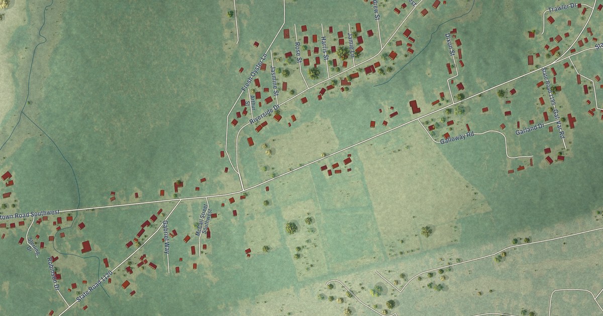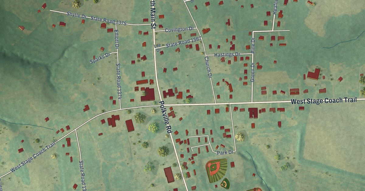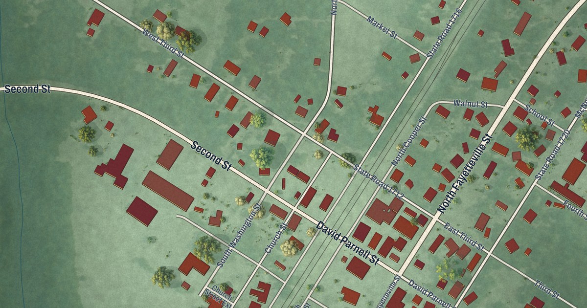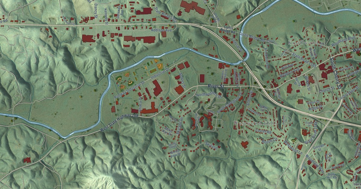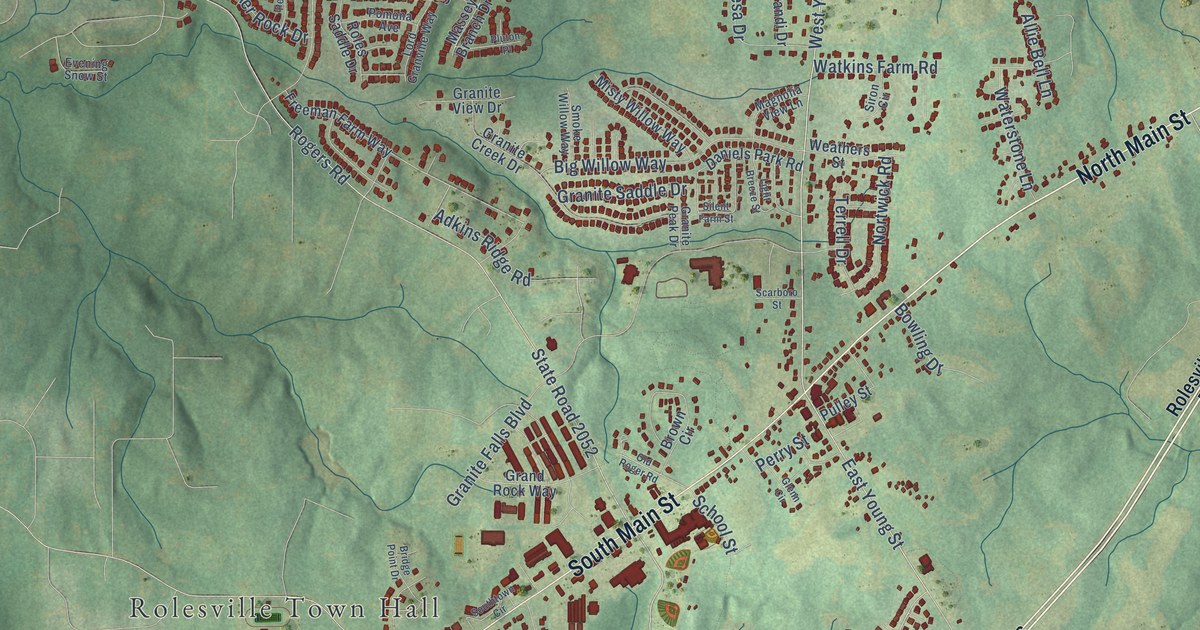
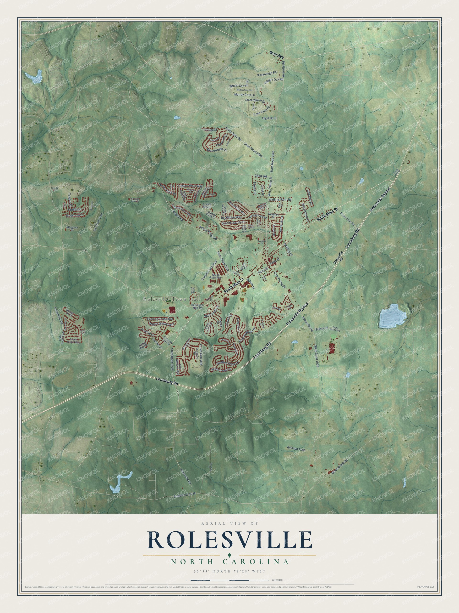
This beautifully detailed map of Rolesville, North Carolina was created in 2026 using aerial imagery combined with modern topographical, census, street and landmark data. It's a modern aerial view of Rolesville in Wake County, North Carolina, that combines modern data with a vintage aesthetic. The roads feature printed names, and if you look closely you can find your exact house accurately shown in its correct location.
Explore an aerial view of Rolesville, North Carolina
On this map you'll find Rolesville Town Hall, Louisburg Road, North Main Street, Rolesville Bypass, South Main Street, Wait Avenue, Virginia Water Drive, West Young Street, Chalk Road, Redford Place Drive, East Young Street, State Road 2052, and more. Each red shape is a building, so zoom in on the preview and look for yours.
Rolesville has a story worth telling. The North Carolina Gazetteer puts it this way: "Rolesville town in E Wake County near the head of Cedar Fork. Settled in the early nineteenth century and named for William Roles, original settler. Inc. 1837; reincorporated 1941."
Rolesville is a town in Wake County. The Census Bureau counted 9,475 people here in 2020.
Take a closer look at the Rolesville map
Names on this map
These names are printed on this map.
Places: Rolesville Town Hall.
Streets and roads: Louisburg Road, North Main Street, Rolesville Bypass, South Main Street, Wait Avenue, Virginia Water Drive, West Young Street, Chalk Road, Redford Place Drive, East Young Street, State Road 2052, Jonesville Road.
More street names, A to Z
Adkins Ridge Road, Allie Bell Lane, Amazon Trail, Ashbrittle Drive, Averette Road, Beaver Tan Court, Bendemeer Lane, Bessie Court, Big Willow Way, Bowling Drive, Brandi Drive, Bridge Point Drive, Brown Circle, Brownwich Street, Burlington Mills Road, Character Drive, Corner Rock Drive, Creek Pine Drive, Cristobal Street, Daniels Park Road, Duke Farm Drive, Edgefield Drive, Evening Shade Avenue, Evening Snow Street, Flash Drive, Forestville Road, Foxwild Lane, Freeman Farm Way, Friesan Way, Glenn Circle, Grand Rock Way, Granite Creek Drive, Granite Falls Boulevard, Granite Peak Drive, Granite Saddle Drive, Granite View Drive, Green Drake Way, Green Turret Drive, Gro-Peg Lane, Hampton Lake Drive, Hares Ear Court, Heswall Court, Irina Drive, Ivy Creek Trail, Jersey Pine Drive, Jones Dairy Road, Kavanaugh Road, Kew Gardens Way, Lawson Walk Way, Light Breeze Street, Littleport Drive, Lonnie Drive, Lord Granville Way, Mackinaw Drive, Magnolia View Lane, Margrave Drive, Marthas View Way, Massey Branch Drive, Middle Ground Avenue, Misty Willow Way, Mitchell Mill Road, Murray Grey Lane, Myrna Lane, Nortwick Road, Old Roger Road, Peaslake Court, Peeler Court, Perry Street, Pluton Place, Pomona Avenue, Prides Crossing, Pristine Lane, Pulley Street, Pulley Town Road, Quarry Road, Rogers Road, Roles Saddle Drive, Rolesville Road, Scarboro Street, School Street, Shadowdale Lane, Shefford Town Drive, Shingle Oak Road, Silent Farm Street, Siron Circle, Smoke Willow Way, Southtown Circle, Staples Drive, State Road 1003, State Road 1945, State Road 2049, State Road 2053, State Road 2224, State Road 2226, State Road 2305, Stone Fly Drive, Strathwood Way, Sweetclover Drive, Teague Street, Teresa Drive, Terrell Drive, Toledo Court, Tortuga Street, Wall Creek Drive, Waterstone Lane, Watkins Farm Road, Weathers Street, Winter Spring Drive, Yardley Drive.
Created by KNOWOL in 2026. The buildings are small red shapes, the roads carry their printed names, and shaded relief shows the shape of the land. The title panel reads "AERIAL VIEW OF ROLESVILLE NORTH CAROLINA" with 35°55' NORTH 78°28' WEST.
It looks right in a kitchen, an office or a den, and it's a gift for anyone who grew up in Rolesville or moved away. Open the preview and find your street. See sizes and frames for the Rolesville map.