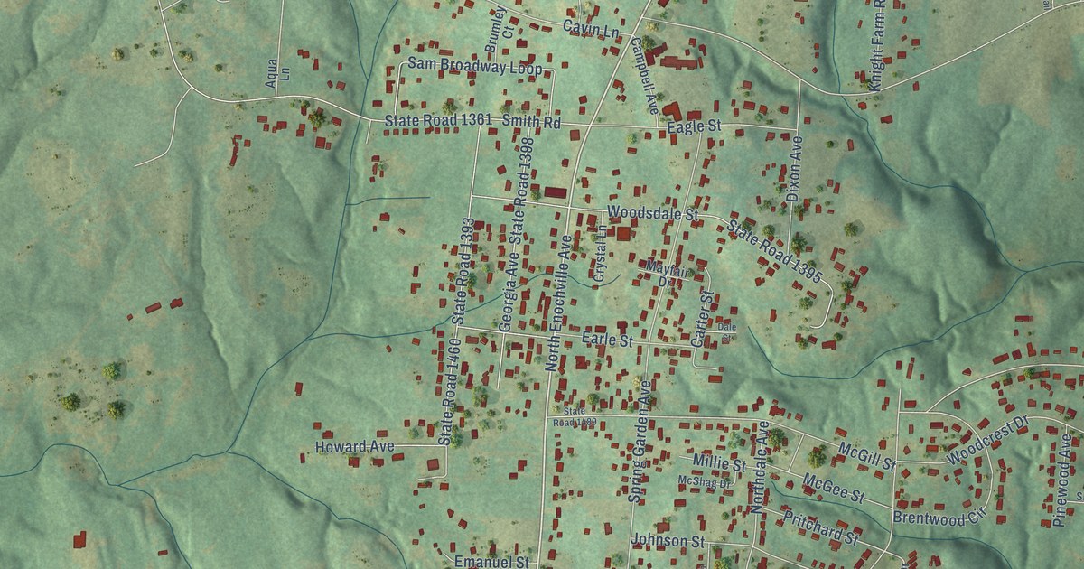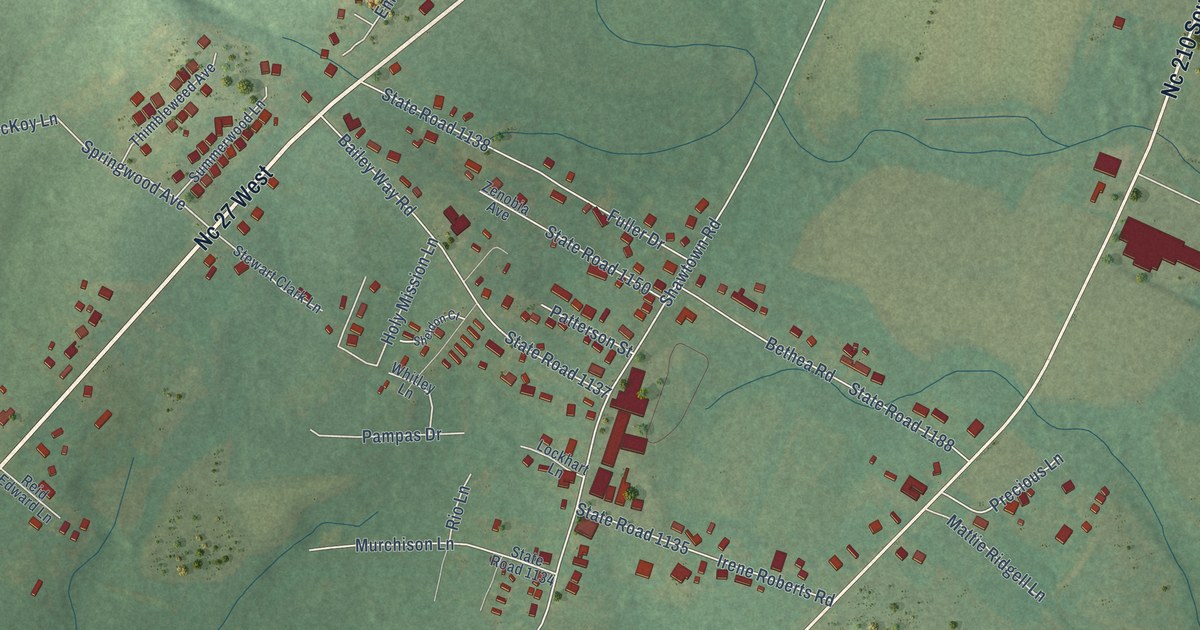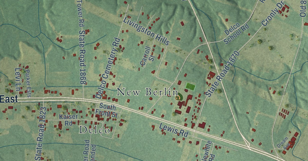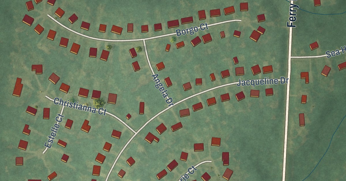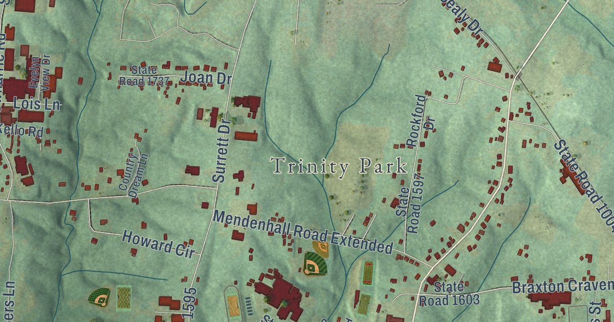
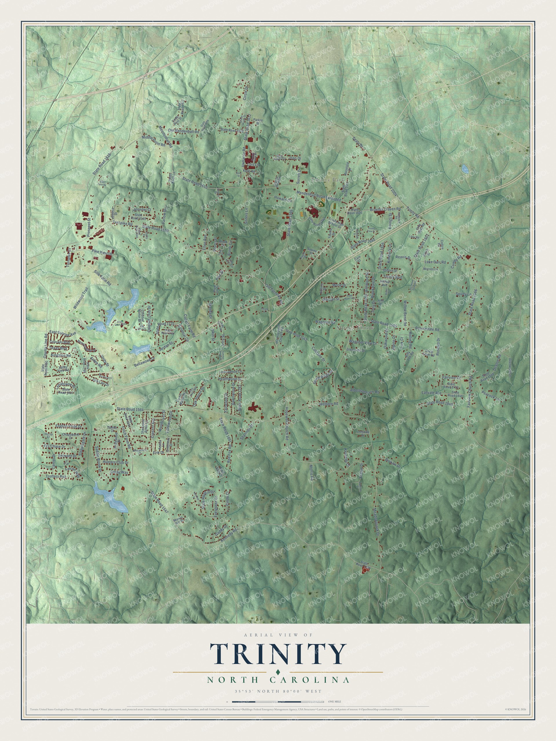
This beautifully detailed map of Trinity, North Carolina was created in 2026 using aerial imagery combined with modern topographical, census, street and landmark data. It’s a one-of-a-kind view of Trinity that combines accurate data with a vintage aesthetic. The map shows every building in its true location, many of the roads carry their names, and the shaded topographic relief shows the shape of the land.
Explore an aerial view of Trinity, North Carolina
On the map you’ll find Trinity Park and Stones Throw, along with County Line Road, State Road 1564, State Road 1547, Cresent Avenue, Surrett Drive, Braxton Craven Road, Brookdale Drive, State Road 1558, Meadowbrook Drive, Hopewell Church Road, and more. If you look closely you can even find your house accurately drawn in its correct location. Zoom in on the preview to look for yours.
Did you know this piece of Trinity, North Carolina history?
From NCpedia: "Trinity College, established in 1838, moved to Durham in 1892 and became Duke University."
Take a closer look at the Trinity map
Street and place names on the Trinity, North Carolina map
These names are printed on the map of Trinity, North Carolina.
Places: Trinity Park and Stones Throw.
Streets and roads: County Line Road, State Road 1564, State Road 1547, Cresent Avenue, Surrett Drive, Braxton Craven Road, Brookdale Drive, State Road 1558, Meadowbrook Drive, Hopewell Church Road, Turnpike Road, Welborn Road.
More street names, A to Z
Albertson Farm Road, Alpine Drive, Anne Street, Arden Road, Ascot Drive, Azalea Lane, Bellawood Drive, Belmont Drive, Billy Lee Road, Blair Farm Road, Bridlewood Drive, Brokaw Drive, Brook Circle, Brook Street, Brown Street, Cain Court, Canter Drive, Cedar Post Street, Chapsworth Drive, Circle Court, Circle Drive, Collett Farm Road, Collins Street, Colonial Circle, Colonial Club Drive, Colonial Manor Drive, Colorado Boulevard, Coltrane Street, Cotton Road, Country Dream Lane, Crotts Drive, Cumby Road, Darr Road Extended, Dawnwood Drive, Deaton Road, Deerwood Lane, Derby Way, Dwight Street, East Sunrise Avenue, Ellen Avenue, Elmwood Street, English Pride Drive, Erik Drive, Evelyn Drive, Evelyn View Drive, Evergreen Drive, Ewings Street, Fairview Church Road, Fairview Court, Fairwood Drive, Falcon Way, Farlow Street, Finch Farm Road, Forest Manor Drive, Fox Chase Drive, Gaddy Drive, Glennville Drive, Gra Lan Drive, Green Acres Drive, Greenway Drive, Grey Oaks Road, Grove Street, Haywood Road, Heathwood Drive, Hilltop Avenue, Howard Circle, Hunters Club Drive, Hunts Knoll Lane, Irwin Street, Jennifer Court, Jerry Street, Jessica Drive, Joan Drive, John Drive, Jordan Street, Kello Road, Kennedy Court, Kennedy Road, Kimberly Lane, Kingston Road, Lake Darr Road, Lakewood Circle, Lansdowne Place, Lanvale Avenue, Lawson Drive, Leesville Street, Libby Road, Link Court, Lois Lane, Lowerywood Circle, Maple Oak Drive, Marvin Hill Place, Meadow Drive, Mendenhall Road, Mendenhall Road Extended, Merle Drive, Meyers Street, Middle Point Road, Morgan Street, Morris Road, Oak Haven Drive, Oak Knoll Court, Oakwood Drive, Old Hopewell Church Road, Old Mendenhall Road, Old Turnpike Road, Oneal Farm Road, Osborn Street, Parker Street, Payne Street, Peacock Lane, Pike Street, Pike View Drive, Prospect Street, Reavis Street, Red Fox Road, Regalwood Court, Rock Dam Court, Rockford Drive, Rolling Road, Ronniedale Road, Rosedale Street, Roselee Drive, Sabine Street, Saddle Brook Drive, Sealy Drive, Shadydale Acres Lane, Shannon Drive, Sherrie Drive, Sink Farm Road, Sisters Lane, Spivey Lane, State Road 1004, State Road 1560, State Road 1563, State Road 1565, State Road 1566, State Road 1568, State Road 1595, State Road 1597, State Road 1603, State Road 1607, State Road 1610, State Road 1612, State Road 1616, State Road 1617, State Road 1619, State Road 1640, State Road 1641, State Road 1651, State Road 1656, State Road 1679, State Road 1731, State Road 1732, State Road 1737, State Road 1748, State Road 1752, State Road 1761, State Road 1786, State Road 1830, State Road 1840, State Road 1846, State Road 1848, State Road 1854, State Road 1857, State Road 1885, State Road 1891, State Road 1899, State Road 2051, State Road 3106, State Road 3107, State Road 3149, Steeplegate Drive, Stirrup Court, Stone Gables Drive, Stone Ridge Drive, Summer Shade Drive, Tanner Court, Texas Boulevard, Tony Drive, Trinity Boulevard, Trinity Court, Trinity High School Drive, Trinity Road, Trotters Run, Turnpike Court, Unity Street, Uwharrie Road, Valley View Road, Wagoner Road, Wagoner View Drive, Wanda Drive, Warren Lane, Wheatmore Court, Wildwood Trail, Willow Bend Road, Woodcrest Street, Younts Street, Younts View Drive.
See the Trinity, North Carolina map on a wall
The Trinity map as an 18 x 24 inch print in a black frame.

This beautifully detailed map of Trinity makes an attractive addition to your office, library, or den, and it can even be used to teach children the geography and history of the area. It also makes a great gift for anyone with Trinity roots. When you’re done exploring, click here to get your copy of the Trinity map.