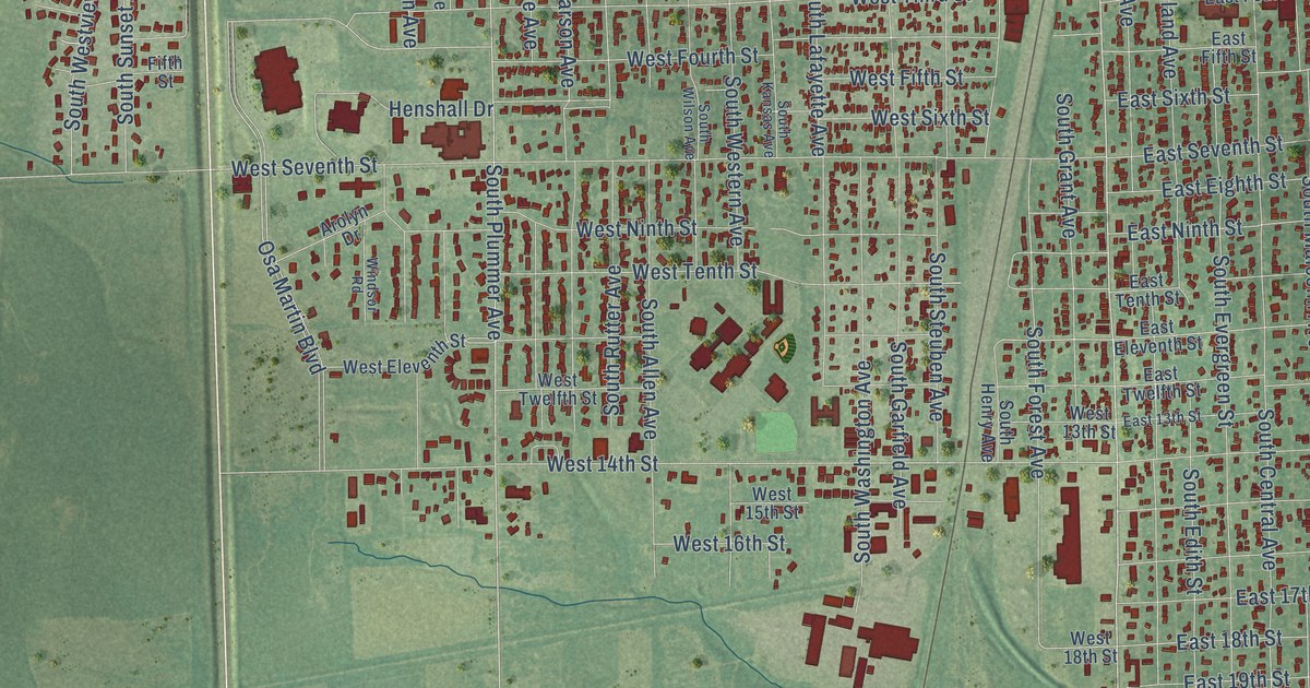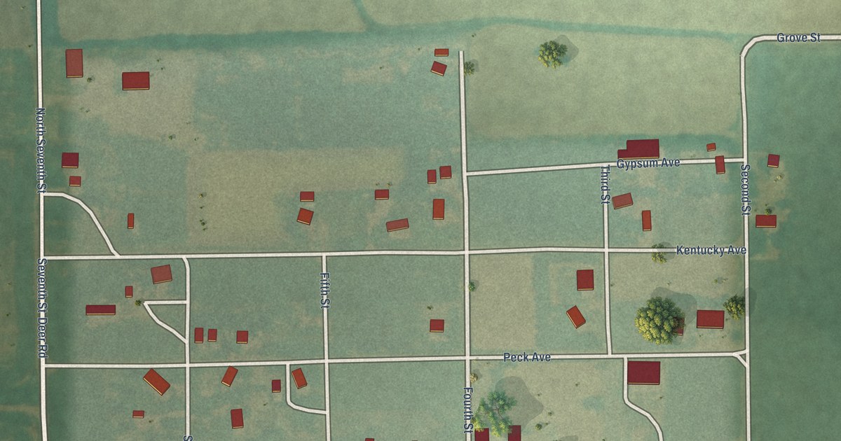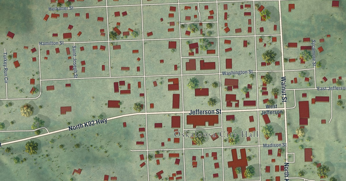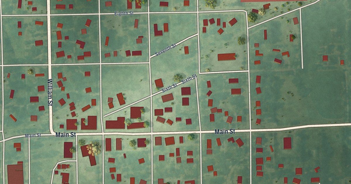
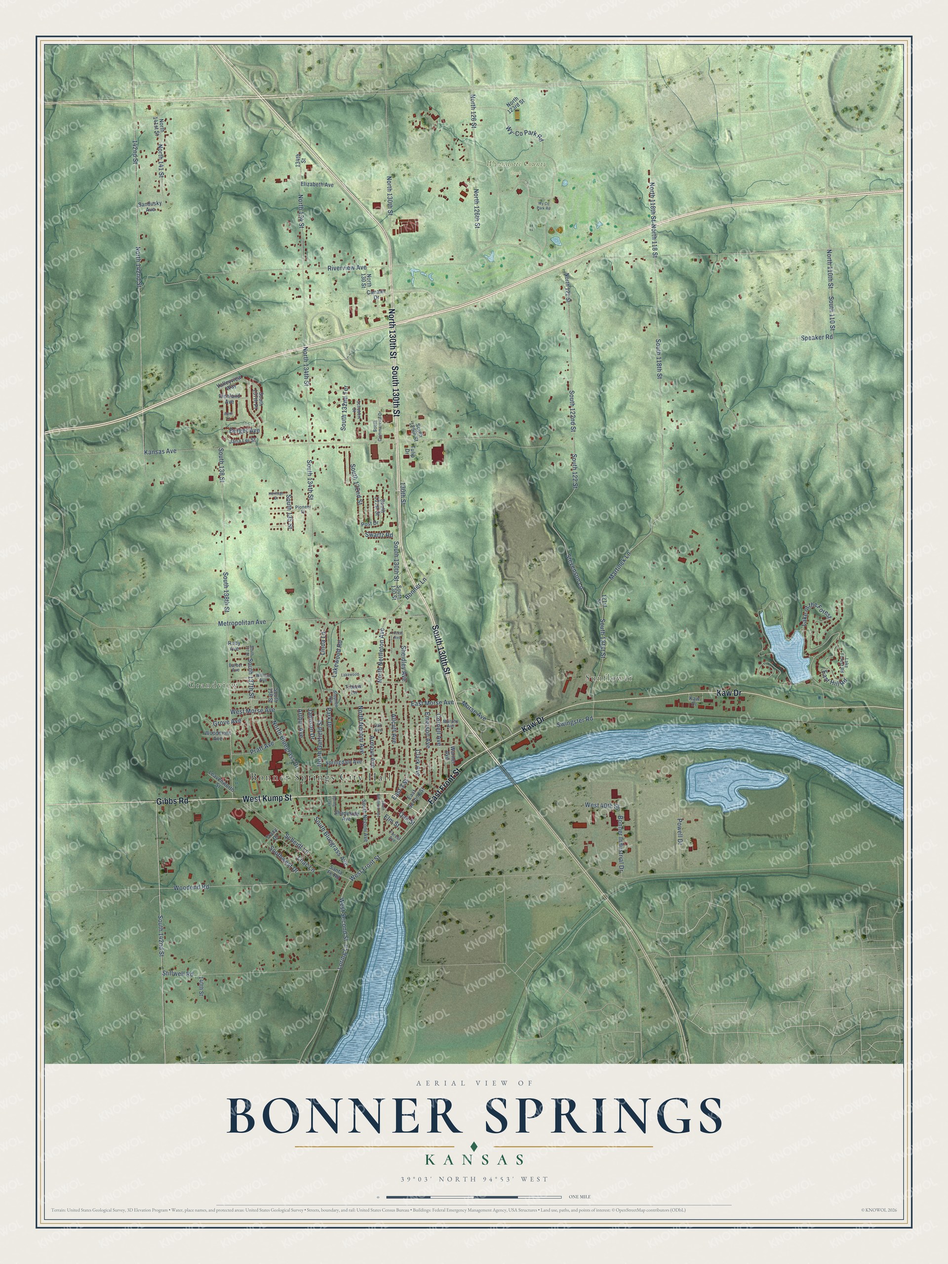
This beautifully detailed map of Bonner Springs, Kansas was created in 2026 using aerial imagery combined with modern topographical, census, street and landmark data. It's a modern aerial view of Bonner Springs in Wyandotte County, Kansas, that combines modern data with a vintage aesthetic. The roads feature printed names, and if you look closely you can find your exact house accurately shown in its correct location.
Explore an aerial view of Bonner Springs, Kansas
On this map you'll find Bonner Springs City Hall, Grandview, Sunflower, Wyandotte County Park, West Kump Street, South 130th Street, Gibbs Road, North 130th Street, Kaw Drive, East Front Street, West Front Street, Lake of the Forest, and more. Each red shape is a building, so zoom in on the preview and look for yours.
Bonner Springs has a story worth telling. The Kansas Cyclopedia of State History puts it this way: "Since the springs have been made an important suburban resort for Kansas City, the place has been renamed in honor of Robert Bonner and is now called Bonner Springs."
Bonner Springs is a city in Wyandotte County. The Census Bureau counted 7,837 people here in 2020.
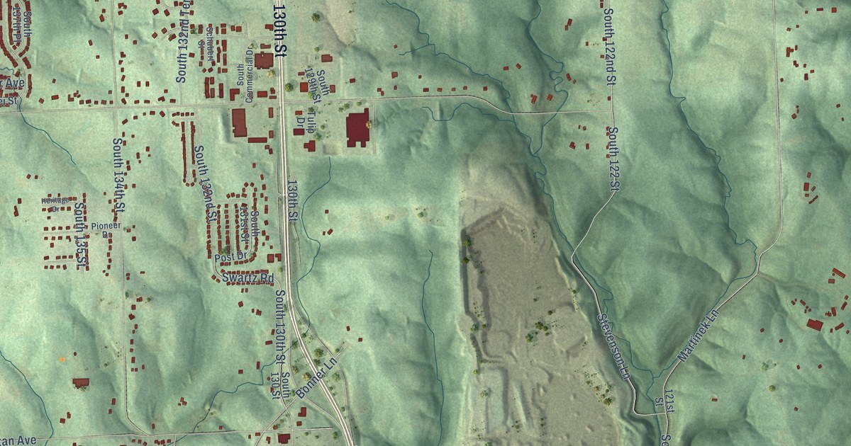
Take a closer look at the Bonner Springs map
Names on this map
These names are printed on this map.
Places: Bonner Springs City Hall, Grandview, Sunflower and Wyandotte County Park.
Streets and roads: West Kump Street, South 130th Street, Gibbs Road, North 130th Street, Kaw Drive, East Front Street, West Front Street, Lake of the Forest, Wy-Co Park Road, Martinek Lane, South 118th Street, South 121st Street.
More street names, A to Z
121st Street, 130th Street, 134th Street, 140th Street, 142nd Street, Allcutt Avenue, April Lane, Armour Avenue, Arthur Avenue, Barber Avenue, Berger Avenue, Bonner Industrial Drive, Bonner Lane, Canaan Drive, Clark Avenue, Cornell Avenue, East 3 Street, East Hill Road, East Morse Avenue, East Second Street, Elizabeth Avenue, Elm Street, Emerson Avenue, Forest Avenue, Grove Avenue, Heritage Drive, Jamison Drive, Jana Lei Street, Kansas Avenue, Lake Forest Road, Lakewood, Lakewood Road, Leavenworth Street, Lilac Lane, Linda Lane, Locust Avenue, Loring Lane, Metropolitan Avenue, Morse Avenue, Murphy Avenue, North 110th Street, North 118 Street, North 118th Street, North 122 Street, North 123rd Street, North 126 Street, North 126th Street, North 130 Street, North 134 Street, North 134th Street, North 141 Street, North 141st Street, North 142nd Street, North Bluegrass Drive, North Garfield Street, North Neconi Avenue, North Nettleton Avenue, Oak Avenue, Oak Street, Park Drive, Pioneer Drive, Post Drive, Powell Drive, Pratt Avenue, Richland Avenue, Riverview Avenue, Ruby Avenue, Sandusky Avenue, Santa Fe Road, Scheidt Lane, Schubert Street, Shadyside Avenue, Sheidley Avenue, South 110 Street, South 122 Street, South 122nd Street, South 129th Street, South 130 Street, South 131st Street, South 132nd Street, South 132nd Terrace, South 134th Street, South 135 Street, South 136 Street, South 137 Street, South 137th Place, South 137th Street, South 138 Street, South 138th Street, South 142nd Street, South Bluegrass Avenue, South Commercial Drive, South Neconi Avenue, South Nettleton Avenue, Southwest Drive, Speaker Road, Springdale Avenue, Spring Valley, Stephen Avenue, Stevenson Lane, Stillwell Road, Swartz Road, Swingster Road, Tiblow Lane, Tracy Drive, Tulip Drive, Valleyview Way, Warner Avenue, West 40th Street, West Morse Avenue, West Second Street, Willard Avenue, Woodend Road, Woodmont Avenue, Wy Co Park Road.
Created by KNOWOL in 2026. The buildings are small red shapes, the roads carry their printed names, and shaded relief shows the shape of the land. The title panel reads "AERIAL VIEW OF BONNER SPRINGS KANSAS" with 39°03' NORTH 94°53' WEST.
It looks right in a kitchen, an office or a den, and it's a gift for anyone who grew up in Bonner Springs or moved away. Open the preview and find your street. See sizes and frames for the Bonner Springs map.