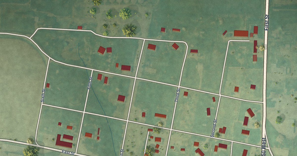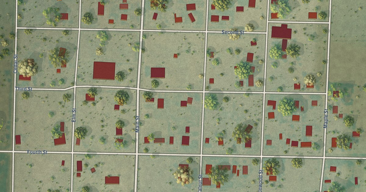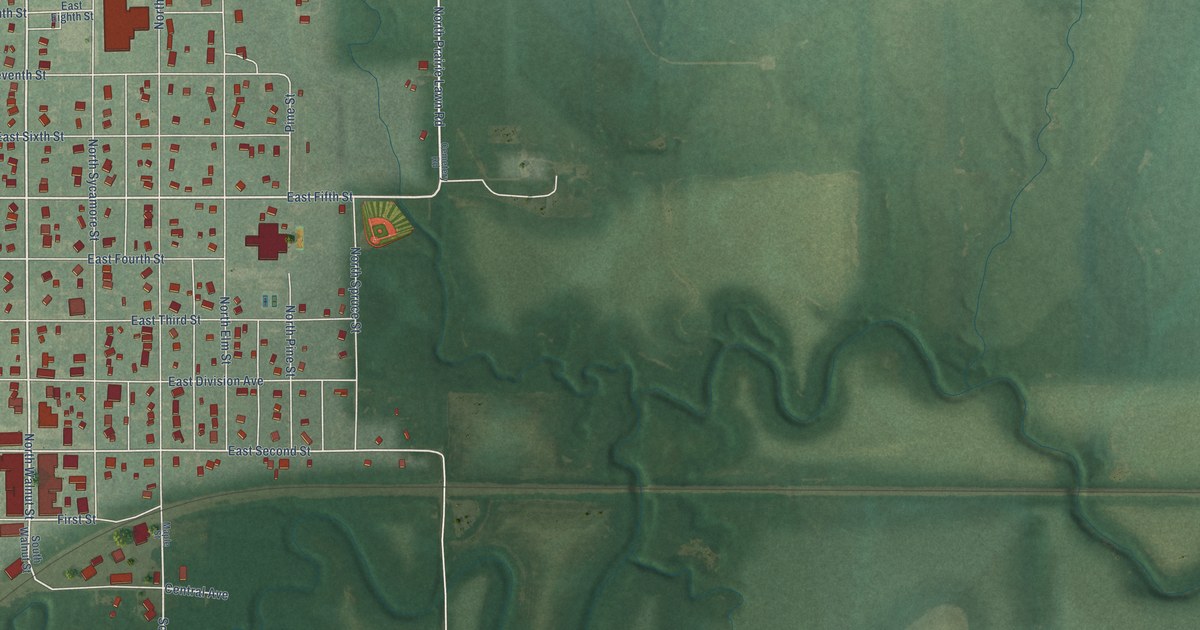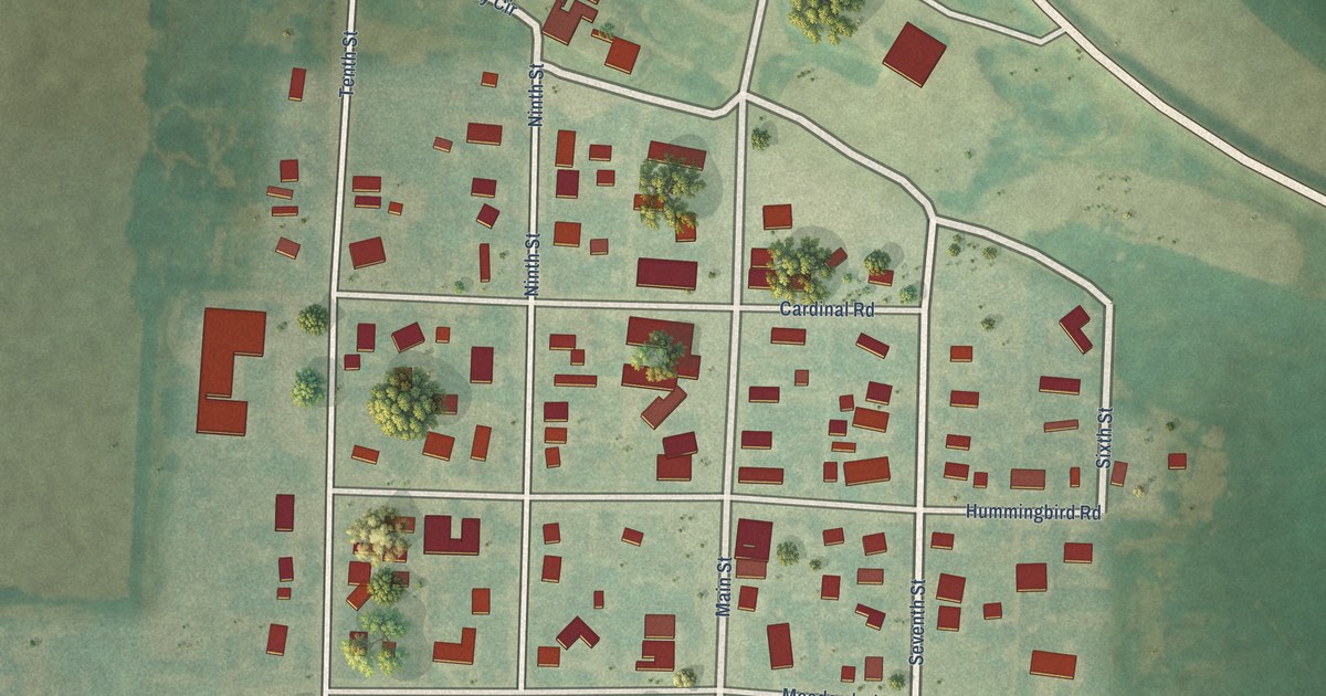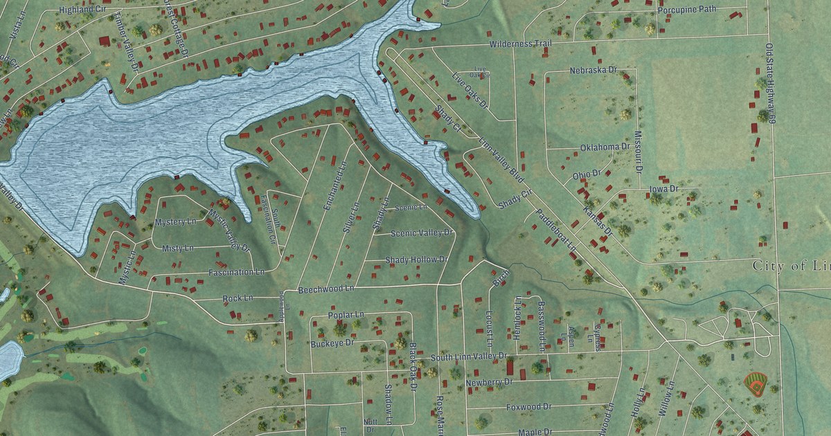
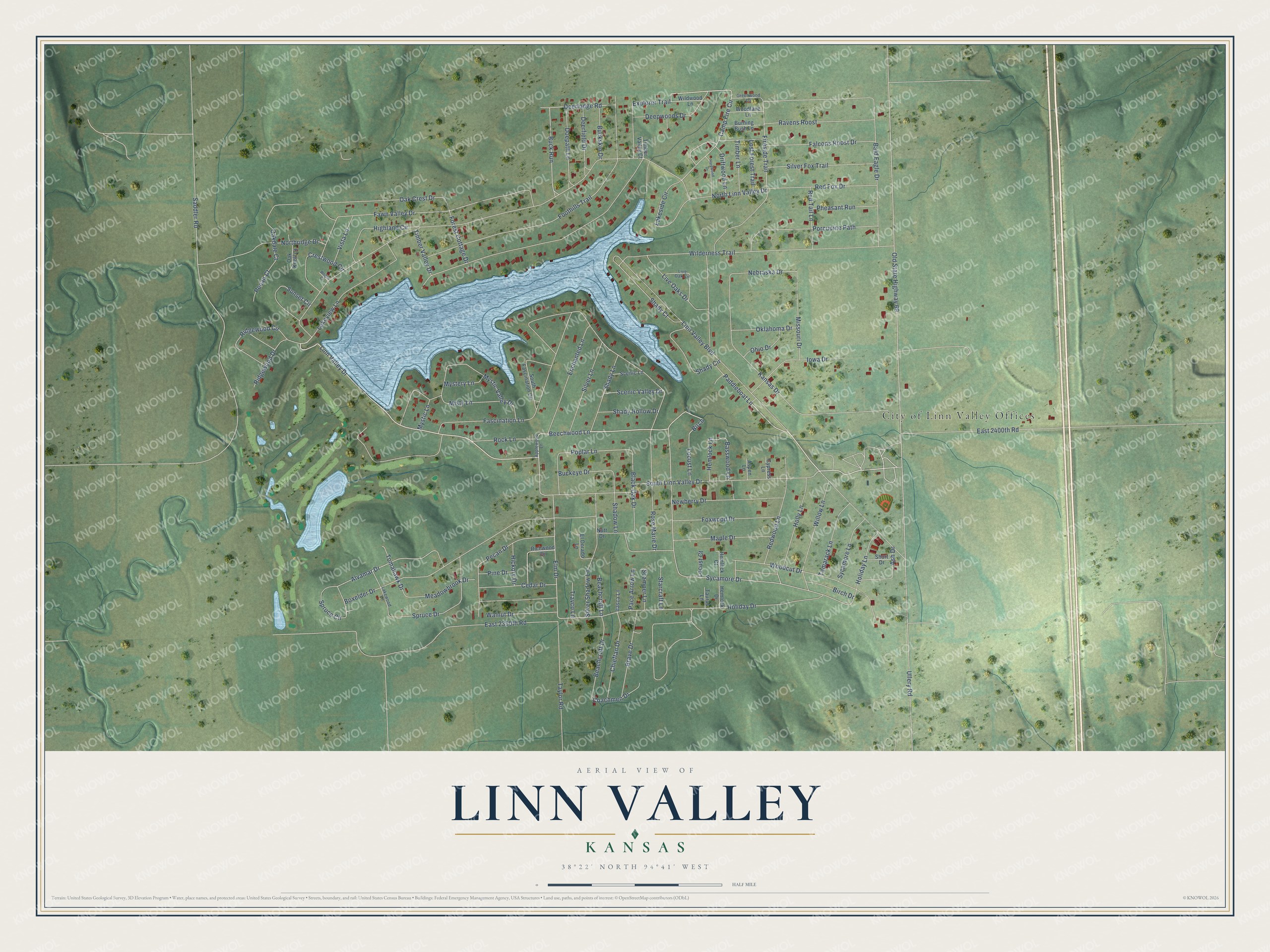
This beautifully detailed map of Linn Valley, Kansas was created in 2026 using aerial imagery combined with modern topographical, census, street and landmark data. It's a modern aerial view of Linn Valley in Linn County, Kansas, that combines modern data with a vintage aesthetic. The roads feature printed names, and if you look closely you can find your exact house accurately shown in its correct location.
Explore an aerial view of Linn Valley, Kansas
On this map you'll find City of Linn Valley Offices, South Linn Valley Drive, Beechwood Lane, Paddleboat Lane, Linn Valley Drive, Birch, Camp Fire Circle, Elm Drive, Buck Run, Sycamore Drive, Fireside Trail, Alvamar Drive, and more. Each red shape is a building, so zoom in on the preview and look for yours.
Linn Valley is a city in Linn County. The Census Bureau counted 956 people here in 2020. The map prints the town name in its title panel, with the coordinates below it.
Take a closer look at the Linn Valley map
Names on this map
These names are printed on this map.
Places: City of Linn Valley Offices.
Streets and roads: South Linn Valley Drive, Beechwood Lane, Paddleboat Lane, Linn Valley Drive, Birch, Camp Fire Circle, Elm Drive, Buck Run, Sycamore Drive, Fireside Trail, Alvamar Drive, Poplar Lane.
More street names, A to Z
Applewood Lane, Ash Drive, Aspen Lane, Bald Eagle Drive, Basswood Lane, Beachcraft Drive, Beachcraft Lane, Birch Drive, Black Oak Drive, Boxelder Drive, Brave Drive, Buckeye Drive, Buckskin Drive, Burning Bush Lane, Cedar Drive, Chieftan Drive, Coachmen Drive, Crestwood Circle, Cypress Lane, Deepwoods Drive, Deerfield Drive, Deerlodge Road, Doepath Lane, Driftwood Lane, East 2350th Road, East 2400th Road, El Dorado Lane, Enchanted Lane, Explorer Trail, Falcons Roost Drive, Fascination Lane, Fawn Valley Drive, Foothills Trail, Forest Cottage Drive, Foxwood Drive, Greenwood Lane, Hardwood Drive, Hemlock Court, Hemlock Drive, Hemlock Lane, Hickory Drive, Highland Circle, Holiday Drive, Holiday Lane, Holly Lane, Iowa Drive, Itasca Lane, Kansas Drive, Lakeside Circle, Lakeview Lane, Lakewood Lane, Linn Valley Boulevard, Live Oak Circle, Live Oaks Drive, Locust Court, Locust Lane, Lost Forest Trail, Maple Drive, Meadowbrook Drive, Missouri Drive, Misty Lane, Mystery Lane, Mystic Lane, Mystic Valley Drive, Nebraska Drive, Newberry Drive, North Linn Valley Drive, Northridge Drive, Nutt Drive, Oak Crest Drive, Oakdale Court, Oak Knoll Court, Ohio Drive, Oklahoma Drive, Old State Highway 69, Pace Arrow Lane, Pecan Court, Pecan Drive, Pheasant Run, Pine Drive, Porcupine Path, Ravens Roost, Red Fox Drive, Red Tail Lane, Redwood Lane, Richwood Drive, Ridgewood Circle, Ridgewood Drive, Rock Lane, Rose Marie Drive, Saddler Road, Scamper Lane, Scenic Lane, Scenic Valley Drive, Shadow Lane, Shady Circle, Shady Court, Shady Hollow Drive, Shady Lane, Short Drive, Silver Fox Trail, Silver Lane, Silver Shadow Lane, South Fascination Circle, Spruce Circle, Spruce Drive, Starcraft Lane, Sunset Circle, Sycamore Lane, Tamarack Lane, Taurus Lane, Taylor Road, Timber Lane, Timber Valley Court, Timber Valley Drive, Tomahawk Drive, Travco Lane, Ullery Road, Vista Lane, Walnut Drive, Wilderness Trail, Wildwood Lane, Willow Lane, Woodcut Drive, Woodlane Lane, Wright Court.
Created by KNOWOL in 2026. The buildings are small red shapes, the roads carry their printed names, and shaded relief shows the shape of the land. The title panel reads "AERIAL VIEW OF LINN VALLEY KANSAS" with 38°22' NORTH 94°41' WEST.
Hang it in the hallway, the office or the cabin, or give it to someone who left Linn Valley and still calls it home. Open the preview and look for a street you know. See sizes and frames for the Linn Valley map.