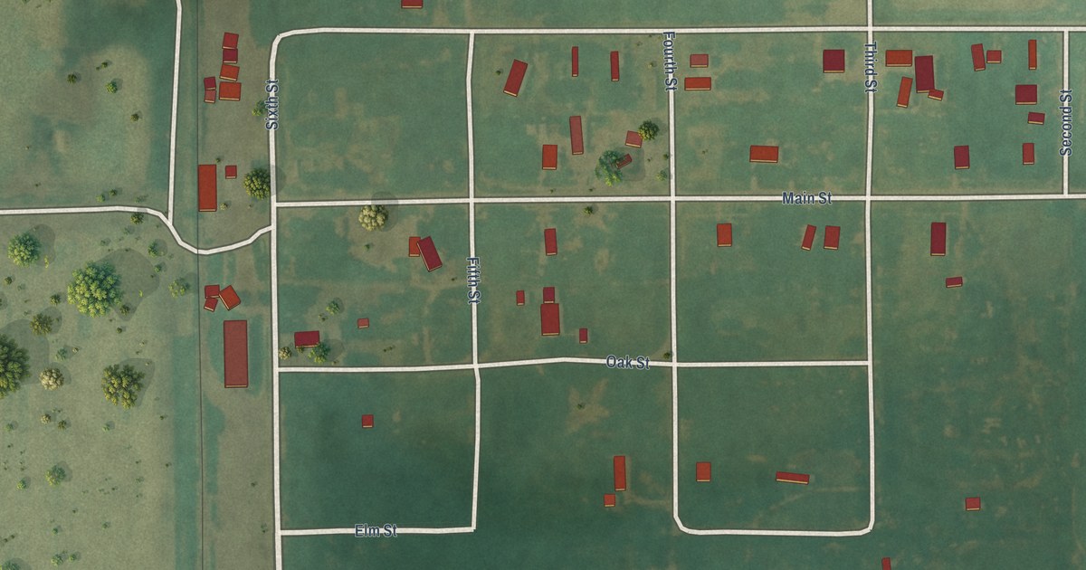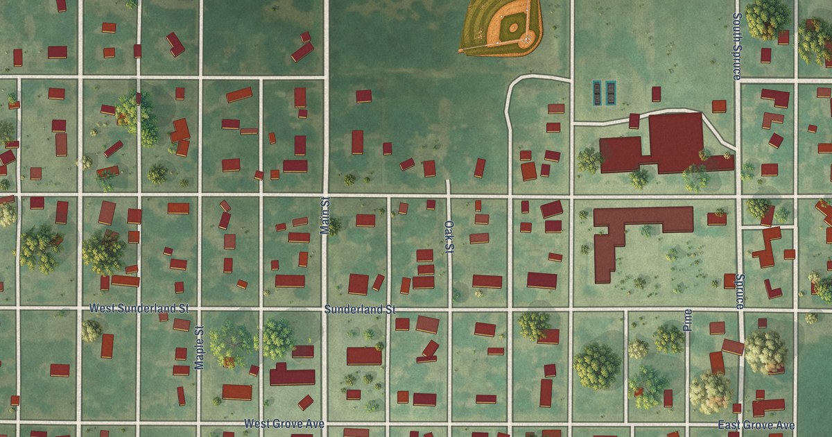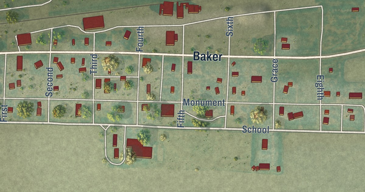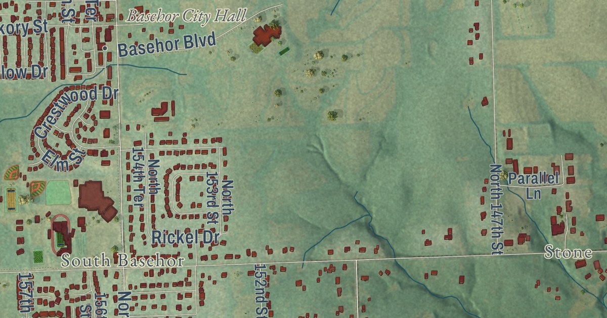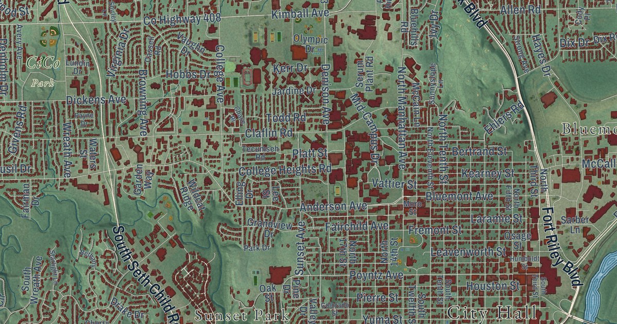
This beautifully detailed map of Manhattan, Kansas was created in 2026 using aerial imagery combined with modern topographical, census, street and landmark data. It’s a one-of-a-kind view of Manhattan that combines accurate data with a vintage aesthetic. The map shows every building in its true location, many of the roads carry their names, and the shaded topographic relief shows the shape of the land.
Explore an aerial view of Manhattan, Kansas
On the map you’ll find City Hall, Bluemont Hill, Sunset Park, CiCo Park, Warner Memorial Park, and Rc-408, along with Fort Riley Boulevard, North Scenic Drive, Tuttle Creek Boulevard, North Seth Child Road, Wildcat Creek Road, South Seth Child Road, and more. If you look closely you can even find your house accurately drawn in its correct location. Zoom in on the preview to look for yours.
Did you know this piece of Manhattan, Kansas history?
From the Kansas Cyclopedia of State History: "In June of the same year a company of 75 persons from Cincinnati, who had come to Kansas for the purpose of establishing a town the name of which should be Manhattan, appeared on the scene. They were given half of the town site of Boston as an inducement to locate at that point, and the name was changed to Manhattan."
Take a closer look at the Manhattan map
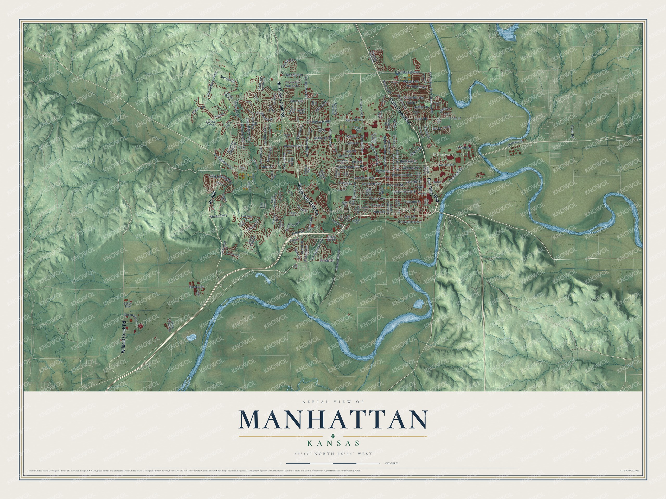
Street and place names on the Manhattan, Kansas map
These names are printed on the map of Manhattan, Kansas.
Places: City Hall, Bluemont Hill, Sunset Park and CiCo Park.
Streets and roads: Fort Riley Boulevard, Rc-408, Wildcat Creek Road, Tuttle Creek Boulevard, North Seth Child Road, South Seth Child Road, Bluemont Avenue, Kimball Avenue, Anderson Avenue, Frontage Road, Poyntz Avenue, North Manhattan Avenue.
More street names, A to Z
Agronomy Field Road, Allen Road, Allison Avenue, Alta Drive, Amherst Avenue, Anneberg Circle, Anneberg Drive, Arbor Drive, Avery Avenue, Bamblewood Drive, Bertrand Street, Bethany, Bluehills Road, Brockman Street, Brookville Drive, Browning Avenue, Butterfield Road, Casement Road, Cassell Road, Chase Place, Cherry Hill, Claflin Road, Cody Place, Colbert Hills Drive, College Avenue, College Heights Road, Colorado Street, Corporate Drive, County Highway 408, County Highway 412, County Highway 418, County Highway 899, County Highway 903, County Highway 905, Cox Circle, Davis Drive, Deakon Drive, De Hoff Drive, Denholm Drive, Denison Avenue, Dickens Avenue, Dix Drive, Dix Road, Drake Drive, Dunbar Road, East Marlatt Avenue, Ehlers Road, Elling Drive, Elm Lane, Englewood Street, Eureka Drive, Eureka Terrace, Everett Drive, Excel Road, Fairchild Avenue, Fair Lane, Fairman Drive, Flint Hills Place, Fossilridge Circle, Fremont Street, Garden Way, Gary Avenue, Geneva Drive, Givens Road, Goodrich Drive, Grand Mere Parkway, Grand Ridge Court, Grandview Drive, Griffith Drive, Hanly Street, Hawthorne Woods Circle, Hayes Drive, Heartland Drive, Highland Ridge Drive, Hillview Drive, Hobbs Drive, Houston Street, Hudson Avenue, Humboldt Street, Hunter Drive, Ivy Drive, James Avenue, Jardine Drive, Kates Court, Kearney Street, Kerr Drive, Knox Lane, Lamonte Drive, Laramie Street, Laussac Drive, Leavenworth Street, Lee Street, Leone Ridge Drive, Levee Drive, Lisa Lane, Little Kitten Avenue, Loma Ridge, Lundin Drive, Marlatt Avenue, McCain Lane, McCall Road, Meadowlark Road, Merced Drive, Mid-Campus Drive, Miller Parkway, Mission Avenue, Moro Street, Musil Drive, Newbury Street, North 14th Street, North 17th Street, North Eleventh Street, Northfield Road, North Fifth Street, North Tenth Street, North Third Street, Oak Street, Olympic Drive, Osage Street, Overhill Road, Park Drive, Parker Drive, Payne Drive, Pierre Street, Pine Drive, Platt Street, Players Drive, Plymouth, Plymouth Road, Poliska Lane, Positano Drive, Potomac Crossing, Pottawatomie Avenue, Purple Aster Place, Rosencutter Road, Sarber Lane, Seaton Avenue, Serum Plant Road, Shelle Road, Sherry Place, Shirley Lane, Shuss Road, South Airport Road, South Tenth Street, South Third Street, South Twelfth Street, South Wreath Avenue, Spain Drive, Stagg Hill Road, Starlight Lane, Stone Drive, Strong Avenue, Sumac Drive, Sunnyside Drive, Sunnyslope Lane, Sunset Avenue, Sykes Boulevard, Tatarrax Drive, Tecumseh Road, Todd Road, Tuttle Street, Valley Drive, Vanesta Drive, Vattier Street, Vaughn Drive, Virginia Drive, Walters Drive, Warner Park Road, Waters Street, Wayne Drive, Westbank Way, Wildcat Ridge, Windsong Lane, Woods Drive, Wreath Avenue, Wyndham Heights Drive, York Circle, Yuma Street.
See the Manhattan, Kansas map on a wall
The Manhattan map as an 18 x 24 inch print in a black frame.

This beautifully detailed map of Manhattan makes an attractive addition to your office, library, or den, and it can even be used to teach children the geography and history of the area. It also makes a great gift for anyone who grew up in Manhattan or moved away. When you’re done exploring, click here to get your copy of the Manhattan map.