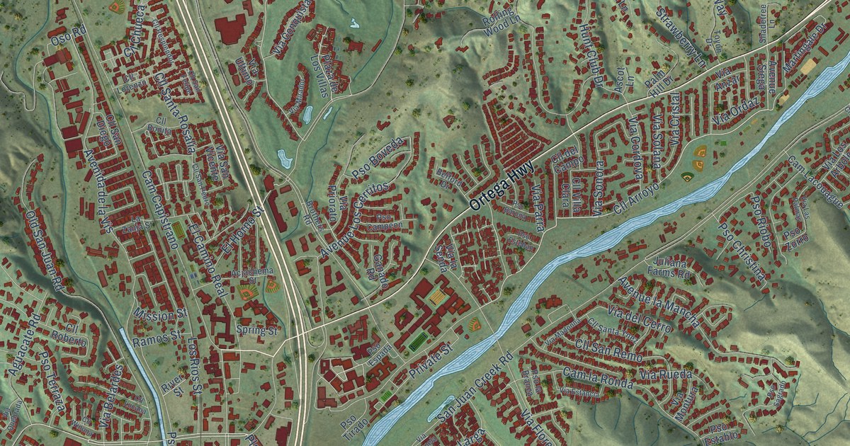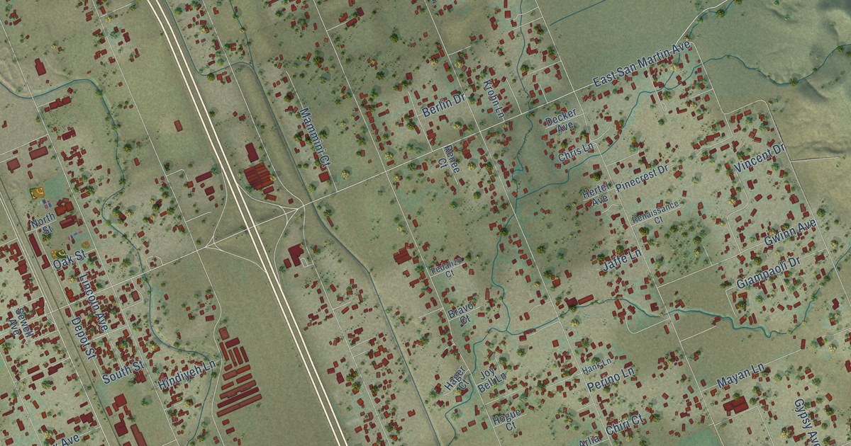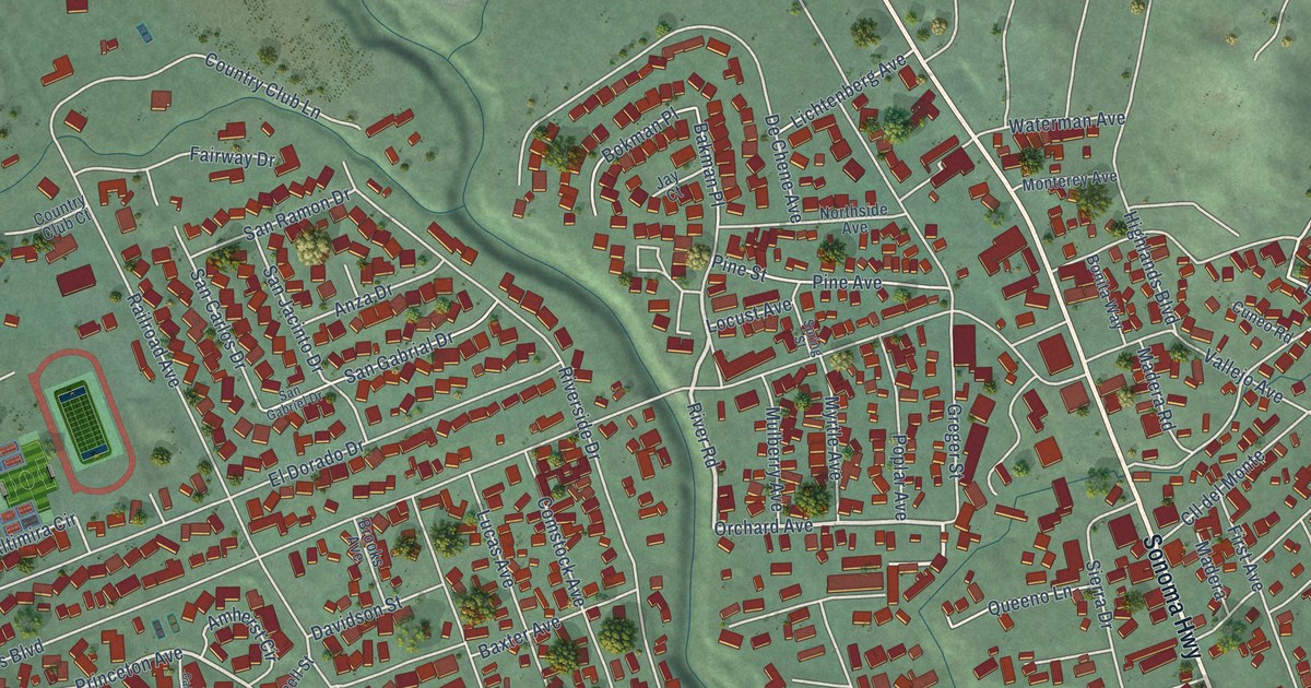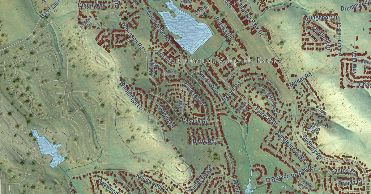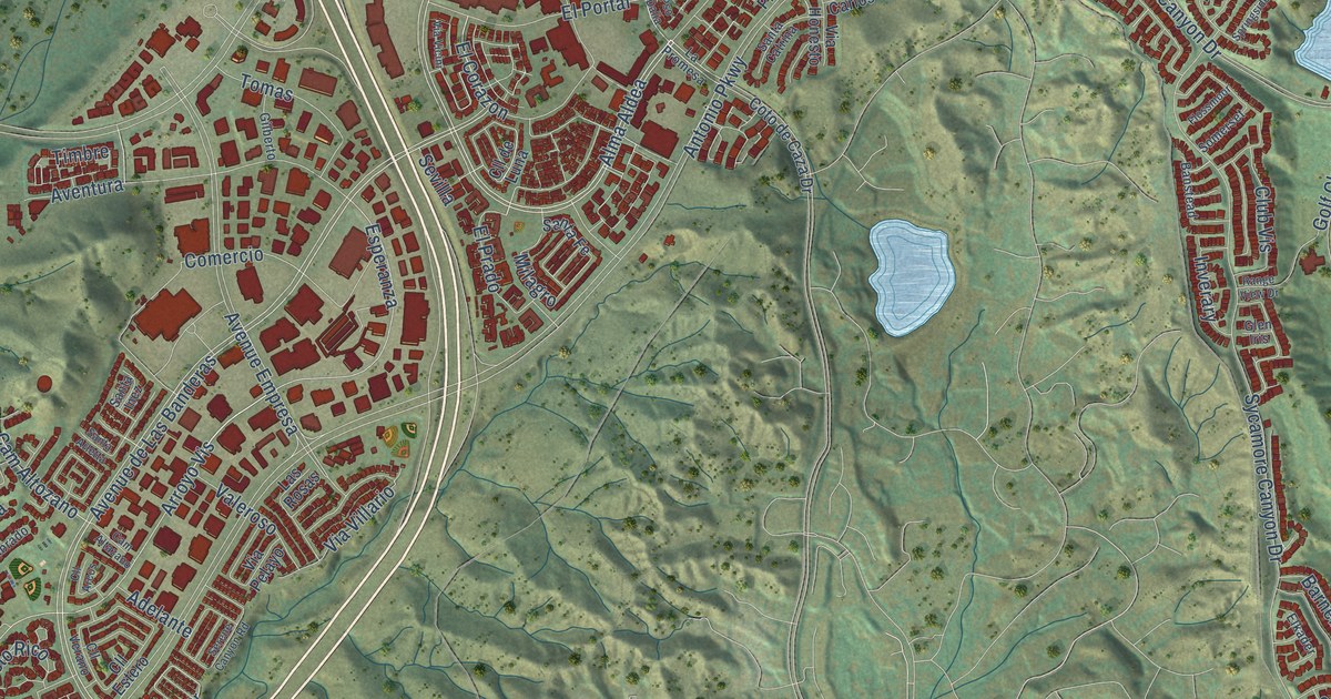
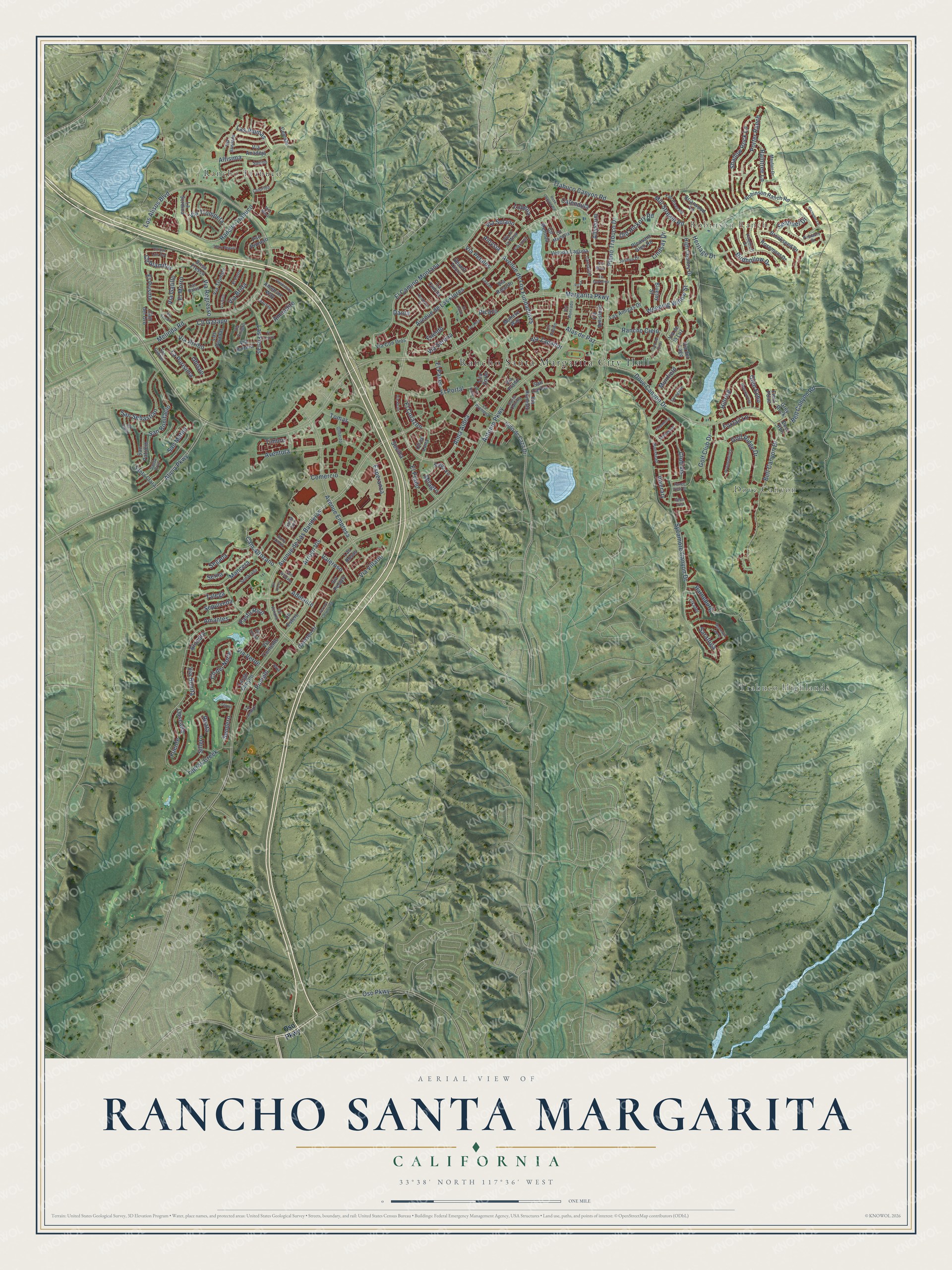
This beautifully detailed map of Rancho Santa Margarita, California was created in 2026 using aerial imagery combined with modern topographical, census, street and landmark data. It's a modern aerial view of Rancho Santa Margarita in Orange County, California, that combines modern data with a vintage aesthetic. The roads feature printed names, and if you look closely you can find your exact house accurately shown in its correct location.
Explore an aerial view of Rancho Santa Margarita, California
On this map you'll find Rancho Santa Margarita City Hall, Robinson Ranch, Trabuco Highlands, Dove Canyon, Rancho Trabuco, Avenue de Las Banderas, Via Serena, Pomelo, Alas de Paz, Alma Aldea, Esperanza, Avenue de Las Flores, and more. Each red shape is a building, so zoom in on the preview and look for yours.
Rancho Santa Margarita is a city in Orange County. The Census Bureau counted 47,949 people here in 2020. The map prints the town name in its title panel, with the coordinates below it.
Take a closer look at the Rancho Santa Margarita map
Names on this map
These names are printed on this map.
Places: Rancho Santa Margarita City Hall, Robinson Ranch, Trabuco Highlands, Dove Canyon and Rancho Trabuco.
Streets and roads: Avenue de Las Banderas, Via Serena, Pomelo, Alas de Paz, Alma Aldea, Esperanza, Avenue de Las Flores, El Camino Montana, Arroyo Vis, Cll del Norte, Antonio Parkway, Margarita Parkway.
More street names, A to Z
Adelante, Alicia Parkway, Allyssum, Alondra, Aloysia, Altisima, Amantes, Ametrine Way, Ammolite, Aventura, Avenue de Los Fundadores, Avenue Empresa, Banstead, Barneburg, Baya, Bell Canyon Drive, Bell Canyon Road, Birdhollow Drive, Bluejay Street, Briarwood Lane, Brisa Fresca, Brookseed Drive, Calendula, Cam Altazano, Cam Altozano, Cam del Cielo, Cam del Oro, Carnation, Cascada, Celeste, Cll Adobe, Cll Alamitos, Cll Arcos, Cll de Luna, Cll Estero, Cll Gazapo, Cll Marbella, Cll Melinda, Cll San Luis Rey, Cll Verano, Club Vis, Colorido, Comercio, Coralino, Coto de Caza Drive, Danta, Deer Run, Desert Thorn, Dove Canyon Drive, El Canto, El Corazon, El Corzo, Elkader, El Morro, El Paseo, El Portal, El Potro, El Prado, El Prisma, Eneldo, Fall River Road, Field Point, Floramar, Flossmoor, Foxtail Lane, Fuente, Galisteo Drive, Gilberto, Glen Echo, Glen Iris, Golf Club Drive, Golf Ridge Drive, Greenspring, Grey Rock, Heritage Drive, High Country Drive, Hillrise, Inverary, Joshua Drive, La Cincha, La Promesa, La Purisima, Largo Canyon, Las Amigas Drive, Las Balas, Las Fieras, La Sordina, Las Pisadas, Las Plumas, Las Rosas, Laurel, Lazurite, Lila Corte, Lindsay Drive, Lobelia, Los Alisos Boulevard, Mancera, Mayfair Drive, Meander Lane, Melinda Road, Milagro, Mill Stream Road, Mira Mesa, Mohave Way, Mountain Laurel, Muirfield, Obispo, Old Hickory Road, Osoberry Street, Oso Parkway, Pasto Rico, Picazo, Pinebluff Drive, Pinnacle Drive, Plano Trabuco Drive, Pleasant Glen Road, Plushstone, Porter Ranch, Promontory, Pso Dalia, Pso Primero, Raintree Lane, Rancho Cielo, Range View Drive, Reata, Robinson Ranch Road, Rosa, Rose Canyon Road, Rosemont Drive, Saltillo, San Bonifacio, San Carlos, San Gabriel, San Mateo, San Patricio, San Sebastian, San Simon, Santa Arletta, Santa Catrina, Santa Clara, Santa Cruz, Santa Fe, Santa Inez, Saratoga, Segada, Sembrado, Sendero, Sentinel Drive, Sepulveda, Serene Canyon Road, Serna, Sevilla, Shadow Rock Lane, Sillero, Somerset, Springside, Sycamore Canyon Drive, Talega, Telura, Tierra Seguro, Tijeras Creek, Timbre, Tomas, Trabuco Canyon Road, Valeroso, Vereda-Laguna, Via Amistosa, Via Anadeja, Via Arribo, Via Babera, Via Bandada, Via Bonita, Via Brida, Via Con Dios, Via Contento, Via de la Luz, Via de la Mesa, Via del Lago, Via Encaro, Via Gardenia, Via Gatillo, Via Honesto, Via Honrado, Via Lampara, Via Maya, Via Onagro, Via Pelayo, Via Petalos, Via Prado, Via Regresso, Via Ricardo, Via Silla, Via Solano, Via Solaz, Via Trompeta, Via Tronido, Via Verde, Via Vicini, Via Villario, Via Zapador, Weeping Willow Street.
Created by KNOWOL in 2026. The buildings are small red shapes, the roads carry their printed names, and shaded relief shows the shape of the land. The title panel reads "AERIAL VIEW OF RANCHO SANTA MARGARITA CALIFORNIA" with 33°38' NORTH 117°36' WEST.
It suits a den, a classroom or a front hall, and it makes a gift for anyone with Rancho Santa Margarita roots. Open the preview and find the block you know. See sizes and frames for the Rancho Santa Margarita map.