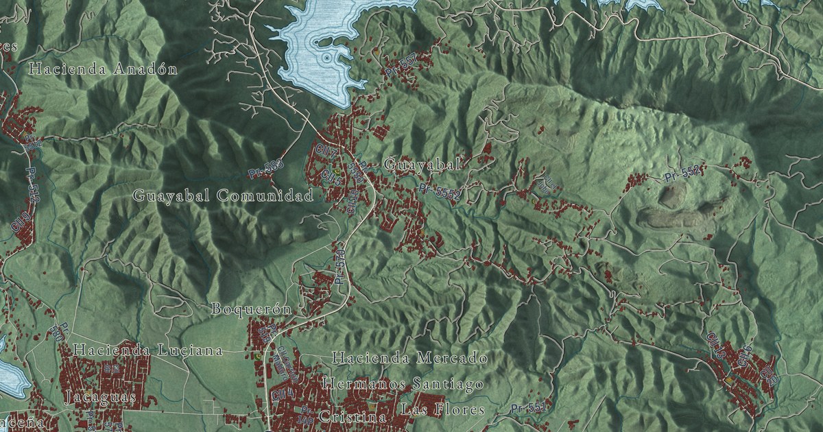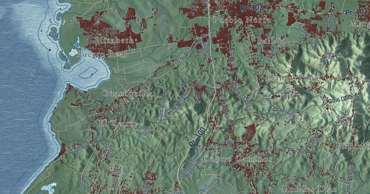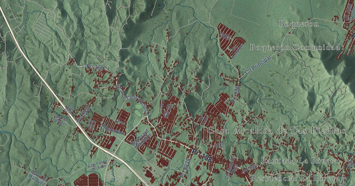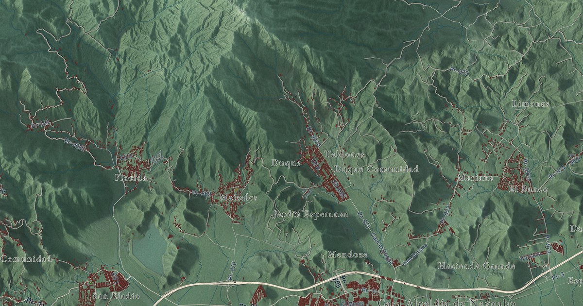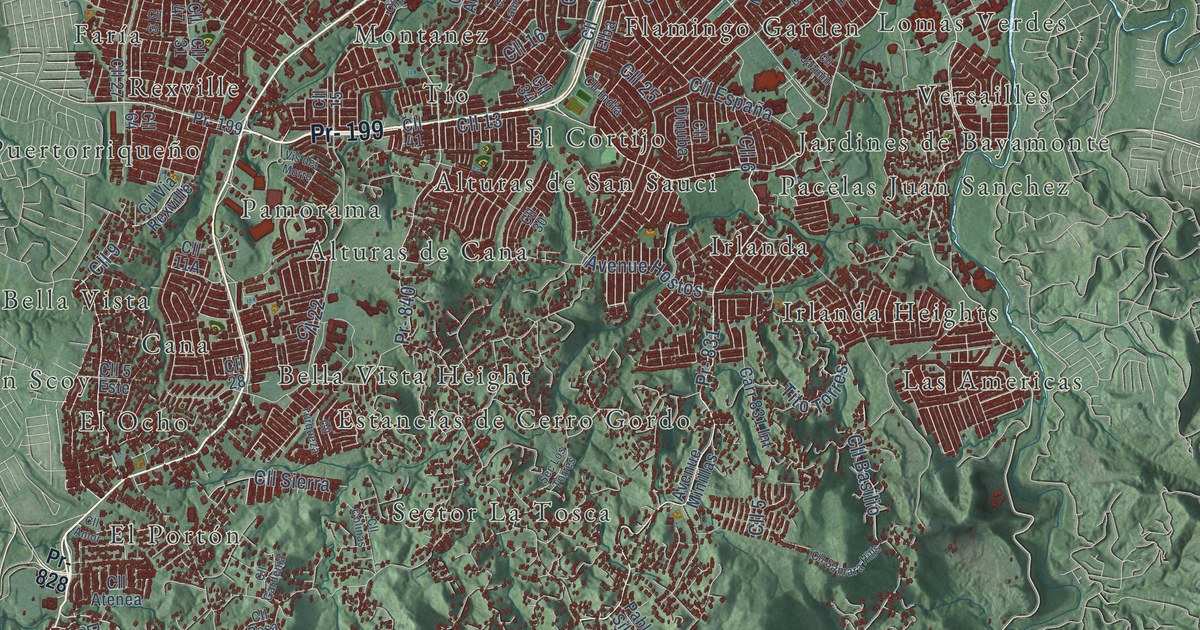
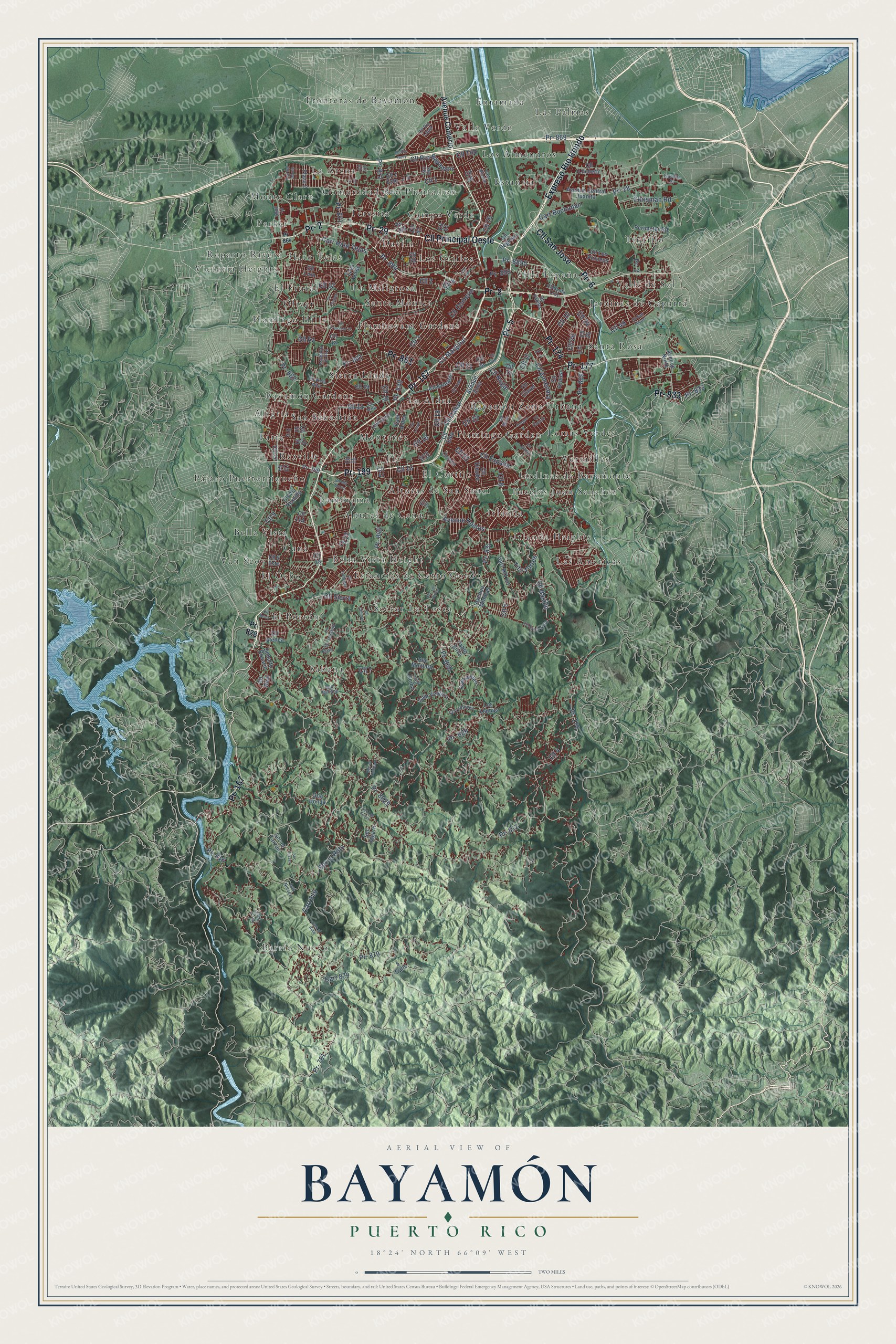
This beautifully detailed map of Bayamón, Puerto Rico was created in 2026 using aerial imagery combined with modern topographical, census, street and landmark data. It's a modern aerial view of the municipio of Bayamón, Puerto Rico, that combines modern data with a vintage aesthetic. The roads feature printed names, and if you look closely you can find your exact house accurately shown in its correct location.
Explore an aerial view of Bayamón, Puerto Rico
On this map you'll find Alegría, Alturas de Cana, Alturas de San Sauci, Barrio Nuevo, Bayamón Gardens, Bayamón Zona Urbana, Bella Vista, Bella Vista Height, Campo Verde, Cana, Comunidad Rio Plantation, Davila, and more. Each red shape is a building, so zoom in on the preview and look for yours.
Every town has a first chapter, and Bayamón is no exception. The 1923 Book of Porto Rico puts it this way: "Bayamón was founded in 1772 and is located seven kilometers from the bay of San Juan."
Bayamón is one of the 78 municipios of Puerto Rico. The Census Bureau counted 185,187 people here in 2020.
Take a closer look at the Bayamón map
Names on this map
These names are printed on this map.
Places: Alegría, Alturas de Cana, Alturas de San Sauci, Barrio Nuevo, Bayamón Gardens, Bayamón Zona Urbana, Bella Vista, Bella Vista Height, Campo Verde, Cana, Comunidad Rio Plantation, Davila, El Cortijo, El Frutal, El Ocho, El Portón, Enramada, Estancias de Cerro Gordo, Estansia, Faría, Flamboyant Gardens, Flamingo Garden, Flamingo Hills, Fronteras de Bayamon, Hato Tejas, Irlanda, Irlanda Heights, Jardines de Bayamonte, Jardines de Caparra, La Aldea, La Arena, La Miligrosa, Las Americas, Las Palmas, Lomas Verdes, Los Almendros, Los Grillos, Montanez, Monte Claro, Oliver, Pacelas Juan Sanchez, Pamorama, Parker, Pájaro Puertorriqueño, Reparto Rivera, Rexville, Sabana, San Sebastián, Santa Mónica, Santa Rosa, Sector La Tosca, Sierra Linda, Teresita, Tintillo, Tío, Valle Verde, Valle de Sol, Van Scoy, Versailles, Victoria Heights and Villa España.
Streets and roads: Pr- 167, Pr- 5, Cll Principal Oeste, Pr- 29, Expreso Río Hondo, Pr- 177, Pr- 199, Pr- 174, Pr- 861, Pr- 2, Cll San Jose, Pr- 6.
More street names, A to Z
5 Calle, Avenue Central Juanita, Avenue Comerio, Avenue Hostos, Avenue Minillas, Avenue Norte, Avenue Zinia, Cam Aldea, Cam Aviles, Cam el Riito, Cam Italiano, Cam Mostal, Cam Vergara, Carr 168, Carr 816, Carr 831 Int, Carr 879, Carr Buchanan, Carr Hato Tejas, Chrisman Road, Cll 1, Cll 2, Cll 2 Este, Cll 3, Cll 4, Cll 5, Cll 5 Este, Cll 6, Cll 7, Cll 8, Cll 9, Cll 10, Cll 11, Cll 12, Cll 13, Cll 14, Cll 15, Cll 16, Cll 17, Cll 18, Cll 19, Cll 20, Cll 21, Cll 22, Cll 23, Cll 24, Cll 25, Cll 26, Cll 27, Cll 28, Cll 29, Cll 30, Cll 31, Cll 32, Cll 33, Cll 34, Cll 36, Cll 37, Cll 41, Cll 44, Cll 45, Cll 47, Cll 49, Cll 51, Cll 61, Cll 64, Cll 70, Cll 76, Cll Almendra, Cll Amor, Cll Atenea, Cll Azalea, Cll Basilio, Cll Ceiba, Cll Clavel, Cll Colinas, Cll Comerio, Cll Dakar, Cll Degetau, Cll Dinuba, Cll Dragon, Cll Duende, Cll Elba, Cll España, Cll Gardenia, Cll India, Cll Jazmin, Cll Laurel, Cll Lirio, Cll Los Pirineos, Cll Luchetti, Cll Margarita, Cll Marginal, Cll Marta, Cll Mirto, Cll Nogal, Cll Orleans, Cll Orquidea, Cll Padilla, Cll Principal 12, Cll Real, Cll Rio Duey, Cll Rosa, Cll Río Bayamón, Cll Río Lajas, Cll Samara Hills, Cll San Miguel, Cll Santa Cruz, Cll Sierra, Cll Thebes, Cll Tilo, Cll Tudor, Cll Turqueza, Cll Via Rexville, Cll Vista Alta, Departo Rosario, Isabella Street, Los Llamas, Los Nieves, Pablo Silva, Perimeter Road, Plaza 2, Pr- 28, Pr- 168, Pr- 781, Pr- 812, Pr- 816, Pr- 828, Pr- 829, Pr- 830, Pr- 831, Pr- 833, Pr- 839, Pr- 840, Pr- 855, Pr- 862, Pr- 864, Pr- 869, Pr- 871, Pr- 872, Pr- 879, Pr- 889, Pr- 8829, Pr- 8855, Pr- 8866, Pso 6, Pso del Monte, Pso la Rogativa, Qda Honda, Sec Algarn, Sec el Chicharo, Sec el Riito, Sec el Tarzan, Sec Los Febus, Sec Los Lopez, Sec Los Torres, Sec Montaez, Sec Tarzan, Tito Torres, Vis del Morro, Zaya Verde.
Created by KNOWOL in 2026. The buildings are small red shapes, the roads carry their printed names, and shaded relief shows the shape of the land. The title panel reads "AERIAL VIEW OF BAYAMÓN, PUERTO RICO" with 18°24' NORTH 66°09' WEST.
Hang it in the hallway, the office or the cabin, or give it to someone who left Bayamón and still calls it home. Open the preview and look for a street you know. See sizes and frames for the Bayamón map.