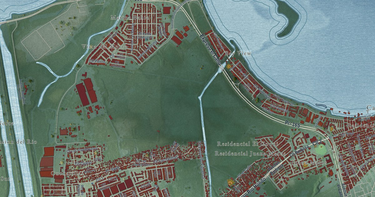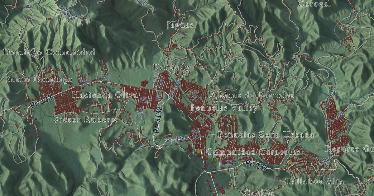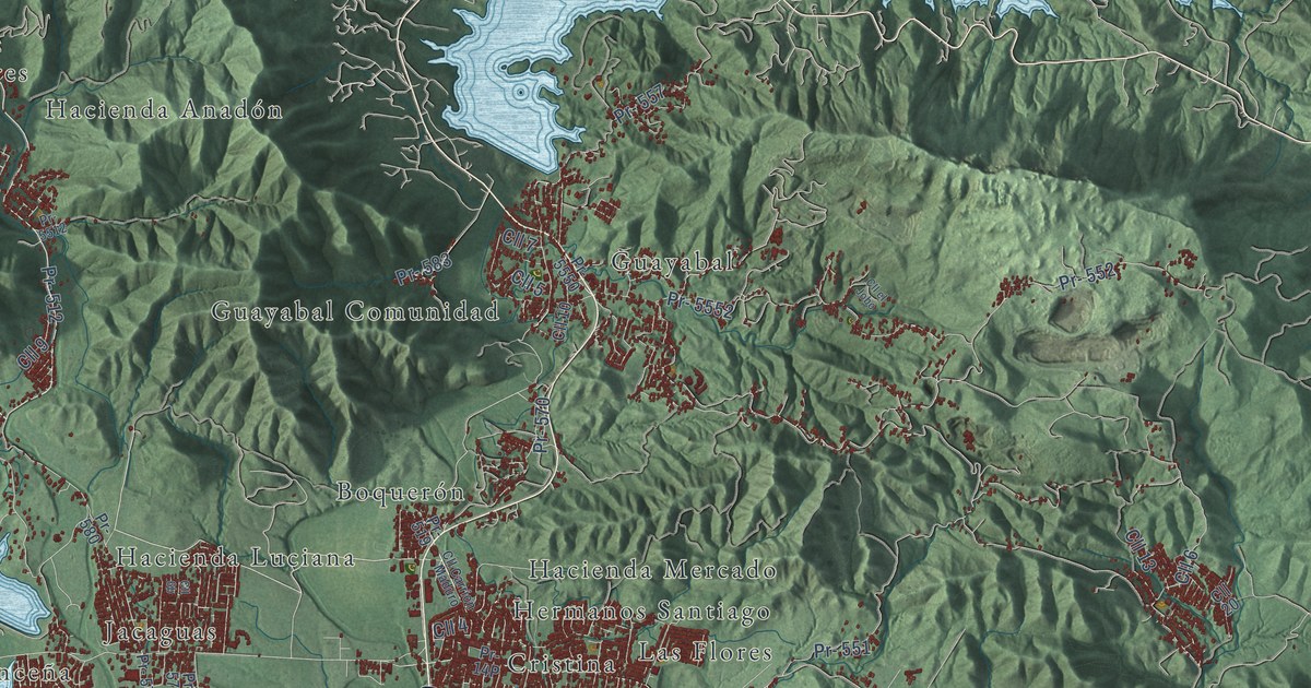
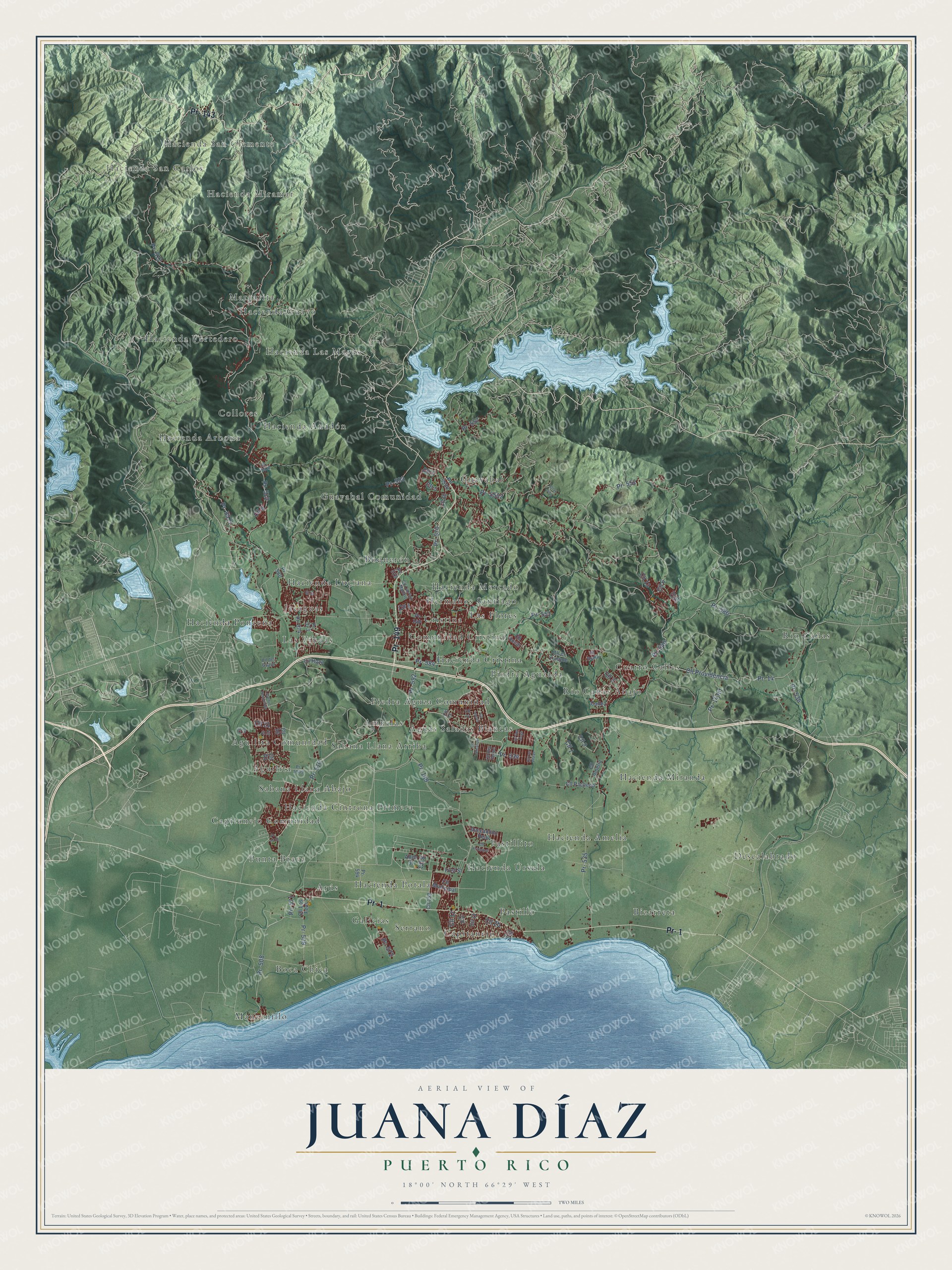
This beautifully detailed map of Juana Díaz, Puerto Rico was created in 2026 using aerial imagery combined with modern topographical, census, street and landmark data. It's a modern aerial view of the municipio of Juana Díaz, Puerto Rico, that combines modern data with a vintage aesthetic. The roads feature printed names, and if you look closely you can find your exact house accurately shown in its correct location.
Explore an aerial view of Juana Díaz, Puerto Rico
On this map you'll find Hacienda San Carlos, Hacienda San Clemente, Hacienda Miramar, Aguas Saladas Blancas, Aguilita, Aguilita Comunidad, Amuelas, Arús, Bizarreta, Boca Chica, Boquerón, Capitanejo, and more. Each red shape is a building, so zoom in on the preview and look for yours.
Every town has a first chapter, and Juana Díaz is no exception. The 1923 Book of Porto Rico puts it this way: "As Juana Díaz was the first town to subscribe to the ideas of Hostos, the first assembly to start the campaign was held there."
Juana Díaz is one of the 78 municipios of Puerto Rico. The Census Bureau counted 46,538 people here in 2020.
Take a closer look at the Juana Díaz map
Names on this map
These names are printed on this map.
Places: Hacienda San Carlos, Hacienda San Clemente, Hacienda Miramar, Aguas Saladas Blancas, Aguilita, Aguilita Comunidad, Amuelas, Arús, Bizarreta, Boca Chica, Boquerón, Capitanejo, Capitanejo Comunidad, Collores, Comunidad Cristina, Cristina, Cuatro Calles, Descalabrado, Galicias, Guayabal, Guayabal Comunidad, Hacienda Amelia, Hacienda Anadón, Hacienda Arbona, Hacienda Cintrona Primera, Hacienda Cristina, Hacienda Guayo, Hacienda Las Magas, Hacienda Luciana, Hacienda Mercado, Hacienda Miranda, Hacienda Ponceña, Hacienda Potala, Hacienda Vertedero, Hacienda Úrsula, Hermanos Santiago, Jacaguas, Las Flores, Las Viudas, Manzanillo, Margarita, Pastillito, Pastillo, Piedra Aguza Comunidad, Piedra Aguzada, Punta Brava, Río Cañas, Río Cañas Abajo, Sabana Llana Abajo, Sabana Llana Arriba and Serrano.
Streets and roads: Pr- 143, Pr- 149, Pr- 1, Pr- 512, Pr- 510, Pr- 5511, Cll 1, Cll 7, Cll 6, Pr- 552, Cll 2, Cll 3.
More street names, A to Z
Allen Street, Avecamino Real, Avenue Peñonsillo, Calle2, Cll 4, Cll 5, Cll 8, Cll 9, Cll 10, Cll 11, Cll 13, Cll 14, Cll 16, Cll 17, Cll 18, Cll 19, Cll 20, Cll 21, Cll 23, Cll 43, Cll 158, Cll Amelia, Cll Carrion Maduro, Cll D1, Cll del Guayo, Cll el Jobo, Cll el Yunque, Cll Emanuel, Cll Hoya, Cll Hucar, Cll Las Vistas, Cll Laurel, Cll Los Feos, Cll Municipal, Cll Pacheco, Cll Principal, Cll Providencia, Cll Rey Felipe, Cll Rey Jorge, Cll Roma, First Street, Pr- 14, Pr- 14 Int, Pr- 508, Pr- 509, Pr- 517, Pr- 519, Pr- 534, Pr- 535, Pr- 536, Pr- 540, Pr- 551, Pr- 557, Pr- 570, Pr- 571, Pr- 572, Pr- 573, Pr- 574, Pr- 580, Pr- 583, Pr- 584, Pr- 586, Pr- 592, Pr- 594, Pr- 5509, Pr- 5510, Pr- 5512, Pr- 5550, Pr- 5552.
See it on a wall
The Juana Díaz map as a framed print. Swipe for more.


Created by KNOWOL in 2026. The buildings are small red shapes, the roads carry their printed names, and shaded relief shows the shape of the land. The title panel reads "AERIAL VIEW OF JUANA DÍAZ, PUERTO RICO" with 18°00' NORTH 66°29' WEST.
Hang it in the hallway, the office or the cabin, or give it to someone who left Juana Díaz and still calls it home. Open the preview and look for a street you know. See sizes and frames for the Juana Díaz map.