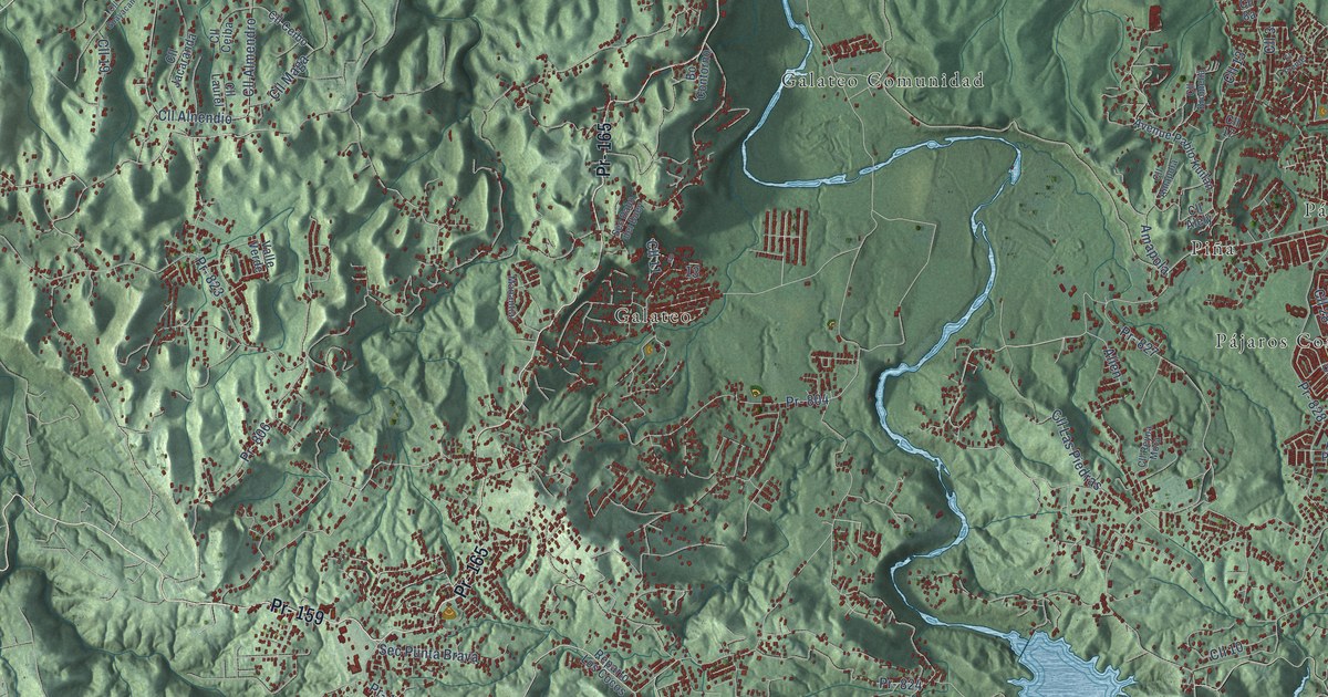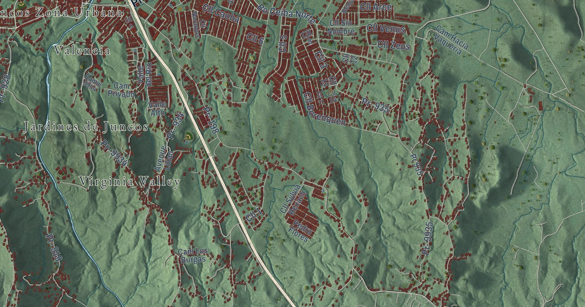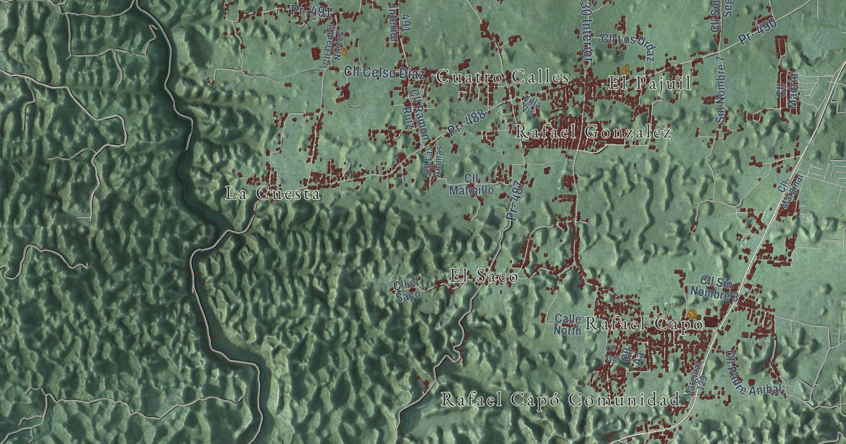
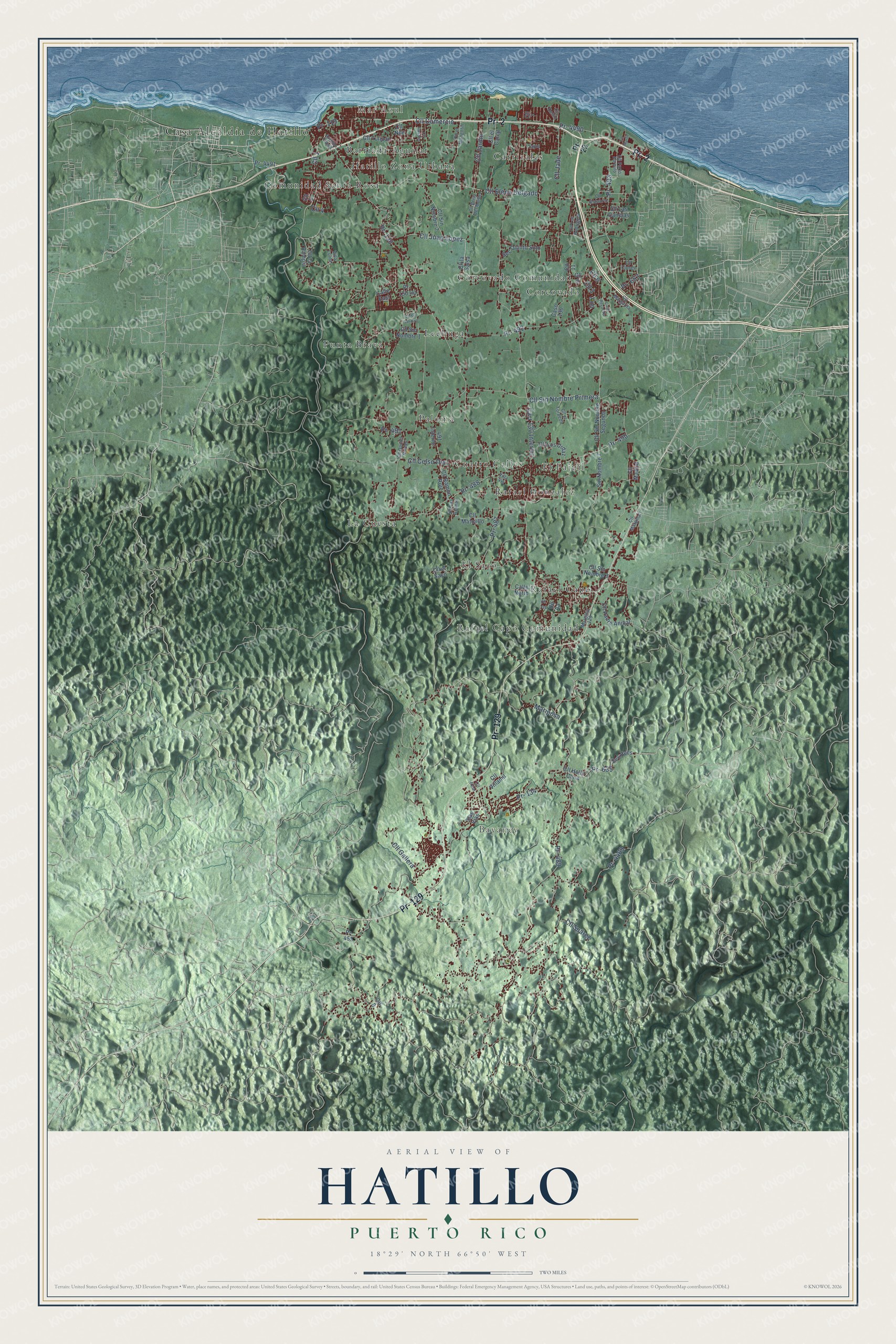
This beautifully detailed map of Hatillo, Puerto Rico was created in 2026 using aerial imagery combined with modern topographical, census, street and landmark data. It's a modern aerial view of the municipio of Hatillo, Puerto Rico, that combines modern data with a vintage aesthetic. The roads feature printed names, and if you look closely you can find your exact house accurately shown in its correct location.
Explore an aerial view of Hatillo, Puerto Rico
On this map you'll find Casa Alcaldía de Hatillo, Bayaney, Mar Azul, Barriada Aguilar, Carrizales, Comunidad Santa Rosa, Corcovado, Corcovado Comunidad, Cuatro Calles, El Pajuil, El Saco, Hatillo Zona Urbana, and more. Each red shape is a building, so zoom in on the preview and look for yours.
Hatillo has a story worth telling. The record at topuertorico.org puts it this way: "During the Spanish colonial period, settlers established farms and ranches throughout the region. Hatillo officially became a municipality on June 30, 1823, after separating from Camuy."
Hatillo is one of the 78 municipios of Puerto Rico. The Census Bureau counted 38,486 people here in 2020.
Take a closer look at the Hatillo map
Names on this map
These names are printed on this map.
Places: Casa Alcaldía de Hatillo, Bayaney, Mar Azul, Barriada Aguilar, Carrizales, Comunidad Santa Rosa, Corcovado, Corcovado Comunidad, Cuatro Calles, El Pajuil, El Saco, Hatillo Zona Urbana, La Cuesta, Lechuga, Paloma, Punta Brava, Rafael Capo, Rafael Capó Comunidad and Rafael Gonzalez.
Streets and roads: Pr- 2, Pr- 129, Cll Elena Delgado, Cll Sin Nombre Primera, Pr- 119, Cll 1, Cll 3, Carr 130 Interior, Pr- 490, Pr- 635, Mariposa, Pr- 130.
More street names, A to Z
491 Interior, Avenue Pajuil, Calle East, Calle North, Calle Royal Vw, Caso 130, Cll 2, Cll 4, Cll 5, Cll 6, Cll 7, Cll 8, Cll 9, Cll 11, Cll Aa, Cll Brisa del Monte, Cll Celso Diaz, Cll Cipres, Cll Comercio, Cll Daniel Nieves, Cll Delfin, Cll el Carial, Cll el Mangotin, Cll el Saco, Cll el Torpedo, Cll Estuario, Cll Gallera, Cll Gg, Cll Hollo Cana, Cll Jade, Cll Jardin, Cll Juan Lopez, Cll la Rampla, Cll la Salsa, Cll Las Animas, Cll Las Canelas, Cll Los Rodriguez, Cll Los Urdaz, Cll Madrid, Cll Marfil, Cll Margarita, Cll Marginal, Cll Matojillo, Cll Nilo, Cll Padre Anibal, Cll Parlo Parvulo, Cll Ramon Ruiz, Cll Real, Cll Rosales, Cll Sin Nombre 1, Cll Sin Nombre 2, Cll Sin Nombre 3, Cll Sin Nombre Segunda, Cll Sin Salida 3, Cll Suarez, Cll Tulipan, Cll Villamil, Las Vias, Marginal 129, Pr- 22, Pr- 130 Int, Pr- 134, Pr- 455, Pr- 487, Pr- 488, Pr- 489, Pr- 491, Pr- 492, Pr- 493, Pr- 653, Pr- 4489, Pr- 4490, Pr- 4491, Sec Hees, Sec Quinto Soto, Sin Nombre 7, Tapis, Villa Lolita, Villa Vis.
See it on a wall
The Hatillo map as a framed print. Swipe for more.


Created by KNOWOL in 2026. The buildings are small red shapes, the roads carry their printed names, and shaded relief shows the shape of the land. The title panel reads "AERIAL VIEW OF HATILLO, PUERTO RICO" with 18°29' NORTH 66°50' WEST.
It looks right in a kitchen, an office or a den, and it's a gift for anyone who grew up in Hatillo or moved away. Open the preview and find your street. See sizes and frames for the Hatillo map.